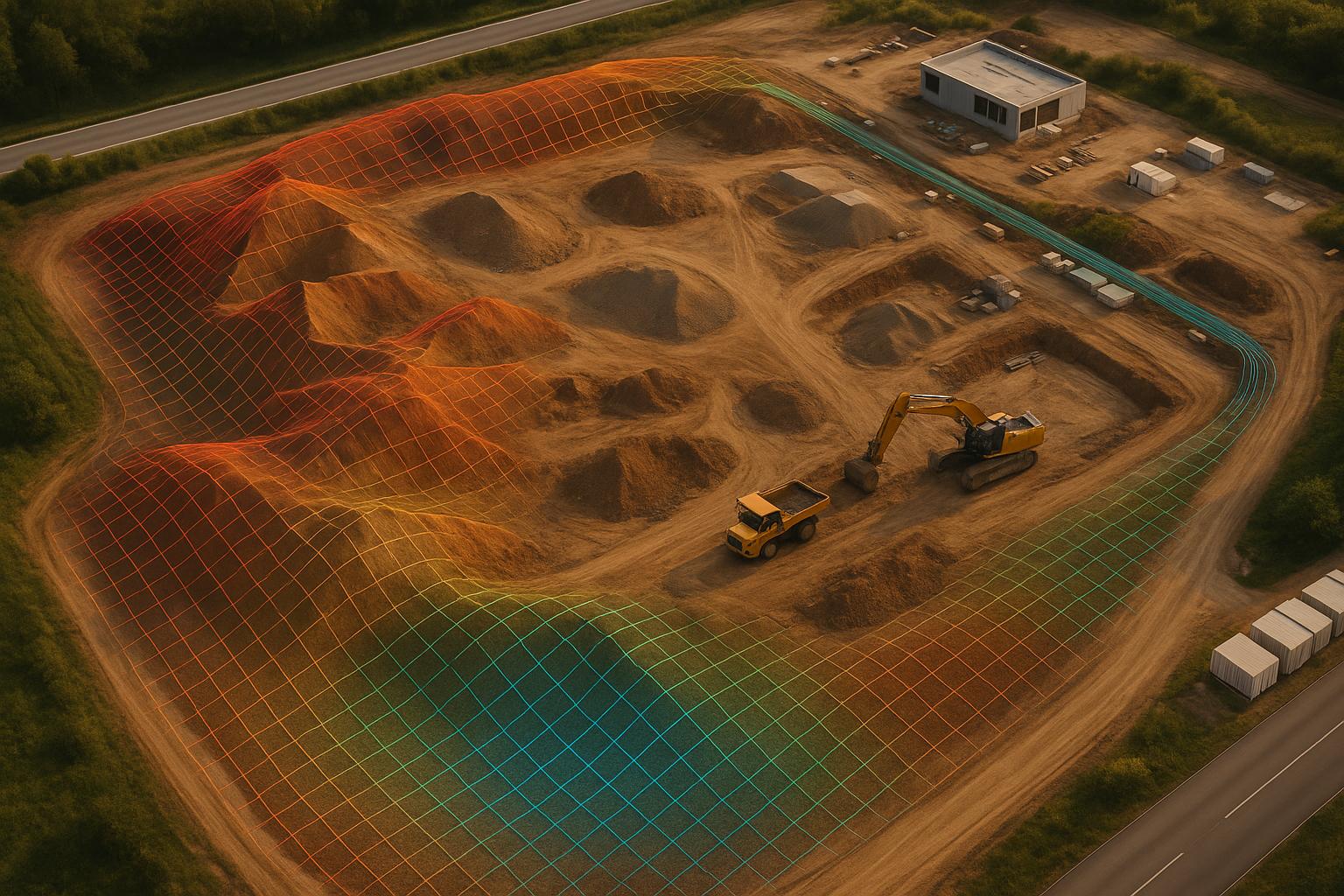
Drone photogrammetry is transforming how industrial sites are documented by generating precise 3D models from aerial images. Here's what you need to know:
- Time and Cost Savings: Reduces survey time by up to 85% and saves up to $114,000 annually.
- Scalability: Useful for managing multiple sites and enabling collaboration through digital twins.
- Challenges: Handling large datasets, ensuring accuracy, and navigating tough environments.
Key Tools and Techniques:
- Drones: From budget-friendly DJI Mini 3 Pro ($750) to enterprise-level WingtraOne Gen II ($20,000).
- Software: Options like Pix4Dmapper, Agisoft Metashape, and RealityCapture process images into 3D models.
- Data Management: Platforms like Anvil Labs handle large datasets, enable collaboration, and ensure secure sharing.
Workflow Summary:
- Pre-Flight Planning: Define goals, check regulations, and plan flight paths with proper overlap (70–80% forward, 60–75% lateral).
- Data Capture: Use nadir and oblique images for detailed models, adjust camera settings, and fly in optimal weather.
- Processing: Use Ground Control Points (GCPs) for accuracy, validate models, and manage data efficiently.
Practical Tips:
- Maintain consistent flight conditions for multi-day projects.
- Use encryption and role-based access controls for secure data sharing.
- Leverage annotation tools for analysis and insights.
By following these steps, industrial teams can create accurate, scalable 3D models while saving time and resources.
How to create high quality 3D models with drones? | Hammer Missions
Required Tools and Software for 3D Modeling
Creating 3D models using drone photogrammetry demands tools that balance performance, precision, and cost. The right mix of hardware and software can make all the difference in delivering accurate results while avoiding data issues or processing delays.
Drone Hardware and Imaging Equipment
The backbone of any photogrammetry project is the choice of drone and imaging equipment. A high-resolution camera is non-negotiable for detailed 3D reconstructions. Look for drones with stable flight capabilities, accurate GPS, and extended battery life to cover larger areas without interruptions.
Here are some popular drone options, catering to varied budgets and needs:
| Drone Model | Price | Key Features | Best For |
|---|---|---|---|
| DJI Mini 3 Pro | $750 | Compact design, high-quality camera | Tight spaces, budget-conscious projects |
| DJI Mavic 3 | $2,200 | Superior camera, long flight time | Large areas, professional-grade applications |
| Parrot Anafi USA | $7,000 | 32x zoom lens, FLIR thermal camera | Industrial use, specialized imaging |
| eBee X | $12,000 | Long flight time, precision mapping | Large-scale surveying, rugged environments |
| WingtraOne Gen II | $20,000 | High-resolution multispectral imaging, VTOL | Enterprise-level, maximum coverage |
Autonomous flight technology is transforming industrial applications. For instance, Sundt Construction reported a 90% reduction in inspection time and halved pilot training durations for large-scale sites.
"We're training pilots in half the time because it takes little to no time for the pilot to learn how to operate the drone properly. Anybody of any skill level, whether you've flown any sort of drone before, you can pick up a Skydio and be in the air in 5 minutes", says Dean Miller, Virtual Construction Engineer at Sundt.
This kind of automation is especially useful in challenging environments, such as GPS-denied zones or areas with high electromagnetic interference, where manual drones struggle to capture detailed scans of structures.
Photogrammetry Processing Software
Once aerial images are captured, specialized software is needed to turn them into detailed 3D models. These programs process thousands of images to create scalable, accurate reconstructions.
- DatuBIM uses AI to generate precise models tailored specifically for construction workflows.
- Pix4Dmapper is user-friendly and integrates seamlessly with GIS tools, producing high-quality outputs.
- Agisoft Metashape offers robust features, including dense point cloud generation and textured mesh creation, for aerial and close-range photogrammetry.
- RealityCapture emphasizes speed, processing large datasets quickly while supporting both 2D images and LiDAR data.
- 3Dsurvey, built by land surveyors, works with a variety of drones and scanners (DJI, Sony, Parrot, LiDAR, SLAM) and supports open formats like LAS, DXF, and OBJ.
When deciding on software, think about your project's specific needs - whether it’s ease of use, compatibility with existing tools, or budget considerations. The rapid evolution of photogrammetry software continues to redefine workflows in construction, surveying, and geospatial analysis.
Data Hosting and Management Platforms
Managing and sharing the massive datasets generated by photogrammetry requires a platform capable of handling large files and complex workflows.
Anvil Labs is a standout option for industrial projects, offering tools for managing 3D models, 360° photos, LiDAR point clouds, and more. Its key features include:
- Annotation and measurement tools for in-depth analysis
- Secure data sharing with access controls for team collaboration
- Cross-device compatibility, from field tablets to office workstations
The platform integrates with tools like Matterport, YouTube, and task management systems, streamlining workflows from data collection to final delivery. Pricing is flexible, with an Asset Viewer plan at $99/month for hosting and collaboration, and a Project Hosting plan at $49/project for one-time needs. Optional data processing is available at $3 per gigapixel.
Anvil Labs also supports thermal imagery and LiDAR data, making it ideal for projects where RGB imagery alone isn’t enough. This capability allows for the creation of detailed digital twins, useful for everything from operational planning to visual documentation.
Step-by-Step Workflow for Creating 3D Models
Turning drone-captured imagery into detailed 3D models involves a structured process. Each phase builds on the one before it, so precision at every step is key to achieving high-quality results.
Pre-Flight Planning and Setup
The groundwork for a successful photogrammetry mission begins well before the drone leaves the ground. Start by outlining the project’s goals - define the area you’ll be mapping and the level of detail you need. For instance, industrial inspections might demand higher resolution, while larger surveys could focus on broader coverage.
Check airspace regulations using tools like the FAA's B4UFLY or LAANC to avoid restricted zones. If your project involves Beyond Visual Line-of-Sight operations, make sure to secure FAA Part 107 waivers in advance. Apps like Aloft – Air Control can also provide real-time airspace classifications to keep you compliant with regulations.
Weather plays a huge role in data quality. Schedule flights on days with calm winds and good lighting conditions. Before launching, inspect your equipment - check propellers, electronics, and GPS signals. Update firmware and calibrate sensors to ensure everything is in top shape.
Plan your flight path carefully. Define waypoints, set altitude, and adjust the overlap ratio to 70–80% forward and 60–75% lateral for balanced coverage and resolution. Use mapping software to outline the survey area and adjust altitude to match your resolution needs. If the terrain is uneven, enable terrain-following modes to maintain a consistent ground sampling distance.
Once the flight plan is ready and equipment is verified, you’re set to capture precise data.
Data Capture and Best Practices
The quality of your 3D model hinges on the imagery you collect. Timing matters - fly during periods of optimal natural lighting to avoid harsh shadows or exposure issues.
Capture nadir images (straight down) for your primary dataset, and add oblique shots (angled views) to capture vertical details. If you’re not using automated flight planning software, manually adjust flight paths to ensure proper overlap.
Stick to an overlap ratio of 70–80% forward and 60–75% lateral for smooth reconstruction. Flight altitude is a balancing act - lower altitudes deliver higher resolution but may increase flight time and battery usage when covering larger areas.
Camera settings are equally important. Reducing drone speed in challenging conditions can help maintain sharp images. Adjust the camera’s aperture based on lighting to achieve proper exposure. Make sure essential EXIF data - like camera model, focal length, pixel size, and resolution - is recorded. Turn off auto-corrections to prevent alterations to image geometry during capture.
Processing and Quality Control
Once you’ve collected your images, the processing phase begins. Organize and upload your data into your photogrammetry software. Ensure all EXIF data is intact, then choose the appropriate output format - whether it’s a point cloud, a mesh, or both - based on your project’s needs.
Ground Control Points (GCPs) are crucial for improving georeferencing accuracy. For most projects, placing 5 to 10 GCPs strategically - at the corners of the mapped area and at the highest and lowest elevation points - can significantly enhance accuracy.
Use auto-calibration within the software to refine camera parameters and account for variables that might affect image geometry. This step ensures the best possible alignment of your dataset.
Quality control is critical. Evaluate the model by checking point cloud density, mesh consistency, and texture alignment. Compare the positions of your GCPs in the model with their known coordinates to confirm accuracy. You can also validate the model by measuring known distances within it and comparing them to real-world measurements.
When your 3D model is finalized, platforms like Anvil Labs can help you take the next step. Their tools allow teams to annotate, measure, and share models securely, making it easier to extract insights and collaborate effectively with stakeholders.
sbb-itb-ac6e058
Techniques for Accuracy and Scalability in 3D Models
Creating precise and scalable 3D models from drone photogrammetry requires a solid grasp of key techniques. These ensure accuracy while handling the large datasets typical of industrial sites. Let’s explore how these methods can seamlessly fit into your 3D modeling workflow.
Image Overlap and Georeferencing
The foundation of accurate 3D reconstruction lies in proper image overlap. Plan drone flights with 70–80% forward overlap and 60–75% lateral overlap to ensure consistent feature matching. For areas with complex terrain, increasing overlap to 90% can produce denser point clouds - up to 2,533.4 points per square meter.
Georeferencing is what transforms a set of images into a spatially accurate model. Ground Control Points (GCPs) play a critical role here. Placing 5–10 GCPs in key locations, such as corners and elevation extremes, can achieve alignment accuracy as fine as 0.016 meters. Additionally, flying drones at lower altitudes often doubles the point density compared to higher-altitude flights, resulting in more detailed models.
Managing Large Data Volumes
Once accuracy is established, managing the massive datasets generated by industrial surveys becomes the next challenge. A single site survey can produce thousands of high-resolution images, translating to terabytes of raw data.
Start with file optimization to reduce dataset sizes. Techniques like polygon reduction and texture compression can shrink file sizes without compromising model integrity, making them easier to store and share.
To protect your data, follow the "Rule of Three" for file storage: keep three copies of all files on two different media types, with one copy stored at a separate location. This approach safeguards against data loss while ensuring accessibility.
"The architecture of a good 3D DAM incorporates a variety of technologies to support network traffic, manage internal workflows and jobs; store, retrieve, and search assets and metadata; monitor system metrics; and enable access control policies."
- Ken Moser, PhD, Senior 3D Cloud Engineer at 3D Cloud
For industrial use, a 3D Digital Asset Management (DAM) system is worth considering. These platforms are tailored for managing 3D assets, offering features like role-based access, automated workflows, and scalable cloud infrastructure.
One example is Anvil Labs, a platform specializing in industrial 3D data management. It supports diverse data types, including 3D models, thermal imagery, LiDAR point clouds, and orthomosaics, while ensuring secure sharing and accessibility across devices.
To streamline data organization, establish clear naming conventions and folder structures that align with your workflows. Use tags and metadata to describe asset characteristics, making searches faster as your library grows. Assign a Digital Asset Manager to oversee organization, access, and workflow consistency.
Annotation and Measurement Tools for Analysis
The real value of 3D models comes from their analysis. Annotation tools are essential for extracting actionable insights. Modern annotation software, equipped with AI-assisted labeling, can reduce annotation time by as much as 70%. Look for tools with features like automated labeling, collaboration options, data validation, and integration with machine learning pipelines. By 2028, the global data annotation market is projected to reach $8.22 billion.
For precise measurements, integrating 3D scanning technologies into your photogrammetry workflow enhances quality control. These scanners can rival traditional coordinate measuring machines (CMMs) in accuracy while offering advantages in speed, cost, and flexibility. Whether you're dealing with desktop, handheld, robotics-mounted, or fixed-position scanners, the right tool depends on the size, complexity, and precision needs of your project.
Anvil Labs also incorporates advanced annotation and measurement tools, enabling precise measurements and secure collaboration.
Best Practices and Troubleshooting for Large-Scale Projects
Tackling large-scale industrial 3D modeling projects comes with its own set of hurdles. Success hinges on meticulous planning and addressing issues head-on, especially when managing vast datasets in complex environments.
Flight Scheduling and Image Quality
Scheduling flights consistently is key to avoiding artifacts caused by moving objects. For the best lighting, aim for midday or overcast conditions. Overcast skies provide even lighting, reducing shadows and glare that might compromise image quality. If your project spans multiple days, starting flights at the same time each day helps maintain consistent lighting.
The required image overlap depends on the terrain. For areas with industrial equipment or unique structures, 60–70% overlap is typically enough. However, for flat and featureless surfaces like rooftops or storage tanks, aim for up to 90% overlap to ensure reliable point clouds. Weather also plays a big role. Windy conditions can destabilize drones, so if your equipment isn’t rated for high winds, delay the flight. For sites near water, include at least 25% land in each image to maintain proper reference points.
A real-world example of these principles is the 2016 project by IATEC Plant Solutions Inc. at Petrobras’s gas treatment plant in Brazil. Using a DJI Inspire 1, they captured 2,588 images over three days, covering 10 sub-areas. Thanks to consistent flight planning and optimal conditions, their models aligned seamlessly with existing 3D designs, proving this approach to be both efficient and cost-effective.
Troubleshooting Common Issues in 3D Modeling
Challenges like incomplete data capture and poor image alignment often stem from insufficient overlap, inconsistent flight settings, or tough environmental conditions. Following overlap guidelines and adjusting parameters like altitude, speed, and trigger rate can help collect a denser dataset.
Choosing the right sensor is equally important. RGB cameras are great for capturing natural colors, multispectral cameras excel in vegetation mapping, and thermal cameras are ideal for inspecting energy facilities.
Shadows can degrade image quality, so plan flights for overcast days or use controlled lighting for indoor inspections. Adjust resolution settings based on your needs: higher resolution for detailed inspections and standard resolution for broader site coverage to balance processing efficiency.
Georeferencing issues, such as model misalignment, can be resolved by using RTK/PPK-enabled drones for precise positioning or adding Ground Control Points (GCPs) to anchor the models accurately. If you encounter flight control problems, especially in ATTI mode, tweak the sensitivity settings on your remote and reduce the maximum horizontal speed for better stability. Keeping the drone within visual line of sight (VLOS) and using spotters when necessary enhances both safety and control. For confined or indoor spaces, videogrammetry can be a helpful supplement to photogrammetry.
By combining these adjustments with solid pre-flight planning, you can ensure high-quality data capture. Once the data is collected, focus on secure sharing to protect sensitive information.
Secure Data Sharing and Collaboration
After capturing and processing your data, the next step is secure sharing to maintain collaborative integrity. Industrial 3D models often contain sensitive information, so use role-based access controls and encrypted storage to keep them safe.
Encrypting data during both transfer and storage is crucial to prevent unauthorized access. Secure file transfer protocols and encrypted storage solutions meet the stringent requirements of industrial projects.
Collaboration tools now play a vital role in organizing and processing data securely. For example, Anvil Labs offers a platform designed for industrial teams, featuring secure sharing with detailed access controls. The platform supports collaboration on 3D models, thermal imagery, and LiDAR data while safeguarding sensitive details. Field teams can access this data on tablets or mobile devices, and built-in tools for annotations and measurements enable real-time teamwork. This ensures both security and efficiency in large-scale projects.
Conclusion
Drone photogrammetry is reshaping the way site documentation is handled, turning what used to be a time-consuming process into the creation of efficient, high-resolution 3D models. This technology not only saves time and money but also delivers exceptional detail and accuracy, making it a game-changer for industrial applications.
To scale these 3D models effectively, precision and strategy are key. Success hinges on factors like choosing the right equipment, ensuring optimal image overlap, and achieving accurate georeferencing. Every step of the workflow - from pre-flight planning to data processing - requires careful attention, but the results are undeniably impressive.
The market for 3D mapping and modeling is on a rapid growth trajectory. Projections show it will expand from $5.4 billion in 2023 to $11.8 billion by 2028, driven by a compound annual growth rate (CAGR) of 17.2%.
Selecting the right data management platform plays a critical role in maximizing efficiency. For instance, Anvil Labs offers a solution that enables inspections 75% faster and identifies 30% more defects compared to traditional methods. Its ability to handle diverse data types - such as thermal imagery and LiDAR point clouds - along with secure sharing capabilities, makes it ideal for the complex demands of industrial projects.
"My overall experience with the software has been satisfying because of the efficient workflow... The ROI is clearly marked within the first few uses." – Angel Rojas, Red Angel Drones
This testimonial highlights the tangible benefits of streamlined workflows, emphasizing both efficiency and return on investment.
To ensure success, it’s essential to establish clear protocols for data capture, processing, and secure sharing. Platforms like Anvil Labs, combined with a well-defined digital twin strategy, can deliver measurable ROI in as little as two months while significantly cutting costs compared to traditional surveying methods.
FAQs
How does drone photogrammetry create accurate 3D models in complex environments?
Drone photogrammetry stands out for its ability to deliver precise results, even in challenging environments. By pairing high-resolution imaging with sophisticated processing algorithms, it effectively tackles hurdles like uneven terrain, obstructions, and shifting lighting conditions.
A couple of essential techniques make this possible. Georeferencing and the integration of ground control points (GCPs) are crucial for maintaining spatial accuracy and verifying measurements. On top of that, adaptive flight planning and routine sensor calibration play a big role in improving the quality and dependability of 3D models, even in the most demanding scenarios.
What should I consider when selecting a drone and software for industrial photogrammetry projects?
When choosing a drone for industrial photogrammetry, pay attention to flight time, camera quality, and how well it works with mapping software. A drone with a high-resolution camera and long flight duration is perfect for capturing detailed data across large industrial areas. Make sure it can also handle the data processing needs of your specific project.
When it comes to software, pick tools that fit the scale and demands of your work. Important features to look for include user-friendliness, precision, and fast processing speeds. It’s crucial that the software integrates smoothly with your drone and camera. Opt for software that offers advanced mapping and analysis capabilities to streamline your workflow.
Lastly, check that your computer hardware meets the system requirements for processing photogrammetry data. Having the right setup ensures efficient data handling and keeps your project running smoothly.
What’s the best way for industrial teams to manage and share large 3D datasets created with drone photogrammetry?
Industrial teams can now handle and share massive 3D datasets from drone photogrammetry more effectively by using cloud-based platforms built to support both scalability and teamwork. These platforms offer secure storage, data processing, and sharing options, making it easier for team members to access and collaborate on projects without interruptions.
Take Anvil Labs, for example. This platform allows teams to host 3D models, add annotations, take measurements, and share data securely with stakeholders. With features like access across multiple devices and compatibility with various data types - such as LiDAR, thermal imagery, and orthomosaics - it simplifies workflows and ensures data accuracy for large-scale industrial projects.
