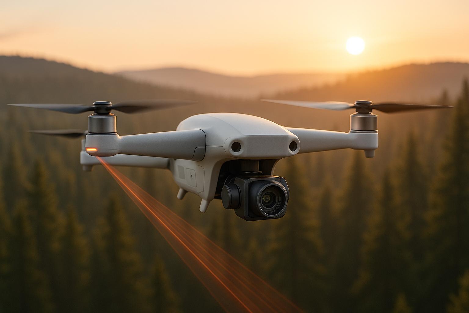
When GPS fails, drones need alternative navigation systems to operate effectively. Two popular options are LiDAR SLAM and Visual SLAM, which help drones map their surroundings and locate themselves without GPS. Both have strengths and limitations, and the right choice depends on your mission, budget, and environment.
Key Differences:
- LiDAR SLAM: Uses lasers to create highly accurate 3D maps. It's reliable in poor lighting and complex spaces but is costly, heavy, and power-intensive.
- Visual SLAM: Relies on cameras and computer vision. It's affordable, lightweight, and works well in well-lit, textured environments but struggles in low light or repetitive surroundings.
Quick Comparison:
| Metric | LiDAR SLAM | Visual SLAM |
|---|---|---|
| Accuracy | High, precise 3D mapping | Depends on lighting and features |
| Cost | Expensive | Affordable |
| Weight | Heavy sensors | Lightweight cameras |
| Power Use | High | Lower |
| Performance in Low Light | Reliable | Limited |
| Effective Range | Better for long distances | Shorter range |
For the best results, hybrid systems combining both technologies are gaining traction. These systems use sensor fusion to balance LiDAR's precision with Visual SLAM's visual detail, ensuring reliable navigation across diverse conditions. Choosing the right system depends on your specific needs, and tools like Anvil Labs can help process and manage the data effectively.
MSA- Visual SLAM (no lidar, no IMU) on a drone -- extended version
LiDAR SLAM for UAV Navigation
LiDAR SLAM plays a key role in enabling precise UAV navigation, especially in environments where GPS signals are unavailable. This makes it an essential tool for industries like construction and emergency response, where accuracy and reliability are paramount.
How LiDAR SLAM Works
LiDAR SLAM combines Light Detection and Ranging (LiDAR) sensors with SLAM (Simultaneous Localization and Mapping) algorithms. When mounted on a UAV, the LiDAR sensor emits laser pulses across a 360-degree field of view. By measuring how long it takes for these pulses to return, the system generates a dense point cloud - a detailed collection of 3D coordinates that represent the surrounding environment.
As the UAV moves, the SLAM algorithms analyze the point cloud in real time. They identify unique geometric features and compare them across successive scans. This process allows the system to simultaneously create a detailed 3D map and track the UAV's exact position within that map.
Benefits of LiDAR SLAM
LiDAR SLAM stands out for its precision, often surpassing traditional GPS-based systems in complex settings or indoor spaces. Since LiDAR sensors emit their own light, they remain effective in low-light or visually challenging environments, such as dark tunnels or dense forests.
Another major advantage is the rich 3D data that LiDAR provides. This data can be used for tasks like asset inspections, volumetric measurements, and structural analysis. Unlike systems that rely on visual features, LiDAR SLAM depends on geometric data, ensuring consistent performance across a wide range of environments.
Drawbacks and Challenges
Despite its strengths, LiDAR SLAM has its share of challenges. High-quality LiDAR sensors are expensive, making them a pricier option compared to camera-based systems. Additionally, their weight and power requirements can limit UAV performance by reducing flight time and restricting the size of compatible drones.
Processing the massive amounts of data generated by LiDAR in real time also demands significant computational resources. This can lead to delays in navigation decisions, especially if the onboard processing power is insufficient. LiDAR systems may also encounter difficulties with reflective or transparent surfaces, like glass or polished metal, as well as in environments lacking distinctive geometric features. Their effective range is another limitation, making them less suitable for large-scale mapping projects. While LiDAR performs well in many weather conditions, extreme factors like heavy rain or fog can still impact accuracy.
Visual SLAM for UAV Navigation
Building on the concept of LiDAR SLAM, Visual SLAM offers a different approach to UAV navigation by using cameras instead of LiDAR sensors. Its affordability and flexibility have made it a popular choice for many industrial UAV applications.
How Visual SLAM Works
Visual SLAM primarily uses cameras, which can be set up as either monocular (one camera) or stereo (two cameras). As the UAV moves, the cameras continuously capture images, and computer vision algorithms analyze these images to detect and track key features like edges and corners.
The process starts with feature extraction, where unique visual landmarks are identified in each frame. These landmarks are then matched across consecutive frames to calculate the UAV's movement. Techniques like triangulation and bundle adjustment help estimate the UAV’s position while simultaneously creating a map of the environment.
Instead of directly measuring distances, Visual SLAM calculates depth indirectly. Stereo setups determine depth by comparing images from the two cameras, while monocular systems rely on motion parallax. This approach forms the foundation for the advantages discussed below.
Benefits of Visual SLAM
One of the biggest advantages of Visual SLAM is its affordability. Standard cameras are much cheaper than high-end LiDAR sensors, making it a cost-effective option.
Cameras are also lighter and consume less energy compared to LiDAR systems. This can extend flight times and allow UAVs to carry additional payloads. Visual SLAM performs particularly well in environments rich in textures, such as urban landscapes, construction sites, or areas with dense vegetation, where the variety of visual features makes tracking more reliable. Additionally, since cameras operate passively without emitting signals, they are ideal for applications requiring discreet sensing.
Drawbacks and Limitations
However, Visual SLAM does face challenges. Lighting is a key factor - low-light conditions or rapidly changing lighting can degrade performance, often requiring additional lighting sources or infrared cameras to compensate.
Depth accuracy is another limitation. While Visual SLAM provides reliable estimates of relative motion, its absolute measurements are generally less precise than those from LiDAR systems. This can be a drawback for applications demanding extremely high accuracy.
Certain environments can also pose problems. Areas with repetitive patterns, blank walls, or uniform surfaces lack the distinctive features needed for accurate tracking. Similarly, weather conditions like rain, snow, fog, or dust can obscure camera lenses and reduce image quality, making navigation difficult.
Finally, the computational load for real-time image processing can be significant, particularly in complex environments or when using high-resolution cameras. This often requires more powerful onboard processors, which can impact the UAV's overall performance. Being aware of these challenges is essential when considering Visual SLAM as an alternative to LiDAR for UAV navigation.
Performance Comparison in GPS-Denied Areas
When operating in GPS-denied environments, picking the right SLAM (Simultaneous Localization and Mapping) technology can make or break a mission. Both LiDAR SLAM and Visual SLAM bring unique strengths and challenges to the table, and understanding these differences is key to achieving success in demanding conditions.
Key Comparison Metrics
-
Mapping Accuracy
LiDAR SLAM excels in accuracy, thanks to its ability to measure distances directly. Visual SLAM’s accuracy, however, depends heavily on the environment - it performs best in settings with abundant features and good lighting. -
Environmental Reliability
LiDAR SLAM is highly reliable across various weather and lighting scenarios. On the other hand, Visual SLAM thrives in well-lit, textured surroundings but struggles in low-light or monotonous environments. -
Hardware Costs
LiDAR sensors tend to be pricey, while Visual SLAM leverages more affordable camera systems, making it a budget-friendly option. -
Processing Requirements
LiDAR SLAM demands significant computational power to handle point cloud data, often requiring specialized hardware. Visual SLAM, though also computationally intensive, can typically run on standard computing systems. -
Field of View
LiDAR sensors often provide a panoramic view, making them ideal for large-scale mapping. Cameras used in Visual SLAM generally have a narrower field of view, which may require multiple cameras or meticulous planning.
Side-by-Side Comparison Table
| Metric | LiDAR SLAM | Visual SLAM |
|---|---|---|
| Mapping Accuracy | Extremely high due to direct distance measurements | Varies based on environmental conditions |
| Hardware Cost | Higher | Lower |
| Weight | Heavier sensors | Lightweight camera systems |
| Power Consumption | High, due to intensive processing | Lower, allowing for energy-efficient operations |
| Weather & Low-Light Performance | Reliable in diverse conditions | Best in well-lit, feature-rich environments |
| Field of View | Panoramic coverage | Narrower; may require multiple cameras |
| Processing Requirements | Requires specialized hardware | Can run on standard platforms |
| Effective Range | Better suited for long-range mapping | Limited to shorter ranges |
| Ideal Applications | Complex environments like tunnels or mines | Urban areas and construction sites |
Practical Impacts on Missions
The choice between LiDAR and Visual SLAM has real-world consequences for mission planning and execution. For instance, LiDAR SLAM shines in dark, uniform, or underground environments, where lighting conditions are poor. In contrast, Visual SLAM works well in urban settings or construction zones, where there’s plenty of light and texture to analyze.
Flight Time Considerations
Visual SLAM systems generally consume less power than LiDAR-based setups. This lower energy demand often translates into longer flight times, which is particularly useful for extended missions or operations in remote areas.
Data Integration Capabilities
LiDAR SLAM produces point cloud data that integrates seamlessly with platforms like Anvil Labs, enabling immediate 3D modeling and spatial analysis. Visual SLAM data, while effective, often requires additional processing to create comparable 3D maps.
These factors - power efficiency, environmental adaptability, and data integration - directly influence mission endurance and operational strategies, making it essential to carefully weigh the pros and cons of each technology.
sbb-itb-ac6e058
Hybrid and Combined Approaches
Drawing from the earlier performance comparisons in GPS-denied environments, a hybrid approach emerges as a practical solution. Instead of relying solely on either LiDAR SLAM or Visual SLAM, many UAV operators are finding that combining these technologies creates a more reliable navigation system. This approach takes the best of both worlds: LiDAR's precision and Visual SLAM's ability to capture detailed imagery, compensating for each method's shortcomings and delivering consistent performance in a variety of conditions.
What is Sensor Fusion?
Sensor fusion refers to the process of merging data from multiple sensors to achieve a more accurate and complete understanding of the surroundings. In the context of UAV navigation, this means integrating LiDAR sensors with cameras to construct an environmental model that would be impossible to achieve with either technology alone.
By addressing the specific limitations of LiDAR and Visual SLAM discussed earlier, sensor fusion creates a navigation system that is both efficient and adaptable. LiDAR provides precise distance measurements, while cameras add rich visual detail. Together, they form a comprehensive map of the environment.
Modern sensor fusion algorithms dynamically adjust their reliance on each sensor based on the situation. For example, in a well-lit area with distinct visual features, the system might prioritize camera data. On the other hand, in dimly lit or textureless spaces, LiDAR data becomes the primary input. This adaptability ensures optimal performance across varying conditions.
Although hybrid systems require more computational power than single-sensor setups, advancements in processing technology now make it possible to run these complex algorithms on compact UAV-mounted computers. This means operators can enjoy the benefits of sensor fusion without significantly compromising flight time or payload capacity.
When to Use Hybrid Systems
Hybrid systems shine in scenarios where lighting and environmental textures change rapidly, such as industrial complexes, construction zones, and underground mines. These systems are particularly useful for UAV operators who need to balance cost, power consumption, and accuracy.
For high-stakes missions, hybrid systems offer an added layer of reliability. Single-sensor failures in critical applications can lead to expensive setbacks, such as aborted missions or damaged equipment. By combining multiple sensors, hybrid systems provide redundancy, reducing the risk of failure. This makes them especially valuable for tasks like infrastructure inspections or emergency response operations, where reliability is non-negotiable.
In challenging conditions - be it poor lighting or adverse weather - hybrid systems ensure mission continuity. Platforms like Anvil Labs take this a step further by using hybrid SLAM data to generate detailed 3D models that combine precise geometry with rich visual textures, improving spatial analysis and decision-making.
Choosing the Right UAV Navigation Technology
Selecting the right UAV navigation technology depends on your mission goals, budget, and the environment you'll be operating in. Whether you're considering LiDAR SLAM, Visual SLAM, or a hybrid approach, the decision goes beyond just technical performance. It's about finding the solution that aligns with your specific needs and constraints.
Key Selection Factors
Start by assessing the precision your mission demands. For tasks requiring high accuracy, LiDAR SLAM is the go-to choice. On the other hand, Visual SLAM is a more budget-friendly option, ideal for general mapping and documentation.
Budget plays a significant role as well. LiDAR systems are typically more expensive due to the advanced sensors they use, making them a better fit for organizations with more resources. Meanwhile, Visual SLAM offers a cost-effective alternative for those working within tighter financial limits.
Consider the weight and power requirements of the sensors, as these impact the UAV's flight time. If you're operating indoors or in areas with poor lighting, LiDAR SLAM performs better. For outdoor environments rich in visual features, Visual SLAM is a natural fit. Keep in mind that LiDAR data generates larger datasets, requiring more robust processing capabilities, while Visual SLAM data is lighter and easier to handle.
These factors not only influence your choice of navigation technology but also determine your data processing and management needs, paving the way for platforms like Anvil Labs.
Working with Platforms like Anvil Labs

Once you've chosen the right navigation system, managing and processing the collected spatial data becomes critical. Platforms like Anvil Labs simplify this process by offering tools to handle diverse data types, including LiDAR point clouds, 3D models, thermal imagery, and orthomosaics.
Anvil Labs eliminates the need for extensive in-house infrastructure by providing powerful data processing and hosting solutions. Teams can upload their navigation data directly to the platform, where it’s processed efficiently and affordably - perfect for operations that require flexibility and scalability.
The platform also supports cross-device accessibility, allowing field teams to review 3D models and navigation data from any device. This feature is especially useful for time-sensitive missions, enabling teams to analyze results quickly and make informed decisions on the spot.
Anvil Labs enhances usability further with annotation and measurement tools. These features help teams turn raw data into actionable insights, whether they're using LiDAR SLAM for precise measurements or Visual SLAM for visual documentation.
For those employing hybrid navigation systems, Anvil Labs supports the integration of LiDAR point clouds with visual imagery. This capability results in detailed 3D models that combine geometric precision with rich visual details, offering improved situational awareness and a clearer understanding of the environment.
Conclusion
When deciding between SLAM methods, the right choice depends on your mission requirements, budget, and operational environment.
LiDAR SLAM stands out when precision is non-negotiable. Its ability to generate highly accurate 3D point clouds, regardless of conditions, makes it a go-to for tasks like industrial inspections or infrastructure monitoring. That said, this level of accuracy comes with higher costs and the need for significant computational power to handle large datasets.
On the other hand, Visual SLAM offers a budget-friendly alternative with lower computational demands. It's particularly effective for general mapping and outdoor environments rich in visual features. However, it does have limitations, such as reduced accuracy and sensitivity to lighting changes, especially compared to LiDAR-based systems.
For those seeking the best of both worlds, hybrid approaches that combine LiDAR and Visual SLAM through sensor fusion are paving the way forward. While these systems offer greater reliability and performance, they also require advanced data management solutions to handle their complexity.
Efficient data processing is key to unlocking the full potential of these technologies. Tools like Anvil Labs simplify this process by providing robust solutions for handling diverse spatial datasets, including LiDAR point clouds, 360° imagery, thermal data, and orthomosaics. This makes advanced SLAM data processing accessible without needing extensive internal resources.
Ultimately, successful UAV navigation depends on choosing the right technology for your goals and pairing it with effective data management workflows. By leveraging tools like Anvil Labs, you can turn raw sensor data into actionable insights and elevate your UAV's capabilities.
FAQs
How do hybrid systems using both LiDAR and Visual SLAM improve UAV navigation compared to using each technology alone?
Hybrid Systems: LiDAR and Visual SLAM for UAV Navigation
Combining LiDAR and Visual SLAM technology creates a powerful solution for UAV navigation, especially in environments where GPS signals are weak or unavailable. These hybrid systems take advantage of the strengths of both methods, resulting in improved accuracy and dependability.
LiDAR offers highly precise depth measurements, even in conditions with poor lighting or minimal surface textures. On the other hand, Visual SLAM excels at detecting and following visual features in the surroundings. When used together, these technologies complement each other, overcoming the weaknesses of using either one alone. This makes hybrid systems particularly well-suited for tasks like industrial inspections, search and rescue missions, and autonomous drone operations in rugged or complex terrains.
What should you consider when choosing between LiDAR SLAM and Visual SLAM for UAV navigation?
When choosing between LiDAR SLAM and Visual SLAM for UAV navigation, the decision largely depends on the environment and the specific needs of the mission. Each technology has strengths that make it better suited for certain scenarios.
LiDAR SLAM stands out in challenging conditions like low-light or GPS-denied areas. Its ability to generate highly accurate 3D maps makes it a strong choice for outdoor environments or places with few distinguishable features. On the flip side, Visual SLAM is often a more budget-friendly option and performs well in well-lit environments, especially indoors where visual features are plentiful.
Here are a few key considerations:
- Environmental conditions: If lighting is poor or the area lacks visual landmarks, LiDAR is better equipped to handle the job.
- Budget: Visual SLAM is typically less expensive and easier to implement.
- Mission requirements: For indoor navigation, Visual SLAM is often sufficient, whereas outdoor mapping may demand the precision of LiDAR.
By weighing these factors, you can determine which technology aligns best with the unique challenges and goals of your UAV mission.
How does Anvil Labs help manage and process data from LiDAR and Visual SLAM systems for UAV navigation?
Anvil Labs makes handling data from LiDAR and Visual SLAM systems easier by providing a powerful platform tailored for UAV workflows. Their tools are compatible with various data formats, including 3D models, LiDAR scans, thermal images, and more.
Equipped with AI-driven analysis, annotation, and measurement tools, the platform delivers precise mapping and localization, even in challenging environments. It also offers secure data sharing and real-time collaboration, simplifying UAV operations and boosting productivity across different projects.
