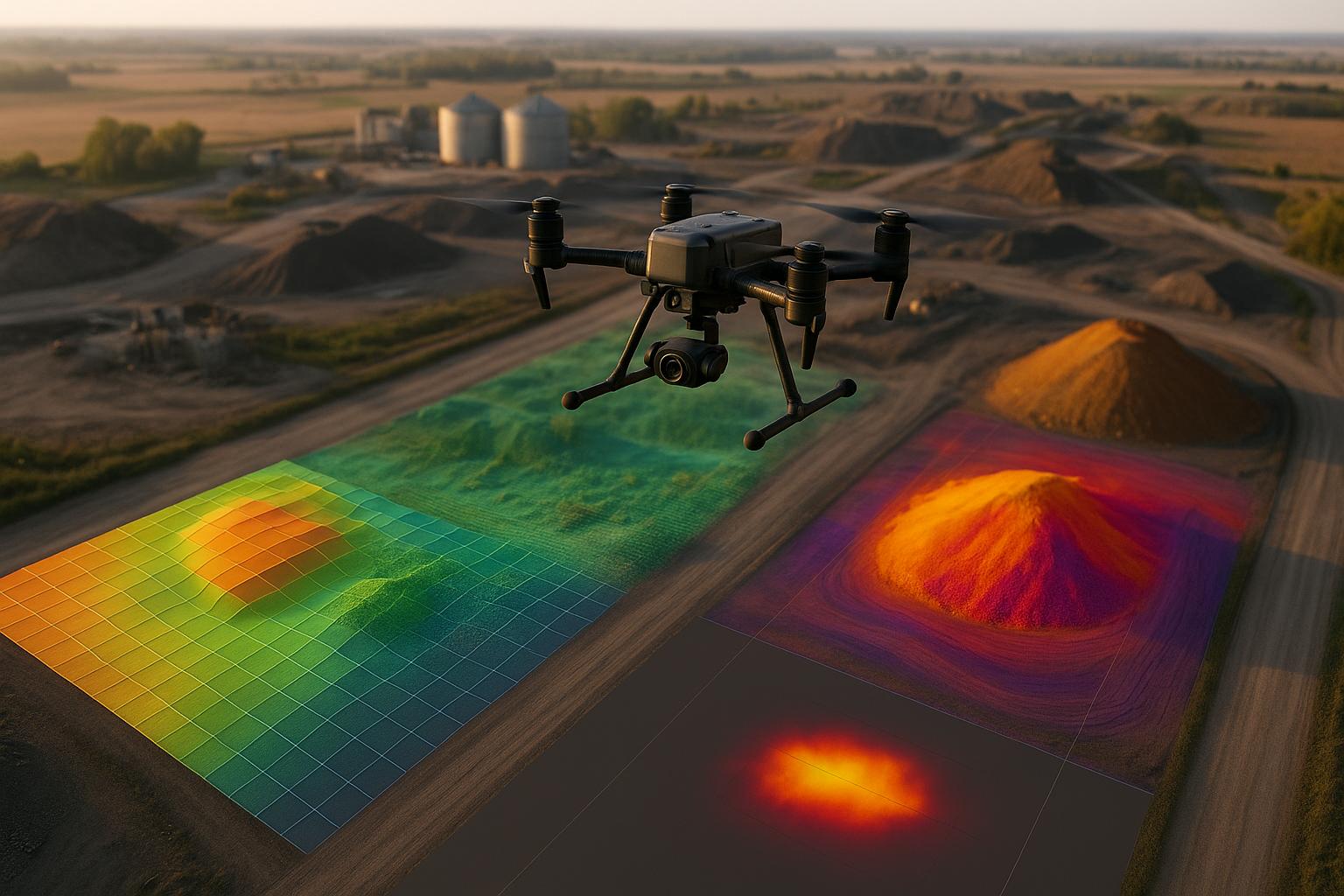
Drone data is only valuable when it’s actionable. Integrating drone outputs - like 3D models, thermal scans, and LiDAR data - into tools your team already uses is key to unlocking their potential. By connecting drone data to AI platforms, task management systems, and cloud services, businesses can streamline workflows, reduce errors, and make faster decisions.
Key Takeaways:
- Faster Workflows: Automated integrations cut inspection times by 75%.
- Improved Accuracy: AI tools detect 30% more defects than manual reviews.
- Centralized Access: Platforms like Anvil Labs combine drone data with AI insights in one interface.
- Collaboration: Cloud-based tools enable real-time sharing and annotations across teams.
- Security: Role-based permissions and encryption protect sensitive data.
To get started, focus on small-scale pilots, standardize data formats, and use APIs to connect drone insights directly to operational systems. This approach ensures better efficiency and measurable results.
CANVAS Workshop | Analyzing Drone Imagery from D2S Using SAMGeo and GeoAI
1. Anvil Labs
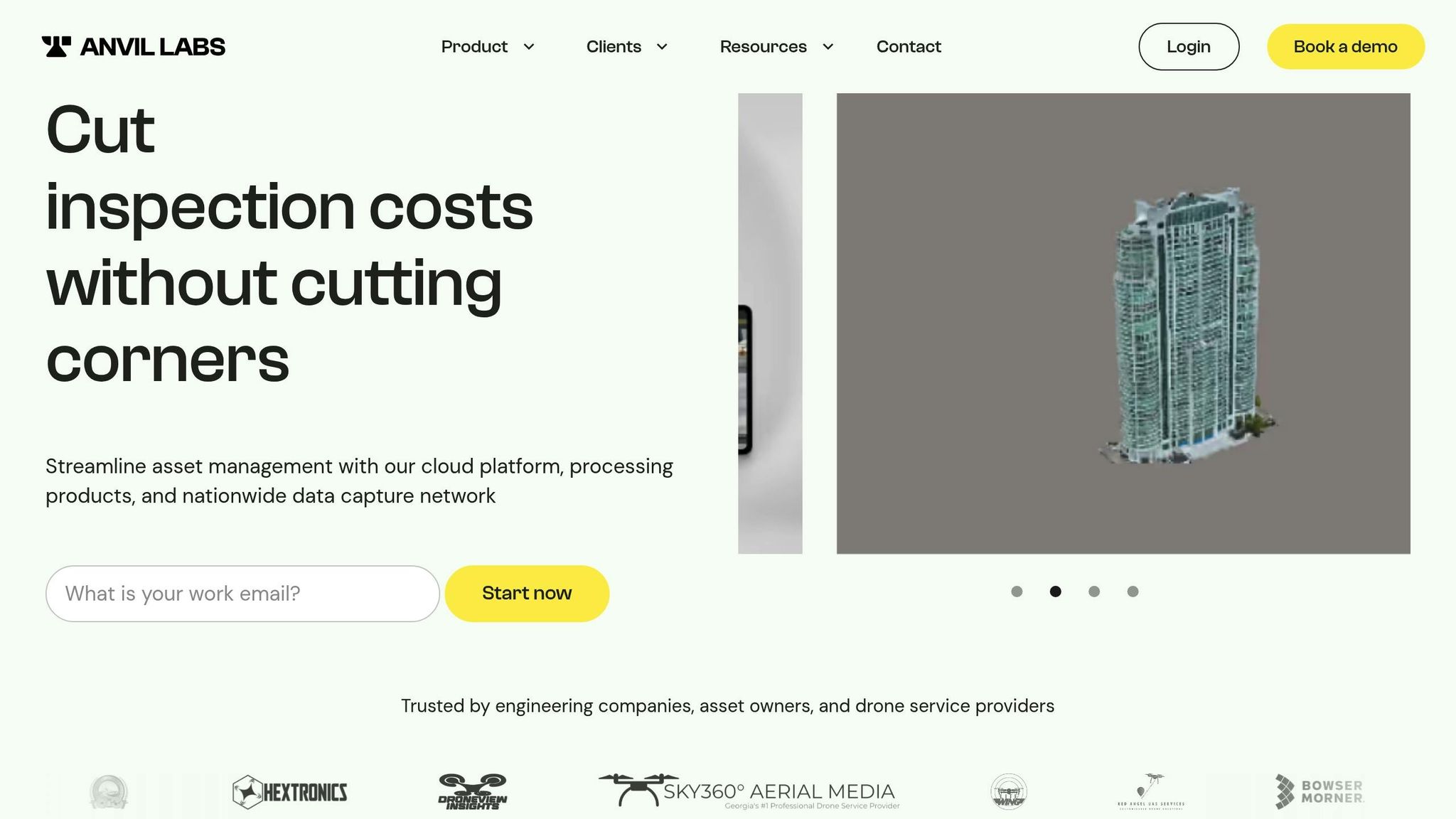
Anvil Labs simplifies drone data management by centralizing and transforming raw outputs into practical insights for industrial operations. Instead of juggling scattered files across various tools, teams can upload their drone data to a cloud platform that processes, stores, and connects spatial information with the systems they already use.
Data Processing & Hosting
The platform handles a variety of drone data types, including 3D models, orthomosaics, LiDAR point clouds, thermal imagery, and 360° panoramas. Once uploaded, the data is converted into browser-based visualizations, removing the need for specialized desktop software or managing bulky local files.
For U.S.-based industries like energy, construction, or utilities, this means teams can capture site data in the morning and have stakeholders reviewing processed 3D models by the afternoon. These digital models serve as a lasting visual record for inspections, progress tracking, compliance checks, and planning discussions.
Measurements are displayed in feet, yards, and miles for U.S. users, with temperature overlays in degrees Fahrenheit. For organizations with international partners, metric units are also available. By merging RGB imagery, thermal data, and LiDAR into one viewer, Anvil Labs eliminates the hassle of switching between specialized tools. For instance, a maintenance engineer can assess roof geometry in 3D, switch to a thermal view to detect heat issues, and explore 360° ground-level imagery - all within the same interface.
This efficient data processing sets the stage for seamless integration with other tools.
Integration Capabilities
After processing, the drone data integrates effortlessly with AI tools, task management systems, and content platforms. AI services can detect defects, calculate volumes, or identify compliance issues. For example, if the AI spots a crack or an unexpected thermal hotspot, the issue is highlighted directly on the 3D model. Integration with task management systems can then generate work orders automatically, streamlining the process from data collection to action.
The platform also supports embedding content from Matterport and YouTube, enabling teams to combine exterior drone models with interior walkthroughs or instructional videos. For example, a construction manager could examine a drone-mapped exterior and seamlessly switch to a Matterport scan of the interior, all within one workspace.
These integrations make Anvil Labs a central hub for visual and spatial data, enriched with AI insights and human input, while triggering actions in project management, asset tracking, and reporting systems.
Collaboration & Accessibility
With cross-device compatibility, field supervisors in remote U.S. locations can review 3D site models on tablets, annotate areas of concern, and have office-based engineers respond within minutes. The browser-based viewer works on desktops, laptops, and mobile devices without requiring app downloads or high-end hardware.
Features like distance measurements, area calculations, volume estimates, and threaded comments turn static drone captures into interactive, collaborative workspaces. A safety manager can measure clearances in feet, an estimator can calculate stockpile volumes in cubic yards, and a project coordinator can leave notes about schedule impacts - all on the same model.
This shared spatial context minimizes miscommunication. Instead of lengthy emails or static screenshots, teams can reference specific points on a 3D model, streamlining remote collaboration.
Security & Data Sharing
Anvil Labs balances collaboration with data security, offering controlled sharing options for sensitive infrastructure data. Role-based permissions and time-limited access meet enterprise security standards.
For critical infrastructure, auditing data access is essential. The platform’s access controls and sharing logs support compliance documentation and security reviews, addressing concerns about capturing imagery of sensitive sites.
"My models look fantastic - Thank you!"
Scott Thomas from SkyAerial360 praised the quality of processed outputs. Adrian, a drone service provider, highlighted the competitive edge:
"This is a differentiator. Those that aren't able to provide visualization but are just doing raw footage - this gives you, in my opinion, that competitive edge."
To accommodate various needs, Anvil Labs offers flexible pricing. The Asset Viewer plan costs $99 per month, with optional data processing at $3 per gigapixel. For one-time projects, the Project Hosting plan is available at $49 per project, eliminating recurring fees.
2. AI Analysis Platforms
AI platforms take drone data management to the next level, turning raw information into insights that decision-makers can use. By leveraging computer vision, these platforms analyze different data types - like imagery, LiDAR, thermal, and multispectral inputs - to identify objects, assess conditions, and create detailed maps and models tied to site coordinates. This level of precision prepares the data for large-scale hosting and further analysis.
Data Processing & Hosting
AI platforms can handle thousands of images, transforming them into outputs like orthomosaics, classified point clouds, and annotated models with centimeter-level accuracy. For U.S. enterprises, reliable detection and rapid processing - whether on a daily or weekly basis - are vital for keeping operations running smoothly.
When it comes to hosting, there are several options to consider: cloud, on-premises, or hybrid setups. Cloud hosting via major providers is particularly suitable for industries like construction or agriculture, where teams operate across numerous locations. On the other hand, sectors like energy utilities or transportation often lean toward on-premises or private cloud solutions to meet strict security and data residency requirements. Hybrid models offer a middle ground, storing raw data on private infrastructure while running analytics in the cloud. This setup provides the speed of cloud computing while adhering to compliance and security needs.
Key factors in choosing a hosting model include compatibility with existing data lakes, expected data volumes (often measured in terabytes annually), and the organization's preference for managing infrastructure versus outsourcing. Platforms that support both cloud and on-premises options offer flexibility, making it easier to adapt to changing IT or security policies.
Integration Capabilities
AI platforms excel when they integrate seamlessly with enterprise systems. REST APIs, webhooks, and SDKs allow analysis results to flow directly into asset management systems, GIS tools like ArcGIS, and software used for construction or maintenance. Native integrations enable automatic syncing of orthomosaics, 3D models, and defect reports with existing workflows.
In practical terms, platforms that generate work orders or tickets from detected issues close the gap between aerial insights and ground-level action. For example, if AI models identify corrosion on infrastructure or changes in stockpile volumes, these findings can be converted into actionable tasks, complete with priority levels, progress tracking, and automated alerts when thresholds are exceeded.
By combining AI insights with tools designed for spatial or 3D management, enterprises gain a clearer understanding of their operations. Whether it's detecting defects or analyzing change maps, this approach provides decision-makers with intuitive tools for planning repairs, managing projects, and communicating effectively across teams.
Collaboration & Accessibility
Browser-based tools make it easy for teams to access maps, 3D models, and AI-generated annotations from any device. Features like shared projects, role-based access, and in-view commenting streamline collaboration, even when team members work asynchronously.
Time-series views and change detection layers add another layer of value, showing how a site evolves over time. These tools are especially useful for documenting progress or meeting regulatory reporting requirements, as they provide clear visual evidence of changes across days, weeks, or months. Importantly, AI outputs are designed to fit into existing workflows, ensuring that teams can integrate findings without overhauling their current processes.
Security & Data Sharing
Secure sharing features allow enterprises to control access to specific projects, maps, or reports. Time-limited, permission-scoped links ensure that external users only see the data they’re authorized to view. Additional safeguards like watermarked previews, restricted downloads, and detailed access logs help maintain an audit trail, which is critical for inspections, claims, or compliance in regulated sectors.
For sensitive data, some platforms support exporting redacted or summarized outputs, such as defect lists or aggregated metrics. Critical infrastructure operators should prioritize platforms with strong user authentication, role-based permissions, encryption (both in transit and at rest), and compliance with U.S.-specific security standards. Options for private networking and geographic data restrictions further protect sensitive information.
Platforms that centralize data from multiple sites across the U.S. offer significant advantages. By tagging datasets with location, time, and asset information, organizations can streamline operations and gain a comprehensive view of their assets. Automated workflows can handle everything from scheduling drone missions to triggering AI analysis and updating dashboards, reducing manual effort. Multi-site management tools also allow teams to focus on high-priority issues based on AI-driven metrics, rather than manually reviewing each site.
Starting with focused use cases - like roof inspections or stockpile measurements - can help validate AI outputs and refine workflows. Once the results are reliable and the benefits are clear, organizations can update their procedures, train teams, and deepen integrations, making AI insights a standard part of their operations.
sbb-itb-ac6e058
3. Cloud Services for Enterprise Use
Cloud platforms have become the backbone of enterprise drone data management, turning raw drone captures into actionable insights that drive industrial operations forward.
Data Processing & Hosting
Modern cloud services handle a wide array of drone data formats, including high-resolution imagery, orthomosaics, digital surface models, 3D point clouds, LiDAR datasets, and thermal imagery. Each type of data has unique storage and performance needs. For instance, a single LiDAR scan of an industrial site might generate terabytes of data, while thermal images from routine inspections require far less storage.
To manage these varied demands, cloud platforms use tiered storage systems. Large raw files are stored in cost-efficient object storage solutions, while frequently accessed metadata and processed derivatives are kept in faster storage types like block or database storage. When drone data is uploaded to the cloud, automated workflows kick in - processing it into mosaics, 3D models, and analytics reports. Serverless functions can even tag files with project-specific information and export results directly to GIS or asset management systems, cutting out manual steps entirely.
Region-specific processing ensures low latency and compliance with geographic regulations. Cost management is another critical factor. Cloud providers charge for storage, compute time, and data egress, so many organizations implement lifecycle rules to move older datasets to cheaper storage tiers while keeping them accessible for audits or re-analysis. Retention policies vary: regulatory industries may need to store inspection records for years, while construction progress photos might only be needed for the duration of a project.
Platforms like Anvil Labs illustrate how these cloud capabilities come together. They host and process massive 3D models, LiDAR scans, and 360° imagery for industrial sites. By leveraging scalable cloud storage and compute clusters, they can process raw spatial data into navigable digital twins. With cloud-based content delivery and caching, users across the U.S. can easily view intricate 3D scenes on any device - be it a laptop, tablet, or smartphone - without performance hiccups.
These processing pipelines integrate seamlessly with enterprise systems through standardized APIs, ensuring smooth data flow.
Integration Capabilities
Cloud platforms shine in their ability to connect with enterprise systems, thanks to robust REST APIs, webhooks, and SDKs. By supporting standard geospatial formats like GeoTIFF, LAS/LAZ, and common 3D file types, they ensure compatibility with AI tools, GIS software, and CAD applications without the need for extra conversion steps.
Event-driven integrations streamline workflows. For example, when new drone datasets are uploaded, they can automatically trigger AI-based defect detection, update GIS layers, or generate tasks in work-order management systems. This eliminates manual handoffs, reducing errors and saving time.
For U.S. enterprises, features like Single Sign-On (SSO) and role-based access controls are critical. These allow drone outputs to integrate directly into existing dashboards and collaboration tools without requiring separate login systems. This ensures that field technicians, project managers, and other stakeholders can access the data they need without added complications.
Secure sharing links and embedded views make it easy to integrate drone data into enterprise portals, turning isolated files into essential parts of daily operations.
Collaboration & Accessibility
Cloud platforms also enhance teamwork by offering real-time, universally accessible visualizations. Browser-based viewers enable users to explore and annotate 2D maps and 3D models in real time, bridging the gap between field and office teams. Annotations can include comments, photos, or documents tied to specific locations. For instance, an engineer can flag a structural issue on a 3D model, and a field technician can see and address that note on-site without needing additional communication tools.
Time-series visualization is particularly useful for tracking changes over time. Whether monitoring construction progress, assessing asset wear and tear, or documenting environmental changes, this feature provides valuable insights. It's especially helpful for regulatory reporting, where visual evidence of site conditions is often required.
"I showed this to the fire department and they all loved it!" - Brian Wellington, Litewing
Mobile-friendly interfaces and offline sync options ensure accessibility for teams working across time zones and remote locations. For example, a supervisor in Texas can review morning flight data from a California site later the same day, keeping operations running smoothly.
"This is a differentiator. Those that aren't able to provide visualization but are just doing raw footage - this gives you, in my opinion, that competitive edge." - Adrian, Drone Service Provider
Security & Data Sharing
Securing drone data during sharing is a top priority. Cloud platforms provide granular sharing options, such as time-limited links, project-level permissions, watermarking, and download restrictions. These features allow organizations to share only the necessary data while keeping sensitive information protected.
Many U.S. enterprises rely on federated access systems, enabling external contractors or regulators to log in with their own credentials while still adhering to the host company’s security policies. This approach maintains audit trails and prevents unauthorized access to internal systems.
Similar to Anvil Labs' role-based permissions, advanced security measures include encryption at rest and in transit, detailed access logging, and fine-grained permissions. These measures align with frameworks like SOC 2 or ISO 27001, which are essential for regulated industries such as energy, infrastructure, and government. Best practices often include segregating development, testing, and production environments and limiting access to sensitive data based on user roles.
Access logging is crucial for compliance and incident response, while data classification ensures appropriate security policies are applied. For example, public marketing imagery can be freely shared, whereas operational data remains tightly controlled.
To optimize costs and performance, processing is often co-located with storage in the same region, reducing data transfer expenses and meeting residency requirements. Strategies like link-based sharing and caching frequently accessed data layers through content delivery networks further enhance efficiency.
Starting with a well-defined data model - covering projects, sites, assets, and time-series data - lays the groundwork for scaling from pilot projects to full-scale deployment. Standardizing file naming conventions and metadata, along with using Infrastructure as Code and deployment templates, ensures that every new site benefits from a secure, tested pipeline for data ingestion, processing, and sharing. Ongoing training and collaboration with IT and security teams help integrate these tools into core operations seamlessly.
Advantages and Disadvantages
After exploring various integration tools, let’s break down the upsides and downsides of each approach. This understanding can help U.S. businesses select the right combination of tools - whether it’s a dedicated platform, AI-powered analytics, cloud infrastructure, or a mix of all three.
Integrated Platforms Like Anvil Labs
Centralized platforms simplify workflows by hosting 3D models, LiDAR scans, orthomosaics, thermal imagery, and 360° photos in one place. Instead of juggling multiple viewers and formats, teams can access all spatial data via a single web interface. This reduces the hassle of switching between tools and minimizes the risk of losing data.
Platforms like Anvil Labs also come with built-in integrations for media, AI, and task management systems. For instance, Anvil Labs connects with Matterport, YouTube, AI analysis tools, and work-order systems, transforming drone data into actionable workflows rather than isolated files. Plus, cross-device accessibility ensures seamless collaboration.
However, these platforms can lead to vendor lock-in. Once proprietary features and workflows become deeply embedded, switching systems can be both time-consuming and expensive. Additionally, some organizations may find that advanced GIS analysis, niche AI models, or specific hosting needs exceed the platform’s capabilities, requiring custom integrations or additional tools. Cost is another factor - Anvil Labs charges $99/month for its Asset Viewer plan or $49/project for Project Hosting, so the benefits must outweigh these recurring expenses.
Next, let’s explore how AI analysis platforms complement such systems by automating inspections and assessments.
AI Analysis Platforms
AI tools are particularly effective at processing large volumes of imagery into actionable insights. They can automate tasks like object detection, defect identification, volumetric calculations, and change detection, significantly reducing manual review time. For organizations managing multiple sites, this automation ensures consistent evaluations, prioritizes maintenance tasks, and provides near real-time alerts. This allows teams to allocate resources efficiently while maintaining safety and compliance.
One major benefit is scalability. AI models can process terabytes of drone data, identifying issues like corrosion, cracks, or missing components across hundreds of assets far faster than human teams could.
That said, AI isn’t perfect. These models can generate false positives or miss subtle issues due to environmental variations, which means human validation is still crucial for important decisions. They also require high-quality imagery and robust computing resources, which can drive up costs. Moreover, proprietary models are often difficult to customize, and training them can be complex. Processing high-resolution imagery or LiDAR datasets may also lead to higher cloud compute expenses.
Cloud Services for Enterprise Use
Cloud platforms like AWS, Azure, and Google Cloud offer scalable storage and computing power, making them ideal for handling drone imagery and 3D models without the need for on-site data centers. They also provide mature security, seamless integrations, and tools for embedding drone-derived insights into dashboards, analytics workflows, and business applications.
Features like web-based 2D and 3D visualization, collaboration tools (e.g., annotations and measurements), and identity management systems make these platforms appealing for distributed teams. Usage-based pricing in U.S. dollars adds flexibility, while features like Single Sign-On simplify user management.
However, cloud services come with potential downsides. Without active monitoring, storage, compute, and data transfer costs can quickly add up. Organizations in regulated sectors may face challenges with data residency, latency, or offline-access requirements, which could necessitate hybrid or edge solutions. Additionally, bandwidth demands for high-resolution datasets can be a bottleneck, and reliance on vendor roadmaps for new features may limit adaptability.
Task Management and Project Integrations
Integrating drone data with task management systems transforms insights into actionable tasks, alerts, and progress reports. This ensures drone findings drive operational actions rather than sitting unused in a viewer. Automated status updates also streamline reporting for stakeholders.
However, there’s a risk of misaligned or duplicated data between systems. Proper configuration and user training are essential to ensure operational teams trust and act on drone-derived tasks. Building and maintaining integrations - whether through APIs or webhooks - requires ongoing effort, including engineering, testing, and monitoring.
Comparison Table
| Tool Type | Key Advantages | Key Disadvantages |
|---|---|---|
| Integrated Platforms (e.g., Anvil Labs) | Centralized access to 3D models, LiDAR, orthomosaics, thermal, and 360° imagery; built-in integrations with AI and task tools; cross-device accessibility | Vendor lock-in; limited support for advanced GIS or niche AI features; recurring costs ($99/month or $49/project); requires disciplined data management |
| AI Analysis Platforms | Automates defect detection and risk assessment; processes large datasets quickly; supports volumetric calculations and change detection; scales without adding reviewers | Risk of false positives/negatives; complex training and tuning; computationally intensive; higher compute costs; limited customization for proprietary models |
| Cloud Services (AWS, Azure, Google Cloud) | Scalable storage and compute; strong security and compliance (SOC 2, ISO 27001); integrates with data lakes, BI tools, and AI services; flexible, usage-based pricing | High ongoing costs for storage and compute; bandwidth/latency challenges; data residency and offline-access limitations; reliance on vendor roadmaps |
| Task Management Integrations | Converts drone findings into actionable tasks and alerts; automates status reporting; streamlines stakeholder communication | Risk of data misalignment; requires careful setup and training; ongoing monitoring and engineering effort needed |
Practical Guidance
Many teams underestimate the effort required to standardize data formats, file naming conventions, and metadata like coordinate systems and timestamps. Missteps here can lead to broken automations or misaligned dashboards. Experts often recommend a layered approach: use a specialized platform like Anvil Labs for collaboration, pair it with targeted AI tools for specific detection tasks, and rely on a governed cloud environment for long-term storage and analytics.
Start by defining clear business goals and measurable KPIs - such as reducing inspection time or resolving safety issues faster. This ensures your integration stack is evaluated based on its operational and financial impact, not just its technical features. Standardize export formats (e.g., GeoTIFF, LAS/LAZ, OBJ/FBX, IFC) to ensure compatibility between drone platforms and downstream systems like GIS or BIM.
When testing AI integrations, pilot projects with labeled ground-truth data are essential. Measure the accuracy of AI models on key use cases - like detecting corrosion or cracks - to confirm they add value. Push high-priority insights into task management tools via APIs or middleware, keeping raw data in specialized viewers to avoid overloading ticketing systems.
For cloud services, monitor storage and data transfer costs closely. Use lifecycle policies to move older data to cheaper storage tiers and estimate costs using cloud providers’ per-gigabyte and per-request pricing. Ensure your data residency and retention policies align with U.S. regulations, particularly for sectors like utilities, energy, and public safety.
Finally, prioritize platforms with strong security features - like SSO, role-based permissions, and encryption - before integrating drone data with internal systems. These steps will help U.S. enterprises build an efficient, secure, and scalable integration strategy.
Conclusion
Choose drone solutions that address your most pressing challenges. Anvil Labs stands out when visual context and cross-functional collaboration are top priorities. Teams across the U.S. can access 3D models, LiDAR scans, 360° imagery, thermal data, and orthomosaics in one spatially aware platform. With competitive pricing, it minimizes the need for manual site visits and simplifies stakeholder reviews, creating a streamlined workflow that supports specialized solutions.
AI tools are invaluable for processing large volumes of imagery to detect defects, classify objects, and track changes. However, their effectiveness depends on high-quality inputs and regular validation. These tools scale effortlessly across hundreds of assets, saving considerable time on inspection reviews. While AI transforms raw data into actionable insights, cloud platforms serve as the backbone for managing and securing that data.
Cloud services are essential for scalability, security, and seamless enterprise integration. They provide critical infrastructure for identity management, audit logging, and cost control while meeting regional data residency requirements - an important factor for regulated industries in the U.S. Cloud platforms also enable event-driven workflows, automatically triggering processes like AI analysis and task creation whenever new drone data is uploaded.
To maximize these platform capabilities, integrating them with operational systems is key. For workflows involving work orders, GIS, or digital twins, prioritize platforms with robust APIs and prebuilt connectors. Anvil Labs acts as the visual interface, linking measurements, annotations, and 3D views to asset IDs or tickets in your CMMS or EAM. Meanwhile, AI engines feed structured detections directly into task management systems, with cloud platforms orchestrating these processes to ensure drone insights lead to actionable results.
Start with one or two pilot sites to build a complete end-to-end workflow: from drone data capture and upload to processing, AI analysis, visualization in Anvil Labs, and automated task creation. Over 6–12 months, establish consistent data standards - such as naming conventions, coordinate systems, and metadata fields - and document integration methods to scale the process to additional sites. By the end of the pilot, you’ll have a proven framework, trained users, and measurable metrics like reduced inspection cycle times or fewer safety incidents to guide future investments.
Enterprises must prioritize platforms with strong security measures, including encryption, role-based access, and SSO, to protect sensitive data. While cloud providers offer extensive security features, specialized drone platforms like Anvil Labs add tailored controls, such as project-specific permissions and secure sharing options for contractors.
The ideal strategy combines a specialized visualization and collaboration platform like Anvil Labs, targeted AI tools for specific tasks, and a secure, scalable cloud environment for long-term storage and analytics. This modular approach provides flexibility, reduces vendor lock-in, and ensures a better fit for complex operations. Organizations with advanced IT capabilities often prefer this architecture, while those with fewer resources may lean toward unified platforms that cover the entire workflow with "good enough" functionality. A well-integrated, secure ecosystem can transform drone data into actionable results. Define clear goals and KPIs - like cutting inspection times by 75% or identifying 30% more defects - to measure the operational and financial impact of your solution stack effectively.
FAQs
How does integrating drone data with AI tools and task management systems enhance efficiency?
Integrating drone data with AI tools and task management systems simplifies workflows by automating tedious tasks such as inspections and compliance checks. This not only cuts down on manual labor but also accelerates data analysis and enhances the accuracy of reports.
Using these integrations, teams can handle large datasets efficiently, focus on high-priority tasks, and make well-informed decisions. The result? A noticeable boost in productivity and smoother operations.
What security measures should I take when sharing drone data with teams and external partners?
When sharing drone data, safeguarding data security is essential to protect sensitive information and adhere to regulatory requirements. Here’s how you can ensure your data stays secure:
- Use encrypted platforms for data transfer and storage to prevent unauthorized access.
- Implement role-based permissions to define who can view, edit, or share specific data.
- Regularly review access controls to revoke permissions for individuals who no longer need access.
- Conduct audits to track how and when data is accessed or shared.
Platforms such as Anvil Labs offer secure solutions for data sharing, enabling seamless collaboration with teams and stakeholders while keeping security a top priority.
How can cloud services help scale and integrate drone data with enterprise systems?
Cloud services are a game changer when it comes to managing and integrating drone data within enterprise systems. They provide secure storage, easy access, and collaboration tools that make handling large datasets more efficient. Whether it's 3D models, thermal imagery, or LiDAR scans, businesses can store vast amounts of drone data while ensuring teams can access it from virtually anywhere.
By using cloud-based integrations, drone data can effortlessly sync with tools like AI analysis platforms, task management software, and enterprise systems. This not only simplifies workflows but also enhances decision-making processes. On top of that, these services often include advanced capabilities such as data processing, annotation tools, and customizable viewing options, making it easier for teams to analyze, interpret, and share insights across the organization.
