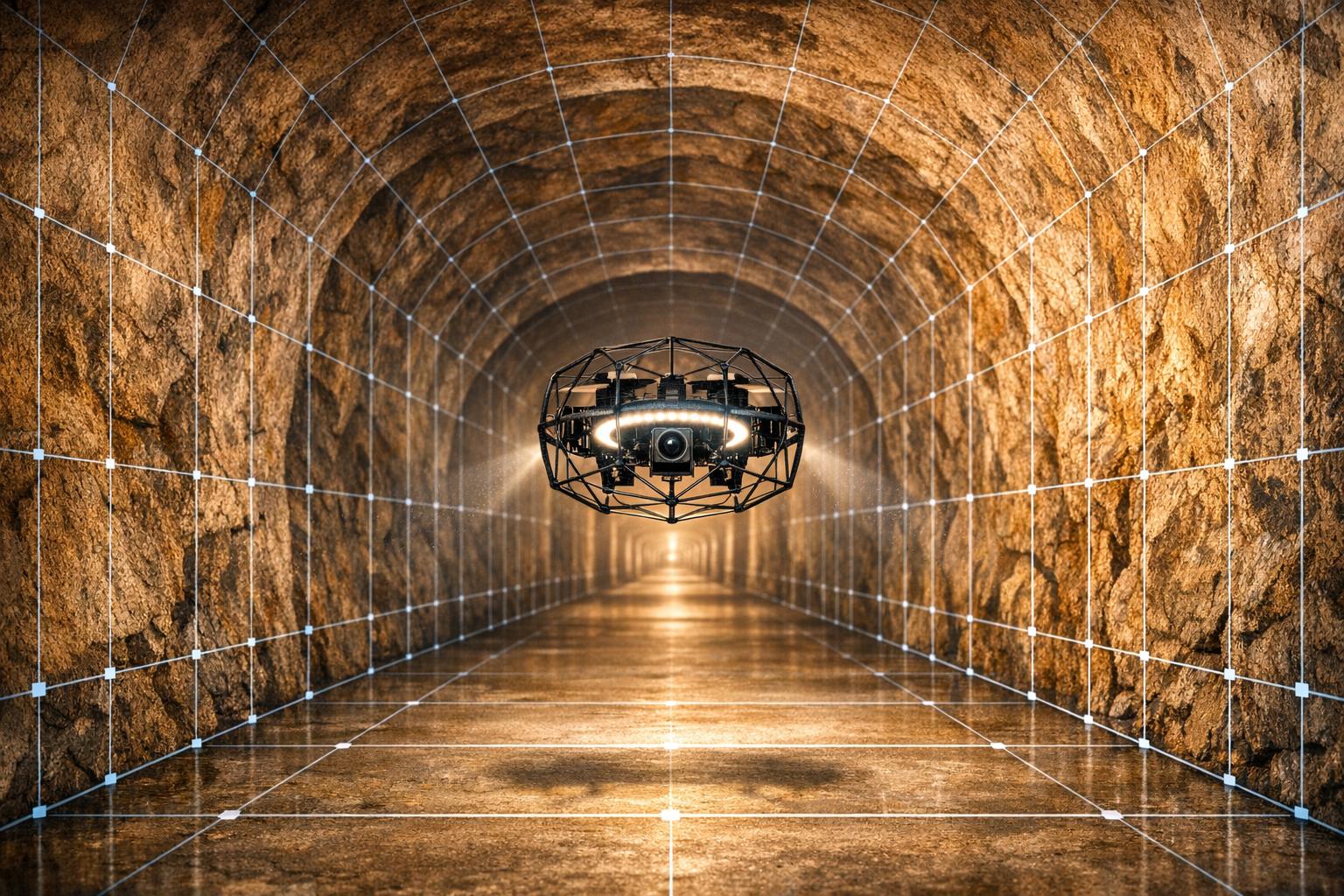
Drone photogrammetry is changing how underground surveys are conducted by offering faster, safer, and more precise methods compared to older techniques. It uses drones to create highly accurate 3D models of underground areas, even in challenging conditions like GPS-denied spaces or complete darkness. Here’s how it works and why it matters:
- How It Works: Drones follow pre-programmed paths, taking high-resolution images with 80–90% overlap. These images are processed with software like Agisoft Metashape to create detailed 3D models.
- Challenges Solved: GPS doesn’t work underground, so drones rely on sensors like LiDAR and SLAM for navigation. Lighting is another obstacle, requiring systems with at least 10,000 lumens for clear imaging.
- Key Benefits:
- Safety: No need for workers to enter hazardous areas.
- Speed: Surveys that used to take days now take hours.
- Precision: Measurement errors as low as 0–10 mm.
Real-world examples include mapping gold mines, inspecting tunnels, and even monitoring construction projects. These advancements save time, reduce costs, and improve safety. With ongoing improvements in sensors and AI, drone photogrammetry is set to play a bigger role in underground surveying and infrastructure maintenance.
Technology for Underground Drone Navigation
Solutions for Environmental Obstacles
Navigating underground presents unique challenges: complete darkness, pervasive dust, and tight spaces where GPS is ineffective. To tackle this, drones rely on Simultaneous Localization and Mapping (SLAM), which enables real-time 3D mapping and precise self-localization. Nicolas Blanchard, a researcher at The University of Arizona, highlights its benefits:
"SLAM is the state-of-the-art approach for UAV localization in an unknown environment. Unlike approaches relying on pure odometry, SLAM is preferred for its ability to correct for trajectory drifts through loop closure."
Since underground drones need intense lighting - at least 10,000 lumens - designers have to account for potential interference. For example, metallic LED lights can disrupt magnetic sensors, but wrapping LED components in aluminum foil helps mitigate this issue.
In June 2022, researchers Kieren Y. Samarakoon, Guilherme A. S. Pereira, and Jason N. Gross tested an autonomous UAV equipped with a RealSense L515 LiDAR sensor in a limestone mine. Using RTAB-Map SLAM software, they discovered that increasing image overlap from 50% to 90% improved loop closure acceptance rates dramatically, from 4.84% to 49.57%. This enhancement significantly boosted mapping reliability. Such advancements are crucial for generating accurate 3D models, which are essential for underground surveys.
These breakthroughs have paved the way for integrating advanced sensor systems, which are discussed next.
Advanced Sensor Systems
To further improve underground navigation, drones are equipped with robust sensor systems that combine multiple technologies. This multi-sensor approach includes tools like LiDAR for detailed mapping, radar for navigating through dust, IMUs for precise orientation, thermal cameras for detecting structural anomalies, and ultrasonic sensors for stable hovering.
- LiDAR systems excel in creating high-precision 3D maps, even in total darkness. For instance, researchers at TU Bergakademie Freiberg tested a Robosense 16-line LiDAR in the Reiche Zeche Research Mine, 492 feet underground. They achieved a mean mapping accuracy of 0.12 meters (σ=0.13 m) over a 262-foot loop.
- Radar integration ensures reliability in harsh conditions where dust or humidity might impair optical sensors. In October 2025, the SubSurfaceGeoRobo project in Germany's Reiche Zeche Research Mine equipped a drone with Indurad ISDR-C 360° radars and a Robosense RS-LiDAR-16. This setup allowed the vehicle to navigate passages as narrow as 3.1 feet while maintaining dependable performance in dusty environments.
- High-precision IMUs (Inertial Measurement Units) provide accurate orientation, calculating north, pitch, and roll with errors under 0.5 mrad.
These advanced sensor systems work together to ensure drones can navigate underground environments with accuracy and reliability, supporting the creation of detailed 3D models essential for various applications.
sbb-itb-ac6e058
Underground Mining Drone: stope photogrammetric mapping - Flyability Elios 2 - Barrick Gold, UAS Inc
Case Studies: Underground Drone Photogrammetry in Practice
These examples highlight how integrating advanced sensors with refined photogrammetry workflows can lead to outstanding results in underground surveys.
Mining Operations
At the Mungari Gold Mine, Evolution Mining's survey team swapped out a low-quality CMS for an Emesent Hovermap LiDAR system mounted on a DJI M210 drone. The result? Nearly 100% data coverage with dense point clouds. The team integrated this data seamlessly with Deswik CAD software, producing detailed void models in less than five minutes. Senior Surveyor Matt Jones shared his thoughts:
"Hovermap has been an unprecedented success in our eyes. This game changing piece of technology allows us to make much more informed decisions about our underground voids, with data collection that is orders of magnitude above existing methods."
At the Empire State Mine in New York, Technical Services Manager Kirk Farrell utilized the Elios 3 drone to map 1930s-era tunnels, just 3.9 feet in diameter, over 15 flight hours. The resulting 3D models revealed that the century-old tunnels showed minimal degradation. Farrell remarked:
"The drone is an absolute game changer for anyone in the underground mining industry and I think it's incredible. No one was in harm's way while we got these maps, and we have more detail and data than ever before."
In 2023, Darling Geomatics tackled a Nevada gold mine that had been abandoned for 25 years. Using Elios 2 and 3 caged drones equipped with LiDAR, three two-person teams collected billions of data points in areas too dangerous for human entry due to partially collapsed tunnels. The outcome was georeferenced 3D as-built models - digital twins of the mine - delivered with an accuracy of ±0.24 inches. These models provided critical insights for future operations.
The impact of these technologies isn't limited to mining; they’re making waves in infrastructure maintenance as well.
Infrastructure Maintenance
At BHP's global sites, DJI M300 drones running UgCS software have replaced traditional terrestrial laser scanning. These drones now cover 2,471 acres in a single flight. What used to take days to process now takes under 30 minutes, and stockpile volume reports are ready in less than an hour after takeoff. This shift has led to faster results and reduced costs.
In Hawaii, during the construction of the Halawa View Apartments, DPR Construction used drone surveys to monitor underground utility placement. A quick 15-minute drone flight replaced an entire day's worth of manual inspections, saving 5 man-hours per site visit. This approach not only eliminated risks to personnel but also provided essential documentation for MEP rough-in work.
Drone Photogrammetry vs. Traditional Survey Methods

Drone Photogrammetry vs Traditional Underground Survey Methods Comparison
When comparing traditional surveying to drone-based approaches, the differences are striking. Traditional methods require surveyors to physically navigate potentially dangerous areas, collecting data point by point. This process often leaves gaps in data that must be filled manually to create a complete digital model. In contrast, drones can capture vast areas in one go, all while keeping operators at a safe distance. The result? Detailed 3D models generated in a fraction of the time.
Drone surveys slash field time by up to 95%, significantly reducing labor costs as well. For example, a survey that might have taken a two-person team several days can now be completed by a single drone operator in just a few hours. On a 100-acre site, labor costs drop dramatically - from about $7,200 to just $300.
Safety is another major advantage. Drones eliminate the need for personnel to enter confined or unstable areas, as they can operate remotely. While traditional methods collect hundreds of data points, drones capture millions, significantly reducing human error. In controlled environments like tunnels, drone photogrammetry achieves measurement errors as low as 0–10 mm. However, achieving this level of precision requires specific conditions: at least 10,000 lumens of artificial lighting, 80–90% image overlap, and strategically placed Ground Control Points for proper georeferencing.
Performance Comparison Table
| Metric | Manual Survey | Drone Photogrammetry | Drone LiDAR |
|---|---|---|---|
| Field Time | 5–7 Days | Hours | 3–4 Hours |
| Labor Cost (100 acres) | ~$7,200 | ~$300 | ~$300 |
| Personnel Required | 2-Person Crew | 1 Pilot | 1 Pilot |
| Safety Risk | High (in-situ exposure) | Low (remote operation) | Low (remote operation) |
| Data Density | Hundreds of points | Millions of points | Millions of points |
| Accuracy | Variable (human error) | 0–10 mm error | Survey-grade precision |
| Lighting Requirements | Ambient/work lights | Min. 10,000 lumens | None (active sensor) |
| Equipment Cost | Low to High | Moderate | High |
This side-by-side comparison highlights how drone photogrammetry has reshaped surveying. It not only improves efficiency and safety but also delivers a level of precision that traditional methods simply can't match. These advancements are setting the stage for more streamlined asset management and further technological progress in the field.
Impact on Infrastructure Survey Practices
Drone photogrammetry is reshaping how underground infrastructure surveys are carried out. It speeds up data collection and simplifies workflows, from field operations to the delivery of final results. When paired with Internet of Things (IoT) systems and Smart Mining strategies, real-time monitoring becomes possible, allowing for instant data analysis and operational control - something traditional survey methods couldn't achieve. This shift not only improves the pace of surveys but also supports smarter, more informed decision-making.
However, managing the vast amount of data generated is a major hurdle. High-resolution imagery from drone surveys produces enormous datasets, requiring advanced platforms to process and interpret them effectively. Research highlights the importance of sophisticated data management tools to convert raw imagery into meaningful insights. Platforms like those developed by Anvil Labs are tackling this challenge head-on.
Data Management Platform Integration
Once the survey is complete, the massive datasets collected need a reliable system for processing and storage. Anvil Labs has created a platform specifically designed to handle the complexities of drone photogrammetry outputs. It supports various data types - such as 3D models, LiDAR point clouds, orthomosaics, thermal imagery, and 360° photos - all in one centralized hub.
The platform's practical features shine during collaborative maintenance and planning. Teams can remotely access detailed 3D models from any device, annotate problem areas like water leaks or structural damage, and use precision tools to measure distances directly on the platform. These capabilities are especially helpful for inspecting underground tunnels, where on-site access can be risky or restricted. Secure sharing options with access controls ensure sensitive infrastructure data remains protected while still enabling collaboration among stakeholders. This centralized approach is transforming underground surveys into safer, faster, and more accurate processes.
Future Developments and Applications
Looking ahead, advancements in automation and accuracy are set to push drone photogrammetry even further. AI-powered tools are on the horizon, promising to automatically detect defects in infrastructure from drone-captured images. With AI, thousands of images could be analyzed in a fraction of the time, turning raw data into actionable insights more efficiently.
Recent studies have already solved one common challenge in underground spaces: lighting. Using 13,000-lumen LED systems, researchers provided the necessary illumination for dark environments. Meanwhile, improvements in vision and infrared sensing technologies are expected to enhance navigation in GPS-denied areas. As these innovations progress, drone photogrammetry could extend beyond mining and transportation tunnels to other applications, including underground parking garages, subway systems, and utility corridors - essentially, any setting where traditional methods struggle with safety or efficiency issues.
Conclusion
Drone photogrammetry is reshaping how underground infrastructure surveys are conducted by addressing persistent challenges and offering measurable improvements in safety, efficiency, and precision. With the ability to capture data remotely from over 50 feet away, drones significantly minimize human exposure to hazardous environments.
The time savings are impressive. Drone mapping can generate digital maps with centimeter-level accuracy in far less time compared to traditional methods. Autonomous drones reduce survey durations by as much as 45% and cover areas 4 to 10 times larger than ground crews in the same time frame. Additionally, tools like 20MP cameras and 4K video enhance the level of detail in models. These advancements highlight the need for advanced systems to manage the influx of complex data.
Handling these large datasets requires sophisticated platforms to convert raw data into actionable insights. Anvil Labs offers one such solution, enabling centralized access to various data formats like 3D models, LiDAR scans, orthomosaics, thermal imagery, and 360° photos. This platform supports remote access, detailed annotations, and seamless collaboration.
With ongoing improvements in sensor technology and autonomous navigation, drone photogrammetry is set to unlock new possibilities for underground applications, setting a higher benchmark for surveying and maintaining critical infrastructure.
FAQs
What drone setup works best underground?
For underground surveys, the right drone setup is crucial to gather precise data. You'll want drones equipped with LiDAR sensors for detailed mapping and high-resolution cameras (at least 20MP) to capture sharp visuals. Since GPS signals are often unavailable underground, autonomous navigation systems like SLAM (Simultaneous Localization and Mapping) are essential for maneuvering in these challenging environments.
To ensure accurate data collection, focus on proper flight planning. This includes optimizing conditions such as using soft, even lighting and ensuring the surroundings are clear of obstructions. These steps can make a significant difference in the quality of the data your drone captures.
How do drones navigate without GPS underground?
Underground drones use sophisticated sensor fusion technologies, including LiDAR, visual-inertial odometry (VIO), and simultaneous localization and mapping (SLAM). These tools allow drones to generate real-time maps and figure out their position within those maps. For instance, LiDAR-based SLAM is particularly effective for creating accurate maps in environments where GPS signals can't reach, such as mines. Meanwhile, VIO, when paired with Time of Flight sensors, helps drones navigate through tunnels and other underground areas with precision.
How do I georeference underground 3D models accurately?
To achieve precise georeferencing for underground 3D models, start by using Ground Control Points (GCPs). Incorporating at least five GCPs can significantly reduce vertical errors, bringing them down to less than 1 inch. For enhanced positioning accuracy in areas where GPS signals are weak or unavailable, rely on RTK (real-time kinematic corrections) or PPK (post-processing kinematic corrections). Additionally, ensure your camera is properly calibrated and capture images with a high degree of overlap. Combining these techniques creates a more accurate and reliable georeferenced model for underground surveys.
