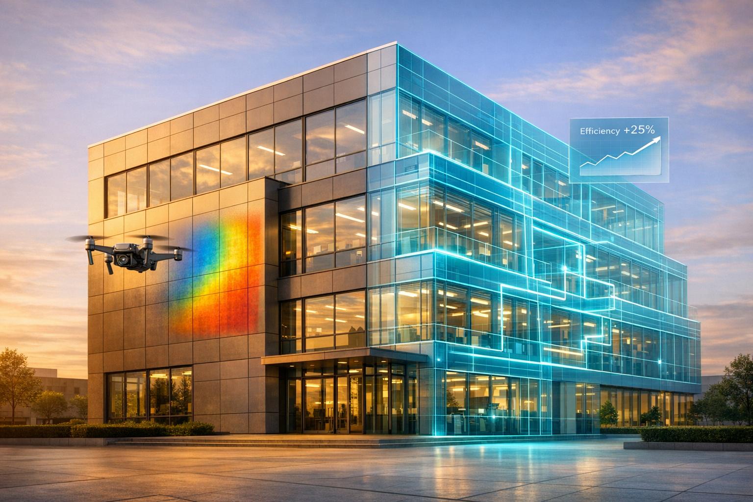
Drones and digital twins are two powerful tools transforming energy monitoring. Drones provide detailed thermal and visual inspections of hard-to-reach areas, while digital twins offer continuous, real-time simulations of systems using IoT data. Together, they can reduce energy use by up to 30% and inspection times by 75%.
Key Points:
- Drones: Ideal for periodic inspections, identifying heat leaks, and mapping structures with sensors like thermal cameras and LiDAR.
- Digital Twins: Provide ongoing system analysis, simulate "what-if" scenarios, and predict potential failures using real-time data.
- Combination: Drones gather external data, and digital twins analyze it for actionable insights, creating a stronger energy monitoring system.
Quick Comparison:
| Feature | Drones | Digital Twins |
|---|---|---|
| Function | Periodic inspections | Continuous system analysis |
| Data Source | Thermal, visual, LiDAR scans | IoT sensors, real-time data |
| Cost | Moderate | High ($50K–$500K) |
| Limitations | Weather, battery life | High setup cost, data needs |
Both tools have unique strengths, and when used together, they provide a more efficient way to manage energy and prevent system failures.

Drones vs Digital Twins for Energy Monitoring: Side-by-Side Comparison
Drones for Energy Monitoring
Drone Capabilities
Drones equipped with advanced sensors like visual, thermal, LiDAR, and RTK GPS are transforming energy monitoring. High-resolution cameras capture detailed images of structures, while thermal sensors identify heat signatures that point to energy leaks or malfunctioning equipment. LiDAR technology generates 3D point clouds with an accuracy of 0.8–2 inches, offering precise structural mapping. Meanwhile, RTK GPS enhances positioning accuracy to within 0.4–0.8 inches, reducing the need for manual ground control points. Together, these tools not only visualize physical structures but also uncover energy inefficiencies.
The way drones fly also matters. For instance, grid patterns work well for surveying large solar farms, while orbital flights are better suited for complex structures like cooling towers. Facade missions are ideal for gathering data from vertical surfaces. Each flight generates substantial amounts of raw imagery - often exceeding 50GB - that is later processed into 3D meshes and orthomosaic maps. Machine learning is increasingly being used to analyze this data, automating tasks like object identification, material classification, and change detection between surveys. These capabilities allow for quicker, safer, and more cost-effective inspections.
Benefits of Drones
One of the biggest advantages of drones is speed. A single operator can inspect an entire site in just 10 minutes, cutting costs by 30–50% and reducing turnaround times by 20–40%.
"DroneDeploy fosters greater communication across teams... it brings better communication from drone pilot to end-user." - Elizabeth Hall, Lead Engineer, Eversource
Drones also excel in accessing hazardous areas such as flare stacks, offshore rigs, and high-voltage zones - places that would otherwise pose significant risks to human workers. Thermal cameras, with a temperature sensitivity of ±3.6°F, can spot overheating components or underperforming solar panels, enabling proactive maintenance. For accurate photogrammetry, drones typically maintain a 70–80% forward overlap and a 60% side overlap in their image capture.
Drone Limitations
Despite their advantages, drones face operational challenges. Weather conditions are a major factor - wind speeds above 15 mph can destabilize flights and blur images. Rain, snow, and extreme temperatures can also halt operations or damage sensitive equipment. Additionally, the flight endurance of most rotary-wing drones is limited, ranging from 10 to 45 minutes depending on the payload and environmental conditions.
Regulations add another layer of complexity. Drone pilots must adhere to FAA altitude limits and obtain proper certification. Airspace restrictions and privacy laws can further complicate operations, sometimes requiring special authorizations. Lastly, the large volumes of data collected by drones require robust processing systems. Without proper infrastructure, there’s a risk of creating information silos between engineering and maintenance teams.
sbb-itb-ac6e058
Digital Twins for Energy Monitoring
Digital Twin Capabilities
Digital twins work hand-in-hand with drones to provide real-time, continuous insights into operations. Acting as dynamic virtual models of physical assets, they stay in sync with real-world data collected from IoT sensors and industrial equipment. Unlike static models, digital twins enable two-way communication with the actual infrastructure, capturing key metrics like power output, temperature, rotational speed, and structural stress to reflect the current operational state.
"A digital twin is a digital model of a physical asset which integrates sensor readings and a form of data exchange between the digital model and the physical asset." - Energy Informatics
This two-way data exchange allows digital twins to operate across multiple scales. For example:
- Component twins focus on individual parts, like turbine blades.
- Asset twins consolidate data from entire machines.
- System twins oversee groups of assets, such as a wind farm.
- Process twins encompass entire energy ecosystems, managing production, storage, and grid distribution.
This hierarchy enables operators to simulate "what-if" scenarios, testing alternative strategies or energy consumption patterns without risking disruptions to the physical system.
Benefits of Digital Twins
The predictive capabilities of digital twins offer impressive returns. For instance, 92% of companies report at least a 10% ROI from their use, with over half seeing returns exceeding 20%. Additionally, digital twins can reduce energy consumption by up to 30%.
By shifting maintenance strategies from reactive to predictive, digital twins use advanced analytics to identify patterns and predict failures before they occur. A practical example of this comes from researchers at the University of Alicante. In November 2025, they used consumer-grade tools - like smartphone photogrammetry and infrared thermography - to create a digital twin of a historic aerodrome control tower. This model identified thermal anomalies and heat loss patterns, showcasing the technology's potential for improving energy efficiency.
Unlike one-off drone inspections, digital twins provide continuous oversight throughout an asset's lifecycle - from design to decommissioning. This creates a "digital thread" of data that enables quicker interventions and better decision-making. Today, roughly 75% of businesses are leveraging digital twin technology in some form, highlighting its value for integrating systems and balancing loads across energy grids.
Still, despite these advantages, digital twins come with their own set of challenges.
Digital Twin Limitations
The high costs of implementation remain a significant hurdle, especially for organizations with limited budgets. Furthermore, digital twins rely on large volumes of high-quality data, which presents a challenge given that over 97% of existing buildings lack the necessary digital infrastructure.
Cybersecurity is another critical concern. The interconnected nature of digital twins demands strong security measures to protect against potential cyber threats. Beyond that, successful deployment requires specialized expertise, seamless interoperability between sensors and software, and the ability to integrate with older systems. For facilities without BIM data or existing sensor networks, implementation becomes even more complex and resource-intensive.
These challenges underscore the importance of pairing digital twins with other tools to create a more holistic energy monitoring strategy.
How Drones & Digital Twins Are Transforming Infrastructure Inspections [Free Training]
Drones vs. Digital Twins: Direct Comparison
In the world of industrial energy efficiency, recognizing the distinctions between drones and digital twins is essential for making informed operational decisions. Both technologies tackle energy monitoring, but they do so in very different ways. Drones act as mobile data collectors, conducting periodic flights to capture external infrastructure data using tools like thermal cameras, LiDAR, and high-resolution imagery. On the other hand, digital twins work continuously, processing real-time IoT sensor data embedded throughout a facility’s systems.
Drones provide snapshots of data, typically on a weekly or monthly basis, while digital twins offer a continuous stream of real-time updates. This difference is key when deciding between periodic structural inspections and ongoing, dynamic system adjustments.
"Digital twins function as living, breathing virtual representations of physical objects or systems. Unlike static 3D models, they continuously update with real-world data." - Jessica May, DroneBundle
In terms of scalability, drones excel in covering large geographic areas like power grids or pipelines. Digital twins, however, shine in their ability to aggregate data from individual assets into comprehensive system-wide insights. For example, professional drones equipped with high-end sensors can detect details as small as a few centimeters from their operating altitudes, while digital twins boast fault detection accuracy rates as high as 98.3%.
Comparison Table
Here’s a side-by-side look at how these technologies differ across key criteria:
| Criterion | Drones | Digital Twins |
|---|---|---|
| Primary Function | Data acquisition through aerial inspection | Data synthesis, simulation, and prediction |
| Collection Frequency | Periodic missions (weekly/monthly snapshots) | Continuous real-time sensor streams |
| Perspective | External/structural view | Internal/operational view |
| Initial Investment | Moderate (hardware and pilot training) | High ($50,000–$500,000 for development) |
| Scalability | Spatial (large geographic areas) | Logical (asset instances to system aggregates) |
| Technical Expertise | Drone pilots and photogrammetry specialists | Data scientists, software engineers, IT integrators |
| Main Constraints | Weather dependent, battery life, airspace regulations | High complexity, data security risks, implementation costs |
| Energy Focus | Heat leaks, insulation gaps, solar panel health | System optimization, predictive maintenance |
Drones are ideal for creating detailed 3D models and capturing thermal imagery, while digital twins excel at analyzing continuous sensor data to enhance energy performance. Together, these technologies complement each other, offering a powerful combination for energy-efficient maintenance. This integration is why nearly 85% of IoT-related industries are projected to adopt digital twins in the near future.
Combining Drones and Digital Twins with Anvil Labs

When drones and digital twins work together, they create a powerful energy monitoring system. Drones handle the heavy lifting for external inspections, capturing thermal imagery, LiDAR scans, and high-resolution photos. Meanwhile, digital twins analyze this data alongside real-time IoT sensor feeds to provide a continuous and detailed view of energy performance. This combination bridges a critical gap: drones deliver precise visual evidence of issues like heat leaks or structural damage, while digital twins transform that evidence into predictive insights and actionable strategies. Together, they make energy monitoring not just smarter but more efficient.
Anvil Labs brings these two technologies together into a seamless system. By processing drone data into actionable 3D models, they integrate it directly into energy monitoring workflows. Within just 72 hours, Anvil Labs converts thermal imagery, LiDAR scans, and orthomosaics into detailed spatial models ready for analysis. This quick turnaround enables energy managers to pinpoint insulation failures or equipment anomalies and feed that information into their digital twin systems for ongoing monitoring and optimization.
"Anvil Labs makes these processes even better by turning your drone data into detailed 3D models and actionable insights." - Anvil Labs
Security is a top priority when dealing with sensitive infrastructure data. Anvil Labs ensures this data is protected with AES-256 encryption for storage and TLS 1.2+ for data in transit. This robust security framework keeps critical information - like thermal scans or LiDAR maps - safe during sharing and collaboration. Their platform also includes a secure sharing environment, allowing energy teams to work with external consultants or maintenance crews without risking data integrity.
Conclusion
Drones play a key role in capturing high-resolution thermal images and LiDAR scans, uncovering hidden heat leaks and structural issues. When paired with digital twins, this data transforms into actionable predictions, identifying potential failures weeks in advance. Studies suggest that using digital twins for building management can lead to energy savings of up to 30%.
However, challenges like weather-related drone limitations and the cost of integrating digital twins highlight the need for a seamless system. Drones excel at gathering data, while digital twins focus on analysis and optimization. This combination underscores the importance of a unified platform to maximize efficiency.
Anvil Labs addresses this gap by converting drone-captured data - such as thermal imagery, LiDAR scans, and orthomosaics - into detailed 3D models. Their rapid processing allows energy managers to quickly identify problems and feed them into ongoing digital twin monitoring. With a secure infrastructure, the platform ensures sensitive energy data stays protected throughout the entire process.
Looking ahead, the evolution of energy efficiency lies in moving from static monitoring to dynamic, proactive asset management. Drones provide a real-time snapshot of current conditions, while digital twins forecast future scenarios. Together, they offer a comprehensive solution to identify and address issues before they escalate, helping to reduce operational disruptions and energy expenses.
FAQs
When should I use drones vs. a digital twin?
Drones and digital twins each bring unique strengths to energy monitoring. Drones are perfect for gathering high-resolution data quickly, especially in dangerous or hard-to-access locations. They’re commonly used for tasks like inspections, thermal imaging, and LiDAR mapping. On the other hand, digital twins take this data and transform it into detailed, real-time virtual models. These models are great for ongoing monitoring, predicting maintenance needs, and improving operations. Think of drones as your go-to for fast assessments, while digital twins handle the continuous analysis and decision-making.
What data do I need to build a digital twin?
To build a digital twin, you’ll need detailed data about the physical asset’s operations, surrounding conditions, and sensor inputs. This involves gathering real-time telemetry data through sensors, IoT devices, drones, and other technologies. Equally important are tools for data fusion, management, and analysis, which process and integrate this information, turning it into a fully operational digital twin.
How do drones and digital twins work together in Anvil Labs?
Drones and digital twins come together in Anvil Labs to create a powerful partnership. Drones collect critical data, such as high-resolution images and thermal scans, while digital twin models use this information to provide dynamic, real-time updates. This combination allows for faster inspections, predictive maintenance, and enhanced safety measures. By using drones for efficient data gathering and digital twins for turning that data into actionable insights, workflows become more streamlined and effective.
