How fast should your drone fly for LiDAR surveys? The answer depends on balancing data quality and efficiency. Flying too fast results in sparse point clouds, while flying too slow limits coverage. Here's a quick breakdown of speed recommendations for different drone types:
- Multirotor Drones: Best for detailed mapping, operating at slower speeds for high point density. Ideal for tight spaces or rugged areas but limited by shorter flight times.
- Fixed-Wing Drones: Perfect for large-scale surveys, cruising at 35–65 mph for efficient coverage. Great for open areas but less suited for obstacle-filled environments.
- Hybrid Drones: Combine the strengths of both, offering flexibility for both detailed inspections and broad-area mapping.
Each drone type has trade-offs in speed, data quality, and terrain suitability. The right choice depends on your project's size, terrain, and required detail. Tools like Anvil Labs can help you analyze LiDAR data for optimal results.
Fixed-Wing vs. Multirotor Drone LiDAR
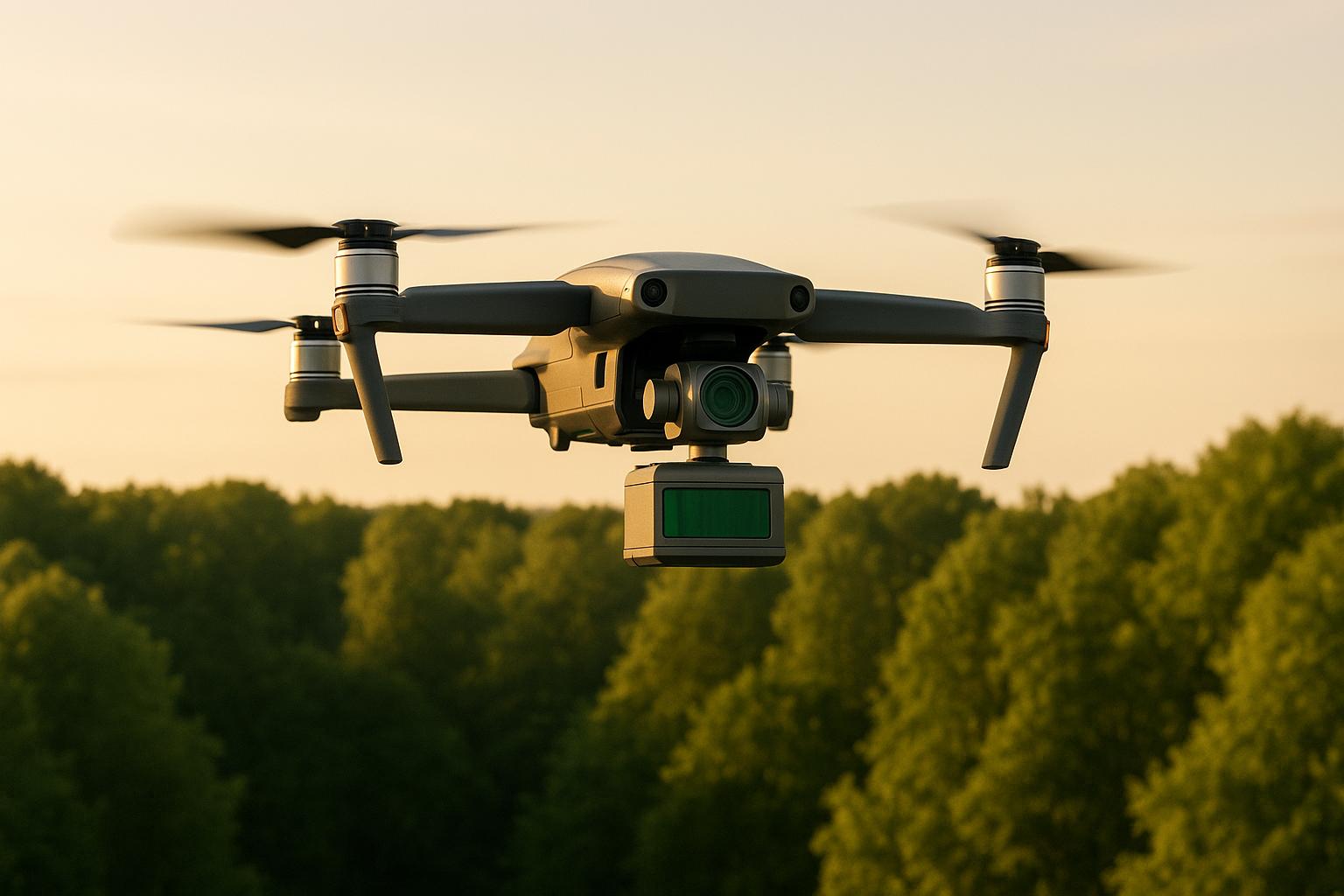
1. Multirotor Drones
Multirotor drones are a go-to choice for precision LiDAR surveys. Their ability to hover steadily, maneuver at slow speeds, and maintain stable flight paths makes them perfect for detailed mapping projects where accuracy and high-quality data are critical.
Speed Ranges
These drones typically operate at carefully selected low speeds, striking a balance between capturing enough point density and covering large areas efficiently. Fly too slowly, and you waste valuable flight time. Go too fast, and the point density drops, compromising data quality. Finding this sweet spot is crucial for achieving reliable survey results.
Data Quality
One of the standout features of multirotor drones is their stability, which plays a big role in delivering high-quality data. By maintaining consistent altitude and precise flight paths, they create uniform point clouds - essential for integrating LiDAR data with other datasets and detecting fine elevation changes. They also adjust for wind drift in real time, ensuring they stay on course, even in narrow corridors or complex environments.
Survey Efficiency
Though slower speeds can improve point density, surveyors must weigh this against the need for efficiency. Thanks to their agility, multirotors can navigate obstacles and uneven terrain with ease, reducing the need for repeated flights and speeding up the overall survey process.
Environmental Suitability
Multirotor drones excel in diverse terrains, from steep hillsides and dense forests to crowded urban areas. Their ability to fly at lower altitudes allows for detailed data collection in spots where clearance is tight. While extreme conditions like cold weather can shorten battery life or high temperatures might trigger safety modes, quality multirotor systems remain reliable. Plus, their vertical takeoff and landing capabilities make them ideal for tight spaces or remote locations where other drone types might struggle.
2. Fixed-Wing Drones
Fixed-wing drones are all about speed and coverage, making them the go-to choice for large-scale mapping projects where efficiency takes precedence over pinpoint precision.
Speed Ranges
Fixed-wing drones operate at much higher speeds compared to multirotors, typically cruising between 35–65 mph during LiDAR operations. This speed advantage means they can cover significantly larger areas. For instance, while a multirotor might map around 500 acres in a day, a fixed-wing drone can handle 2,000 to 3,000 acres in the same timeframe.
That said, speed and data quality must be carefully balanced. Flying too fast can lower point density and leave gaps in coverage, while flying too slowly diminishes the efficiency that fixed-wing drones are known for. Most operators find an optimal cruising speed of 45-55 mph, which ensures sufficient point overlap without sacrificing coverage. These speeds play a key role in maintaining data quality, as discussed below.
Data Quality
The forward motion of fixed-wing drones produces unique data patterns. Unlike multirotors, which can hover for detailed scans, fixed-wing drones need to keep moving to stay airborne. This results in even point spacing across large areas, though the point density at specific locations may be lower.
External factors like crosswinds can disrupt flight paths, potentially affecting coverage consistency. However, modern fixed-wing systems are equipped with advanced GPS and course correction technologies, ensuring straight, accurate flight lines even in less-than-ideal conditions.
Survey Efficiency
When it comes to efficiency, fixed-wing drones are hard to beat. They boast extended flight times - often 60-90 minutes compared to the 25-35 minutes typical of multirotors. Fewer battery swaps mean less downtime, and their faster speeds make them perfect for surveying long, linear structures like highways, pipelines, or transmission lines.
However, there are trade-offs. Fixed-wing drones require runways or catapult launch systems, which can limit their use in confined spaces. Revisiting specific areas for additional detail isn't as simple as hovering; it requires re-planning flight paths for those locations. These factors shape their practicality in certain survey scenarios.
Environmental Suitability
Fixed-wing drones excel in open areas with few obstacles. Large agricultural fields, coastal regions, and expansive industrial sites are ideal environments where their speed and endurance can shine. They also handle wind better than multirotors due to their aerodynamic build and higher speeds once airborne.
On the flip side, these drones are less suited for densely forested or urban areas, where precise navigation around obstacles is crucial. Their typical operating altitudes of 300-500 feet above ground level make them less effective for surveys requiring ultra-high resolution or in areas with strict altitude restrictions.
Cold weather can impact battery life, but the constant airflow during flight helps keep systems cool. In hot conditions, they perform well since they aren't stationary, allowing natural cooling during forward motion.
sbb-itb-ac6e058
3. Hybrid Drones
Hybrid drones combine the precision of multirotor systems with the efficiency of fixed-wing designs. This dual capability allows them to transition smoothly between vertical takeoff and landing and high-speed, long-range flight, making them ideal for both detailed inspections and large-scale mapping.
Speed Ranges
These drones operate at different speeds depending on the task. During takeoff and landing, they move slowly to ensure maximum control and precision. Once in fixed-wing mode, they accelerate to cover larger areas more efficiently. This flexibility means they can slow down for high-density zones and speed up over broader, less detailed areas, tailoring their performance to the specific needs of the survey.
Data Quality
The blend of multirotor and fixed-wing modes ensures consistent, high-quality LiDAR data. At lower speeds, hybrid drones can capture dense point clouds in critical areas. Meanwhile, their fixed-wing mode offers steady, uniform coverage over expansive regions, maintaining data integrity throughout the flight.
Survey Efficiency
By combining rapid, wide-area coverage with detailed, high-resolution inspections in a single flight, hybrid drones simplify surveying workflows. This efficiency reduces the need for multiple drone deployments, saving both time and money. Their versatility also allows them to adapt to a variety of operational conditions, making them a practical choice for diverse projects.
Environmental Suitability
Hybrid drones excel in urban environments, rugged terrains with significant elevation changes, and areas with variable wind conditions. Their ability to adjust altitude ensures consistent performance and data quality across challenging survey scenarios.
The LiDAR data collected by hybrid drones can be processed and analyzed using spatial data platforms like Anvil Labs. This enhances project accuracy and streamlines workflows, making these drones a powerful tool for complex surveying tasks.
Advantages and Disadvantages
When choosing a drone for a specific project, understanding the advantages and disadvantages of different types can help align the platform with your needs. Each drone type - multirotor, fixed-wing, and hybrid - offers distinct strengths and trade-offs, making some better suited to certain tasks than others.
Multirotor drones are the go-to choice for tasks requiring precision and detailed data collection. Their ability to hover and maintain a steady position makes them ideal for inspecting infrastructure, monitoring construction sites, or surveying intricate landscapes. However, they come with limitations: shorter flight times and slower speeds make them less efficient for large-scale mapping projects.
Fixed-wing drones shine when it comes to covering vast areas quickly and efficiently. Their streamlined design supports sustained high-speed flights, making them perfect for large-scale mapping or agricultural surveys. On the downside, they struggle with capturing fine details in tight or obstacle-filled spaces and typically need more room for takeoff and landing.
Hybrid drones offer a mix of both worlds, combining the precision of multirotors with the extensive coverage capabilities of fixed-wing drones. This versatility makes them a strong choice for projects requiring both detailed inspections and broad area mapping. However, this flexibility can introduce added complexities, such as higher maintenance demands and the need for advanced piloting skills.
While multirotors are precise and easy to deploy, they are more vulnerable to strong winds. Fixed-wing and hybrid drones, though better suited for windy conditions and larger areas, require more space and skilled handling.
When paired with tools like Anvil Labs, all drone types can process LiDAR data efficiently, supporting various data formats and enabling seamless analysis for industrial applications.
Conclusion
Finding the right speed settings for LiDAR surveys is all about balancing the specific demands of your project with the conditions in the field. Multirotor drones shine in tight spaces or when detailed, precise surveys are needed, thanks to their ability to hover steadily. On the other hand, fixed-wing drones are perfect for covering large, open areas efficiently, maintaining good data quality at higher speeds. Hybrid drones bring the best of both worlds, offering detailed inspections alongside broad-area mapping.
The choice of drone and speed settings isn't just about the survey goals - it also depends heavily on environmental factors. Strong winds or rugged terrain might call for slower, more cautious flight speeds, while extreme temperatures can affect battery life and overall flight plans.
A successful LiDAR survey comes down to aligning the right drone type, speed settings, and field testing. Matching the drone’s capabilities to the project’s requirements - like data resolution, area size, terrain, and weather - can make a big difference in both data quality and efficiency. Tools such as Anvil Labs can also play a crucial role in processing and analyzing LiDAR data, turning raw survey results into actionable insights for industries.
Ultimately, on-site testing remains key. It’s often the best way to fine-tune speed settings and strike the perfect balance between capturing high-quality data and maintaining efficiency.
FAQs
How do wind and temperature affect drone speed settings during LiDAR surveys?
When planning drone speeds for LiDAR surveys, wind and temperature play a crucial role. Strong winds can compromise flight stability, drain battery power faster, and affect the precision of the collected data. To counter this, operators may need to reduce speeds or adjust flight paths. On the other hand, extreme temperatures - whether scorching heat or freezing cold - can impact battery efficiency and sensor performance. This often requires tweaking speed settings and flight parameters to ensure consistent data collection.
By accounting for these environmental factors, operators can achieve dependable and precise results, even when weather conditions are less than ideal.
What factors should I consider when selecting a multirotor, fixed-wing, or hybrid drone for a LiDAR survey project?
When deciding on the best drone for a LiDAR survey, you’ll need to weigh factors like the size of the survey area, flight time, and the level of detail your project demands.
- Fixed-wing drones are a great choice for covering large areas quickly. They’re built for efficiency and extended flight durations, but they can be pricey and aren’t as nimble when it comes to navigating tight spaces.
- Multirotor drones shine in smaller, more detailed surveys. Their ability to hover and maneuver precisely makes them perfect for localized work, though their shorter flight times mean they’re better suited for smaller areas.
- Hybrid drones offer a middle ground, blending longer flight times with decent maneuverability. This makes them adaptable for projects requiring both coverage and precision.
Ultimately, the right drone for your survey will depend on your project’s unique needs, including efficiency, budget, and the complexity of the terrain.
How does on-site testing help fine-tune drone speed for high-quality LiDAR surveys?
Fine-tuning drone speed on-site is a key step in ensuring LiDAR surveys run smoothly. Adjusting the flight speed in real-time allows operators to match the drone's movement to the sensor's performance, safeguarding the accuracy and detail of the collected data.
This hands-on approach helps pinpoint the best speed for the survey's unique conditions, striking a balance between efficiency and precision. By avoiding unnecessarily slow flights while still capturing high-quality data, on-site testing boosts both the reliability and productivity of LiDAR surveys.
