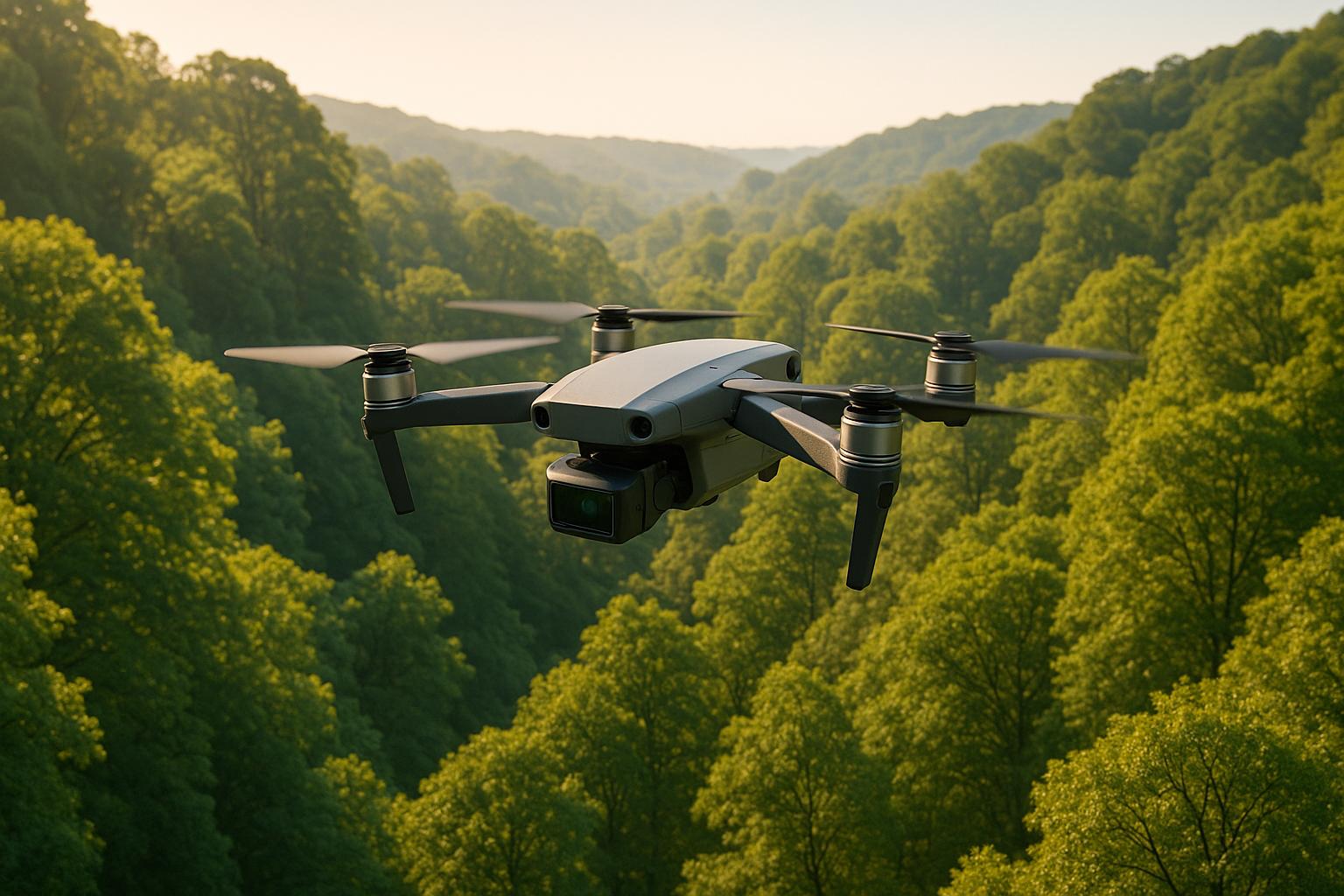
Drone LiDAR is transforming forest health monitoring in the U.S. by replacing labor-intensive ground surveys with faster, more detailed data collection. Mounted on drones, LiDAR sensors use laser pulses to create 3D models of forests, offering insights into tree height, canopy density, and ground elevation. This technology helps forest managers detect early signs of pests, disease, or stress, making it easier to protect and manage forest ecosystems. Here’s a quick breakdown:
- How It Works: LiDAR sends laser pulses that penetrate forest canopies, capturing data from leaves, branches, trunks, and the ground.
- Key Benefits: Faster data collection, access to remote areas, detailed 3D models, and insights into biomass, carbon storage, and wildfire risks.
- Applications: Tree inventory, canopy gap analysis, biomass estimation, and early detection of forest health issues.
- Equipment: Choose drones and sensors based on project goals, balancing payload capacity, flight time, and data resolution.
- Compliance: Operators must follow FAA Part 107 regulations, secure permits, and plan flights carefully.
Drone LiDAR is a game-changer for forest health monitoring, offering precise data and actionable insights for sustainable management.
How a LiDAR Drone Maps the Bare Earth through trees!
Pre-Flight Planning and Regulatory Compliance
Successfully launching a LiDAR drone mission requires careful planning and strict adherence to regulations. These steps aren't just formalities - they ensure safety, legal compliance, and the collection of usable, high-quality data. Overlooking them could lead to fines, safety risks, or wasted time and resources.
U.S. Regulatory Requirements
If you're operating drones commercially in the United States, you must comply with FAA Part 107 regulations. These rules require remote pilots to hold a valid Part 107 certification, which involves passing an aeronautical knowledge test. Certified pilots are then bound by operational guidelines: flights must occur during daylight or civil twilight (with proper anti-collision lighting), the drone must stay within visual line of sight, and altitude must remain below 400 feet above ground level. Additionally, manned aircraft always have the right of way.
Flying in forested areas adds unique challenges. For operations in controlled airspace, you'll need approval through the FAA's Low Altitude Authorization and Notification Capability (LAANC) system. This system provides quick authorizations for certain airspace, but planning ahead is still essential. Special waivers are required for flights over people or at night, and these can take weeks to process.
On top of federal rules, forest access permits are a must when operating on public land. Agencies like the U.S. Forest Service, Bureau of Land Management, and state forestry departments each have their own permitting procedures. Flying over tribal lands requires separate permissions, often involving direct consultation with tribal authorities. Keeping detailed records of all permits and communications is key for compliance audits and shows professionalism to stakeholders.
Notifying stakeholders is another crucial step. Before flying, inform local authorities, landowners, and nearby communities about your plans. Notifications should outline the purpose of the flight, its timing, potential impacts, and safety measures. For larger projects or sensitive areas, public meetings may even be necessary.
Once you've addressed these legal and permitting requirements, it's time to shift your attention to fine-tuning your flight plan.
Site Assessment and Flight Planning
After clearing regulatory hurdles, a thorough site assessment ensures safe and efficient operations. Start by examining topographic maps and aerial imagery to identify terrain features and hazards like power lines, steep slopes, or communication towers. Understanding canopy density and tree height will help you decide on the best flight altitude and sensor settings.
Before flying, establish ground control points (GCPs) to ensure accurate georeferencing. These points align LiDAR data with ground measurements, which is critical for long-term monitoring.
Choose safe launch and recovery zones with clear takeoff paths and emergency landing options. Be mindful of wildlife or sensitive habitats that could require route changes or restrictions during nesting or migration periods. Some areas might even have seasonal limitations.
Weather is another critical factor. Consult reliable local forecasts and NOAA data, paying attention to wind speed (mph), precipitation (inches), visibility (miles), and temperature (°F). Ideal conditions include wind speeds below 20 mph, no precipitation, visibility over 3 miles, and temperatures above freezing to avoid sensor icing. Use real-time weather apps to monitor conditions during the mission.
The design of your flight path plays a big role in data quality. Plan routes with 20-30% overlap between flight lines to capture data from multiple angles, which improves point cloud density and ensures full coverage. Altitude should be just above the canopy - typically 100-200 feet above ground level - to balance data resolution and coverage.
Flight speed matters, too. Flying too fast can result in sparse data, while going too slow wastes battery life. Automated flight planning tools can help optimize speed and other parameters, but manual adjustments may be needed for complex forest environments.
Finally, consider battery limitations. Most LiDAR drones can only fly for 15-30 minutes per battery. This means you'll need to break large areas into smaller segments and plan charging logistics carefully. Always land with at least 20% battery remaining to ensure safety, and optimize flight paths to maximize data collection within these limits.
Selecting Equipment and Sensors
Picking the right combination of drone and LiDAR sensor is a game-changer for forest health monitoring. Your choice should align with your goals - whether you're estimating biomass, monitoring large areas, or detecting early signs of disease. These decisions directly affect the quality of data collected and how smoothly the process flows from planning to analysis.
LiDAR Sensor Capabilities
LiDAR sensors come in different types, with single-return and multi-return systems being key distinctions. Multi-return sensors are particularly valuable because they capture data from multiple canopy layers - like the top, middle, understory, and ground. This layered data provides a detailed picture of forest structure, which is essential for creating accurate Digital Terrain Models (DTMs) and identifying tree density, vegetation layers, and canopy gaps - key indicators of forest health issues.
High point density is another important feature, as it allows for precise measurements of tree height, trunk diameter, and crown dimensions, making it ideal for biomass calculations and inventory assessments.
Two commonly used sensors highlight the trade-offs in forest applications. The VUX-120 excels in high-precision terrain modeling and dense canopy penetration, making it perfect for environmental monitoring. Meanwhile, the miniVux-3 stands out for its lightweight design and high-resolution scanning, which is especially useful for measuring tree height and biomass when working with drones that have limited payload capacity.
Sensor range is also a critical factor. For large-area mapping, sensors with greater range allow for higher-altitude flights, covering more ground in one go. However, this often comes at the expense of finer detail. If your project requires detailed inventory work, shorter ranges and lower-altitude flights are better suited. For broader environmental monitoring, extended range capabilities are more effective.
Drone Platform Specifications
The LiDAR sensor you choose will dictate which drone platform you need. Sensor weight must match the drone’s payload capacity, typically measured in pounds. Lightweight sensors like the miniVux-3 pair well with smaller drones for low-altitude surveys, while heavier sensors require larger drones with higher payload capacities.
Flight time is another critical consideration. Limited battery life often means dividing missions into segments. Look for drones that offer sufficient payload capacity, reliable GPS alignment, and strong stabilization to ensure high-quality data collection, even in challenging forest conditions. These features are especially important for capturing detailed metrics like canopy gaps and biomass changes.
Take the ideaForge Q6 UAV as an example. In one deployment, this platform covered 64.5% of a forest area in a single flight, automatically counting over 5,400 trees and assessing their health using AI tools. Such efficiency is only possible when the drone can carry the right sensors while maintaining stable, extended flights.
The key to success is aligning the drone’s capabilities with the sensor’s requirements, ensuring a smooth transition from data collection to actionable insights.
Multi-Sensor Integration
Beyond the drone and sensor specifications, integrating multiple sensors can significantly enhance data quality. For example, pairing RGB cameras with LiDAR allows you to overlay true-color imagery onto LiDAR point clouds. This combination enriches visualization and aids in species identification by blending structural data with visual details.
Multispectral sensors add another layer of sophistication by capturing data across various spectral bands, including near-infrared (NIR) light. This enables early detection of tree stress, diseases, and pest infestations. By analyzing water stress, nutrient deficiencies, and disease patterns before visible symptoms appear, multispectral sensors provide a proactive approach to forest health monitoring.
However, integrating multiple sensors comes with trade-offs. Additional sensors increase payload weight, which can reduce flight time and may require a larger, more expensive drone. It also demands advanced data processing tools to handle and analyze the diverse datasets. Platforms like Anvil Labs simplify this by offering tools for managing and analyzing 3D models, LiDAR, and multispectral data. Features like secure data hosting, annotation tools, and AI integration make it easier to extract meaningful insights from complex datasets.
When planning your sensor setup, start with your primary objectives. If structural metrics like tree height, density, and biomass are your focus, a high-quality LiDAR sensor may be all you need. However, if species identification or early disease detection is a priority, adding RGB or multispectral sensors can be invaluable. The goal is to align your equipment choices with the specific forest health questions you’re aiming to answer.
Data Acquisition and Field Practices
Fieldwork, from preparation to execution, plays a critical role in gathering accurate forest health data. Following a structured approach ensures reliable results from the start.
Pre-Flight Checks
Before launching, complete these essential pre-flight tasks:
- Sensor calibration and payload setup: Verify that the LiDAR sensor is properly calibrated, securely mounted, and that the payload is evenly balanced. Calibration errors can lead to inaccurate data, while an unbalanced payload may cause instability and degrade the quality of your results.
- Battery readiness: Ensure batteries are fully charged, with at least a 20% reserve left for safety.
- GPS and IMU checks: Confirm that the GPS has a strong lock and the Inertial Measurement Unit (IMU) is functioning correctly to ensure accurate georeferencing.
- Mission plan upload: Load the flight plan into your ground control software. Double-check waypoints, altitude settings, flight speed, and overlap parameters to match your project’s specifications.
- Weather conditions: Assess wind speed, precipitation, and visibility. LiDAR systems work best in clear, calm conditions. Avoid flying in rain, fog, or strong winds, as these can compromise both safety and the quality of your data. If conditions aren’t favorable, it’s better to delay the mission.
Once these checks are complete, you’re ready to move on to flight execution.
Flight Execution Tips
With pre-flight checks done, focus on maintaining consistent flight parameters during the mission.
- Select the right altitude: Base your flight altitude on your LiDAR sensor’s specifications and the data density you need. Higher altitudes provide broader coverage but lower point density, while flying lower increases data detail but takes more time. For tasks like biomass evaluation or tree inventory, flying at 100–150 feet above the canopy often strikes the right balance.
- Use terrain-following mode: Enable this feature to maintain a consistent distance from the canopy, especially in areas with uneven terrain. This automated adjustment prevents the need for manual altitude changes and ensures better data consistency.
- Monitor telemetry: Keep an eye on altitude, ground speed, and sensor performance in real time. If conditions like wind cause deviations, adjust the flight path immediately. A ground speed of 20–35 mph is often ideal - slower speeds enhance point density but consume more battery, while faster speeds reduce data detail.
- Maintain visual line of sight: Always keep the drone in view to respond quickly to unexpected issues, such as wind gusts or sensor malfunctions. Dense forests and mountainous terrain can sometimes disrupt signals, so be prepared for potential flight instability or data interruptions.
- Pause if conditions worsen: If wind speeds exceed your drone’s limits (typically 20–25 mph) or GPS signal quality drops significantly, stop the mission and reschedule. It’s better to ensure safety and data quality than to push through unfavorable conditions.
Initial Data Validation
After landing, immediately validate the data to catch any issues while still on site.
- Check point cloud density: Download a sample of your collected data and assess its density. For example, biomass studies and tree inventories often require 50–100+ points per square meter. Digital terrain models typically need 10–25 points per square meter, while canopy structure analysis benefits from 25–50 points per square meter.
- Ensure complete coverage: Review the flight log and coverage map to confirm all planned areas were surveyed. If you spot gaps caused by GPS loss or flight path deviations, re-fly those sections before leaving the site.
- Inspect the point cloud visually: Load the data into portable analysis software to identify any noise or artifacts that might not show up in density metrics alone.
- Verify sensor performance: Confirm that all sensors - LiDAR, RGB, or multispectral - functioned properly throughout the flight. Check for continuous data recording and ensure file sizes and formats are intact.
- Document metadata: Record key details like altitude, speed, weather conditions, and sensor settings. Note any anomalies or deviations from the flight plan for future reference.
- Create backups: Immediately save copies of the collected data on multiple storage devices to avoid any risk of data loss.
sbb-itb-ac6e058
Processing and Analyzing LiDAR Data
After gathering raw LiDAR data in the field, the next step is transforming those unprocessed laser pulses into meaningful forest metrics. This process involves several technical steps to ensure accurate and reliable insights for decision-making.
Point Cloud Processing
Raw LiDAR data consists of countless laser returns that map out the vertical and horizontal distribution of vegetation and terrain. The first step is to organize this data into a structured point cloud - a 3D representation of the forest.
The initial task is to filter out noise and remove artifacts caused by atmospheric interference or sensor glitches. While advanced software algorithms handle most of this cleanup, it’s always a good idea to manually review any unusual clusters to ensure accuracy.
Next, you’ll need to classify ground points. This step is crucial for distinguishing the forest floor from trees, shrubs, and canopy layers. Algorithms are typically used for this, but their accuracy needs verification - especially in areas with dense vegetation or steep slopes. Misclassification here can ripple through the rest of the analysis.
Once classification is complete, you can generate Digital Terrain Models (DTMs) for bare ground and Digital Surface Models (DSMs) for vegetation. The difference between these models reveals vegetation height, which is a key indicator of forest health.
To ensure quality, check that the point cloud meets minimum density standards. Basic forest surveys generally require 4–8 points per square meter, while detailed tree-level studies benefit from 15 or more points per square meter. Confirm that there are no coverage gaps in critical areas, and compare LiDAR-derived elevations with surveyed ground control points. A well-executed survey should have a vertical accuracy of 0.15 meters (6 inches) and a horizontal accuracy of 0.30 meters (1 foot). This refined point cloud forms the backbone for extracting detailed forest metrics.
Forest Health Metrics
With a clean and classified point cloud, you can extract important forest health indicators directly from the data.
Tree height, crown size, and trunk diameter can all be measured to assess growth and estimate biomass. These metrics are essential for evaluating growth rates and calculating timber volume. Canopy density and gap analysis provide insights into forest structure. For instance, large gaps - over 82 feet (25 meters) between tree clusters - might indicate areas needing reforestation or further investigation for disease. Monitoring canopy density and gaps gives a clearer picture of forest vitality.
Biomass estimation, which combines tree height, diameter, and crown dimensions, is another critical application. It helps evaluate carbon storage potential, a key factor in climate change mitigation. Repeated measurements over time can reveal whether biomass is increasing, signaling healthy growth, or declining, which may suggest stress, disease, or mortality.
LiDAR is particularly effective at detecting subtle structural changes that might indicate early warning signs of trouble. For example, canopy thinning, reduced vertical complexity, or shifts in height distribution can appear before visible symptoms of pests or disease. Additionally, point cloud data allows for species diversity mapping. Since different tree species have unique structural characteristics, this data can improve ecological assessments and help identify invasive species, which often display distinct growth patterns.
Using Platforms for Advanced Analysis
Once you’ve processed high-quality LiDAR data, advanced platforms can take your analysis to the next level. These tools use artificial intelligence to extract actionable insights from massive datasets. For example, AI algorithms can automatically identify canopy gaps, flag areas for reforestation, and even detect unauthorized structures within forest boundaries.
Platforms like Anvil Labs offer a comprehensive solution for managing LiDAR datasets alongside other spatial data types. They provide secure hosting for point clouds, orthomosaics, RGB imagery, and thermal data, allowing for multi-layered analysis in one interface. With customizable viewing options, forestry professionals can examine forest structures from various perspectives. Annotation and measurement tools make it easy to mark areas needing attention directly on 3D models.
These platforms also streamline workflows by integrating LiDAR data with AI tools and task management systems. This means you can process point clouds, identify problem areas, assign tasks to field crews, and track progress - all within a single system.
Temporal analysis becomes straightforward when you store multiple survey datasets in one location. By comparing point clouds from different dates, the platform can highlight changes in canopy cover, tree heights, and biomass. This is particularly useful for monitoring disease progression, evaluating reforestation efforts, or assessing recovery after wildfires. Using consistent flight paths across surveys - guided by AI to replicate coverage patterns - ensures data comparability.
Collaboration is simplified with secure sharing options. You can grant stakeholders viewing access to findings without allowing them to download or modify the data. This is especially helpful when working with agencies, landowners, or conservation groups that need different levels of access.
Combining LiDAR point clouds with 360° panoramas and orthomosaics adds valuable context. Field crews can view true-color imagery alongside structural measurements, making it easier to locate specific trees or understand ground conditions before heading to a site. Thermal imagery can also be integrated, offering insights into temperature variations that may indicate water stress, disease hotspots, or microclimates affecting tree health.
Reporting and Decision-Making
Once LiDAR data is analyzed, the next step is presenting it in a way that prompts immediate action from stakeholders. The quality of data collected earlier becomes crucial, as it forms the foundation for reports that guide decisions. Forest managers, conservation organizations, and government agencies often need tailored insights from the same dataset. The challenge lies in transforming technical measurements into actionable recommendations.
Standard Reporting Formats
U.S. forestry reports should consistently use imperial units. For example, tree height should be reported in feet, canopy density as a percentage, biomass in tons per acre, and forest area in acres. This ensures compatibility with existing forestry databases and compliance with regulatory standards.
Reports should be organized to address key concerns clearly. Start with an executive summary that highlights critical findings, such as disease outbreaks, deforestation trends, or areas with high carbon storage potential. Different stakeholders require specific data:
- Forest managers: Biomass estimates (tons per acre), tree inventory counts, and growth rate calculations.
- Conservation groups: Species identification, habitat mapping, and wildlife area recommendations.
- Government agencies: Land cover changes, carbon sequestration potential (tons of CO2 per acre), and regulatory compliance documentation.
Visual aids, like colorized 3D models, can simplify complex data. These models, created by merging LiDAR point clouds with RGB imagery, offer an intuitive way to grasp forest structures. Alongside visuals, provide detailed documentation of methods used, so forestry professionals can verify the findings.
Reports should include essential metrics like tree density, canopy cover, and carbon sequestration, all formatted in imperial units. Maps generated from drone surveys should highlight forest health indicators with clear legends and scale bars for easy interpretation.
Tailoring reports to specific needs is critical. For wildfire prevention, focus on terrain data (slope and drainage patterns in feet and degrees), vegetation density, and identification of high-risk areas for firebreaks or controlled burns. For monitoring forest regeneration, include changes in understory vegetation, canopy gaps, and regeneration patterns over time.
Anvil Labs simplifies reporting by integrating diverse datasets into interactive digital twin models. These models allow stakeholders to explore forested areas directly, using annotation and measurement tools to highlight areas of concern. Secure sharing options ensure appropriate access levels, letting groups view findings without altering the core data.
With standardized reports in place, temporal analysis offers insights into how forests change over time.
Temporal Analysis for Change Detection
Repeated surveys are essential for spotting trends that single snapshots might miss. Consistency is key - use the same flight parameters and AI-guided paths across survey periods to ensure data comparability. Baseline measurements, such as tree height, crown diameter, canopy density, and biomass estimates in tons per acre, should be documented during the initial survey.
Subsequent surveys should replicate these parameters, including LiDAR sensor specifications and flight altitude (in feet above ground level). Conduct surveys during the same season each year to account for natural vegetation cycles.
The frequency of surveys depends on management goals. For disease or pest monitoring, surveys every 3-6 months during high-risk seasons are ideal. Multispectral data can detect early signs of stress, while comparing canopy density over time highlights vulnerable areas. For tracking tree growth and biomass accumulation, annual surveys are typically sufficient.
Focus on identifying anomalies like unexpected tree loss, changes in canopy structure, or shifts in vegetation health. Comparative maps can illustrate forest cover changes, biomass trends, or species composition shifts. Presenting these findings in a timeline format helps stakeholders visualize progress, while documenting any interventions or natural events between surveys provides context.
Subtle structural changes, such as thinning canopies or shifts in height distribution, can signal issues like disease, pest infestations, or environmental stress. Comparing point clouds over time makes it easier to monitor disease progression, evaluate reforestation efforts, or assess recovery after wildfires.
To optimize costs without compromising quality, plan flights to maximize coverage within the 15-30 minutes of battery life, ensuring a 20% reserve upon landing. Standardize survey parameters and document key metadata like date, time, weather conditions, sensor specs, and flight altitude. This ensures temporal changes are interpreted accurately and helps troubleshoot inconsistencies.
While standardized reporting supports decision-making, comparing drone LiDAR to traditional methods highlights its efficiency.
Drone LiDAR vs. Manual Ground Surveys
Drone LiDAR and traditional ground surveys differ significantly in efficiency and detail. Manual surveys are labor-intensive and often lack the precision needed for effective forest management. In contrast, drone-based LiDAR offers a fast, detailed, and scalable solution.
| Aspect | Drone LiDAR | Manual Ground Surveys |
|---|---|---|
| Data Collection Speed | Rapidly covers large areas | Time-consuming and labor-intensive |
| Accuracy | High-resolution 3D data | Limited detail, prone to human error |
| Scalability | Easily scales to large regions | Difficult across extensive areas |
| Cost Efficiency | Lower per-acre cost for large-scale efforts | Higher labor costs for broad coverage |
| Frequency of Updates | Enables frequent monitoring | Infrequent due to resource constraints |
Drone LiDAR can penetrate dense canopies to capture ground details and generate accurate digital terrain models, something ground-based methods struggle to achieve. Drones also allow for continuous monitoring of large areas, completing tasks in hours that might take weeks for ground teams.
LiDAR's high-resolution 3D point cloud data is invaluable for calculating timber volume and biomass (tons per acre). It can also detect unauthorized structures, triggering alerts for further investigation - a capability manual surveys lack.
Integrating drones into forestry represents a shift toward faster, more precise data collection. For dense forests where drones may face challenges, combining aerial LiDAR with ground-based SLAM LiDAR ensures comprehensive coverage while improving operational efficiency.
Data Management and Security
Drone LiDAR surveys produce massive amounts of data - terabytes from a single flight over a forested area. This data captures intricate details like tree structures, terrain features, and vegetation. Without proper systems in place, managing, analyzing, or sharing it can become a logistical nightmare. Effective data management is the backbone of reliable forest health monitoring and informed decision-making.
At the same time, forest monitoring data often contains sensitive information, such as details about timber resources, conservation zones, and land composition. This makes security a critical concern. Organizations must safeguard this data from unauthorized access while ensuring that legitimate users - researchers, conservationists, government agencies, and foresters - can collaborate seamlessly. Below, we’ll explore how to securely manage, store, and integrate this data.
Secure Storage and Access Control
Cloud platforms are a reliable solution for storing and managing large LiDAR datasets. They offer substantial storage capacity and secure, remote access. Encryption protects data both at rest and during transmission, while multi-factor authentication ensures only verified users can log in.
Role-based access control is essential when multiple teams or organizations work with the same data. Not everyone needs full access. For instance, field teams might require detailed point cloud data for specific areas, while executives may only need high-level visual summaries. Conservation groups could access biodiversity-related data without viewing sensitive inventory details.
Platforms like Anvil Labs (https://anvil.so) make this possible with customizable access levels. Users can control who can view, annotate, or modify datasets. This is particularly useful for sharing LiDAR point clouds or 3D models with external partners while protecting sensitive information, such as the coordinates of rare species or high-value timber. The platform also includes audit logs to track every access attempt and modification, which is crucial for regulatory compliance and internal reviews.
Version control is another critical feature. When multiple team members process the same dataset, maintaining versioned files helps track changes, compare results, and revert to earlier versions if needed. Clear naming conventions also reduce confusion. For example, labeling datasets with details like "RedwoodForest_11-15-2025_Raw_v1" communicates collection date, location, and processing version. Metadata should include flight parameters, sensor specs, processing methods, and quality metrics for transparency and accuracy.
To prevent data loss, geographically distributed backups are a must. Organizations should keep copies in at least two separate locations and set up automated backup schedules. Retention policies should balance the cost of storage with the need to preserve historical data - typically for 5 to 10 years in long-term monitoring programs.
Sensitive data, such as the locations of valuable timber or conservation areas, should be compartmentalized to prevent misuse. Strict governance policies and regular security audits help ensure that access is limited to authorized personnel under clearly defined conditions.
"My overall experience with the software has been satisfying because of the efficient workflow. I would highly recommend other organizations to use your software simply because of how much value you get for what you pay for... The ROI is clearly marked within the first few uses."
– Angel Rojas, Red Angel Drones
Collaboration tools are another key feature for efficient teamwork. Platforms with annotation and measurement capabilities allow users to highlight areas of interest, add notes, and share findings without altering the original data. This preserves the integrity of point cloud datasets while enabling productive collaboration.
Integration with AI and Analytics Tools
Secure storage alone isn’t enough - turning raw LiDAR data into actionable insights is where advanced AI tools shine. Manual analysis can be slow and inconsistent, but AI offers speed and precision for tasks like forest health assessments.
AI tools can automate processes like tree counting, species identification, and biomass estimation. For example, combining LiDAR data with multispectral imagery allows AI to classify tree species by analyzing physical traits like height, crown shape, and branching patterns, along with spectral signatures. Biomass estimation algorithms use LiDAR metrics - such as tree height, crown diameter, and trunk diameter - to calculate biomass in tons per acre. These insights support initiatives like carbon credit programs, timber management, and climate research.
AI also excels at detecting anomalies that might indicate forest health issues. By analyzing factors like tree structure changes, canopy density, or height distribution, AI can flag potential problems such as disease outbreaks, pest infestations, or environmental stress. Comparing current data with historical datasets enables early intervention in affected areas.
Beyond health monitoring, AI helps identify unauthorized activities. It can detect changes such as new structures, cleared land, or access roads that weren’t present in earlier surveys, triggering investigations into potential illegal logging or encroachment on protected areas.
Integration is key for making AI tools effective in real-world workflows. Platforms should connect with task management systems to automatically generate work orders when issues are identified. For example, if AI flags an area needing reforestation or pest treatment, it can create a task with location details, priority levels, and relevant data attached. Integration with GIS software allows teams to overlay LiDAR maps with property boundaries, forest inventories, or other environmental layers, providing valuable context for decision-making.
Anvil Labs supports seamless integration with AI tools, enabling automated point cloud processing without the need for manual exports or imports. The platform handles various data types - 3D models, thermal imagery, multispectral data, and LiDAR point clouds - allowing for comprehensive analysis. This reduces the time between data collection and actionable insights.
API access further enhances flexibility. Organizations can build custom workflows tailored to their specific needs, such as automated reporting systems for regulatory compliance or integrating LiDAR data with climate models for research. Export capabilities also ensure data portability, supporting formats like LAS/LAZ point clouds, GeoTIFFs, and shapefiles to avoid vendor lock-in.
Real-time or near-real-time data synchronization is invaluable for quick decision-making. For instance, if AI detects a rapidly spreading pest infestation, updated maps and data can be shared with field teams immediately, enabling a fast response.
Automated processing pipelines ensure consistency across datasets. When surveys are conducted regularly, using the same AI models and parameters ensures that any observed changes reflect true forest variations rather than inconsistencies in data processing.
"I had a meeting yesterday with my clients and they really liked the panoramas. I appreciate all the cool tech you've got here. This saves me from DroneDeploy! The per project pricing makes it easy for me to bill customers. It's too arbitrary to predict the cost to customer with Agisoft or Pix4D's cloud costs."
– Connor Barnes, Leading Edge Environmental and Emergency Services
Conclusion
Drone LiDAR has reshaped how forests are monitored and managed, offering a sharp contrast to traditional ground surveys. While ground surveys are labor-intensive and often lack the detail needed to effectively maintain ecosystems, drone LiDAR systems provide high-resolution visual data that paints a precise picture of forest health.
Practical applications highlight the advantages of drone LiDAR, combining speed and accuracy to equip foresters and conservationists with real-time insights. This enables proactive decision-making for sustainable forest management.
A well-structured checklist - covering everything from planning and compliance to data processing - ensures reliable forest insights. Effective planning establishes project goals and flight paths, while selecting the right equipment ensures sensor capabilities align with monitoring objectives. Using multiple sensors offers a more complete evaluation of forest health. Temporal analysis also plays a key role, allowing for the early detection of threats like disease, pests, or environmental stress.
As discussed in the processing and analysis section, AI and advanced analytics are vital tools for improving decision-making. Automated workflows not only speed up forest monitoring but also enhance outcomes. Platforms like Anvil Labs simplify this process, supporting various data types - such as 3D models, LiDAR point clouds, thermal imagery, and orthomosaics - while offering seamless AI integration, customizable access controls, and cross-device accessibility. This infrastructure ensures that investments in LiDAR technology continue to yield value through better collaboration and faster decisions.
By merging precise data collection with advanced analytics, organizations can adopt a streamlined, data-driven approach to forest management. Drone LiDAR enables accurate tree measurements for timber volume and biomass calculations, supports biodiversity conservation with habitat mapping, aids climate change efforts through carbon storage estimation, and even helps detect illegal logging in remote regions.
Incorporating drones into forestry practices represents a major shift - replacing time-consuming traditional methods with efficient, drone-enabled forest intelligence. As regulations adapt and sensor technology evolves, organizations that invest in drone operation, data processing, and geospatial analysis will unlock the full potential of this game-changing technology.
FAQs
What are the advantages of using drone LiDAR over traditional ground surveys for monitoring forest health?
Drone LiDAR brings a new level of efficiency and precision to monitoring forest health compared to traditional ground surveys. With its ability to cover large areas quickly, it cuts down the time and resources usually needed for thorough surveys. Plus, it can easily navigate tough or dangerous terrains, ensuring every corner of the forest gets assessed.
What sets drone LiDAR apart is its ability to capture incredibly detailed 3D data. This allows for precise measurements of tree height, canopy density, and overall forest structure. Such detailed insights are invaluable for forest management and conservation, making it an essential tool for safeguarding forest ecosystems.
What are the key regulations and compliance steps for using LiDAR drones in U.S. forests?
When using LiDAR-equipped drones in forested areas across the U.S., following federal, state, and local regulations is a must. Here are some important steps to keep in mind:
- FAA Certification: The drone operator must have a valid FAA Part 107 Remote Pilot Certificate, which is mandatory for all commercial drone activities.
- Airspace Authorization: If your flight area falls within controlled airspace, you’ll need FAA authorization. This can be obtained through LAANC or other approved systems.
- Permits for Protected Areas: Certain locations, like national parks or protected lands, may require special permits for drone operations. Always research local restrictions before proceeding.
On top of that, prioritize safety by keeping the drone within your line of sight, steering clear of flying over people, and respecting altitude limits. Staying updated on drone regulations will help keep your operations compliant and hassle-free.
How can combining sensors like RGB and multispectral with LiDAR improve forest health monitoring?
Integrating RGB and multispectral sensors with LiDAR technology offers a broader and deeper perspective on forest health. LiDAR stands out for its ability to capture intricate 3D structural details, while RGB sensors contribute high-resolution imagery. Meanwhile, multispectral sensors detect variations in light reflection across wavelengths, offering valuable information about vegetation health.
Together, these technologies enable more precise evaluations of tree canopy coverage, identification of species, and early detection of stress factors like disease or drought. By combining these datasets, it becomes possible to generate actionable insights that support better forest management and conservation efforts.
