Drones are transforming industries by making inspections, construction monitoring, disaster response, energy management, and site surveying faster, safer, and more cost-effective. Equipped with advanced sensors, drones collect data efficiently, feeding into digital twin systems to optimize operations and reduce costs. Here's what you need to know:
- Inspections: Drones reduce maintenance costs by up to 30%, improve safety, and cut inspection times significantly. For example, bridge inspections that took two weeks now take just two-and-a-half days.
- Construction Monitoring: Real-time site data from drones shortens project timelines by 15–25% while reducing labor costs by 20–30%.
- Disaster Response: Drones provide rapid damage assessments, cutting response times by 71% and reducing costs compared to helicopters.
- Energy Asset Management: Predictive maintenance enabled by drones cuts downtime by 20% and lowers maintenance costs by 18%.
- Site Surveying: Drones complete surveys up to 24 times faster than manual methods, saving time and reducing errors.
While drones offer clear advantages, they require upfront investments in equipment, certifications, and data management tools. Despite challenges like weather limitations and regulatory hurdles, industries report returns on investment within a year, driven by faster processes, improved safety, and reduced costs.
Key Takeaway: Drone-enabled digital twins are reshaping operations across sectors, delivering measurable efficiency and cost savings.
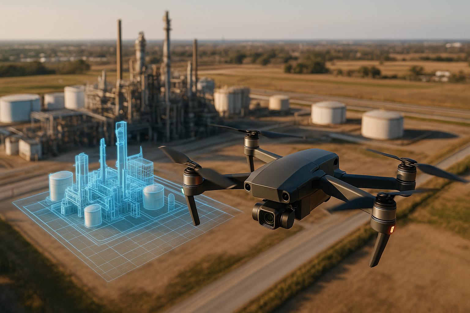
Drones for Oil & Gas Industry 4.0 (INSPECTION & LIDAR AS-BUILT CASE STUDY)
1. Infrastructure Inspection
Using drones for infrastructure inspection has proven to be a game-changer. Unlike traditional methods that depend on scaffolding, cranes, or rope access teams - often posing safety risks and causing operational disruptions - drones offer a safer, cost-effective, and efficient alternative. They also deliver high-quality data and detailed visual records that are invaluable for maintenance and planning.
ROI Drivers
The financial and operational benefits of drone inspections are hard to ignore. Companies that switch to drones can cut maintenance costs by up to 30% while significantly improving safety metrics. According to a McKinsey study, manual inspections can cost 30% more in maintenance and safety expenses compared to drone-based methods.
Time savings are another major advantage. For example, Stantec reduced the time needed for bridge inspections from two weeks to just two-and-a-half days by using gNext and Skydio drones. Similarly, the West Virginia Department of Transportation (WVDOT) saved over $343,000 in a single month, reduced its inspection team size by 83%, and completed inspections 40% faster.
Drones also excel in early defect detection, which can prevent costly repairs. A striking example comes from Cyberhawk, which inspected 30,000 utility poles in California in one month. Their findings showed that 30% of the poles didn’t need replacement, saving the utility company $180 million.
Cost Categories
Organizations investing in drone inspection programs should account for several cost factors. Drone equipment alone can range from $13,000 to $16,500, depending on the model. Other costs include pilot training, certification, software for flight planning and data management, insurance, and maintenance. While personnel costs are part of the equation, they are often offset by the reduced need for manual labor.
Benefit Categories
The benefits of drone inspections go beyond just cost savings. Safety improvements are among the most impactful, as drones eliminate the need for workers to access hazardous areas. This shift can reduce accident rates by as much as 91%.
Cost reductions are also substantial. For example, inspections of the Ridracoli dam in Italy using drones eliminated the need for scaffolding and climbers, cutting costs by 40% to 60%. In the wind energy sector, drone inspections typically cost $300 to $500 per turbine, compared to manual inspection costs that can range from $3,000 to $225 in certain regions of Eastern Europe.
Additionally, drones provide high-resolution imagery, thermal data, and precise measurements, creating digital records that support better decision-making and predictive maintenance strategies.
Operational Efficiency
Drones enhance operational efficiency by completing tasks faster and with greater accessibility. Reports show that jobs requiring several days of manual labor can now be finished in just a few hours. Veolia observed that Elios drones inspect assets twice as fast as traditional methods, while drones inspecting deep pipes are 8–10 times more efficient, eliminating the need for winching personnel.
Reduced downtime is another key benefit. Drones can inspect active assets with minimal disruption, avoiding the costly shutdowns often required by traditional methods. For instance, Bilfinger saved a client nearly $165,000 by using the Voliro T drone for an inspection, completing the task 95% faster without scaffolding or rescheduling.
Frequent inspections are also easier with drones, enabling organizations to track changes over time and verify installation quality. Severn Trent Water, for example, saved approximately $950,000 in 2020, and those savings nearly doubled to $1.8 million the following year by using drones for tasks previously done under more hazardous conditions.
These improvements in cost, safety, and efficiency highlight how drone-enabled digital twins are transforming infrastructure inspections, delivering measurable benefits across various industries.
2. Construction Progress Monitoring
Drones are changing the game in construction monitoring by providing real-time site data, cutting down on wasted resources, and improving communication among stakeholders. Unlike traditional methods that rely on manual site visits and lengthy documentation, drones can gather detailed site data in just minutes. This quick turnaround helps projects stay on track and within budget, offering a modern alternative to time-consuming manual processes.
ROI Drivers
The financial benefits of using drones in construction are hard to ignore. Projects using drones have seen inspection times drop by up to 60% and labor costs reduced by 20–30%. In many cases, overall project ROI has increased by 15–25% across various construction types.
ROI in this context isn’t just about saving money - it’s also about faster project completion, better safety standards, and smarter decision-making through real-time data.
"When we talk about ROI in construction, we're referring not only to cost savings but also to faster project completion, improved safety, and enhanced decision-making through real-time data."
– Shayne Chatterton, iSky Films
Take, for example, a developer working on a 20-story renovation. By using drone-generated 3D models, they cut inspection time by 60%, reduced labor costs by 30%, and boosted ROI by 25% through early defect detection.
Safety is another area where drones shine. On one highway construction project, drone usage led to a 40% drop in safety incidents. High-resolution maps created by drones allowed for better logistics planning, cutting material delivery times and shortening the project timeline by 15%. Without drones, projects risk running 80% over budget and facing delays of up to 20 months.
Cost Categories
While the benefits are clear, understanding the costs of drone adoption is essential. A 92% majority of construction firms using drones reported seeing ROI within a year, making the upfront investment worthwhile.
| Cost Category | Description |
|---|---|
| Drone Purchase | Ranges from $30,000 to $200,000, depending on sensors and camera quality |
| Accessories and Software | Additional expenses for specialized data processing tools |
| Training | Costs for training programs and certifications for field specialists |
| Certifications | FAA Part 107 certification for commercial drone use |
| Maintenance | Ongoing costs to keep drones operational |
For companies hesitant about buying equipment, outsourcing is a smart alternative. For instance, Bison Construction paid about $600 to hire a local drone operator for a site survey. On the other hand, companies with in-house drone pilots typically pay salaries ranging from $50,000 to $70,000 per year.
The Minnesota Department of Transportation offers a great cost comparison: a traditional bridge inspection costs $40,800, whereas a drone-assisted inspection costs $19,900, saving 40%.
Benefit Categories
Drones provide a wide range of benefits, from saving time to improving accuracy.
- Time savings: Drones can collect comprehensive site data in hours instead of the days or weeks required by traditional methods. On average, inspection times are reduced by 50–60% with drones.
- Cost efficiency: Beyond labor savings, drones can enhance marketing efforts. For example, a residential development firm used drones to document progress, leading to a 20% jump in buyer inquiries and faster sales cycles.
- Improved accuracy: Drones equipped with photogrammetry tools prevent costly errors and delays. McCarthy Building Companies used drone models to streamline communication and data management on a $65 million hospital project in north Dallas.
- Better decision-making: Real-time data allows project managers to address issues quickly, avoiding delays and reducing rework.
"At the end of the day, we're coordinators and communicators. We pull a lot of people together to try to build very complex jobs, and we can't do it alone. We want the best product for our clients at the end of the day, so communication and collaboration are very important to us."
– Ryan Moret, Field Solutions Manager, McCarthy Building Companies
Operational Efficiency
Drones simplify construction workflows by automating data collection and improving inventory management. A large majority - 84% of construction managers - report that drones help shorten timelines, reduce errors, and improve tracking accuracy. Drone surveys can be completed up to 5 times faster than traditional methods, while survey costs can drop by around 20%.
In one large-scale commercial project in Albuquerque, weekly drone surveys detected misaligned structural elements early on, preventing delays and saving an estimated $500,000 in labor and rework costs. The project finished two weeks ahead of schedule.
Drones also enhance safety by inspecting hard-to-reach areas like roofs, cranes, and facades without putting workers at risk. This approach can improve safety standards by up to 55%, while avoiding injury-related delays keeps projects moving smoothly.
The data collected by drones - such as 360° views and precise measurements - feeds directly into digital twin platforms, creating virtual models that reflect real-world progress. Platforms like Anvil Labs allow project managers to visualize and analyze site data in real time, supporting proactive decision-making and efficient project management.
3. Disaster Assessment and Response
When disaster strikes, time is everything. Drones have transformed how emergency teams assess damage and coordinate relief, offering speed and flexibility that traditional methods can't match. Unlike ground crews that might face blocked roads or helicopters that need specific conditions to operate, drones can take off quickly and navigate almost any terrain. Just as they’ve streamlined construction and inspections, drones are now reshaping disaster recovery efforts.
The results speak for themselves. After Hurricane Harvey devastated Houston in 2017, 43 organizations used drones to evaluate damage across the city. Farmers Insurance noted a striking improvement: drones allowed claims adjusters to process three houses in just one hour - a task that would typically take a full day using traditional methods.
ROI Drivers
The financial argument for drones in disaster response is hard to ignore. Emergency operations report cost savings of up to 95% per hour when compared to older methods. For instance, while a manned helicopter might cost around $650 per hour, drones deliver similar aerial intelligence for just $20–$25 per hour.
Speed is a major factor here. Take Terra Drone Arabia's Hajj medical delivery project: using DJI M350 RTK drones, they cut delivery times for blood bags and critical medical samples from over two hours by ground to just six minutes. In emergencies, saving time can mean saving lives.
Beyond immediate response, drones also contribute to long-term recovery. Data collected by drones can be used to create digital twins - virtual models of disaster-affected areas. These models assist with future planning, insurance claims, and disaster preparedness, giving communities the tools they need to rebuild smarter and more efficiently.
Cost Categories
Understanding the costs involved helps organizations plan for drone-based disaster response. Compared to traditional equipment, drones are more affordable, making them accessible even to smaller emergency teams.
| Cost Category | Disaster Response Range |
|---|---|
| Drone Equipment | $5,000–$50,000 for emergency response models |
| Emergency Sensors | Thermal imaging, night vision, communication tools |
| Rapid Deployment Kits | Portable chargers, weatherproof cases, transport gear |
| Pilot Certification | FAA Part 107 with specialized emergency training |
| Communication Systems | Real-time data streaming and coordination tools |
Traditional methods, like manual debris volume calculations, can have up to a 30% error rate. Drones eliminate these inaccuracies, delivering faster and more reliable data for recovery planning.
Benefit Categories
Drones bring four key advantages to disaster response:
Speed and Rapid Deployment:
Drones can be deployed within minutes and reach disaster zones regardless of road or terrain conditions. This was evident during the 2015 Nepal earthquake, where damaged transportation routes made conventional assessments nearly impossible. International agencies used drones to quickly evaluate the situation and direct search-and-rescue efforts.
Enhanced Safety:
Drones keep responders safe by eliminating the need to enter unstable buildings, contaminated zones, or hazardous areas. Teams can gather critical information remotely, ensuring ground crews are only sent in when conditions are deemed safe. This approach not only protects lives but also ensures recovery efforts are more coordinated and efficient.
Real-time Situational Awareness:
Drones provide live video feeds, high-resolution images, and sensor data from disaster sites, enabling agencies to collaborate effectively. After Typhoon Hagibis hit Japan in 2019, drones delivered real-time footage of hard-to-reach areas, significantly aiding relief efforts and government coordination.
Cost-effectiveness:
Drones can perform assessments at a quarter of the cost of traditional methods, while covering 43% more ground than teams operating at ground level. This efficiency allows for thorough evaluations even with limited budgets.
Operational Efficiency
Drones simplify disaster response, cutting through logistical hurdles and saving precious time. They’ve been shown to reduce response times by 71% compared to traditional methods.
For example, during the Wennington fire response, Iprosurv created a comprehensive digital twin of the affected area, which was shared with multiple stakeholders simultaneously. This eliminated the need for repeated site visits by insurance adjusters, contractors, utility companies, and government officials. Similarly, after hurricane damage in Jersey Village, Iprosurv collected data for over 50 damaged homes in a single operation. Contractors could immediately begin planning repairs without needing additional site inspections.
Emergency medical services have also seen dramatic improvements. Drones equipped with infrared cameras can locate accident victims and conduct preliminary assessments before ground teams arrive. This speeds up response times and ensures that medical teams are better prepared when they reach the scene.
Platforms like Anvil Labs further enhance the value of drone data. By integrating real-time information into digital twin systems, agencies can visualize damage, track recovery progress, and coordinate resources more effectively. These tools not only streamline immediate disaster response but also improve long-term recovery planning, ensuring communities are better equipped to handle future crises.
sbb-itb-ac6e058
4. Energy Asset Management
Energy companies are tapping into the powerful synergy of drones and digital twins to manage their vast and varied assets. Whether it's sprawling wind farms or the intricate systems within nuclear power plants, this technology is reshaping how assets are monitored, maintained, and optimized. By combining drones with digital twins, companies are moving toward predictive maintenance, which saves time, reduces costs, and improves operational efficiency.
The energy sector presents unique challenges that make this combination particularly effective. Traditional inspection methods often involve halting operations and consuming significant resources. Drones, however, provide detailed visual data without disrupting operations, while digital twins process this information to predict maintenance needs. This shift from reactive to predictive maintenance not only increases return on investment (ROI) but also enhances safety.
ROI Drivers
Implementing drone-enabled digital twins in energy asset management delivers measurable financial benefits. For example, digital twins can boost productivity by 15–20% by digitizing asset information and reduce asset downtime by 20% and maintenance costs by 18% through predictive maintenance.
Wind farms are a standout example. Predictive maintenance can cut operations and maintenance costs by 11%. Issues with turbine blades, gearboxes, and electrical systems can be identified early, preventing costly failures and downtime.
Energy efficiency is another major advantage. Facilities can reduce utility bills by as much as 30% through optimized energy use. For instance, a commercial building using a digital twin for its HVAC system scheduled maintenance during off-peak hours, cutting energy consumption by 15% and extending the system's lifespan by 20%.
AI-powered digital twins amplify these benefits. Recent implementations have shown a 35% reduction in unplanned downtime, an 8.5% increase in energy production, 98.3% accuracy in fault detection, and a 26.2% reduction in energy costs.
Cost Categories
Achieving these benefits requires understanding the costs associated with drone-enabled digital twin systems. These costs depend on the complexity of the assets being monitored and the desired level of automation.
| Cost Category | Energy Asset Management Range |
|---|---|
| Industrial Drones | $5,000–$16,500 for energy-specific models |
| Specialized Sensors | Thermal imaging, LiDAR, gas detection equipment |
| Digital Twin Platform | Software licensing and customization |
| Pilot Training & Certification | FAA Part 107 plus energy sector specialization |
| Data Processing Infrastructure | Cloud storage, analytics, and integration systems |
Popular options for large-scale operations include the DJI Matrice 300 RTK at $13,000 and the Skydio X10 at $15,000. For confined spaces, drones like the Elios 3, priced at $5,000, offer tailored solutions.
Traditional inspection methods often hide significant costs. For example, Shell's Scotford refinery compared drone inspections to older methods involving cranes and scaffolding. Drones completed inspections in about an hour, saving tens of thousands of dollars per event.
"The digitalization tools will be standardized globally in due time since there is a clear ROI. The digital cost, including basic digital infrastructure, connectivity, and processing, amounts to less than 1% of the total costs."
Benefit Categories
The adoption of drone-enabled digital twins delivers a range of benefits that directly impact operational performance and financial outcomes:
- Predictive Maintenance: Regular monitoring extends the lifespan of equipment by 20–30%. One facility using digital twins reduced energy costs by 25% by upgrading machinery and adopting energy-efficient practices.
- Improved Safety: Drones like the Elios 3 minimize the need for workers to enter hazardous environments, cutting costs and reducing risks.
- Comprehensive Monitoring: Asset dashboards decrease field inspections by 60% and reduce repair lead times by 85%.
- Operational Optimization: Real-time data analysis allows companies to make faster, more informed decisions. For example, Arizona Public Service uses drones to identify anomalies, triggering automated maintenance workflows that streamline repairs.
Operational Efficiency
The combination of drones and digital twins has revolutionized inspection processes, delivering unprecedented speed and accuracy. VZU Plzen used the Elios 3 to inspect penstocks, reducing inspection time by 80%, from 12 days to just 2. Similarly, a wind farm saved over $500,000 by using the Elios 3 to inspect 100 wind turbines, cutting inspection time by 75%.
Automated operations further enhance efficiency. Pampa Energía, for instance, standardized flight paths for daily inspections and nighttime security patrols at thermal power plants. The New York Power Authority adopted similar practices, using predefined flight plans to capture consistent data for predictive maintenance.
"Digital twins are a visual manifestation of different strings of data. Without them multiple teams would all be dealing with different parts of the puzzle. It would be like sharing a jigsaw out among your friends and never getting together to piece it into a whole."
Platforms like Anvil Labs simplify the management of data from drone inspections. They support thermal imagery, LiDAR, and 360° panoramas, enabling the creation of detailed digital twins that integrate seamlessly into existing systems. This ensures inspection data flows directly into maintenance workflows, enabling timely and informed decisions.
In one example, a waste-to-energy plant reduced its shutdown time by 2 days using the Elios 3, saving over $250,000. These examples highlight how drone-enabled digital twins not only improve performance but also deliver a clear financial return.
5. Site Surveying and Mapping
Drones are revolutionizing the way we collect and process spatial data for digital twin creation. By offering a faster, more efficient alternative to traditional methods, drones are becoming a game-changer for construction companies, engineering firms, and land developers. When combined with digital twins, aerial data simplifies project management, improves tracking accuracy, and leads to smarter decision-making - all of which contribute to measurable returns on investment.
Traditional surveying methods often require weeks of work, large crews, and heavy equipment. Drones, on the other hand, can scan a 100-acre site in under an hour, gathering detailed data that would take ground teams days or even weeks to collect. This efficiency directly translates into lower costs and faster project timelines. The financial benefits are clear: 92% of construction firms using drones report seeing a positive return on investment within a year. Let’s dive deeper into how drone surveying is driving these results.
ROI Drivers
The profitability of drone-enabled surveying comes from several factors. For example, construction companies can cut project costs by 25% and save up to five man-hours per survey by replacing lengthy manual inspections with a quick 15-minute drone flight. On larger sites, drones reduce the effort needed from 100 hours to just 2 hours per 12 acres. Additionally, drones are up to 10 times cheaper than airplanes or helicopters for topographic surveys, eliminating the need for costly equipment and large teams.
Drones also deliver precise measurements, accurate within 1–2% of true volume. This level of accuracy reduces errors and prevents over-ordering, helping projects avoid costly change orders that can run into six figures.
Cost Categories
To make informed decisions about investing in drone surveying, it’s important to understand the associated costs. Here’s a breakdown:
| Cost Category | Site Surveying Range |
|---|---|
| RTK-Enabled Drones | $5,000–$10,000 for centimeter-level accuracy |
| Photogrammetry Systems | $2,000–$40,000 depending on capabilities |
| LiDAR Systems | $90,000–$280,000 for high-precision applications |
| Processing Software | Monthly subscriptions plus per-project fees |
| Insurance Coverage | Starting at $1,000/year for liability protection |
RTK-enabled drones offer centimeter-level accuracy while saving time. Cloud-based platforms, like Anvil Labs' Asset Viewer, make processing and hosting more predictable, with service fees increasing by up to $400 per project.
Benefit Categories
The advantages of drone surveying go beyond cost savings:
- Better Data Quality: Drones collect hundreds of thousands more data points than traditional methods, creating highly detailed digital twins. Orthomosaic maps generated from drone data are orthorectified, ensuring uniform scale and precise calculations.
-
Improved Safety: Drones can safely access hazardous areas, such as steep terrain or active construction sites, reducing risks for workers. As Alexander Tubaltsev, Chief Miner at Ferrexpo Yeristovo Mining, put it:
"Drones significantly reduce the number of workplace hazards exposed to employees".
- Faster Project Management: Quick data turnaround allows for faster decisions and helps avoid delays with clear, visual data.
- Cost Efficiency: Beyond direct savings, companies can cut labor costs, speed up project completion, and reduce errors, saving an estimated $114,000 annually.
Operational Efficiency
Drone surveying significantly boosts operational efficiency. While traditional ground-based surveys can take 2–3 weeks from start to finish, drones can complete the same process in just 1–4 days. They can cover up to 120 acres per hour compared to only 5 acres manually, offering a 24-fold increase in data collection speed.
Take Grade Tech Power Services in Idaho as an example. By using drones for takeoff data, they received processed results in just 24 hours and saved $90,000 by repurposing excess materials. The same company prevented nearly all downtime by deploying a Phantom 4 RTK drone 1–2 days before arrival, saving $3,500 per day. Jim Gorrie, CEO of Brasfield & Gorrie, highlighted the benefits:
"Using drones, we've created a much more efficient process. We can literally take weeks out of the schedule, our projects are much higher quality than before, and they're safer".
Modern drone mapping software adds another layer of efficiency. These tools can automatically detect site anomalies, track progress, and compare deviations from plans. With AI-equipped drones, measurement accuracy improves to within 2–3 cm, while reducing site survey labor by over 50%. Platforms like Anvil Labs generate outputs such as orthomosaics, LiDAR point clouds, and 360° panoramas, seamlessly integrating survey data into project workflows. Michael Lambert, VDC Manager at Chasco Constructors, explained:
"Combining surveying, drones and CAD information allows us to display our projects in ways never seen before. We provide our team with the big picture and the information they need to more effectively share information and make better-informed decisions".
As teams grow more proficient with drone technology, these benefits multiply. One mid-sized UK builder, for instance, achieved a 200% return on investment over two years by reducing rework, making faster decisions, and avoiding site delays with AI-enhanced drones.
Benefits and Drawbacks
When weighing the use of drones, it’s clear they bring undeniable advantages, but they also come with trade-offs that can influence return on investment (ROI). Each application has its unique considerations that impact overall effectiveness and cost-efficiency.
One major advantage is how drones enhance worker safety. Traditional inspections often place workers in risky environments - scaling cell towers, inspecting the undersides of bridges, or navigating disaster zones. Drones remove the need for human presence in these hazardous situations while still delivering precise, high-quality data. As Mike Winn, CEO of DroneDeploy, puts it:
"By creating a digital replica of these sites, you can more easily track, predict and act on these environments in real-time versus sending human workers to inspect different areas constantly".
Drones also significantly cut down inspection times and labor demands. For instance, the West Virginia Department of Transportation reduced its inspection team by 83% while completing inspections 40% faster. Similarly, Bilfinger achieved savings of nearly $165,000 by performing a flare stack inspection 95% faster than traditional methods.
However, drones are not without challenges. Managing the sheer volume of data they generate - from thousands of high-resolution images to detailed LiDAR point clouds - requires substantial investments in software and storage infrastructure. Organizations must rethink their workflows and adopt advanced data management tools to make the most of drone-collected data.
Weather conditions also pose a significant limitation. Many commercial drones cannot operate in winds exceeding 25 mph or during rain, which can delay critical tasks. These operational constraints often necessitate buffer periods in project schedules.
Here’s a breakdown of key ROI factors across different drone applications:
| ROI Factor | Infrastructure Inspection | Construction Progress Monitoring | Disaster Assessment and Response | Energy Asset Management | Site Surveying and Mapping |
|---|---|---|---|---|---|
| Time Savings | Significant | Moderate | Significant | Moderate | Significant |
| Data Accuracy | High | High | High | High | High |
| Benefits | Safety, cost reduction | Progress tracking, coordination | Rapid assessment, resource allocation | Predictive maintenance | Detailed maps, 3D models |
| Drawbacks | Regulatory hurdles | Data management | Data overload | Specialized expertise | Processing time |
For infrastructure inspection and energy asset management, drones provide strong ROI by enabling early defect detection and predictive maintenance. For example, one utility saved $180 million through a comprehensive drone program. Similarly, Aerospec Technologies found that inspecting solar farms with drones saves approximately $1,916 per megawatt per inspection compared to traditional methods.
Construction progress monitoring benefits from regular visual updates, but the constant influx of data requires dedicated personnel and robust processing systems. Disaster response applications prioritize rapid data collection to support emergency decision-making. Meanwhile, site surveying offers clear time and labor savings, though delays can occur between data capture and the delivery of final results.
Regulatory and operational barriers vary by application. Infrastructure inspections often require complex FAA waivers for beyond-visual-line-of-sight operations, while simpler site surveying tasks typically fall under standard Part 107 rules. Privacy concerns are particularly relevant for construction monitoring and site surveying in urban areas, where legal challenges might arise.
Despite these challenges, the drone inspection and surveillance market is expected to grow from $11.6 billion in 2022 to $23 billion by 2027. This rapid growth highlights the need to address operational hurdles to fully tap into the potential of drones, especially in creating digital twins and optimizing workflows.
Conclusion
This analysis highlights how drone-based digital twin applications are reshaping industries like infrastructure and energy asset management. The numbers speak for themselves: organizations have seen operational efficiency gains between 20–30%, demonstrating the financial advantages of adopting this technology.
In the energy sector, drones enable fast, autonomous data collection, streamlining processes and cutting costs. And it’s not just energy companies seeing results. As Yariv Geller, CEO and Founder of vHive, puts it:
"The drone is a means to the end of the digital twin – in itself, it's a dramatic shift in the way things are done. Autonomous data acquisition and digital twin platforms need each other."
The telecommunications industry is another standout example. A Tier 1 carrier cut onsite time for 5G tower upgrades from 5 days to just 2.4 days, saving $10,000 per day and reducing labor costs by 52%. Meanwhile, manufacturing facilities using digital twins have reported productivity boosts of 30–60% and material waste reductions of 20%.
These benefits go beyond operational improvements. Organizations that integrate drone-collected data into strategic decision-making unlock even more value. Markets tied to drone-based digital twins are expected to grow from $3.1 billion in 2020 to $48.2 billion by 2026. As Geller points out:
"Companies have drifted mostly to focus on the analytics – they don't care how the data comes in. Drones, by now, aren't news."
To fully realize the potential of digital twins, companies should prioritize use cases that involve complex decision-making processes. Robust data management and advanced tools are key to success. Platforms like Anvil Labs, which offer 3D models, thermal imagery, and LiDAR, help organizations transform drone data into actionable insights that drive measurable business outcomes.
FAQs
How do drones help create and improve digital twins across industries?
Drones are instrumental in crafting digital twins, offering the ability to capture high-resolution images, LiDAR scans, and real-time environmental data. This information lays the groundwork for creating accurate and interactive virtual models of physical assets.
Industries benefit significantly from drone technology, as it streamlines data collection, lowers operational costs, and enhances safety - particularly in dangerous or hard-to-access areas. Regular updates from drone surveys ensure digital twins remain up-to-date, enabling smarter decisions and improving efficiency across multiple sectors.
What are the upfront costs and common challenges of using drones for digital twin projects?
When stepping into the world of drone technology for digital twin projects, the initial investment can be a bit steep. For smaller-scale setups, you're looking at $45,000 to $60,000, while medium to larger projects often come with higher price tags. These costs usually cover the essentials like equipment, software, and the initial setup process.
However, it’s not just the price that can pose a challenge. Other hurdles include complex data integration, cybersecurity concerns, and difficulties with standardization and connectivity, especially when dealing with large-scale data or trying to sync with other systems. Tackling these obstacles requires thoughtful planning and tapping into expert platforms that specialize in these areas.
How do drones enhance safety and efficiency during infrastructure inspections compared to traditional methods?
Drones play a key role in boosting safety by taking humans out of risky situations. Whether it’s inspecting high elevations or navigating unstable structures, drones handle tasks that would otherwise require scaffolding, ladders, or even shutting down traffic. This shift not only lowers the chance of accidents but also keeps workers out of harm's way.
On top of that, drones significantly improve efficiency. They can quickly scan large areas and collect detailed information, like high-resolution images, thermal readings, and even 3D models, all without interrupting ongoing operations. This fast and precise data collection saves time, cuts costs, and speeds up decision-making, making drones an essential tool for managing modern infrastructure.
