
AR heads-up displays (HUDs) are transforming drone operations by displaying critical flight data directly in the pilot's view. This eliminates the need to switch between screens, reducing errors and improving safety. From inspections to emergency responses, AR HUDs provide tools like 3D maps, obstacle detection, and live sensor feeds to help pilots work more efficiently.
Key benefits include:
- Real-time overlays: Flight metrics like altitude, battery life, and GPS strength are always visible.
- Obstacle alerts: Visual markers highlight hazards to prevent collisions.
- Mission tools: Features like waypoints and airspace boundaries ensure compliance with FAA Part 107 rules.
- Data integration: Advanced tools like thermal imagery and LiDAR enhance inspection accuracy.
Platforms like Anvil Labs extend these capabilities by integrating digital twins and live data into HUDs, streamlining workflows and saving time. Whether for industrial inspections or search and rescue, AR HUDs are becoming essential for safe and efficient drone operations.
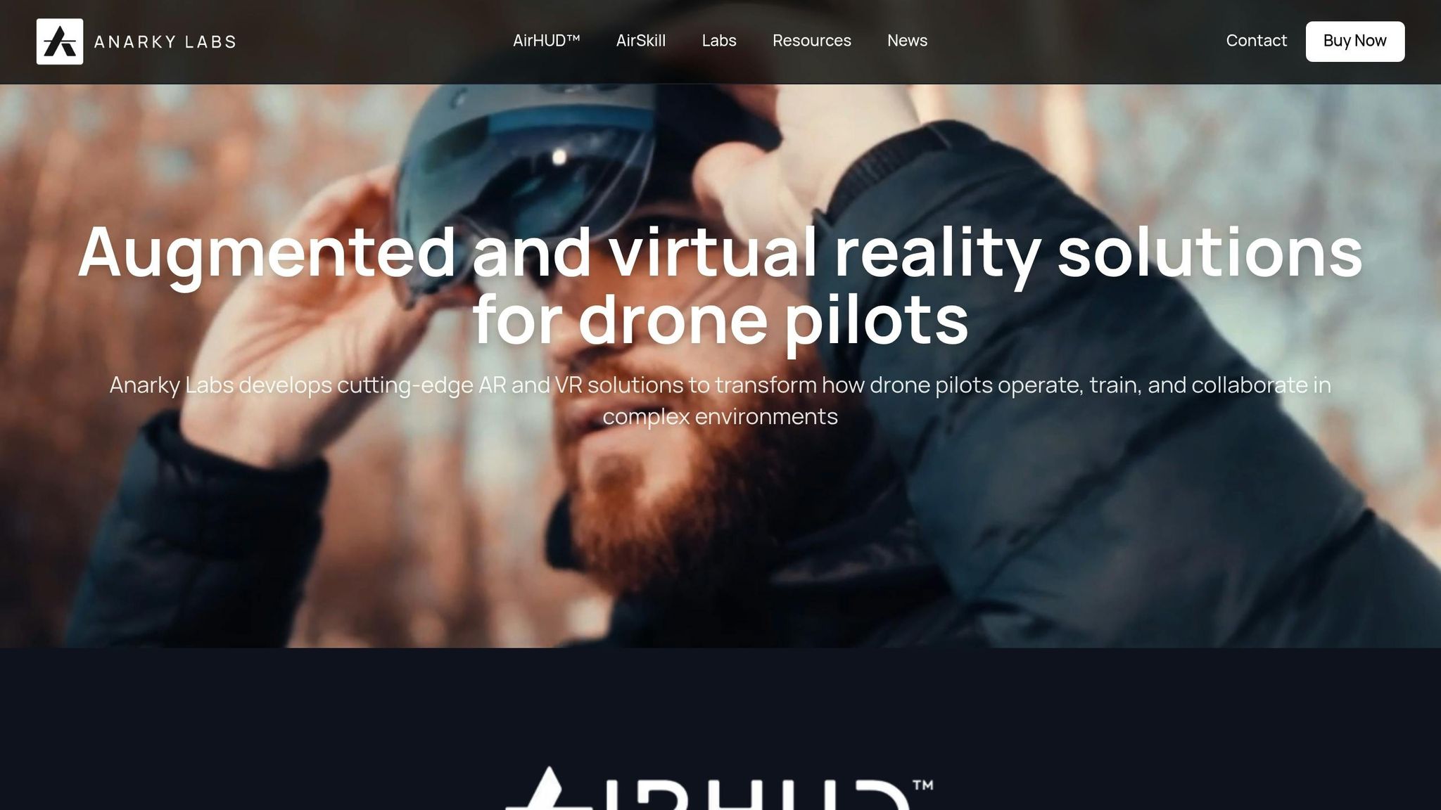
AirHUD – The First True Heads-Up Display for Drone Pilots
Core Features and Functions of AR HUDs
AR HUDs bring crucial flight information directly into view, allowing pilots to access vital data without distraction. These systems are designed to enhance safety and streamline decision-making by presenting essential flight metrics in a single, easy-to-read interface.
Key Features for Enhanced Drone Operations
Modern AR HUDs are packed with features that simplify drone operations, especially in industrial settings. Here's how they make a difference:
- Live GPS Overlays and Real-Time Visualization: These systems display critical details like position, heading, altitude, speed, battery level, and signal strength through intuitive graphics. No more toggling between screens - everything you need is right in front of you.
- Obstacle Detection: Using sensor data, AR HUDs flag potential hazards and their distances with clear visual indicators, reducing the risk of collisions.
- Mission Tracking: Waypoints and routes are visualized as 3D overlays, making it easier to follow pre-planned paths.
- Airspace Awareness: Restricted zones and altitude limits are outlined visually, helping operators stay compliant with FAA Part 107 regulations.
Integration with Advanced Data Types
AR HUDs don’t just stop at basic metrics - they integrate complex data types to provide richer insights for specialized tasks.
- Thermal Imagery and LiDAR: These tools offer detailed environmental data, which is especially useful for inspections, search and rescue missions, and navigation in challenging conditions.
- 3D Model Overlays: Digital twins are projected onto real-world environments, providing accessible asset information and inspection details. For instance, Anvil Labs supports advanced data types by processing and integrating thermal imagery, LiDAR scans, and orthomosaics into AR HUD systems.
- Orthomosaic Integration: High-resolution aerial imagery is incorporated to enable precise navigation. Anvil Labs’ solutions have demonstrated measurable benefits, including hundreds of thousands of dollars saved, inspections completed 75% faster, and a 30% increase in defect detection.
Device Compatibility and Cross-Platform Access
AR HUDs are compatible with a range of devices, such as Microsoft HoloLens 2, Magic Leap 2, and MetaQuest Pro, as well as standard smart controllers. This broad compatibility ensures operators can access and share data across platforms seamlessly.
For example, Anvil Labs adopts a "Available on all devices" philosophy, ensuring processed data is accessible anywhere. This approach fosters collaboration and integrates AR HUDs into larger operational ecosystems. By connecting with workflow management systems, asset databases, and regulatory compliance tools, these devices become indispensable tools for efficient and coordinated operations.
Safety and Performance Improvements
AR HUDs are reshaping drone operations by bringing critical safety details directly into the pilot's line of sight. This advancement tackles common causes of drone accidents while enhancing performance in tough environments.
Improving Situational Awareness
In traditional drone operations, pilots often have to shift their focus between the drone, the controller, and their surroundings. This divided attention can lead to dangerous lapses, especially in complex or high-pressure situations.
AR HUDs address this issue by ensuring pilots maintain a continuous view of the operational environment. This is especially crucial during beyond visual line of sight (BVLOS) operations, where drones may be obscured by buildings, terrain, or poor lighting. With AR HUDs, pilots can track their drone's position even when it's out of sight, thanks to tools like 3D maps, waypoints, and real-time telemetry overlays.
In scenarios with low visibility, such as fog or nighttime operations, pilots benefit from this technology's ability to display the drone's position and path clearly. In obstacle-heavy areas, AR HUDs take it a step further by showing indicators for obstacle distances and potential collision risks directly in the pilot's view. This immediate feedback helps prevent accidents caused by tunnel vision, which can occur in tight industrial sites or urban landscapes. The result? Faster, better-informed decision-making during critical moments.
Reducing Errors and Emergency Response
In addition to improving awareness, AR HUDs play a key role in reducing errors and speeding up emergency responses. Many drone accidents stem from situational, decision-based, or skill-based errors, along with technical issues like GPS loss or battery depletion. AR HUDs help mitigate these risks by delivering real-time alerts and automated warnings that guide pilots through urgent situations.
For instance, during emergencies, pilots receive instant visual alerts for low battery levels, GPS signal loss, or proximity to no-fly zones. These warnings, displayed right in the pilot's field of view, ensure that critical information isn’t overlooked, even in high-stress conditions. The system also visually marks regulatory limits, like altitude ceilings (depicted as red barriers) and restricted zones (outlined with boundary markers).
By reducing the need to juggle multiple data sources, AR HUDs lower the cognitive load on pilots. This allows for quicker responses and better focus during safety-critical moments. The technology’s ability to keep pilots connected to their operational environment minimizes collision risks and prevents incidents like losing track of the drone’s position.
Applications in Search and Rescue and Industrial Inspections
AR HUDs have proven invaluable in search and rescue missions, where every second counts. Public safety agencies have adopted the technology to overlay live thermal camera feeds and coordinate multiple assets more effectively.
In 2023, during the Interpol Drone Summit, AR HUDs were used in search and rescue operations, helping pilots maintain high situational awareness. This led to faster and more accurate searches compared to older methods.
For industrial inspections, AR HUDs streamline navigation and data collection. Pilots can access real-time telemetry, navigation prompts, and annotated 3D models without needing to switch screens or consult paper maps. This reduces the tunnel vision effect that can lead to accidents during detailed inspections.
Integration with tools like Anvil Labs further enhances these capabilities. Pilots can pull up 3D models, annotated site maps, and live asset data directly in the HUD, enabling them to visualize inspection targets, measure distances, and document findings on the spot. This seamless workflow boosts efficiency and maintains situational awareness in complex environments.
Training programs are also leveraging AR HUDs to enhance pilot skills. In 2023, training organizations incorporated the technology into their programs, allowing trainees to simulate industrial inspection missions in AR environments. This approach has led to greater pilot confidence and fewer training-related incidents.
Additionally, AR HUDs support compliance with FAA Part 107 regulations, a key concern in the U.S. By improving situational awareness and reducing the risk of losing visual line of sight, the technology helps pilots operate safely and legally. Automated alerts and real-time airspace updates ensure that pilots stay within regulatory limits while focusing on their mission objectives. This alignment with industry standards makes AR HUDs a practical addition to advanced inspection workflows.
sbb-itb-ac6e058
Implementation and Best Practices for AR HUDs
To implement AR HUDs effectively, it’s crucial to meet regulatory, technical, and interface design standards that ensure safe and efficient operations.
Regulatory and Technical Requirements
In the United States, FAA's Part 107 regulations set the rules for commercial drone operations. AR HUD systems must help operators comply with these guidelines, including maintaining visual line of sight (VLOS), staying within the 400-foot altitude limit, and avoiding restricted airspace.
To make compliance easier, your AR HUD should visually enforce these rules. For example, it can display red ceiling indicators for altitude limits and visual barriers to mark minimum distances from structures. This way, operators can stay informed without constantly referring to external materials.
Pair your AR HUD with a compatible headset, such as the Microsoft HoloLens 2, Magic Leap 2, or Meta Quest Pro, alongside a smart drone controller that integrates with the AR system. Reliable connectivity between the drone, controller, and AR device is essential for smooth operations.
For safe and effective use, ensure real-time data transmission and low-latency video feeds. Delays in telemetry data or video streams could compromise decision-making. Battery life is another critical factor, especially for long missions - make sure your hardware can support the full duration of your planned activities.
While basic telemetry overlays require less bandwidth, more advanced features like high-resolution thermal imagery or LiDAR data demand a robust wireless connection. Evaluate your connectivity needs based on the type of data being transmitted. Once your hardware and connectivity are solid, the next step is refining the user interface.
Customizing AR HUD Interfaces
The success of an AR HUD depends on presenting the right amount of information without overwhelming the operator. Too much data can lead to cognitive overload, while too little defeats the purpose of the system.
Focus on prioritizing critical information in the display. Key details like battery status, GPS signal strength, altitude, and heading should be prominently visible. Secondary data, such as wind speed or camera settings, can appear only when relevant.
Adapt the interface based on the mission phase. For example:
- During takeoff and landing, emphasize altitude and proximity sensor data.
- While cruising, highlight navigation waypoints and battery status.
- In emergencies, use clear and distinct alerts that communicate the problem without obstructing the operator’s view.
Allow customizable layouts to suit different mission types. A search-and-rescue mission might need thermal overlays and coordinate displays, while industrial inspections benefit from tools like measurement markers and asset identification features. Pilots should have the flexibility to adjust the interface based on their specific needs.
Test the interface with pilots to fine-tune the design. Start with minimal overlays and gradually add features as users become comfortable. This iterative approach ensures the system is both functional and user-friendly, paving the way for seamless integration into broader industrial workflows.
Integration with Industrial Site Management Platforms
Taking operations a step further, AR HUDs can integrate with industrial site management platforms to streamline workflows. For instance, platforms like Anvil Labs provide real-time access to 3D models, asset locations, and spatial data directly within the pilot’s view.
During industrial inspections, operators can overlay live thermal imagery or LiDAR scans on site maps, mark points of interest, and instantly sync findings with the platform for analysis. This eliminates the back-and-forth traditionally required between field teams and data processors.
Secure data sharing ensures that sensitive site information remains protected while enabling collaboration. Features like access controls and audit trails maintain data integrity, supporting team-based workflows.
By enabling cross-device accessibility, data captured through the AR HUD can be accessed across multiple platforms and devices. This flexibility supports various tasks, from field operations to office-based analysis and reporting.
Integration with digital twin technology allows operators to compare real-time site conditions with existing models. This helps identify maintenance needs or safety issues more quickly.
Finally, customizable viewing options let operators tailor the data presentation to their objectives. Whether focusing on thermal anomalies, structural measurements, or asset tracking, the system adapts to meet inspection goals while keeping safety a priority.
Conclusion
AR HUDs are reshaping drone operations, especially in industries where safety and precision are non-negotiable. By projecting essential flight data, airspace details, and environmental insights directly into the pilot's line of sight, these systems tackle some of the biggest contributors to accidents.
From a safety standpoint, AR HUDs are a game-changer for professional drone pilots. They allow operators to keep their eyes on the drone while accessing real-time telemetry, obstacle warnings, and compliance indicators - all without needing to constantly shift focus to a separate screen. This minimizes distractions and reduces tunnel vision, a feature that’s particularly useful in training scenarios. With AR HUDs, new pilots not only become more proficient but also experience fewer incidents during practice. These safety gains ripple into more efficient operations overall.
But it’s not just about safety. AR HUDs also enhance mission execution. Pilots can drop waypoints, annotate key areas, and monitor flight paths without breaking their focus. Whether working in low-light conditions or navigating around obstacles, these systems expand operational possibilities. This is especially critical for missions like search and rescue, where quick access to spatial and sensor data can make all the difference.
The value of AR HUDs goes even further when paired with advanced site management platforms. Tools like Anvil Labs elevate AR HUDs from being just flight aids to becoming indispensable industrial solutions. By integrating real-time data, thermal imaging, LiDAR, and spatial analysis directly into the pilot’s view, these systems streamline workflows and eliminate traditional bottlenecks. Secure data sharing and multi-device accessibility ensure seamless collaboration between field teams and data processors.
For organizations, adopting AR HUDs alongside site management platforms isn’t just a tech upgrade - it’s a strategic move toward greater safety, efficiency, and staying ahead in the competitive landscape. As the technology evolves and regulations adapt to advanced drone operations, AR HUDs are poised to become the gold standard for professionals seeking unmatched situational awareness and operational excellence.
FAQs
How do AR heads-up displays enhance safety and efficiency for drone pilots?
AR (Augmented Reality) heads-up displays are transforming the way drone pilots operate by projecting vital flight data directly into their line of sight. Pilots can keep track of crucial metrics like altitude, speed, navigation paths, and obstacle alerts without ever needing to divert their attention from the drone or its controls.
This seamless integration of real-time information boosts spatial awareness and minimizes distractions, enabling pilots to make quicker, more accurate decisions during flights. It's particularly beneficial in challenging environments like industrial zones or busy urban settings, where precise maneuvering and split-second reactions are essential.
What features of AR heads-up displays make them valuable for industrial inspections and search and rescue operations?
AR heads-up displays (HUDs) bring crucial, real-time data directly into a drone pilot's line of sight. This setup helps pilots stay fully aware of their surroundings while boosting their ability to perform tasks efficiently. For industrial inspections, these displays can project details like asset locations, thermal imaging, and structural information. This means pilots can analyze and navigate with precision - without ever needing to divert their gaze from the drone's environment.
In search and rescue missions, AR HUDs prove invaluable by offering features like live mapping, terrain overlays, and GPS coordinates. These tools allow pilots to pinpoint individuals or detect hazards swiftly and with accuracy. By combining multiple data streams into one easy-to-use interface, AR HUDs have become essential for handling high-stakes, time-sensitive operations.
How do AR heads-up displays (HUDs) help drone pilots comply with FAA Part 107 regulations?
AR heads-up displays (HUDs) provide drone pilots with real-time flight data right in their line of sight, making it easier to comply with FAA Part 107 regulations. These displays show essential information like altitude, speed, GPS location, and no-fly zones, allowing pilots to stay aware of their surroundings without taking their eyes off their drone.
With features such as geofencing alerts and airspace notifications, AR HUDs also help pilots avoid restricted areas and identify potential hazards. This added layer of awareness supports safer flights and ensures pilots can focus on their tasks while staying within FAA guidelines.
