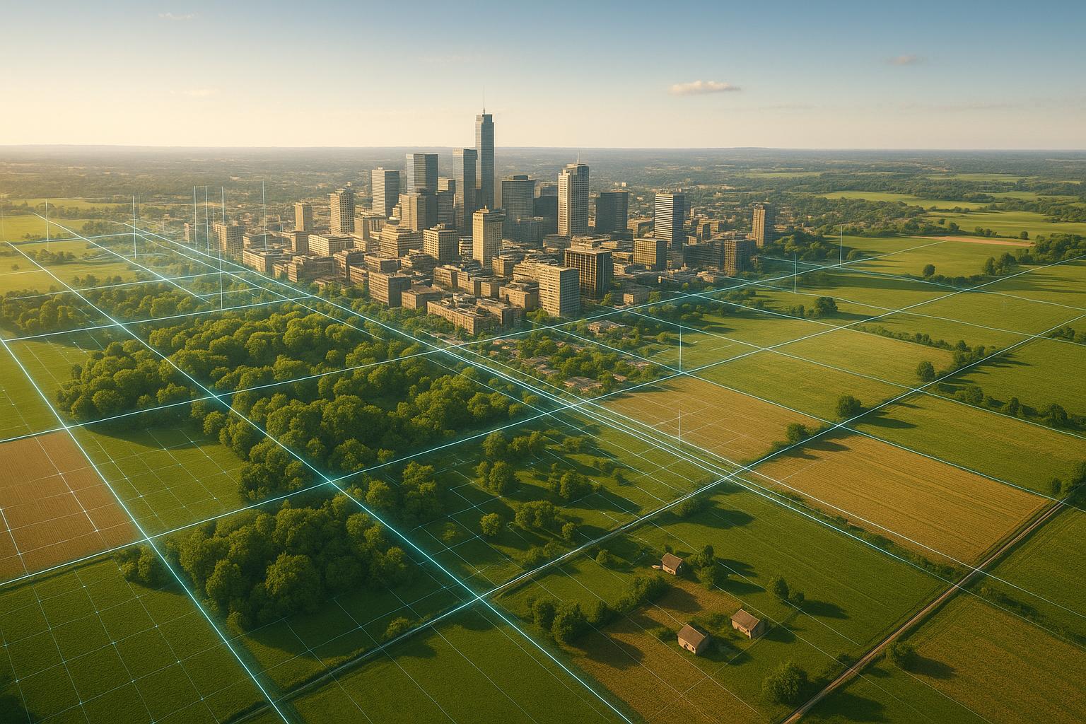
AI-powered digital twins are transforming land use planning by creating dynamic, real-time virtual models of physical spaces. These tools combine data from sources like sensors, satellite imagery, and 3D models to provide planners with a detailed, up-to-date view of urban environments. By integrating artificial intelligence, these models go beyond visualization, offering predictive insights into the impact of decisions on traffic, infrastructure, and community development.
Key Takeaways:
- What they are: Digital twins are virtual models that reflect real-world environments using live data.
- How AI helps: AI analyzes patterns, predicts outcomes, and simulates scenarios to guide better planning decisions.
- Why they matter: They replace outdated, static methods, offering faster, more accurate, and interactive planning tools.
- Applications: From zoning changes to optimizing urban spaces, digital twins support smarter, data-driven decisions.
- Community engagement: Realistic 3D visualizations make plans easier for residents to understand, improving transparency and feedback.
AI-powered digital twins are helping planners and communities make informed decisions, reduce risks, and improve urban spaces efficiently.
'Smart cities and digital twin technology: the case of Dublin' data.europa academy
Core Technologies and Data Sources for AI-Powered Digital Twins
For AI-powered digital twins to work effectively, they rely on high-quality spatial data and advanced processing platforms. These technologies form the foundation for the real-time and predictive abilities of digital twins discussed earlier. For planners aiming to leverage this technology, understanding these components is crucial.
Key Data Types
The functionality and precision of digital twins hinge on the variety and quality of data they use. Several critical data types play a vital role, each offering unique insights:
- LiDAR data: This technology uses laser pulses to create detailed 3D maps of environments, capturing features like elevation and vegetation.
- 3D models: Formats like BIM, CAD, and mesh representations provide the structural framework for digital twins, enabling precise design and visualization.
- 360° photos: These offer immersive, panoramic views of sites, helping planners and stakeholders visualize current conditions with clarity.
Integration of IoT and Sensor Networks
To build actionable digital twins, platforms must integrate a variety of data sources while ensuring secure storage and offering tools for visualization and collaboration. This integration is essential for transforming raw data into practical, interactive models.
Platforms Supporting Spatial and Data Analysis
Anvil Labs provides a comprehensive platform for managing spatial data. It supports a wide range of data types - such as 3D models, 360° photos, thermal imagery, LiDAR, and orthomosaics - and integrates them into cohesive digital twin models.
The platform prioritizes security with customizable access controls, ensuring sensitive planning data is protected while still allowing collaboration among stakeholders. Its cross-device accessibility enables planners, developers, and community members to interact with digital twin models on various devices, encouraging broader engagement.
Built-in tools for annotations and measurements let users highlight areas of interest, take accurate measurements, and attach contextual notes directly to the models. Anvil Labs also integrates with services like Matterport, AI analysis tools, and task management systems, creating a streamlined workflow that connects visualization with project management.
To handle the computational demands of large datasets common in land use planning, the platform offers scalable data processing capabilities. Pricing options include a $99 monthly subscription or $49 for project-specific hosting, making it adaptable to different project needs.
Applications of AI-Powered Digital Twins in Land Use Planning
AI-powered digital twins bring theoretical planning ideas to life, turning them into practical, testable scenarios. They help planners make informed, data-backed decisions while fostering better engagement with communities.
Simulating Zoning Changes
Digital twins are incredibly effective for testing zoning changes before they’re implemented. They allow planners to visualize how proposed adjustments might impact neighborhoods. For instance, shifting a zone from single-family housing to mixed-use can be simulated to reveal effects on traffic, parking, and infrastructure.
These simulations uncover ripple effects that traditional methods might miss. For example, increasing building density in one area might strain water systems several blocks away or cause unexpected traffic congestion during rush hours. By analyzing multiple factors at once, digital twins provide insights into how zoning changes could influence housing affordability, public transit usage, and emergency response times.
Economic impacts, such as changes in property values or tax revenue, can also be modeled. With this level of detail, planners can move forward with zoning decisions more confidently.
Optimizing Land Use for Urban Development
Beyond simulations, digital twins assist in optimizing urban development by evaluating demographics, economic trends, and environmental factors. This helps planners determine the best distribution of residential, commercial, and green spaces.
Underutilized areas can also be identified for potential development without disrupting established communities. By analyzing factors like foot traffic, building occupancy, and infrastructure capacity, digital twins pinpoint where different types of development would be most successful while ensuring compatibility with surrounding land uses.
Green spaces are another critical consideration. Digital twins assess how parks and urban greenery affect air quality, temperature control, and stormwater management. This helps planners determine the right balance of green space, even in areas experiencing growth. Additionally, they model how different land use patterns impact transportation, including commuting distances, public transit efficiency, and pedestrian safety. This holistic approach ensures smarter, more sustainable urban development.
Public and Stakeholder Engagement
AI-powered digital twins also transform how communities and stakeholders participate in planning. Their interactive visualizations make public meetings more engaging by turning abstract plans into tangible 3D models. Residents can explore these models to see how new developments might look from various viewpoints in their neighborhoods.
Platforms like Anvil Labs make this process even more accessible by offering cross-device compatibility, so community members can review proposals on their phones, tablets, or computers. Real-time collaboration features allow developers, city officials, and residents to discuss plans simultaneously, fostering open and productive conversations. At the same time, secure sharing ensures sensitive information stays protected while enabling transparent public involvement.
Community members can provide specific feedback - such as concerns about building heights or design elements - and even use measurement tools to verify claims, like how a new structure might affect sunlight on nearby properties. This turns community engagement into a collaborative, informed process where everyone’s voice is heard.
sbb-itb-ac6e058
AI-Driven Predictive Capabilities for Future Land Use
AI is turning digital twins from static representations into dynamic tools that can predict how cities will evolve. These forecasting abilities enable urban planners to foresee potential challenges, explore various growth scenarios, and make informed decisions that can positively shape communities for years to come. By simulating different possibilities, planners can assess risks and develop strategies with greater confidence.
Scenario Simulation for Urban Growth
AI's ability to simulate urban growth scenarios is a game-changer. For example, traffic pattern predictions become highly accurate when AI evaluates historical data alongside proposed developments. It can forecast how new residential complexes might impact morning commutes, highlight potential bottlenecks, and identify intersections that may need upgrades. Factors like school zones, shopping centers, and employment hubs are included to create realistic traffic flow models.
Environmental impact modeling goes a step further by predicting how development choices will influence air quality, stormwater runoff, and urban heat islands over decades. AI can simulate the effects of different building materials, green space layouts, and transportation networks on a city's environmental health.
Population density scenarios provide insights into how growth will affect infrastructure and services. For instance, AI can predict how adding 10,000 residents to a district might strain grocery stores, emergency services, and public utilities. These forecasts allow cities to make necessary upgrades before issues arise.
Economic forecasting powered by AI helps planners understand how changes in land use might impact local businesses, property values, and tax revenue. For example, converting industrial zones into mixed-use developments can be tested to determine if the economic benefits justify the investment.
Risk Assessment and Resilience Planning
AI also excels in identifying risks and enhancing resilience. Flood risk modeling, for example, combines historical weather data, topography, and proposed development plans to pinpoint areas most at risk. It can simulate 100-year flood scenarios with new infrastructure in place, helping planners make decisions that improve flood resilience.
Infrastructure strain analysis is another critical capability. AI can predict when roads, water systems, and power grids will reach their limits by analyzing population growth, climate changes, and usage patterns. This foresight helps cities avoid costly emergency repairs and service disruptions by planning upgrades in advance.
Disaster preparedness benefits significantly from AI simulations. Planners can model evacuation routes, emergency response times, and shelter capacities under various development scenarios. This helps identify potential bottlenecks and areas where additional emergency services might be required.
Climate resilience planning is enhanced by AI's ability to model long-term environmental changes. Rising temperatures, shifting precipitation patterns, and extreme weather events are all factored into these simulations, enabling planners to design developments that can adapt to changing conditions.
Platforms like Anvil Labs play a key role in these efforts by processing diverse datasets such as thermal imagery, LiDAR, and orthomosaics. Their AI tools analyze these data types together, uncovering patterns and risks that might otherwise remain hidden when examined individually.
Comparison of Current vs. AI-Powered Approaches
AI-powered planning methods offer clear advantages over traditional approaches, especially in terms of speed, accuracy, and scalability.
| Aspect | Traditional Methods | AI-Powered Digital Twins |
|---|---|---|
| Data Analysis | Relies on manual review of separate datasets | Automates integration and analysis of multiple data sources |
| Scenario Testing | Limited to a few scenarios due to time constraints | Can rapidly test dozens of scenarios |
| Risk Assessment | Based on historical data and expert judgment | Combines historical data with predictive modeling |
| Timeline | Takes months to analyze complex proposals | Completes analysis in days or weeks |
| Stakeholder Engagement | Uses static maps and reports | Offers interactive 3D models and real-time collaboration |
| Accuracy | Prone to human error | Provides consistent results with measurable confidence levels |
| Cost | High labor costs for manual analysis | Reduces long-term costs through automation |
While AI provides a robust analytical foundation, its true power lies in complementing human expertise. Experienced planners can interpret AI-driven insights through the lens of local knowledge and community priorities, ensuring that decisions align with broader strategic goals.
Best Practices for Implementing AI-Powered Digital Twins
Deploying AI-powered digital twins for land use planning is no small task. Success hinges on three key areas: managing data effectively, selecting the right platform, and fostering collaboration with stakeholders. When these elements are thoughtfully addressed, digital twins can provide meaningful insights rather than becoming costly experiments.
Data Quality and Integration
Solid data is the core of any effective digital twin system. Without it, predictions and insights are unreliable. Start by auditing and standardizing your data sources to ensure they are complete, accurate, and up-to-date. For instance, many planning departments encounter outdated GIS data or mismatched coordinate systems. Fixing these issues before integrating data into your digital twin platform is critical.
To avoid compatibility problems, standardize data formats - from naming conventions to coordinate systems and metadata. Imagine trying to merge thermal imagery using one temperature scale with building energy data using another; the AI simply can’t connect the dots without consistency.
Automated data validation workflows can help catch errors early. For example, if property boundary data doesn’t align with aerial imagery, the system should flag it before it’s incorporated into the model. This ensures only clean, reliable data feeds into the digital twin.
Keeping your digital twin current is equally important. Set up regular update schedules based on how often different data types change. Traffic patterns might need monthly updates, while geological data could remain unchanged for years. Immediate updates are essential for dynamic data like building permits or zoning changes.
Also, consider the spatial resolution your project requires. Street-level planning might demand data accurate to within 3 feet, while regional modeling can work with a 30-foot resolution. Higher precision comes with trade-offs like increased storage needs and longer processing times, so find the right balance for your goals.
Once your data is in order, the next step is choosing a platform that can handle it securely and efficiently.
Using Secure and Scalable Platforms
The platform you choose can make or break your project. It needs to grow with your needs while keeping sensitive data protected.
Look for robust security features like role-based access controls, encrypted data transmission, and detailed audit trails. Planning data often contains sensitive information - property values, infrastructure details, and development plans - that must be safeguarded from misuse or breaches.
Platforms like Anvil Labs excel in this area, offering secure data sharing with granular access controls. Their system supports a wide range of data types, including 3D models, LiDAR, thermal imagery, and orthomosaics, all while meeting government-level security standards.
Scalability is another must-have. Your platform should handle projects of all sizes, from neighborhood developments to citywide plans. Cloud-based solutions are particularly useful, as they can adjust computing resources based on demand.
Integration capabilities are equally important. The platform should work seamlessly with existing systems like GIS databases, permitting tools, and other municipal software. Some platforms require external data processing before upload, while others handle it internally. For example, Anvil Labs offers both options, with their Asset Viewer plan providing managed data processing services for those who prefer it.
A secure, scalable platform not only ensures smooth operations but also sets the stage for effective collaboration with stakeholders.
Collaborating with Stakeholders
Even the best platform is just a tool unless stakeholders actively engage with it. Collaboration turns data into actionable insights and drives meaningful planning decisions.
Involving stakeholders early is critical. Representatives from city departments, community groups, and development organizations can help identify use cases and potential challenges. Their input ensures the digital twin addresses real-world planning needs and avoids costly revisions later.
Training sessions are essential to help stakeholders interpret and use digital twin outputs effectively. For example, a 3D visualization of traffic congestion might look impressive, but stakeholders need to understand the assumptions and limitations behind the data to make informed decisions.
Keep stakeholders engaged with regular demonstrations. Monthly meetings can showcase how the digital twin supports various responsibilities - public works might focus on infrastructure modeling, while economic teams explore commercial growth scenarios. Tailor the information to each audience: planning commissioners may need high-level summaries, while engineers require detailed technical specs.
Interactive tools like annotation and measurement features enhance collaboration. During meetings, stakeholders can highlight specific areas of concern, measure distances, or leave comments directly within the 3D model. These tools transform digital twins from static visuals into dynamic planning aids.
Lastly, ensure the platform includes robust reporting tools. These should generate formal documents for municipal requirements while remaining accessible to non-technical users. Establishing feedback loops is also vital - allow stakeholders to flag discrepancies between predictions and real-world outcomes. This feedback refines AI models over time, building trust and improving accuracy.
Conclusion: Transforming Land Use Planning with AI-Powered Digital Twins
AI-powered digital twins are reshaping land use planning by blending real-world data with advanced AI to create dynamic, actionable models. This approach streamlines the planning process, saving time and improving decision-making.
Instead of taking months, digital twins can analyze data - like traffic patterns, zoning laws, and environmental factors - in just hours. This rapid integration allows planners to test multiple scenarios quickly, identifying potential issues before they become larger problems.
Interactive 3D models and tools for real-time annotations are enhancing how stakeholders collaborate. What used to be static documents has evolved into a platform for precise, interactive discussions, making the planning process more engaging and effective.
AI capabilities also allow planners to predict the long-term effects of zoning changes on property values, traffic, and public services. These systems can even flag risks like flooding or infrastructure strain years in advance, thanks to their ability to process diverse and high-quality data seamlessly.
By incorporating technologies like LiDAR, thermal imagery, IoT sensors, and 360° photography, digital twins provide unmatched clarity on how land is being used versus how it’s zoned. This level of detail enables more informed and nuanced planning decisions.
Beyond technical advancements, AI-powered digital twins are making land use planning more transparent and inclusive. Platforms such as Anvil Labs are leading the way with tools that offer interactive visualizations, detailed annotations, and secure data sharing. These features empower both planners and community members to engage with proposed developments. Residents can visualize how their neighborhoods might change, understand the reasoning behind decisions, and provide meaningful feedback based on a shared, transparent view.
As these systems continue to advance, their ability to combine real-world data, AI-driven insights, and collaborative tools positions them as indispensable for building sustainable and livable communities.
FAQs
How do AI-powered digital twins enhance public involvement in land use planning?
AI-powered digital twins are transforming land use planning by giving communities access to realistic, interactive 3D models of their environment. These virtual models allow residents to visualize proposed changes, spot potential issues, and share thoughtful feedback.
By simulating various scenarios, digital twins promote collaboration and open communication. This approach builds trust and ensures that urban development reflects the needs and priorities of the people it impacts most - local stakeholders.
What data sources and technologies are essential for building AI-powered digital twins?
AI-powered digital twins come to life through a mix of essential data sources and modern technologies. The data fueling these models includes IoT sensor readings, historical records, maintenance logs, real-time operational metrics, and information from external databases. Together, these inputs lay the groundwork for building precise and adaptable digital representations.
On the technology side, digital twins rely on data integration systems, AI-driven analytical algorithms, advanced visualization platforms, and simulation tools. These elements work together to enable real-time tracking, predictive analytics, and smarter decision-making. By merging diverse data with advanced tech, digital twins have become valuable tools for improving land use planning and shaping urban development.
How does AI improve urban planning to support sustainable growth and resilience?
AI is reshaping urban planning by leveraging predictive models to anticipate how cities will grow, make better use of land, and pinpoint risks before they become problems. By analyzing data like satellite images, traffic trends, and environmental conditions, AI equips planners with insights to design cities prepared for future demands.
This technology helps planners develop infrastructure that minimizes urban sprawl, adapts to climate-related challenges, and promotes efficient, sustainable growth. With AI-driven tools, cities can become smarter and better equipped to support vibrant, well-planned communities.
