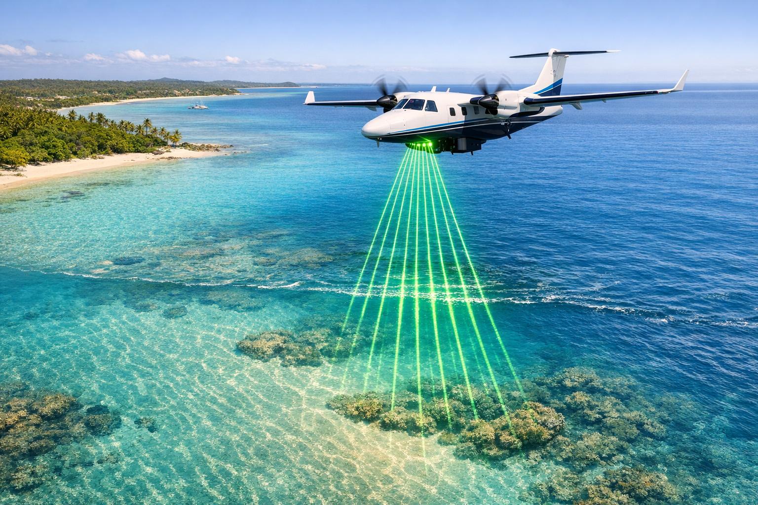
Bathymetric LiDAR is a remote sensing technology that uses green lasers to measure water depths and map underwater terrain. It’s designed to penetrate water, bounce off the seabed, and return highly detailed data. By combining near-infrared and green lasers, it creates 3D models of both land and underwater environments, enabling depth measurements up to 50 meters (or 75 meters in clear water). This method is crucial for surveying areas that are unsafe or inaccessible for traditional methods, such as shallow coastlines or surf zones.
Key Points:
- Technology: Uses a 532 nm green laser for water penetration and a 1,064 nm infrared laser for surface detection.
- Applications: Coastal management, harbor surveys, infrastructure planning, flood modeling, and underwater archaeology.
- Accuracy Factors: Water clarity, turbidity, seabed material, and equipment settings like altitude and laser power.
- Data Output: Produces 3D point clouds integrated with GPS and other data for precise mapping.
This method is particularly useful for mapping shallow or complex underwater environments, offering a safe and efficient alternative to ship-based surveys.
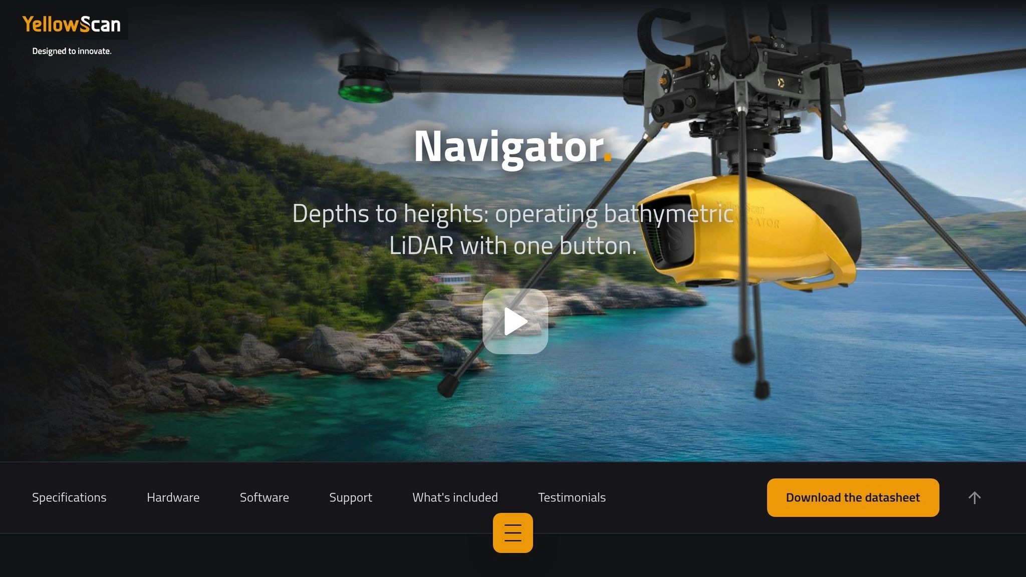
Harbour surveying with the topo-bathymetric LiDAR - YellowScan Navigator
How Bathymetric LiDAR Works
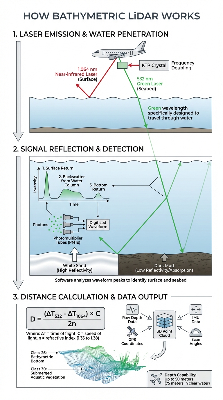
How Bathymetric LiDAR Works: 3-Step Process from Laser Emission to 3D Mapping
Laser Emission and Water Penetration
Bathymetric LiDAR systems rely on two distinct laser wavelengths to gather underwater data: a near-infrared laser at 1,064 nm, which pinpoints the water surface, and a green laser at 532 nm, specifically designed to penetrate the water column and reach the seabed. The green wavelength is particularly effective for traveling through water due to its shorter wavelength.
To generate the green laser, the system passes the 1,064 nm infrared laser through a KTP crystal, which doubles the frequency and reduces the wavelength to 532 nm. Once the laser enters the water, it refracts and slows down - a critical change that enables precise depth measurements. These adjustments in light behavior are fundamental to capturing underwater data accurately.
Signal Reflection and Detection
After penetrating the water, the green laser interacts with suspended particles and eventually reflects off the seabed. As the laser travels through the water, it produces a full waveform that includes three key components: the surface return, backscatter from the water column, and the bottom return. Photomultiplier Tubes (PMTs) capture these reflected photons and convert them into electrical signals almost instantaneously.
These electrical signals are then digitized into detailed waveforms that show the intensity of the reflected light over time. Specialized software analyzes these waveforms to identify peaks, with the first peak corresponding to the water surface and subsequent peaks representing the seabed or underwater objects. The reflectivity of the bottom return can vary significantly depending on the seabed material - white sand, for instance, reflects much more light than darker materials like mud, which tend to absorb it.
Distance Calculation and Data Output
The system calculates water depth by measuring the time delay between the laser reflections from the surface and the seabed. To ensure accuracy, it applies a refractive index correction, typically ranging from 1.33 to 1.38, depending on the water's properties.
The depth is determined using the formula: D = (ΔT₅₃₂ - ΔT₁₀₆₄) × C / 2n, where ΔT is the time of flight for each wavelength, C is the speed of light, and n is the refractive index. This raw depth data is then integrated with GPS coordinates, Inertial Measurement Unit (IMU) data for aircraft orientation, and scan angles to create a detailed 3D point cloud. These points are categorized using standards from the American Society for Photogrammetry and Remote Sensing (ASPRS), such as Class 26 for Bathymetric Bottom and Class 30 for Submerged Aquatic Vegetation.
Factors That Affect Bathymetric LiDAR Accuracy
The precision of bathymetric LiDAR surveys depends on both the properties of the water being measured and the technical setup of the equipment used.
Water Clarity and Turbidity
The clarity of the water largely determines how deep bathymetric LiDAR can penetrate. A simple measurement called the Secchi depth - calculated by lowering a white plate into the water until it disappears - is often used to estimate this. Most LiDAR systems can reach depths between 1 and 3 times the Secchi depth.
Suspended particles like sediments, algae, and organic matter can scatter and absorb the green laser used in these systems, weakening the return signal. The type of seabed also plays a role: white sand reflects more light, while dark mud absorbs laser energy, which can result in gaps in the data.
| Water Clarity | Estimated Maximum Depth Range |
|---|---|
| Clear Water | Up to 300 meters |
| Slightly Turbid | Up to 100 meters |
| Moderately Turbid | Up to 50 meters |
| Highly Turbid | Up to 10 meters |
| Extremely Turbid | Up to 3 meters |
Surface conditions add another layer of complexity. Rough or turbulent water can cause diffuse reflections and weaken the signal, making accurate measurements harder to obtain. Even small changes in temperature and salinity can affect readings, with variations of 4–6 mm being typical.
While environmental factors are critical, the configuration and operation of the LiDAR system itself are equally important.
Platform and Equipment Variables
Technical and operational settings significantly influence the accuracy of bathymetric LiDAR. For instance, flying altitude is a key factor. Bathymetric systems generally operate at lower altitudes than their topographic counterparts to maintain a strong signal. The EAARL-B system, for example, is commonly flown at 300 meters to achieve high-resolution coastal mapping.
Laser power also impacts performance. When the U.S. Geological Survey increased the EAARL-B system's peak laser power by tenfold, it achieved depths of 44 meters, meeting International Hydrographic Organization (IHO) Order 1 standards for vertical accuracy. Meanwhile, modern systems like the Leica Chiroptera 4X can capture 140,000 points per second, offering data density four times greater than earlier models.
The scan angle is another crucial variable. Many systems use a slight off-nadir angle (about 2.3°) to minimize Fresnel reflections from the water surface, which can overwhelm the sensor. For surveys in deeper waters - beyond 20 meters - specialized receivers with larger fields of view, up to 5 meters in diameter, are employed to capture scattered and refracted light that standard receivers might miss.
sbb-itb-ac6e058
Applications of Bathymetric LiDAR
Bathymetric LiDAR is a powerful tool for underwater mapping, seamlessly capturing data from the shoreline to the seafloor. This makes it especially useful for projects where traditional survey methods may fall short in terms of safety or efficiency.
Coastal Zone Management
Coastal regions are constantly changing due to factors like erosion, storms, and rising sea levels. Bathymetric LiDAR provides high-resolution data that helps track these changes and design effective countermeasures. With a resolution of nearly 1 meter, it can distinguish features such as sand waves, reef structures, and island contours.
"Lidar resolution (approximately 1 m × 1 m) allows a broad range of seabed features to be distinguished at many different spatial scales, such as sand waves, island topography, and reefscapes."
- USGS
A practical example of this technology in action occurred in 2012, when the U.S. Geological Survey used airborne LiDAR to evaluate the damage caused by Hurricane Sandy along New Jersey's coastline. In Mantoloking, NJ, the data revealed a 250-meter-wide breach in the barrier island and extensive beach erosion. By comparing elevation data from before and after the storm, researchers were able to model overwash deposition and assess areas prone to future damage. Airborne mapping also eliminated the need for hazardous fieldwork, improving both safety and efficiency.
This capability naturally extends to more intricate environments, such as harbors.
Infrastructure and Harbor Surveys
Harbor surveys present unique challenges, including shallow waters, turbid conditions, and steep fjord walls, which often make traditional methods ineffective. Ship-based surveys, for example, struggle in waters shallower than 50 feet due to obstacles like rocks, kelp, and complex shorelines. Bathymetric LiDAR excels in these situations, providing accurate depth data in areas where vessels cannot safely operate.
In 2021, NV5 Geospatial mapped 630 miles of rugged shoreline in Alaska’s Revillagigedo Channel for NOAA using Leica Chiroptera 4X and HawkEye 4X LiDAR sensors. Despite difficult conditions like turbid water, low clouds, and steep fjord walls, the project successfully captured seafloor details at depths ranging from 52 to 66 feet. This data revealed submerged rocks and informed safe navigation for subsequent multibeam sonar operations. As Andres Vargas, a Technical Expert at NV5 Geospatial, noted:
"NOAA is trying to get very accurate and precise data to promote the safety of all the vessels working in these complicated environments."
Beyond navigation, bathymetric LiDAR is also used to monitor bridge scour (erosion around bridge foundations) and track sediment buildup in reservoirs, which helps calculate remaining water storage capacity. For dam removal projects, it provides the detailed topographic and bathymetric data engineers need for planning and environmental impact assessments. With U.S. ports handling $1.5 trillion in goods annually, keeping navigation charts updated is critical.
Data Processing and Platform Integration
Processing Raw Data
Turning raw bathymetric LiDAR data into something actionable for infrastructure projects requires several steps. The process begins by combining laser range data with GPS, IMU readings, scan angles, and calibration details. Together, these elements create a dense 3D point cloud, where each point is assigned precise latitude, longitude, and height coordinates.
To ensure accuracy, specialized software corrects for refraction - the change in light speed as it moves from air to water. Without this adjustment, depth measurements would be unreliable. Once corrected, algorithms classify the points into categories like water surface, water column, and submerged bottom. These categorized points are then transformed into Digital Elevation Models (DEMs) or Digital Terrain Models (DTMs), which provide a seamless representation of the Earth's surface, both above and below water.
This processed data plays a crucial role in infrastructure evaluations, such as analyzing bridges. By feeding the data into 1D or 2D hydraulic models, engineers can simulate water flow, velocity, and direction - essential for understanding flood risks. Modern bathymetric LiDAR systems are impressively efficient, capturing over 100,000 points per second and achieving densities exceeding 10 points per square meter in shallow waters. Once processed, this data is ready for integration into platforms that enhance visualization and collaborative analysis.
Using Platforms like Anvil Labs
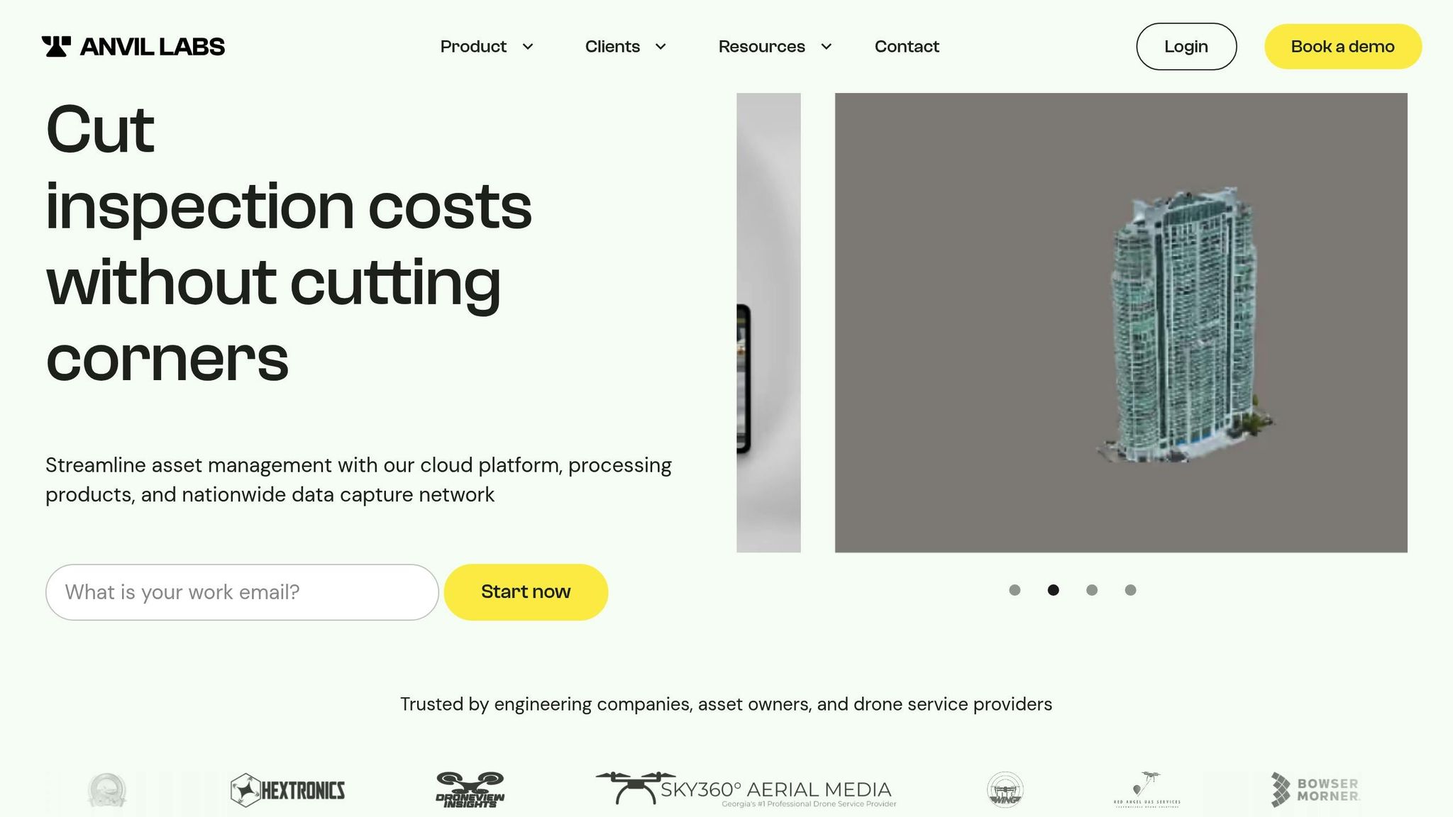
To handle large datasets and facilitate teamwork, platforms like Anvil Labs offer a secure and efficient solution for managing processed bathymetric LiDAR data. These platforms allow teams to visualize underwater terrain alongside 3D models, orthomosaics, and even thermal imagery.
With built-in annotation and measurement tools, engineers can analyze critical issues such as bridge scour, sediment buildup, and coastal erosion patterns directly within a 3D workspace. The platform’s cross-device accessibility ensures that field teams can access data on any device, while secure sharing features safeguard sensitive infrastructure information. By supporting standardized file formats like LAS 1.4-R15, these platforms make it easy to integrate bathymetric data, overlay multiple surveys, and monitor temporal changes in dynamic coastal environments.
Conclusion
Bathymetric LiDAR has redefined how we map underwater environments. By using a 532 nm green laser - unlike the 1064 nm infrared laser used in terrestrial surveys - it can measure depths up to 50 meters with impressive vertical accuracy of under 10 cm. The system operates by emitting laser pulses, capturing reflections from both the water's surface and the seafloor, and calculating distances to generate detailed 3D point clouds.
In terms of performance, water clarity is the key factor that limits its effectiveness. Typically, the laser can penetrate water up to 2–3 times the Secchi depth. Advanced scanning techniques and sophisticated processing, which account for refraction and classify underwater points, help mitigate environmental challenges.
This technology shines in shallow or hazardous areas where traditional sonar-equipped vessels face risks. Its real-world impact is evident in projects like the post-Superstorm Sandy assessment of the Mantoloking Bridge in New Jersey and the 2016 USGS study of flood damage on the I-64 bridge.
FAQs
How does water clarity impact the accuracy of bathymetric LiDAR measurements?
Water clarity is a key factor in how well bathymetric LiDAR performs. In clear water, the green laser pulses can reach greater depths and return stronger signals, leading to more precise depth readings. On the other hand, in murky or turbid water, particles in the water scatter and absorb the laser light. This limits how far the light can travel, which impacts the quality and accuracy of the data collected.
Bathymetric LiDAR works best in environments where the water is clear, allowing light to travel with minimal disruption.
How is Bathymetric LiDAR used in coastal management?
Bathymetric LiDAR is an essential tool in coastal management, offering precise underwater mapping and detailed data analysis. It's widely used to measure shallow water depths, chart seafloor landscapes, and identify submerged vegetation and habitats.
Beyond mapping, this technology plays a key role in monitoring water quality, tracking pollutant spills, and supporting hydrodynamic and storm-surge modeling. It also proves invaluable for shoreline mapping, evaluating coastal vulnerabilities, and planning emergency responses - helping safeguard and manage coastal areas with greater precision and care.
How is bathymetric LiDAR data processed and applied in infrastructure projects?
Bathymetric LiDAR relies on green laser technology to gather precise underwater data, which is then transformed into elevation models like digital elevation models (DEMs) or digital terrain models (DTMs). These models offer a clear representation of both the water surface and the seabed, making them highly useful for a wide range of projects.
The processed data is often incorporated into GIS platforms or civil engineering software. This integration supports the design, planning, and monitoring of critical infrastructure such as bridges, ports, flood control systems, and habitat restoration projects. By delivering detailed insights, this technology empowers engineers and planners to make well-informed decisions for coastal and inland developments.
