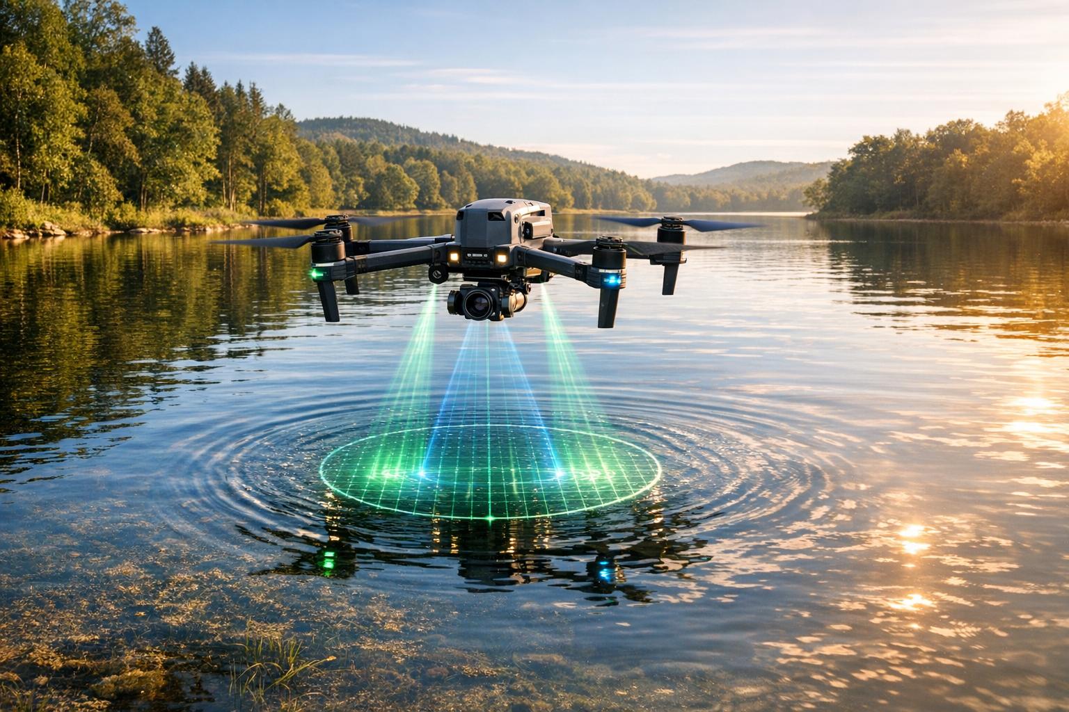
Drone digital twins are reshaping how we monitor water quality in rivers, lakes, and reservoirs. By combining drones equipped with advanced sensors and real-time computational models, these systems create virtual replicas of water bodies. This approach addresses the limitations of manual sampling and lab tests, offering faster, more detailed insights into contamination risks and water health.
Here’s what you need to know:
- What They Do: Drones collect data on parameters like pH, turbidity, temperature, and dissolved oxygen, transmitting it to cloud platforms for analysis.
- Why It Matters: Nearly 40% of the U.S. population relied on unsafe drinking water systems between 2016 and 2019, highlighting the need for better monitoring methods.
- How They Help: Digital twins predict contamination scenarios, identify pollution hotspots, and improve response times during water crises.
- Core Technologies: Multirotor drones, IoT sensors, machine learning models, and cloud platforms like AWS or ThingSpeak are key components.
This technology is already being used in projects like monitoring the Boise River in Idaho and the Ganga River in India, demonstrating its potential for improving water safety and management. While challenges like short drone flight times and data integration issues remain, advancements in modeling and data processing are paving the way for wider adoption.
AQUADRONE: UAV Assisted Deployment System for Water Quality Monitoring
Core Technologies in Drone-Based Digital Twins
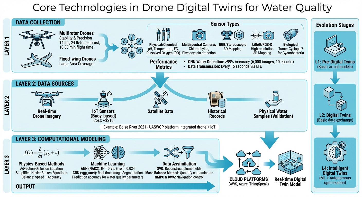
How Drone Digital Twins Monitor Water Quality: Core Technologies and Data Flow
Creating a functional digital twin for monitoring water quality involves three essential layers: drones and sensors for data collection, varied data sources to feed the models, and computational methods that transform raw data into meaningful insights.
Drone Platforms and Sensors
The backbone of these systems starts with the drones themselves. Multirotor drones, such as the DJI Matrice 600 Pro, are ideal for stability and precise measurements, while fixed-wing models are better suited for covering larger areas. A notable example occurred in July 2018 when researchers at Clemson University deployed a custom-built hexacopter to monitor a 2.7-acre agricultural pond. This drone, weighing 14 lbs and generating 24 lb-force of thrust, successfully collected in-situ measurements at depths of 1.6 ft and 9.8 ft during a 10-minute flight.
Equipped with specialized sensors, drones measure critical water quality indicators. Physical and chemical sensors track pH levels, water temperature, electrical conductivity (EC), and dissolved oxygen (DO) - key metrics for assessing water health [6, 11]. Multispectral cameras monitor chlorophyll-a and phycocyanin levels, helping detect algal blooms, while RGB and stereoscopic cameras create 3D maps for navigation [7, 10]. LiDAR and RGB-D sensors add high-resolution 3D mapping capabilities, aiding in ground geometry assessments and obstacle avoidance. For more specific tasks, biological sensors like the Turner Instruments Cyclops-7 measure phycocyanin concentrations to estimate cyanobacteria biomass.
A practical application of these technologies occurred during the 2019 harmful algal bloom season. The DrOne Water Sampling SystEm (DOWSE) collected 180 surface water samples from Grand Lake St. Marys, Lake Erie, and Lake Anna. Using the Cyclops-7 sensor, researchers identified mean microcystin concentrations of 15.00 ppb at Grand Lake St. Marys - levels exceeding safety thresholds for recreational use. Additionally, a CNN-based water detection algorithm trained on 6,000 images achieved over 99% accuracy in distinguishing water from land pixels within just 10 training epochs. These advanced tools work seamlessly with diverse data sources to power digital twin models.
Data Sources for Water Quality Monitoring
Drone data alone isn’t enough. Effective digital twins combine real-time drone imagery with inputs from IoT sensors (like buoy-based monitors), satellite data, and historical records. Together, these sources create a dynamic, real-time representation of water bodies. For example, in 2021, the University of Idaho used their UASWQP platform on the Boise River to integrate drone imagery with IoT sensors. The IoT device components cost approximately $210, making it an affordable solution.
Physical water sampling remains essential for validating digital models. In September 2025, researchers at the Jordan University of Science and Technology used a DJI Phantom-4 drone equipped with multispectral sensors to monitor an artificial lake. By collecting water samples from 10 different points, they correlated spectral reflections with chemical parameters, achieving a prediction accuracy (R²) of 0.95 and a relative error of just 0.034. This combination of data sources builds a strong foundation for computational modeling.
Modeling Approaches in Digital Twins
Digital twin models rely on a mix of physics-based methods, machine learning, and data assimilation techniques to analyze and predict water quality trends.
Physics-based approaches use the advection-diffusion equation to simulate contaminant spread and simplified Navier-Stokes equations for fluid dynamics. These methods balance computational speed with reliable accuracy.
Machine learning excels in handling complex, non-linear relationships. For instance, Artificial Neural Networks (ANN), particularly the Nonlinear Autoregressive with Exogenous Input (NARX) architecture, predict water quality parameters with impressive precision. Convolutional Neural Networks (CNN), such as the vgg_unet architecture, perform real-time image segmentation to distinguish water from land.
Data assimilation techniques like Singular Value Decomposition (SVD) reconstruct complete plume fields from limited sensor data. The Mass Balance Method, on the other hand, quantifies source emission rates and contaminant levels through experimental data. For navigation, systems employ Non-linear Model Predictive Control (NMPC) and the Dynamic Window Approach (DWA) for precise landings in unfamiliar environments.
Digital twins are evolving through several stages. Early "Pre-Digital Twins" (L1) are basic virtual models. "Digital Twins" (L2) involve basic data exchange, while "Intelligent Digital Twins" (L4) incorporate machine learning and autonomous optimization. This progression is moving us from reactive monitoring to proactive risk management for water contamination.
Applications of Digital Twins in Water Quality Monitoring
Monitoring Water Quality Parameters
Digital twins, when paired with drones, are transforming how we monitor water quality. By using aerial sensors and advanced cloud-based analytics, these systems can track critical water quality indicators in real time. For instance, in 2025, researchers at Jordan University of Science and Technology employed a DJI Phantom-4 drone equipped with multispectral sensors (Blue, Green, Red, Red Edge, Near-Infrared) to study an artificial lake. They combined spectral reflection data with physical samples taken from ten locations, feeding this information into a NARX Artificial Neural Network. The result? An impressive prediction accuracy (R²) of 0.95 and a relative error of just 0.034. This method allows for efficient monitoring of chlorophyll-a, turbidity, and contaminant levels without needing physical access to every point of interest. Moreover, the data is sent to a cloud platform every 15 seconds via LTE, enabling real-time updates that are crucial for risk assessment and disaster preparedness.
Contamination Risk Assessments
Digital twins go beyond monitoring - they play a key role in evaluating contamination risks by simulating different intervention strategies. In January 2025, researchers created a digital twin for a 480 km stretch of the Ganga River in India. This tool allowed managers to simulate various scenarios and allocate resources more effectively.
"Digital twins are emerging as a powerful tool for managing complex systems... to create a multipurpose simulation of water quality conditions. The model can be used to explore changes in water quality based on various scenarios."
– Md Rafiul Kabir, IEEE
Another example comes from 2023, when the Digital Twin Lake Framework (DTLF) was implemented at Lake Chaohu, China’s fifth-largest freshwater lake. The system combined data from 42 land-based video devices, 8 automated water quality stations, and satellite remote sensing to detect harmful algal blooms. With real-time updates as frequent as once per second, this framework enabled detailed 3D analyses of subsurface contamination risks, significantly improving response times.
Disaster Response and Scenario Analysis
When environmental disasters strike, digital twins provide invaluable tools for rapid assessment and planning. In 2022, the River Observation System (RiOS) used a simulation-driven digital twin (RiOS-Sim) to develop algorithms for live-adaptive UAV trajectory planning. This innovation allowed for swift river flow measurements and thermal variation detection, even in unfamiliar locations. Such technology is addressing major gaps in monitoring - for example, only about 8% of rivers in California are currently under observation. By integrating live data with predictive models, digital twins can simulate scenarios like heavy rainfall, industrial spills, or the effects of climate change. This capability ensures a comprehensive and proactive approach to water safety management, combining real-time insights with long-term planning strategies.
sbb-itb-ac6e058
Data Management and Visualization Platforms
Turning raw sensor data into meaningful water quality insights relies heavily on effective data management and visualization.
Handling Large Data Volumes
Drone-based digital twins generate a staggering amount of data, requiring advanced storage and processing solutions. For instance, when a DJI Matrice 600 Pro gathers water samples and transmits real-time sensor readings via LTE networks, the data piles up quickly. To handle this, cloud-based IoT analytics platforms like ThingSpeak are often used to aggregate and process the incoming data efficiently. For larger-scale projects - such as mapping entire water bodies - enterprise-level services like Amazon Web Services (AWS) or Microsoft Azure are ideal. Many digital twin systems also use hybrid modeling, which blends stochastic and deterministic methods. This approach ensures high accuracy while allowing the models to run on portable hardware, such as laptops, instead of requiring costly supercomputers.
Visualization Techniques
Visualization tools transform raw data into insights that are easy to understand and act upon. Time-series dashboards, for example, track water quality metrics like pH levels, dissolved oxygen, and temperature over time, helping operators detect trends or sudden contamination spikes. A notable example is the UASWQP platform, which, in 2022, monitored the Boise River in Idaho. Real-time data was uploaded to the ThingSpeak cloud, enabling field crews to use mobile devices to track agricultural return flows from Mason's Creek.
Interactive 2D maps and 3D models further enhance decision-making by identifying contamination hotspots and guiding sampling efforts. Simulations like 3D plumes predict pollutant spread and concentration over time, while "what-if" scenarios - such as heavy rainfall or industrial discharge - equip water managers to prepare for future challenges. These visualization tools provide a strong foundation for platforms like Anvil Labs to enhance data analysis further.
How Anvil Labs Supports Digital Twin Management
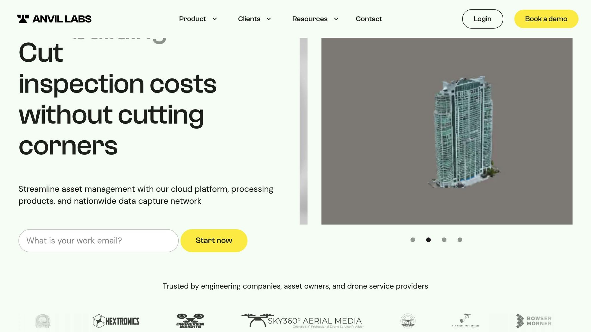
Platforms like Anvil Labs bridge the gap between raw data and actionable insights. Specifically designed for managing spatial datasets from drone-based digital twins, Anvil Labs supports a wide range of data types, including 3D models, thermal imagery, LiDAR point clouds, and orthomosaics. This makes it an essential tool for water quality monitoring systems.
With pricing starting at $49 per project for hosting and sharing, and $99 per month for full asset management, Anvil Labs offers enterprise-level tools for organizations of all sizes. Key features include annotation tools for marking contamination zones, precise distance measurement capabilities, and collaborative risk assessment options. Its cross-device accessibility means field crews can view real-time updates on tablets, while stakeholders analyze the same data on desktops.
Secure sharing and access control features ensure that water management agencies can collaborate with regulatory bodies and community stakeholders without risking data breaches. Additionally, integrations with AI tools enable automated detection of water quality anomalies, streamlining the entire process from data collection to actionable insights.
Challenges, Limitations, and Future Directions
Technical and Operational Challenges
Drone digital twins face several practical hurdles. One major issue is limited flight endurance. Small UAVs typically manage flights lasting only 10 to 30 minutes, while even professional models like the DJI Matrice 600 Pro can only fly for about 16 minutes when carrying a full payload of 12–13 lbs. This short flight time restricts the area they can cover and limits how often they can sample data over large water bodies.
Another significant challenge is data synchronization. Systems often use inconsistent variable naming, which forces researchers to manually align data - a process prone to errors. Additionally, creating high-fidelity 3D models of gas plumes or complex river flows requires substantial computing power, leading to compromises between accuracy and real-time performance. Thermal sensors, which are critical for estimating flow, need active cooling to reduce noise levels to less than 20 mK. However, this adds weight to the payload and drains battery life even faster.
These technical hurdles are compounded by regulatory and organizational challenges that further complicate the adoption of drone digital twins.
Regulatory and Organizational Barriers
In the U.S., regulatory restrictions and fragmented organizational practices create barriers to progress. Although there's a clear need for better water quality management, inconsistent policies and siloed operations slow down the adoption of advanced tools like digital twins.
"The main factors affecting the accessibility of water data in China include the high cost of data purchase for end users, national security concerns, the lack of policy for data sharing, and the lack of credibility of data quality." - Lin et al.
While this quote refers to China, similar issues exist in the U.S. Organizational silos often result in duplicated data collection efforts and wasted resources. Traditional water management approaches, which rely on "experience-based" and "post-event" strategies, struggle to incorporate the real-time predictive capabilities that digital twins offer. Furthermore, there are no standardized methods for integrating high-resolution drone data into digital twin platforms, which remains a major obstacle.
Future Research Opportunities
Overcoming these challenges will require innovative research and development to unlock the full potential of digital twins for proactive water quality management.
One promising direction is hybrid modeling, which combines physics-based models with machine learning to enhance predictive accuracy while keeping computational demands manageable. Coordinated use of drone swarms, along with surface and underwater vehicles, could enable more comprehensive 3D data collection. Researchers are also exploring fractional calculus-based spatial-temporal modeling to better understand pollutant dispersion.
In December 2024, a study from the University of Louisville highlighted a key gap: while drones excel at capturing high-resolution data, integrating that data into predictive digital twin models for sustainable water management remains a significant challenge. Advancements in autonomous path planning, particularly systems that can adapt in real time to contamination plumes, represent an exciting frontier for improving mass balance assessments. Additionally, enterprise-scale cloud platforms like AWS and Azure will be critical for managing the massive data volumes generated by high-resolution sensors.
Conclusion
Drone digital twins are changing the game in water quality monitoring. By merging real-time aerial data with predictive modeling, they’ve shifted water management from being reactive to proactive. Consider this: between 2016 and 2019, nearly 40% of Americans relied on drinking water systems that violated the Safe Drinking Water Act. That’s a staggering number - and a clear sign that traditional methods haven’t been cutting it.
Here’s what drone digital twins bring to the table: real-time, high-resolution data, the ability to access hazardous or hard-to-reach areas, early detection of pollution, and tools to simulate "what-if" scenarios to prevent disasters. Unlike conventional monitoring systems, drones offer unmatched spatial coverage and frequent updates. When this data is paired with digital twin platforms, it transforms into actionable insights - helping with everything from contamination risk analysis to planning disaster responses.
Platforms like Anvil Labs are leading the charge in this space. They provide the infrastructure to handle the massive datasets generated by drones, supporting advanced tools like 3D models, thermal imaging, and LiDAR data. These capabilities make them ideal for managing the complex spatial information that digital twins rely on.
As hybrid modeling evolves and integration frameworks become more standardized, drone digital twins will play an essential role in safeguarding public health and natural resources. With their proven ability to provide real-time insights and proactive risk management, the next challenge is scaling their adoption nationwide.
FAQs
How do drone-based digital twins enhance water quality monitoring?
Drone-based digital twins merge real-time data from UAV sensors with virtual models to produce precise simulations. This method enables quicker, more frequent, and expansive water quality assessments compared to the slower, labor-intensive boat-based sampling traditionally used.
By cutting down on manual work and lowering safety risks, drone digital twins offer a more efficient and cost-effective way to monitor water quality. Tools from platforms like Anvil Labs simplify the creation and management of these digital twins, making large-scale water quality monitoring both accurate and straightforward.
What are the main challenges drone-based digital twins face with data integration and flight limitations?
Drone-based digital twins encounter two major hurdles: managing data and navigating flight constraints.
On the data front, drones generate massive amounts of sensor information - like images, multispectral data, and environmental readings. Processing, cleaning, and synchronizing all this data in near real-time is no small feat. Factors like changing light conditions, water clarity, and fluctuating weather can throw off data consistency, which in turn affects the reliability of predictive models.
When it comes to flight, drones face physical and regulatory limits. Short battery life and limited payload capacity restrict how far they can fly and how many sensors they can carry in one go. Harsh weather - whether it’s strong winds, rain, or extreme temperatures - can cut flight times and reduce how well sensors perform. On top of that, strict rules about altitude and maintaining a line of sight often mean more flights are needed to cover larger areas, making it trickier to merge datasets into a cohesive whole.
How do machine learning models help digital twins predict water contamination?
Machine learning models work by analyzing real-time sensor data alongside the physics-based framework of a digital twin. This combination allows them to detect patterns in water contamination. By studying how pollutants spread and change over time and across different areas, these models can simulate and predict contamination levels under various conditions - whether it's runoff, leaks, or industrial discharges.
Using advanced methods like recurrent neural networks (such as LSTM), these systems process complex environmental data to deliver precise forecasts. This capability supports proactive decision-making, helping to reduce risks and safeguard water quality effectively.
