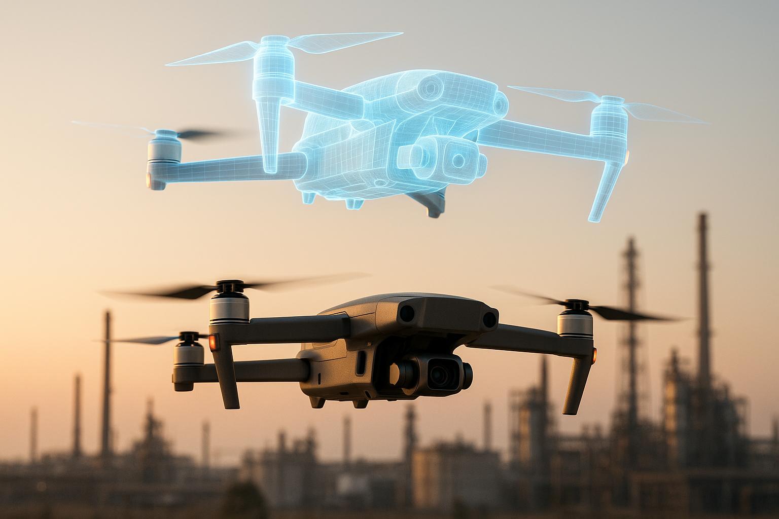
Drone digital twins are transforming how industries monitor risks by combining drones, advanced sensors, and 3D modeling to create real-time virtual replicas of physical assets. These tools allow for faster inspections, safer operations, and better decision-making while reducing costs and improving efficiency.
Key Highlights:
- What They Are: Virtual models of assets updated in real time using drone-collected data.
- How They Work: Drones with RGB cameras, LiDAR, and thermal sensors gather high-quality data, processed into 3D models for risk analysis.
- Benefits: Faster inspections (e.g., 320 miles of pipeline in a day), cost savings (up to 52% on labor), safer operations (less human exposure), and better compliance with regulations.
- Applications: Used in construction, energy, telecommunications, oil and gas, mining, agriculture, and urban planning.
- Challenges: Data security, regulatory compliance, skilled workforce shortages, and integration with existing systems.
- Future Trends: AI integration, dynamic digital twins, blockchain for secure data sharing, and improved photogrammetry techniques.
Drone digital twins are becoming essential for industries aiming to improve safety and efficiency while staying competitive in a rapidly growing market projected to exceed $110 billion by 2030.
How to create 3D models (Digital twins) with drones for reporting.
Technologies That Power Drone-Based Digital Twins
The success of drone-based digital twins hinges on three key technology layers working in harmony. These components transform raw aerial data into actionable insights, enabling safety teams to better protect industrial operations. Let’s break down the sensors, software, and platforms that make this transformation possible.
Drone Sensors and Equipment
Modern drones come equipped with advanced sensors that collect a variety of data types. For instance, RGB cameras deliver high-resolution visual imagery, while thermal imaging sensors detect temperature variations that might indicate overheating equipment or structural problems. Meanwhile, LiDAR systems generate accurate 3D point clouds by using laser pulses to measure distances. The precision of these sensors is critical - high-resolution cameras, for example, can capture intricate details that are essential for identifying even minor risks.
Adding to this, Real Time Kinematics (RTK) technology enhances positional accuracy, reducing errors in complex environments. Automated flight control software plays a major role here, ensuring consistent data capture with proper coverage and image overlap. A great example of this is from February 2024, when Paper Airplane used DJI drones paired with Dronelink software to map the Oklahoma District Court House and Federal Judicial Learning Center and Museum. These automated missions allowed for safe, high-quality data collection, resulting in deliverables that exceeded client expectations. The DJI Mavic 3 Enterprise, known for its faster mechanical shutters and superior image quality, represents the industry’s current standard for such operations. Together, these tools enable quicker and more precise risk assessments in critical industrial environments.
Data Processing and Analysis
Turning raw sensor data into meaningful insights requires advanced processing tools. Photogrammetry algorithms transform overlapping images into detailed 3D models that accurately represent physical assets. From there, AI analytics take over, converting processed data into actionable insights. For example, cutting-edge visual recognition technology can identify components with 99.7% accuracy, automatically flagging risks like corrosion, structural damage, or equipment misalignment.
Beyond identification, analytical algorithms simulate how assets perform under different conditions, helping teams predict maintenance needs and uncover potential issues that traditional inspections might miss. Automated data management systems also streamline the handling of large datasets generated during drone missions. A case in point: vHive significantly improved its operations by adopting Globhe’s platform, which allowed them to scale across multiple countries while cutting data acquisition costs by up to 50%. As Luke Bauer, Vendor Operations Manager at vHive, put it:
"Through GLOBHE's vast network of drone operators and fast turnaround, we have been able to move quickly and scale our operations globally, saving both time and money".
Secure Data Management Platforms
Drone missions often capture sensitive information about facilities, security systems, and operational workflows. To protect this data, secure management platforms implement measures like role-based access control, which tailors viewing and editing permissions to authorized users. Other features include data classification, usage tracking, and secure APIs, all designed to meet industry standards.
End-to-end encryption ensures data remains safe during transmission and storage, while multi-factor authentication and biometric security add extra layers of protection. Regulatory compliance is also a must - violations of GDPR can result in fines reaching 4% of annual global turnover or €20 million, while HIPAA penalties range from $100 to $50,000 per violation.
Industries like aviation provide a strong example of these practices. GE Aviation uses digital twins to monitor aircraft engine performance and predict maintenance needs, relying on robust security measures such as encryption and strict access controls to maintain customer trust. Similarly, Anvil Labs offers a platform that supports multiple data formats - like 3D models, thermal imagery, LiDAR point clouds, and orthomosaics - while ensuring secure hosting and sharing. Their customizable access controls allow teams to collaborate effectively without compromising data integrity or regulatory compliance.
Emerging technologies like blockchain are also being explored to guarantee data immutability, further supporting regulatory requirements.
Workflow: From Drone Data to Risk Insights
Drone footage transforms into detailed digital twins, enabling teams to identify and address potential risks with speed and precision. This streamlined workflow supports industrial teams in detecting hazards and taking timely action.
Planning Drone Missions and Data Collection
Effective risk monitoring starts with well-planned drone missions. This involves setting clear objectives and optimizing data collection parameters. A pre-flight survey is essential to spot obstacles, evaluate weather conditions, and design flight paths for thorough coverage.
Key factors to optimize include altitude, image resolution, and area coverage. Maintaining at least 60% image overlap ensures accurate stitching of images. Drone speed should balance efficiency with image clarity to avoid motion blur, which could compromise risk assessments.
Automated flight control software simplifies this process by managing parameters like flight paths and real-time monitoring. These tools also support both nadir mapping (overhead views) and vertical mapping (detailed facade inspections), ensuring comprehensive data collection.
Weather is another critical factor. Atmospheric conditions can impact drone performance and data quality, so flights should be scheduled during favorable weather, with adjustments made as needed on-site.
"Proper drone mission planning is key to achieving these goals. By carefully planning drone missions, operators can minimise risk, optimise efficiency, and maximise the value of the data collected." - Brooke Hahn, Author
With a well-executed mission and high-quality data, teams can quickly convert these inputs into actionable risk insights.
Building Models and Assessing Risk
Once the data is collected, advanced processing techniques turn raw sensor inputs into interactive 3D models. Photogrammetry processes overlapping images, aligning them with real-world coordinates while correcting distortions.
These digital twins go beyond static models. They integrate real-time data streams, enabling predictive maintenance and ongoing risk management. Teams can overlay images from different angles, making it easier to pinpoint damage or hazards with exceptional accuracy.
The digital twin becomes a dynamic tool for simulating scenarios, predicting asset behavior under various conditions, and planning maintenance before problems escalate. Features like annotation and measurement tools help document findings, track changes over time, and create detailed risk assessments.
Team Collaboration for Risk Management
Managing risks effectively requires smooth collaboration across various stakeholders, from field operators to executives. Cross-device access ensures that everyone can view critical data, regardless of their location or device.
Role-based access controls play a key role in balancing security and collaboration. Team members are granted permissions based on their responsibilities, ensuring sensitive data remains protected while still enabling efficient teamwork.
This collaborative approach extends to external partners when immediate cross-functional responses are necessary. Integrated communication tools allow teams to share findings, discuss strategies, and coordinate responses in real time - an essential capability during emergencies.
Secure data-sharing features make it easy to collaborate with contractors, regulatory bodies, or other external stakeholders. Platforms like Anvil Labs support a variety of data formats, such as 3D models, thermal imagery, LiDAR point clouds, and orthomosaics, while maintaining strict access controls.
By integrating with task management systems, this workflow ensures identified risks are turned into actionable tasks, such as work orders or maintenance schedules. This connection between risk detection and operational response helps close the loop on risk management. Additionally, the collaborative environment builds a comprehensive risk history, which can guide future decisions.
This structured process aligns with broader digital twin strategies, offering a proactive approach to managing operational risks.
sbb-itb-ac6e058
Industry Applications and Benefits
Expanding on the earlier discussion about technologies and workflows, digital twins are proving their worth in managing operational risks across industries. Drone digital twins, in particular, are reshaping risk monitoring by improving safety, efficiency, and cutting costs. The global drone market is set to grow significantly, from an estimated $40.6 billion in 2025 to $57.8 billion by 2030. This surge reflects how organizations are increasingly using these tools to strengthen their risk management strategies.
Real-World Use Cases
In construction, drone digital twins are driving efficiency. For instance, OHLA, a construction company, is utilizing drone imagery and GIS-powered digital twins for a $47 million bypass road project in Spain. This approach has streamlined project timelines and minimized delays. Miguel Amérigo, OHLA's corporate head of R&D and innovation, remarked, "GIS helps us very much regarding communication and coordination and collaboration".
Similarly, Royal BAM Group employs digital twin technology for both commercial and residential projects. These virtual replicas enhance design precision, allow real-time progress tracking, and help project managers address delays effectively. A standout example is Heathrow Airport Terminal 5 in London, where a digital twin simulated factors like airflow, lighting, energy use, and thermal comfort. These insights led to optimized HVAC settings and improved energy efficiency.
In the energy and utilities sector, improved safety and inspection efficiency are key benefits. Phoenix Air Unmanned (PAU), in partnership with Shell Pipeline Company, inspected 320 miles of pipeline in a single day using BVLOS drone operations, showcasing the efficiency and safety of UAV inspections. Southern Company also secured an FAA Part 91 exemption to enhance infrastructure inspections and storm response, reducing the need for helicopters and ground crews.
The telecommunications sector is seeing cost and time savings. A major Tier 1 carrier cut onsite time for 5G tower upgrades from 5 days to 2.4 days, saving $10,000 per day in onsite costs and reducing labor expenses by 52% per upgrade. Team assessments per site were also slashed by 75%.
In oil and gas, companies like BP are leveraging digital twins for continuous monitoring. By creating virtual models of offshore platforms, BP monitors real-time data such as temperature, pressure, and equipment performance, enabling engineers to address issues proactively.
Mining operations are also benefiting from real-time monitoring. Rio Tinto uses digital twins to oversee machinery, production processes, and environmental conditions, optimizing its mining operations.
In agriculture, digital twins are helping farms use resources more efficiently. Farms adopting this technology have reduced resource use by 30% while boosting yields by up to 20%. John Deere integrates sensors into its machinery to monitor crop health, soil moisture, and equipment performance in real time.
The urban planning sector is also reaping the rewards. Siemens developed a digital twin for Singapore to simulate urban environments. This allowed for improvements in traffic flow, energy distribution, and environmental management.
"Digital twins empower industries to test scenarios, optimize operations, and mitigate risks before they occur. From disaster response to urban planning, these tools allow us to address complex challenges with precision and foresight." - Heather Richmond, CEO of Creative Strategy Studios
Drone Digital Twins vs Standard Methods
The advantages of drone digital twins become clear when compared to traditional monitoring methods. The table below highlights some of the key differences:
| Aspect | Drone Digital Twins | Standard Methods |
|---|---|---|
| Data Collection Speed | Inspect 320 miles of pipeline in a single day | Manual inspections take weeks or months |
| Cost Efficiency | 52% labor cost savings; $10,000/day savings | Higher costs due to extended manual processes |
| Safety | Remote monitoring avoids human exposure | Personnel must access hazardous locations |
| Inspection Capacity | 3X more visual inspections | Limited by human availability |
| Remediation Time | 70% faster issue resolution | Slower due to delayed problem detection |
| Accuracy | High-resolution, detailed insights | Prone to human error and limited visibility |
| Real-Time Monitoring | Continuous data streams and predictive maintenance | Periodic inspections with gaps |
| Collaboration | Secure, cross-device data sharing | Relies on physical presence or static reports |
| Documentation | Comprehensive digital records | Paper-based or basic digital documentation |
| Scenario Testing | Simulations without disruption | Limited ability to test safely |
For example, a large electric utility achieved a 70% reduction in remediation time and tripled its inspection capacity using AI-driven drone inspections. Similarly, a port authority cut its mean time to repair by 60% with autonomous drones and integrated ticketing systems.
The digital twin market is expanding rapidly, projected to grow from $10.1 billion in 2023 to $110.1 billion by 2028, with a CAGR of 61.3%. Heather Richmond, Chief Strategist Officer for Spray Tech, summed it up well: "Digital twins, drones, and AI are no longer just innovations - they're critical public safety tools, helping us predict, prepare for, and prevent crises while safeguarding lives".
Anvil Labs is a prime example of how these technologies are transforming industries, offering robust support for diverse data formats and secure, collaborative risk management.
Challenges and Future Developments
Drone digital twins hold great promise for real-time risk monitoring, but implementing these technologies comes with its own set of hurdles. The projected growth of the digital twin market - from $6.9 billion in 2022 to an estimated $73.5 billion by 2027 - highlights both the opportunities and the complexities involved in their deployment.
Building on the earlier discussion of technologies and workflows, let's explore the challenges organizations face today and the trends that could shape the future of drone digital twins.
Current Implementation Challenges
Deploying drone digital twins isn't without obstacles. Data privacy and security are major concerns, as the sensitive information collected by drones is vulnerable to cyber threats like data manipulation, infrastructure breaches, and denial-of-service attacks.
Compliance with regulations adds another layer of complexity. Organizations must navigate data protection laws such as GDPR and CCPA while adhering to airspace regulations set by authorities like the FAA, EASA, and CAA.
Another pressing issue is the lack of skilled personnel. Successfully implementing these systems requires professionals who can operate drones, handle complex data streams, and develop advanced digital twin models.
Additionally, integrating drone data with existing systems presents interoperability challenges and can involve significant upfront costs - an issue particularly acute for smaller organizations.
Experts suggest that standardizing processes for integrating drone data with digital twin platforms could help overcome these barriers. Encouraging collaboration across fields like environmental science, data science, and engineering is also seen as key to unlocking the full potential of these tools.
Future Technology Trends
The future of drone digital twins is poised to become even more advanced. One notable development is the emergence of dynamic digital twins, which can evolve and adapt in real time, offering a significant leap over current static models.
Integrating AI into digital twins is another exciting trend. AI can enhance risk management by enabling predictive analytics, anomaly detection, and better decision-making processes. By 2027, it's expected that over 90% of IoT platforms will incorporate digital twinning capabilities.
"The future of drone delivery cybersecurity isn't hinged on a single solution or technology but on a collective shift in perspective. Cybersecurity shouldn't be viewed as an incremental part of the development process but rather an integral aspect of every step." – Mark Hill, CyberExperts.com
Emerging security technologies are also addressing current vulnerabilities. Blockchain technology offers potential for secure data sharing and verification, while quantum cryptography could provide unprecedented levels of protection. Biometric authentication systems are being explored to ensure that only authorized personnel can access and control drone systems.
Machine learning-based real-time threat recognition systems are expected to play a key role in countering evolving cyber threats. These systems, combined with geofencing technologies, can automatically prevent drones from entering high-risk or restricted areas.
The market's growth projections further emphasize the momentum behind these technologies. Nearly 60% of executives across industries plan to adopt digital twins by 2028. The market itself is forecasted to grow at an annual rate of 25% from 2023 to 2032, potentially reaching $183 billion by 2031.
Advancements in data processing and photogrammetry are also on the horizon, promising more accurate 3D models for applications like site planning, volumetric analysis, and as-built documentation. Real-time synchronization between physical project developments and virtual plans is likely to become a standard feature.
For organizations to keep pace with these advancements, creating high-fidelity models that closely mirror real-world systems will be critical for effective risk monitoring. Workforce training and upskilling will also be essential, as these systems demand advanced management and interaction capabilities. At the same time, prioritizing data security and privacy will remain a cornerstone of these efforts, given the sensitive nature of the information involved.
Platforms like Anvil Labs are already supporting these trends by offering robust data management and secure collaboration tools designed to adapt to emerging technologies.
These developments mark an exciting phase for risk monitoring, aligning with the growing demands for improved industrial safety and operational efficiency.
Conclusion
Drone-based digital twins are reshaping how industries manage risks and oversee operations. By merging real-time data collection with advanced virtual modeling, these tools allow companies to monitor asset conditions continuously, anticipate potential failures, and make smarter decisions - all while keeping their teams out of harm's way.
The impact is clear: operational metrics have improved by 15%, system performance has increased by over 25%, and inspections are up to three times faster, cutting manual interventions by 30–50%. With over 70% of enterprises pursuing digital transformation, the adoption of drone digital twins is gaining serious traction.
As Yariv Geller, CEO and Founder of vHive, puts it:
"The drone is a means to the end of the digital twin – in itself, it's a dramatic shift in the way things are done. Autonomous data acquisition and digital twin platforms need each other. The story of digitization is really the evolution of the drone market."
The real power of drone digital twins lies in their ability to turn data into actionable insights. For instance, manufacturing facilities can monitor production lines in real time, catching irregularities early and avoiding costly downtime. Infrastructure managers, on the other hand, can remotely inspect bridges, power plants, and telecom assets, reducing reliance on manual labor and enhancing safety.
To fully leverage these tools, companies should focus on building detailed 3D models, integrating analytics into their workflows, and utilizing diverse data formats like thermal imaging, LiDAR, and 360° panoramas. Platforms like Anvil Labs make this possible by offering secure data sharing, cross-device accessibility, and seamless AI integration - key features for effective risk management.
The market is responding enthusiastically: digital twin technology is expected to grow at an annual rate of 60% through 2027, reaching a value of $73.5 billion. Companies adopting these solutions are seeing tangible results, including a 19% reduction in costs, a matching revenue boost, and significant carbon footprint reductions for 38% of adopters.
As drone digital twins continue to evolve with AI-driven enhancements, their role in industrial safety and efficiency will only expand. What we’re seeing today is just the beginning - a foundation for the next wave of smarter, safer, and more efficient industrial operations.
FAQs
How do drone-based digital twins improve risk monitoring over traditional methods?
Drones equipped with digital twin technology are revolutionizing risk monitoring by delivering real-time insights with unmatched accuracy. This approach allows for the immediate identification of potential problems, speeds up decision-making, and optimizes how resources are allocated. As a result, organizations can cut downtime and enhance their recovery strategies.
What sets drone-based digital twins apart from traditional methods is their ability to provide a constantly updated, dynamic view of assets and surroundings. This makes proactive risk management possible, ensuring that critical issues are identified and addressed without unnecessary delays.
What challenges do industries face when using drone digital twins for real-time risk monitoring?
Implementing drone-based digital twins for risk monitoring isn't without its challenges. One of the biggest concerns is cybersecurity. With drones collecting and transmitting sensitive data, there's always the risk of breaches, unauthorized access, or system vulnerabilities that could compromise operations.
Another significant hurdle is the high upfront costs. For many organizations, the steep investment and uncertainty about the potential return on investment (ROI) can be a deterrent. On top of that, data privacy concerns add another layer of complexity, especially when handling sensitive or regulated information.
There's also the challenge of ensuring smooth integration with existing systems. As operations expand, maintaining scalability becomes crucial, and that often requires careful planning. Finally, regular updates and ongoing maintenance are non-negotiable to keep the technology both accurate and effective over time. These factors combined make adoption a complex but manageable process when approached thoughtfully.
What upcoming trends in drone-based digital twin technology should businesses be aware of?
Businesses are set to see AI merging more deeply with digital twins, paving the way for sharper real-time decision-making and better predictive analytics. At the same time, immersive AR/VR technologies are expected to take the spotlight, making it easier for users to interact with complex 3D models and environments in a more intuitive way. On another front, improvements in drone autonomy and sensor technology promise faster and more precise data collection, along with more detailed environmental simulations.
The numbers tell the story: the market for drone-powered digital twin technology is forecasted to skyrocket from $13 billion in 2023 to an impressive $259 billion by 2025, signaling rapid advancements and growing adoption across various industries.
