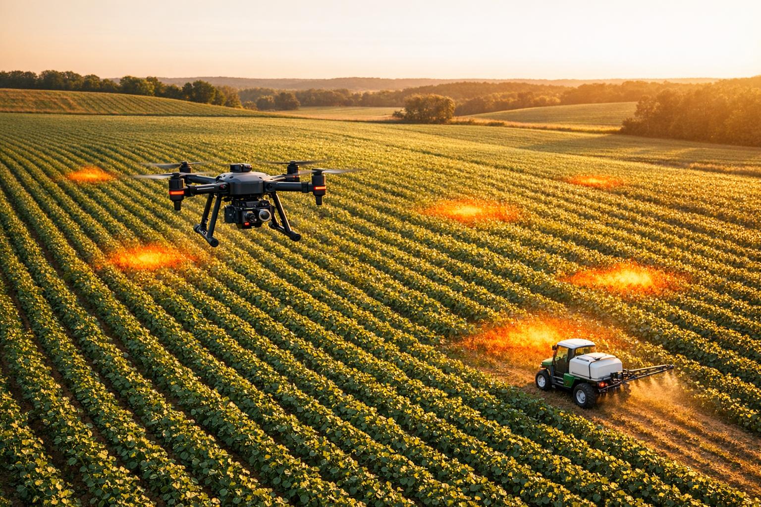
Drones are reshaping pest control by providing precise, data-driven solutions for farmers. They detect pest issues early, reduce chemical waste, and improve crop health monitoring. Here's how drone technology is transforming Integrated Pest Management (IPM):
- Early Detection: Advanced sensors (multispectral, thermal) identify plant stress before visible symptoms appear, enabling timely interventions.
- Targeted Pesticide Use: AI-powered drones spray only affected areas, cutting pesticide use by 30–50% and reducing environmental harm.
- Efficiency: Drones cover 25–37 acres per hour, saving time and resources compared to manual methods.
- Biological Control: Precise release of natural pest predators like wasps and lacewings reduces reliance on chemicals.
- Data-Driven Insights: AI models analyze drone imagery to create pest risk maps, improving accuracy (89–94%) in pest identification.
While drones offer clear advantages, challenges include high costs, limited battery life, and regulatory hurdles. Future advancements, like drone swarms and real-time AI processing, promise to further enhance their role in sustainable agriculture.
Research Studies on Drone-Based Pest Detection
Multispectral and Thermal Imaging for Early Detection
Multispectral sensors are powerful tools for identifying early plant stress by capturing visible and near-infrared light. These sensors detect changes in reflectance, such as the loss of chlorophyll, long before visible symptoms emerge. Specifically, near-infrared bands (780–2,500 nm) can reveal molecular changes, allowing drones to track subtle biochemical shifts in plants.
Thermal sensors, on the other hand, focus on temperature changes in leaves and canopies. Stress in plants often reduces transpiration, leading to increased leaf temperatures. According to a study published by Springer Nature:
by measuring the leaf or canopy temperature, changes in plant traits such as stomatal conductance can be observed in minutes to hours, providing an early (and pre-visual) indication of the plant responses to stress.
When combined, multispectral and thermal sensors provide a fuller picture of plant health. Thermal imaging captures immediate physiological changes, like temperature shifts, while multispectral sensors document longer-term structural and pigment alterations. Together, these tools create a robust early warning system by integrating data on temperature, pigments, and biomass, enabling precise identification of stressors.
High-Resolution Aerial Imaging for Crop Health Monitoring
High-resolution RGB cameras, offering approximately 2 cm/pixel resolution, are highly effective for identifying pest hotspots and monitoring crop health. Unlike satellite imagery, which is limited by lower resolution (over 3.3 ft), cloud cover, and infrequent updates, drone-based imaging provides detailed and timely insights.
For instance, in September 2025, researchers led by Mohammadreza Narimani conducted a study on a tomato farm in Woodland, Yolo County, California. They used multispectral imaging and analyzed data across five growth stages with Long Short-Term Memory (LSTM) networks and SMOTE augmentation. The system achieved an impressive 88.37% accuracy and 95.37% recall in detecting branched broomrape.
Another study, conducted in February 2024 by researchers at Sejong University, used an optimized YOLOv5s model to identify pests such as ants, grasshoppers, palm weevils, shield bugs, and wasps. This approach achieved a precision rate of 96.0%. Overall, high-resolution systems have shown pest identification accuracy rates ranging from 89% to 94% under normal conditions. When paired with advanced AI models like AgroVisionNet, which combines CNN-based spatial feature extraction with Transformer-based contextual attention, drone data analysis becomes even more effective. These advancements play a crucial role in improving integrated pest management strategies.
sbb-itb-ac6e058
Practical Applications of Drones in Precision Pest Control
Targeted Pesticide Application
Drones are transforming pesticide application with their Perception-Decision-Execution (PDE) framework. The process begins with sensors detecting pest hotspots. AI then creates precise spray maps, and variable-rate systems deliver pesticides only where needed. This method can cut pesticide use by 30% to 50% compared to traditional broadcast spraying.
A key technology here is Pulse Width Modulation (PWM), which adjusts nozzles in real time based on factors like crop density or weed presence. Drone rotors also create a downwash effect, pushing droplets deeper into the crop canopy. This improves coverage on the lower leaves and reduces off-target drift by more than 30%.
In December 2024, Iowa State University's Digital Ag Innovation Lab, under the guidance of Extension Specialist Doug Houser, showcased the potential of this tech. Using the Sentera Aerial WeedScout system on a soybean field, the drone generated a tailored herbicide prescription within 24 hours. A John Deere ExactApply sprayer then executed the plan. Operating at speeds of 2–5 m/s and flying about 6.5 feet above the canopy, the system achieved maximum deposition while minimizing drift. The results? A 50% reduction in tank mix usage (70 gallons versus 130.5 gallons for broadcast spraying), saving $13.42 per acre. Weed detection accuracy hit 94%, and harvest data revealed no yield differences compared to broadcast-treated areas.
Deployment of Biological Controls
Drones aren’t just for chemical applications - they’re also enabling precise biological pest control. By releasing natural predators like parasitoid wasps and lacewings, drones help maintain ecological balance while reducing chemical dependency. Equipped with multispectral and thermal imaging to locate pest hotspots and Real-Time Kinematic Global Positioning System (RTK-GPS) for pinpoint accuracy, drones can release these beneficial insects exactly where they’re needed.
Standardized flight parameters ensure even distribution. Drones typically operate at heights of 5 to 10 feet and speeds of 3 to 5 m/s, spreading beneficial insects uniformly across the crop canopy. High-efficiency drones can cover up to 52 acres per hour, making them a quick and effective tool during critical pest outbreaks.
In 2021, researchers tested drone-released lacewings in California’s organic lettuce fields to combat aphids. The study confirmed that drones could effectively suppress pests, offering a strong alternative to pesticides in organic farming systems. Similarly, early-stage releases of beneficial insects in cotton fields significantly reduced the need for later chemical treatments.
"By combining remote sensing data, drones can target beneficial insect releases to pest-concentrated areas to optimize efficiency and cost-effectiveness." - Wenhao Liu and Yiannis Ampatzidis, University of Florida/IFAS
Drones shine in areas where traditional equipment struggles - steep slopes, fragmented plots, or dense canopies. They also excel in early-stage pest control, often eliminating the need for follow-up chemical applications.
Drone Series 2024: Next-Generation Pest Management Tools
Data Processing and Analysis for Drone-Based IPM
Turning raw drone data into actionable insights is a game-changer for pest control in Integrated Pest Management (IPM). Here's how it works:
Image Stitching and Orthomosaic Creation
Before drone images can help with pest management, they need to be stitched together into a cohesive map. Using Structure from Motion (SfM) algorithms, overlapping 2D images are transformed into detailed 3D field structures and orthomosaics, creating georeferenced maps of the area.
Tools like DJI Terra and Agisoft simplify this process by automating the creation of orthomosaics and vegetation index layers from raw images. These maps are essential for identifying pest hotspots and assessing crop health over large fields. For instance, multispectral imagery captured from altitudes below 6.5 feet can achieve a resolution of 0.8 inches per pixel, allowing for weed identification with 95% accuracy. These detailed maps provide the foundation for AI models to assess pest risks effectively.
AI-Driven Pest Risk Modeling
Artificial intelligence takes drone imagery to the next level by transforming it into pest risk insights. Convolutional Neural Networks (CNNs) detect early warning signs like lesions or chlorosis, while Recurrent Neural Networks (RNNs) and Long Short-Term Memory (LSTM) models analyze temporal patterns, linking pest activity to factors like weather conditions.
These advanced models integrate drone imagery with a mix of other datasets, including weather patterns, crop growth stages, soil health, and real-time IoT sensor data (like temperature and humidity). The result? Highly targeted prescription maps that guide drones to apply pesticides only where pests are detected. Current UAV deep learning systems boast pest identification accuracy rates between 89% and 94%.
Explainable AI (XAI) tools, such as Grad-CAM, make these systems more transparent by generating heatmaps that highlight affected areas, helping agronomists validate the AI's decisions. For example, the AgroVisionNet hybrid CNN-Transformer model, running on NVIDIA Jetson Nano hardware, combines drone imagery with IoT data to create disease-spot activation maps using Grad-CAM. Similarly, the Agroview application processes UAV data to locate plants, distinguish between healthy and stressed vegetation, and map pest activity in citrus fields.
Using Anvil Labs for Data Hosting and Analysis

Managing the variety of data collected - such as RGB images, multispectral scans, thermal imagery, and LiDAR point clouds - requires a centralized platform. Anvil Labs steps in by offering a hub for hosting and analyzing these datasets. Their platform allows agronomists to securely store orthomosaics, thermal maps, and LiDAR data, all while ensuring easy access across devices.
Anvil Labs also integrates seamlessly with AI tools, enabling users to overlay pest risk models directly onto field maps. Starting at $99 per month, their service includes annotation and measurement tools, making it easier for teams to validate AI-generated pest detections and coordinate interventions across multiple locations. This streamlined approach ensures precision and efficiency in pest management workflows.
Benefits and Challenges of Drone Data in IPM

Manual vs Drone-Based Integrated Pest Management Comparison
Drone-based Integrated Pest Management (IPM) enhances pest control efforts but isn't without its hurdles.
Comparison of Manual vs. Drone-Based IPM
Drones bring a significant speed advantage to IPM, covering 10–15 hectares (25–37 acres) per hour, compared to the 2–6 hectares possible with manual methods. This increased efficiency allows for faster pest detection and quicker intervention.
Another major benefit is the reduction in resource use. Precision spraying with drones can cut pesticide use by 30–65%, save up to 90% of water, and reduce off-target drift by more than 30%.
"The precision offered by drones significantly reduces the amount of pesticide needed, thereby minimizing the environmental footprint and lowering costs for farmers."
- Nitika Saini, International Journal of Research in Agronomy
To better understand the differences, here's a comparison of manual and drone-based IPM:
| Feature | Manual/Traditional IPM | Drone-Based IPM |
|---|---|---|
| Detection Speed | Slow; requires physical scouting of the field | Rapid; covers 10–15 hectares (25–37 acres) per hour |
| Chemical Use | High; uniform "blanket" spraying | Low; 30–65% reduction via targeted application |
| Cost Efficiency | High labor costs and chemical waste | Higher initial cost but lower long-term labor and input expenses |
| Ecological Impact | Greater drift risk and soil compaction | Reduces drift by over 30% and saves 90% of water |
| Accuracy | Limited to visible symptoms; subjective | 89–94% accuracy, including detection of non-visible spectral stress |
This improved efficiency and accuracy also boost crop yields, with documented increases ranging from 3.6% to 9.7%.
However, adopting drone technology comes with its own set of challenges.
Barriers to Adopting Drone Technology
The high upfront cost of drones, especially those equipped with advanced tools like LiDAR and multispectral sensors, makes them less accessible for smaller farms. Additionally, drones face operational limitations - multirotor models often have a battery life of only 20 to 30 minutes, requiring frequent battery changes for larger fields.
Environmental factors also pose challenges. According to Scientific Reports:
"UAV-deep learning systems achieve pest identification accuracy rates of 89–94%, but this significantly declines to 60–70% under strong light or occlusion conditions."
Other obstacles include adverse weather conditions, complex aviation regulations, and the need for specialized training. Operators must navigate varying rules on airspace and Beyond Visual Line of Sight (BVLOS) operations, which can complicate large-scale use. Furthermore, the lack of standardized guidelines - like optimal flight altitudes and speeds for different crops - often forces farmers to rely on trial and error.
While drones offer clear advantages, these barriers highlight the need for broader accessibility and better support for farmers.
Conclusion and Future Directions
Drone technology is reshaping pest management by enabling faster detection, precise pesticide application, and reduced reliance on chemicals. Research highlights how combining multispectral imaging, AI-driven analytics, and variable-rate spraying can protect crops efficiently while minimizing environmental harm. These advancements directly address inefficiencies and ecological concerns raised in earlier studies.
Key Takeaways on Drone-Based IPM
The PDE framework leverages advanced sensors, AI tools, and variable-rate systems to manage pests at the subfield level. This approach focuses on pest "hotspots", moving away from the traditional method of treating entire fields uniformly.
By integrating RGB, multispectral, thermal, and LiDAR data, drones can create 3D canopy models and detect early signs of plant stress. This proactive approach allows farmers to address issues before visible symptoms develop, giving them a critical advantage in pest control.
"Precision spraying technology - integrating UAV-based detection, real-time pesticide mixing, and adaptive variable-rate spraying - provides a critical pathway for sustainable crop protection."
- Nature
The metrics are compelling: drones achieve 89–94% accuracy in pest identification, reduce pesticide use by 30–50%, and can cover 25–37 acres per hour. These advancements are essential as global food demand is expected to increase by 60% by 2050, while pests currently cause 35–50% of crop losses.
Future Trends in Drone Technology for Agriculture
The progress so far lays the groundwork for even greater innovations in agricultural drone technology. Emerging trends promise to refine precision and efficiency further. For instance, drone swarms - multiple drones working in coordination - can cover larger areas more quickly and provide multi-angle observations to address occlusion challenges. Meanwhile, hybrid propulsion systems, such as electric-gasoline or solar-electric combinations, will push flight times beyond the current 20–30 minute limits of battery-powered drones.
Another breakthrough is edge computing. By embedding lightweight AI models directly into drones, farmers can achieve real-time decision-making in the field, sidestepping delays associated with cloud-based processing. This capability will be vital for autonomous operations.
Regulatory changes will also play a crucial role. Expected updates to Beyond Visual Line of Sight (BVLOS) regulations will allow drones to operate over much larger distances, making them viable for large-scale farming. The integration of 4G and 5G networks will further enhance these capabilities.
Future research is shifting toward monitoring plant susceptibility to pests and diseases, which could enable preventive management rather than reactive measures. With IoT-enabled smart traps and machine learning-based insect classification, farmers can establish a comprehensive early-warning system for pest threats.
"The strategic adoption of AI-enabled crop protection tools can play a decisive role in safeguarding global food security while reducing the environmental footprint."
- Advancements in Entomology, Springer
For farmers looking to adopt these technologies, operational optimization is key. Maintaining flight altitudes below 6.5 feet (2 meters) and speeds around 6.5 feet per second (2 m/s) ensures maximum data resolution. Platforms like Anvil Labs simplify this transition by offering tools to process multispectral imagery, thermal data, and orthomosaics, turning raw data into actionable pest management insights.
FAQs
How do drones help detect pests in crops early?
Drones are transforming how farmers detect pests early, thanks to advanced sensors like multispectral, hyperspectral, and thermal imaging. These technologies let drones scan crops from above, spotting subtle indicators of pest activity - like shifts in plant health or unusual temperature patterns - well before they’re noticeable to the human eye.
By quickly identifying problem areas, drones enable farmers to respond with precision, addressing issues before they escalate. This targeted approach not only limits crop damage but also boosts efficiency, saving time, cutting costs, and conserving resources - all while promoting smarter farming practices.
What challenges come with using drones for pest management?
Using drones for pest management comes with its own set of challenges. Weather conditions such as strong winds, rain, or snow can interfere with drone operations, making them less effective. On top of that, many drones aren't equipped to handle the spray volume required for certain pesticides. For example, some chemicals need 5–10 gallons per acre, which goes beyond what most spray drones can manage.
Another obstacle is navigating regulatory requirements and ensuring operators are properly trained. Drone applications must comply with pesticide labels and aerial application rules, which can differ significantly from traditional methods. Other practical issues include limited battery life, shorter flight durations, and potential connectivity problems. To make drones a more viable tool for pest management, advancements in technology and updated regulations will be essential.
How do drones and AI work together to improve pest management in agriculture?
Drones powered by AI are transforming how we manage pests in agriculture. They excel in early detection, precise species identification, and even predicting outbreaks. With tools like machine learning, computer vision, and remote sensing, these drones monitor crop conditions in real time, spotting pests before they become a major problem.
What makes this so impactful? Farmers can take targeted actions, cutting down on the need for blanket pesticide applications. This not only helps protect the environment but also boosts productivity. By pairing aerial imagery with AI-driven analysis, drones offer an efficient, cost-effective way to keep crops healthy and yields high.
