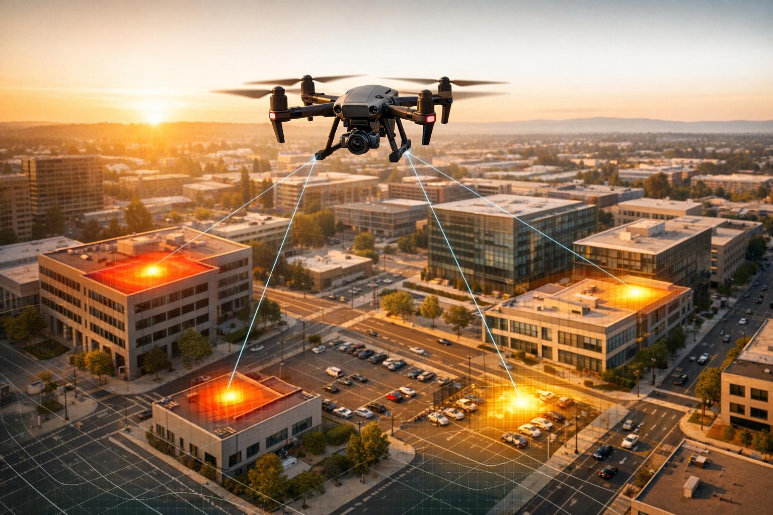
Drones are transforming how organizations detect and respond to threats. Unlike fixed cameras or patrols, drones provide high-resolution, real-time aerial views, covering large areas quickly and efficiently. Equipped with advanced sensors like thermal imaging, LiDAR, and AI-powered analytics, drones improve detection of heat signatures, structural issues, and potential risks. For instance, a drone can survey 120 acres in an hour compared to just 5 acres manually.
Key benefits include:
- Faster response times: Drones can be deployed in minutes to verify alerts.
- Improved accuracy: Sensors like LiDAR achieve centimeter-level precision.
- Cost savings: Drone surveys are up to 40% cheaper than older aerial methods.
- Data integration: Platforms like Anvil Labs centralize drone data for analysis and collaboration.
Drones also streamline post-incident investigations by recreating events using geospatial data. This combination of speed, precision, and advanced analytics makes drones a powerful tool for modern threat intelligence.

Drone Data Impact on Threat Intelligence: Key Statistics and Benefits
Collecting and Processing Drone Data for Threat Intelligence
Capturing High-Quality Data from Drones
Start by aligning your sensors with your specific intelligence goals. For example, LiDAR is ideal for creating detailed 3D maps, even in areas with dense vegetation or complex infrastructure. Thermal imaging is perfect for detecting heat signatures, making it useful for nighttime surveillance or search-and-rescue missions. Multispectral sensors are excellent for monitoring environmental changes. The success of your mission depends on choosing the right tools for the job.
Next, precision positioning ensures your data is accurate from the outset. Drones equipped with RTK (Real-Time Kinematic) technology deliver pinpoint GPS corrections, achieving centimeter-level accuracy. This eliminates common issues like "map shifting", where measurements can be off by several feet when comparing data collected on different dates. To get the best results, aim for a 70% sidelap and 80% frontlap during flights, and set your shutter speed to at least 1/1000 to avoid motion blur.
Automated mission planning can further reduce errors and improve consistency. By programming drones to follow identical flight paths and waypoints, you can easily detect changes over time - whether it’s unauthorized tampering or structural wear. For instance, as of 2024, Woodside Energy has been using autonomous ground robots to capture RGB, thermal, and 360° imagery. This data is then geolocated and uploaded to digital twin software, allowing remote inspections of assets. This approach not only enhances safety by keeping inspectors out of hazardous areas but also streamlines the threat assessment process.
Converting Raw Data into Usable Insights
Once you’ve captured reliable data, the next step is turning it into actionable intelligence. AI-driven computer vision can analyze raw footage to perform tasks like facial recognition, weapon detection, and identifying unauthorized vehicles. It can even use OCR (Optical Character Recognition) to extract text during post-incident analysis.
Geospatial intelligence (GEOINT) takes this a step further by converting imagery into 3D models and heat maps, highlighting areas with high activity. For added security, you can set up geofencing around restricted zones. If unauthorized movement is detected, automatic alerts - via SMS or email - can be triggered. To get the most out of this data, combine it with external datasets, such as known criminal hotspots, suspect locations, or environmental sensor readings. This approach helps identify patterns and relationships that might otherwise go unnoticed. Platforms like Anvil Labs support this process by hosting various data types, including LiDAR point clouds, thermal imagery, and orthomosaics. These platforms also offer secure sharing options and cross-device accessibility, making it easier for security teams to collaborate.
Real-world examples demonstrate the benefits of efficient data processing. In 2024/2025, Turner Construction used 360° photo documentation and ground robotics to slash inspection times on large data center projects by 95%. Similarly, Leighton Asia cut tunnel survey times from 30 days to just one week by using automated flight paths.
"We can now retroactively check our 360 Walks and identify any areas we may have missed. Then, we can directly send or tag this documentation to workers on-site."
- Wilson Haworth, Senior VDC Engineer, Juneau Construction
These advanced processing techniques ensure that drone data can seamlessly integrate with modern security platforms, providing real-time insights and bolstering overall threat intelligence capabilities.
Integrating Drone Data with Security Platforms
Using Platforms for Secure Data Hosting and Sharing
Security teams need a reliable, centralized system to manage the vast amounts of intelligence gathered by drones. Platforms like Anvil Labs provide a secure space to store and share diverse data types, including 3D models, thermal imagery, LiDAR point clouds, and orthomosaics. This data can be accessed seamlessly across multiple devices, ensuring flexibility and convenience. Tools for annotations and measurements allow teams to highlight concerns directly on 3D models or aerial images, while customizable access controls ensure that sensitive information is shared only with the right people.
Budgeting is straightforward with a $49 per-project pricing model. For operations requiring higher security, platforms leveraging AWS GovCloud or MongoDB Atlas GovCloud meet stringent government and defense standards.
"This is a differentiator. Those that aren't able to provide visualization but are just doing raw footage - this gives you, in my opinion, that competitive edge." - Adrian, Drone Service Provider
This secure infrastructure supports operational demands without compromising data integrity.
Real-Time Integration with Security Tools
Modern platforms enable real-time integration of drone data through streaming, IoT API connections, or manual uploads for archival purposes. Bi-directional data flows allow systems to sync directly with CAD calls, triggering automated drone responses when needed.
Intelligent Process Automation (IPA) takes it a step further by sending instant alerts via SMS or email when AI-powered analytics detect unauthorized objects, individuals, or heat signatures. Platforms such as Motorola CommandCentral Aware, Axon Fusus, and Genetec Security Center can integrate live drone feeds into existing video management systems, creating a unified security framework. This approach has delivered tangible results - organizations have seen 75% faster inspections and 30% more detected anomalies compared to older methods. In some cases, these integrated workflows have led to a return on investment in as little as two months.
Improving Threat Assessment and Response Protocols
Building Effective Threat Response Workflows
Drone technology is transforming how threats are detected and addressed. By automating detection and sending instant alerts via SMS or email, drones eliminate the lag caused by manual monitoring efforts. This rapid response capability ensures critical issues are flagged immediately.
Integrating drone data with 3D models and GIS maps creates a "visual twin", offering a real-time view of strategic hotspots. For instance, California Resources Corporation saved $500,000 annually by using thermal drone inspections on oil and gas well points in California. These drones identified heat abnormalities and potential leaks much faster than traditional ground crews. Southbase Construction also saw impressive results, cutting project timelines by 33% through automated drone inspections that highlighted issues as they occurred.
To enhance these workflows, geofencing boundaries can be established, and pre-built APIs can link drones to security platforms. Standardized flight paths further aid in spotting subtle changes before they escalate into larger problems.
These proactive measures not only improve immediate responses but also feed seamlessly into post-incident analysis, where detailed drone data reconstructs events for deeper insights.
Using Drones for Post-Incident Analysis
Drones play a key role in post-incident investigations, offering aerial imagery, LiDAR, and thermal data to recreate events without disturbing the scene. Teams can generate timelines and perform link analysis by comparing post-incident data with historical records, making it easier to identify vulnerabilities.
"Drones provide real-time traffic insights, helping authorities manage road incidents... and analyze crime scenes to identify evidence and reconstruct events." - OWL Intelligence Platform
Take Woodside Energy, for example. They deploy autonomous ground robots and drones to capture RGB, thermal, and 360° imagery of industrial assets. This geolocated data is then uploaded to digital twin software, enabling inspectors to remotely review conditions and address potential issues before they lead to outages. Similarly, Rio Tinto uses drones across massive mining sites, creating a centralized "single source of truth" that speeds up decision-making for stakeholders.
These insights are invaluable for refining security protocols, helping to uncover blind spots, unauthorized access points, and structural weaknesses that demand immediate attention. Platforms like Anvil Labs, which offer secure hosting and 3D modeling capabilities, further simplify both threat response and post-incident evaluations.
sbb-itb-ac6e058
Measuring the Impact of Drone Data on Threat Intelligence
Key Metrics for Performance Evaluation
To understand the value of drone data in threat intelligence, it's crucial to focus on specific metrics. One essential measure is Mean Average Precision (mAP), which evaluates how accurately object detection models identify threats in drone footage. Another critical factor is detection time, which reflects the delay between capturing data and identifying potential threats.
The quality of data can be assessed using tools like the F-beta score, which balances precision and recall. For instance, a 2024 study showed that using an F2-score reduced the resources needed for AI training data by 26.5% compared to relying on F0.5 metrics.
Operational efficiency is another key area to monitor. This can be done by comparing the performance of automated analysis systems to the output of full-time human analysts. Metrics like alert speeds for unauthorized detections and the reliability of tamper-proof logs for legal post-incident reviews are also critical. Together, these indicators provide a clear picture of how drone data enhances threat detection and response, as demonstrated in recent case studies.
Case Studies and Quantitative Evidence
Real-world examples bring these metrics to life. For instance, autonomous drone missions have achieved 30% faster scanning for tasks such as barcode recording and mapping solar farm locations.
The COURAGEOUS project, backed by the European Union's Internal Security Fund, offers another compelling example. This initiative introduced the CWA 18150 standardized test methodology for evaluating counter-drone systems. Through trials conducted in Greece, Belgium, and Spain, the project validated its approach and reviewed over 200 drone-related incidents across Europe. Notably, only 5% of these cases had operational detection systems in place at the time of the incident.
A survey on UAV-related cyber risks revealed a significant knowledge gap: over 70% of respondents were unaware of specific drone threats, and just 28% had any familiarity with such risks. For organizations using platforms like Anvil Labs for secure data hosting and 3D modeling, these findings underscore the importance of turning raw drone data into actionable intelligence. By refining threat awareness and improving response accuracy, such platforms enable faster, more informed decision-making, ultimately strengthening overall security efforts.
The State of Drone Security: Analysing 1000+ drone incidents - Mike Monnik (DroneSec) GDSN #2

Conclusion
Drone data is transforming the way we approach threat intelligence. By leveraging aerial imagery, thermal feeds, LiDAR scans, and RF signals, drones provide security teams with insights that go beyond what traditional sensors can capture. This shift allows for a proactive stance - identifying risks before they escalate into serious incidents. Essentially, drones are redefining how quickly and effectively threats can be detected and addressed.
Autonomous drone missions are no small feat, increasing scanning efficiency by 30%. When combined with platforms that centralize drone data, teams gain a unified view that fosters better collaboration between remote stakeholders and on-site personnel. Add AI-driven analytics into the mix, and drones become powerful tools for automating tasks like object detection, behavioral analysis, and risk scoring. This ensures that routine activities are distinguished from genuine threats, saving time and resources.
Drone data isn’t just about real-time monitoring - it’s also invaluable for post-incident analysis. By examining flight paths, RF signatures, and environmental changes, security teams can reconstruct incidents with precision. This deeper understanding helps refine threat profiles and uncover patterns that might otherwise go unnoticed. Over time, these insights strengthen long-term planning and improve overall response strategies.
To maximize the benefits, organizations need secure platforms that integrate drone data seamlessly into their workflows. Tools like Anvil Labs offer features such as secure hosting and 3D modeling, making it easier to manage and analyze complex data. Best practices include implementing geofencing alerts, using tailored risk-scoring systems, and ensuring data collection is handled by certified professionals to maintain accuracy and compliance.
As drone technology continues to advance, organizations that integrate this data into their threat intelligence systems will gain a significant edge. By combining rapid detection, automated analytics, and thorough post-incident reviews, they create a security strategy that is not only faster but also smarter than traditional methods. This unified approach enhances situational awareness, enabling teams to respond to threats with unparalleled efficiency and insight.
FAQs
How do drones enhance threat detection compared to traditional methods?
Drones improve threat detection by providing real-time monitoring and quick data collection, especially in locations that are hard or unsafe for people to reach. With advanced sensors and AI-driven analysis, they can rapidly spot and differentiate potential threats - like telling the difference between a harmless object and something dangerous.
Compared to older methods, drones offer a faster and more efficient way to gather essential information, boosting situational awareness and supporting better decisions. Plus, their ability to sync with security platforms allows for smoother team collaboration and sharing of threat intelligence.
What types of drone sensors are best for enhancing threat intelligence?
Drone sensors are key players in enhancing threat intelligence, offering specialized data for a range of security needs. Radar sensors are perfect for detecting and tracking drones over long distances, even when visibility is poor. Thermal cameras shine in spotting heat signatures, making them invaluable in low-light settings or challenging conditions like smoke or dense vegetation. Meanwhile, high-resolution RGB cameras provide sharp visual details, and acoustic sensors pick up unique sound patterns to differentiate harmless drones from potential threats.
For more complex threat assessments, LiDAR sensors step in with precise 3D mapping and obstacle detection, crucial for analyzing intricate environments. Paired with AI-powered analysis tools, these sensors deliver quicker, more precise threat detection and improve situational awareness, forming a critical backbone for advanced security systems.
How can organizations safely integrate drone data into their security systems?
Organizations can seamlessly integrate drone data into their security systems by leveraging platforms designed for secure data handling. Solutions like those from Anvil Labs support a variety of data formats, including 3D models, thermal imagery, LiDAR, and orthomosaics. These platforms also offer critical security features such as encrypted data transmission, role-based access controls, and secure access across devices.
To strengthen security further, adopting best practices is crucial. This includes keeping software and firmware up to date, securing network configurations, and actively monitoring for potential cyber threats. When combined with strong access controls and adherence to privacy regulations, these steps not only safeguard sensitive data but also enhance threat detection and foster better collaboration.
