Digital twins are reshaping construction site planning by creating dynamic 3D models that mirror real-world conditions. These models integrate drone data, IoT sensors, and analytics to provide accurate, real-time insights into site progress, resource allocation, and risk management. By replacing static blueprints, digital twins streamline communication and improve decision-making across teams.
Key highlights from the article:
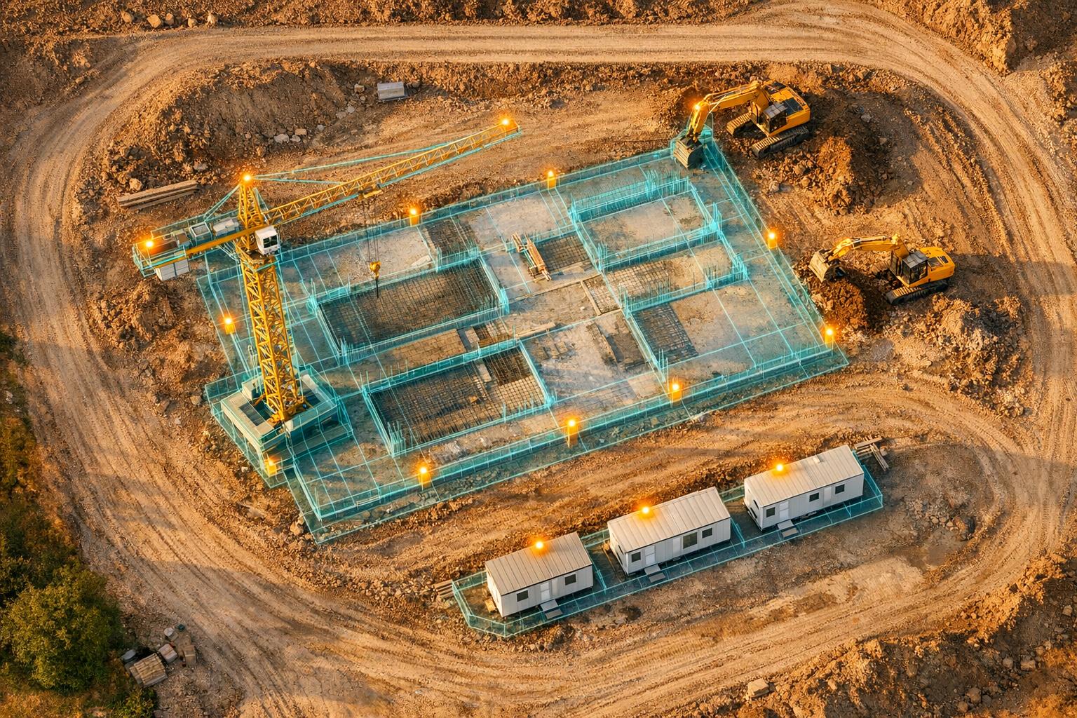
- Drone Technology: Drones equipped with high-resolution cameras and LiDAR sensors collect precise data for digital twins. Advanced tools like RTK-equipped drones achieve centimeter-level accuracy, eliminating the need for traditional ground surveys.
- Applications: Digital twins support progress tracking, quality control, pre-construction analysis, and real-time updates. Teams can detect deviations, simulate scenarios, and optimize site layouts.
- Efficiency Gains: Drone-based data collection is faster and safer than manual methods, reducing delays and cutting costs. For example, a single operator can document 1,000 sq ft of a site in one minute.
- Case Studies: Projects like the Oklahoma District Court House and LAX utility tunnel show how digital twins prevent delays, reduce travel, and enhance collaboration.
- Anvil Labs: This platform simplifies digital twin management with tools for hosting, measuring, and sharing 3D models. Plans start at $49 per project, with most users seeing a return on investment in two months.
Digital twins are rapidly becoming a standard in construction, offering precise, real-time insights that improve efficiency, safety, and collaboration.

Digital Twin Creation Process: From Drone Data Capture to Construction Application
Data Capture Methods for Digital Twins
Drone Data Collection
Drones equipped with high-resolution RGB cameras, LiDAR sensors, and thermal imaging systems are essential tools for gathering data on construction sites. The process starts with mission planning, where flight control software like Dronelink or DroneDeploy helps define output requirements, accuracy goals, and asset details. Using this software, drones are programmed to follow precise flight paths - such as grid, crosshatch, or vertical patterns - with 80% overlap in both directions. This ensures accurate 3D reconstruction. For urban facade mapping, vertical flight patterns are particularly effective, as they maintain a clear line of sight while prioritizing safety.
Ground Control Points (GCPs) are often deployed to calibrate coordinates, delivering accuracy within 5 centimeters. However, drones equipped with Real-Time Kinematic (RTK) receivers can achieve even higher precision - down to the centimeter - without requiring GCP setup. This is especially beneficial in urban areas where GPS signals can be obstructed by tall buildings. Enterprise-level drones with mechanical shutters and RTK capabilities allow for faster and more precise data collection. For instance, a drone flying at 160 feet can cover 6 acres and capture around 149 images in under 9 minutes. These images are then processed using Structure from Motion (SfM) techniques to create 3D meshes, point clouds, and orthomosaic maps. These datasets form the foundation of the digital twin and can be enriched by integrating other data sources.
Additional Data Sources
In addition to drone surveys, other data sources enhance the accuracy and depth of digital twins. IoT sensors, for example, provide real-time updates on equipment usage, environmental factors like temperature and humidity, and structural stress on critical components. Wearable devices worn by construction workers contribute safety and location data, enabling project managers to monitor personnel and identify potential hazards. Ground surveys using traditional surveying tools or handheld cameras can also verify data in areas where drone access is limited or where additional detail is needed.
Thermal sensors on drones can identify issues like heat leaks or moisture problems that standard RGB cameras might miss, while ground-based IoT sensors ensure continuous monitoring between drone flights.
Advantages Over Manual Methods
Drone-based data collection offers clear benefits in terms of speed, safety, and precision compared to traditional manual methods. Inspections that rely on scaffolding, elevating platforms, or ground-based surveying equipment are labor-intensive and time-consuming. Drones, on the other hand, can easily access hard-to-reach or hazardous areas - like tall facades or unstable structures - without putting human safety at risk.
"Presently, UASs are recognized as one of the most effective means of generating a Digital Twin (DT) of construction projects, surpassing traditional methods in terms of speed and accuracy."
– Jhonattan G. Martinez, Aarhus University
Drone-generated 3D models are extremely detailed, capable of detecting cracks and damage down to the millimeter level, with a Ground Sample Distance as fine as 0.14 inches per pixel. Additionally, drones cut down on the need for expensive equipment and labor-intensive processes, offering a complete digital record that can be revisited and analyzed long after the data is collected.
sbb-itb-ac6e058
Building Digital Twins from Drone Data
Photogrammetry and Data Processing
Turning drone-captured images into digital twins is a crucial step for precise construction site planning. Drones gather overlapping images that photogrammetry software processes into detailed 3D models. This involves using structure-from-motion algorithms to align photos into a dense point cloud, converting the points into a mesh, and creating georeferenced orthomosaics for accurate measurements. These 3D models lay the groundwork for rigorous quality checks.
For instance, Gammon Construction in Hong Kong utilized GIS-integrated photogrammetry to develop digital twins for the Lyric Theatre Complex. This approach improved logistics planning while cutting down vehicle emissions and minimizing traffic disruptions.
Accuracy and Quality Control
Achieving high accuracy requires strict controls throughout the data processing phase. Ground Control Points (GCPs), typically spaced at a density of 5 to 10 per acre, help align the model's coordinates to real-world positions. When paired with RTK GPS-equipped drones, digital twins can reach an accuracy of 1 to 5 cm, meeting the sub-inch precision needed for most construction layouts. Quality checks include verifying that control point residuals stay below 0.1 ft, minimizing reprojection errors, and ensuring image overlap exceeds 80% in all directions.
For example, Corgan’s team documented an 18,000 sq ft utility tunnel at LAX using Matterport Pro2 technology. They completed 50 scans in just one hour, avoiding four weeks of potential delays. Once accuracy is confirmed, these digital twins can be formatted for a range of construction applications.
Export Formats and Uses
Digital twins can be exported in various formats, depending on the intended use. OBJ and PLY files are ideal for visualizations and design reviews, while LAS and LAZ files store point clouds for detailed analyses, such as measuring cut-and-fill volumes or simulating crane paths. GeoTIFF orthomosaics provide high-resolution 2D maps, perfect for area calculations and material staging layouts, with volume measurements accurate to within 1–2%.
"Our photogrammetry software produces accurate spatial models by correcting errors like camera tilt and lens distortion to enable precise volume measurements."
– Anvil Labs
Swinerton Construction leveraged these export formats to cut MEP and architect travel time by 50% and eliminate client travel entirely. This virtual coordination not only reduced costs but also helped avoid errors before physical work began. Tools from Anvil Labs further enhance this process with advanced spatial analysis and secure sharing, making it easier to measure areas, simulate layouts, and maintain precision using imperial units for U.S. projects.
Applications in Construction Site Layouts
Real-Time Monitoring and Updates
Digital twins bring IoT sensors and drones together to deliver instant updates on site progress, material deliveries, and equipment usage. This constant flow of information means project managers can adjust timelines on the spot instead of waiting days for manual reports. For instance, using digital twins to monitor earth-moving equipment has reduced idle times by 25% on large infrastructure projects.
A striking example comes from January 2025, when OHLA used a GIS-based digital twin for a $47 million bypass road project in Cáceres, Spain. Led by Miguel Amérigo and Manuel Carpintero, the team transformed 65,000 drone images into a detailed 3D model of the worksite. This allowed them to manage 12,000 cubic meters of concrete and 10 tons of asphalt while keeping regulators and landowners updated in real time.
By comparing "as-built" drone models with "as-designed" BIM models, teams can quickly detect deviations in material placement, equipment positioning, and labor workflows [9,18]. Digital twins also enable "what-if" simulations to address potential issues like crane availability or bad weather before they arise. Additionally, cloud-based control towers that integrate real-time and predictive data have boosted on-site productivity by up to 50%. These tools not only improve efficiency but also create smoother collaboration among teams on the ground.
Team Collaboration
Digital twins simplify teamwork by consolidating data from drones, GIS, and BIM into a single platform. This ensures that contractors, architects, and project managers are working from the same up-to-date information, minimizing miscommunication.
"Information is power, [but] it's very difficult to exchange information among the members of the value chain... GIS helps us very much regarding communication and coordination and collaboration."
– Miguel Amérigo, Corporate Head of R&D and Innovation, OHLA
In 2017, Takenaka Corporation in Japan adopted digital twin technology, cutting the time needed to create 360-degree site photographs by 90%. This change allowed for more frequent remote collaboration between field and office teams. Digital twins also provide visual evidence of progress and material placement, which can help resolve disputes between subcontractors and project managers. Beyond that, teams can attach critical documents - like safety plans, warranties, and material specifications - directly to the 3D model using tags or notes, making key information easily accessible to everyone involved.
Pre-Construction Analysis
Before construction begins, digital twins play a crucial role in analyzing site conditions, examining environmental factors, and planning layouts. Aerial imagery and 3D point clouds allow teams to evaluate terrain, available space, and potential obstacles like trees or existing structures [6,18]. This spatial data helps determine the most efficient arrangement of machinery, materials, and workers.
Pre-construction simulations refine site layouts and assess environmental impacts. For example, photogrammetry models guided The Shard's integration with its surroundings in London, while virtual airflow simulations helped optimize the HVAC design for Heathrow Terminal 5.
Project managers can also test how different building materials, structural designs, or extreme weather conditions might affect a project's timeline [20,21]. This virtual testing identifies design clashes and structural conflicts before physical resources are used, greatly reducing risks [12,21]. Tools like Anvil Labs support these workflows by hosting 3D models, offering annotation and measurement features, and enabling secure data sharing across teams - all accessible from any device. These early insights feed directly into the broader digital twin strategy, ensuring efficient layout planning throughout the project lifecycle.
Geo Week 2025: Revolutionizing Construction: Digital Twins, Drones, and Real-Time QA/QC
Using Anvil Labs for Digital Twin Management
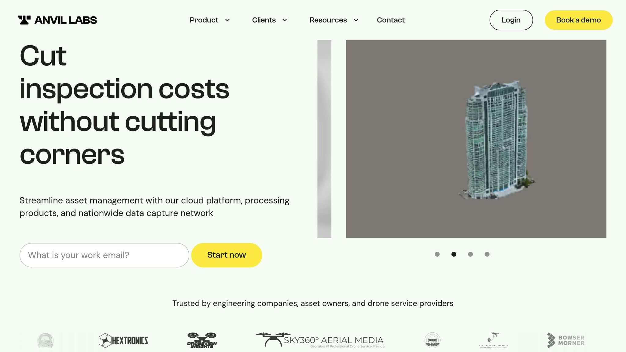
When it comes to digital twins, creating them accurately is just the beginning. Managing them effectively is equally important, and that’s where Anvil Labs comes in. Their cloud-based platform simplifies the entire process, making digital twin management more accessible and efficient.
Core Features of Anvil Labs
Anvil Labs offers a centralized, cloud-based solution for managing digital twins. The platform hosts high-resolution 3D models and processes raw drone footage into spatial models, such as digital terrain models and orthomosaics. It also includes tools for annotations, measurements, and secure, role-based data sharing - all in one place.
The results? Inspections are completed 75% faster, and users identify 30% more defects compared to traditional manual methods.
Supported Data Types and Integrations
The platform supports a wide variety of data formats, including:
- 3D models
- 360° photographs
- Thermal imagery
- LiDAR point clouds (with LAZ to LAS conversion)
- Orthomosaics
This versatility allows users to consolidate data from drones, laser scanners, and thermal cameras into a single, unified system.
Anvil Labs also integrates seamlessly with tools like Matterport, YouTube, AI analysis platforms, and task management systems. Whether you're a field supervisor using a tablet or an executive on a desktop, everyone gets access to the same up-to-date data.
Benefits for Construction Teams
Anvil Labs replaces scattered spreadsheets and outdated blueprints with a single, real-time data source. Automated tools make it easy to compare site data over time, helping teams spot discrepancies between planned and actual construction before they escalate into costly mistakes.
"This is a differentiator. Those that aren't able to provide visualization but are just doing raw footage - this gives you, in my opinion, that competitive edge." – Adrian, drone service provider
The financial benefits are just as impressive. Engineering companies have saved hundreds of thousands of dollars by switching from traditional inspection methods, with most users seeing a return on investment in just two months.
"The ROI is clearly marked within the first few uses." – Angel Rojas, Red Angel Drones
Anvil Labs’ pricing is straightforward and flexible. Plans start at $49 per project for hosting and sharing, or $99 per month for full access to hosting, management, and collaboration tools. Optional data processing is available at $3 per gigapixel, making it an affordable way for construction teams to scale their digital twin capabilities.
This streamlined approach ensures that construction site layout planning stays precise and efficient, from pre-construction analysis to real-time updates on-site.
Conclusion
Key Takeaways
Digital twins are changing the game for site layout planning by replacing outdated methods like manual surveys and static blueprints with high-resolution 3D models. These models offer a centralized, real-time view of construction sites, breaking down data silos and enabling quicker, better-informed decisions across the project lifecycle.
With automated progress tracking, engineers can easily compare site data over time, identifying discrepancies between planned and actual progress before they escalate into costly issues. Integrated tools for measuring distances, volumes, and points directly on the 3D models provide results much faster and with greater accuracy than manual processes. In fact, many users see a return on their investment in as little as two months.
The shift from 2D workflows to 3D modeling is gaining momentum, with 55% of global software decision-makers already adopting digital twin technology. This approach unifies teams, ensuring that decisions are always based on up-to-date and accurate information.
Next Steps
Start with a pilot project to implement digital twins. Begin by capturing drone data and processing it into 3D models for real-time inspections and measurements. Use these tools to automate compliance checks and track progress, reducing delays and preventing expensive rework.
Anvil Labs offers a simple and flexible solution to get started. Their monthly plans include full hosting, data management, and collaboration tools, making the transition seamless. The platform supports various data types - like photogrammetry, LiDAR, and thermal imagery - and integrates AI analysis and task management tools. By choosing Anvil Labs, you can move from manual workflows to a centralized digital twin system with ease.
FAQs
How often should we fly drones to keep a site digital twin current?
To keep a digital twin current, drones need to be flown on a daily or weekly basis. These regular flights help catch potential errors early and provide precise site monitoring. How often you fly the drones depends on how complex the project is and how detailed the data needs to be.
When do we need ground control points versus using an RTK drone?
Ground control points (GCPs) are a must when you need centimeter-level georeferencing accuracy - think construction projects or detailed terrain analysis. While RTK drones often deliver accurate results without GCPs for most tasks, GCPs become essential when absolute precision is non-negotiable or if you need to double-check the accuracy of RTK data.
How can a digital twin be used to check BIM designs against as-built work?
A digital twin bridges the gap between BIM designs and the actual construction by generating an accurate, real-time 3D model of the site. This is achieved through drone imagery and sensors, allowing teams to spot discrepancies, misalignments, or clashes early in the construction process. By catching these issues quickly, they can be resolved before they escalate into larger problems.
