
Drones and AI are transforming accessibility planning by providing accurate, real-time data for safer evacuations and infrastructure improvements. Traditional methods rely on outdated maps and manual surveys, but drones equipped with AI can quickly collect and analyze high-precision data, identifying hazards and optimizing routes. Here's what you need to know:
- Faster Data Collection: Drone surveys cut survey times by up to 75% and reduce costs by 50%.
- High Accuracy: Modern photogrammetry achieves centimeter-level precision for identifying obstacles and designing accessible paths.
- AI-Powered Insights: Machine learning detects barriers like curbs or fire hydrants and predicts future accessibility challenges.
- Real-World Applications: From disaster response to urban planning, drones provide actionable data for safer evacuation plans and ADA-compliant designs.
Key Takeaway: AI and drones streamline accessibility planning, saving time, reducing costs, and improving safety outcomes. Whether mapping disaster zones or designing wheelchair-friendly routes, this technology is reshaping how we approach accessibility challenges.
How can AI be used in Drones?
Core Components of Drone Surveys for Accessibility

5-Stage Drone Survey Workflow for Accessibility Planning
Data Types Collected by Drones
Drones are equipped to gather several types of data that are crucial for accessibility-focused surveys. 2D orthomosaics provide high-resolution, georeferenced maps, making them perfect for tasks like measuring sidewalks, monitoring wear and tear, and documenting site changes. In addition, drones can generate LiDAR point clouds, which deliver highly accurate 3D elevation data with vertical precision as fine as 1.2 inches and densities reaching up to 330 points per square meter in vegetated areas using triple returns. LiDAR is especially useful in dense vegetation, as it can penetrate through to reveal the true ground surface, which is critical for identifying hidden slopes or uneven terrain that could impede wheelchair access.
Other outputs include Digital Terrain Models (DTMs) and Digital Surface Models (DSMs), which translate point cloud data into slope and elevation maps - essential tools for planning accessible routes. Drones can also produce integrated 3D meshes and 360° panoramas, offering interactive views of infrastructure for detailed inspections. These tools are invaluable for verifying ramp slopes and designing wheelchair-friendly pathways. Additionally, geospatial video combines full-motion footage with GIS data, enabling real-time analysis of movement patterns and obstacles.
Together, these data types form the foundation of an effective survey workflow, ensuring accessibility challenges are addressed with precision.
Standard Drone Survey Workflow
To turn raw data into meaningful insights, drone surveys follow a structured workflow designed to meet accessibility needs. This process ensures that the data collected directly addresses challenges like uneven terrain, inadequate ramps, or obstructed pathways.
A typical drone survey involves five key stages. During planning, surveyors define site boundaries, determine flight heights to clear obstacles, and set gimbal angles - using 0 degrees (nadir) for 2D mapping and oblique angles for 3D modeling of vertical elements like curbs and ramps. Image overlap is configured between 70–80% to ensure accurate 3D reconstructions. Pre-loading existing GIS data can provide helpful context before the flight begins.
In the capture stage, automated flights are executed with built-in safety checks. Features like terrain following ensure a consistent height above uneven surfaces, maintaining uniform image overlap and ground sampling distance (GSD). For positional accuracy, drones use RTK (real-time corrections) during flight or PPK (post-flight corrections), which is particularly effective in areas with signal interference, such as urban environments or dense forests. Flight patterns vary depending on the target: corridor scans for sidewalks, crosshatch patterns for 3D structures, and area surveys for open spaces.
The processing phase converts raw data into usable formats. Block adjustment aligns overlapping images and metadata to determine accurate orientations. Ground Control Points (GCPs) can further anchor the data spatially, especially when RTK is not utilized. This stage produces outputs like 2D orthomosaics, 3D point clouds, and DTMs, which are critical for identifying slopes, obstacles, and other accessibility barriers.
Finally, in the delivery stage, the processed data is exported to GIS or BIM platforms. Here, planners can measure slopes, detect obstacles, and design accessible routes with precision.
"This system will enable us to efficiently acquire LIDAR and imagery for sites upwards of 1,000 acres [400 ha] in a single day. What this translates to for our clients is reduced time and effort in the field, with faster turnaround of final products to keep their projects on schedule."
- Ravi Soneja, Program Manager, McKim & Creed
AI Techniques for Accessibility Planning
Machine Learning for Data Analysis
AI has revolutionized how we turn drone imagery into practical insights for accessibility planning. By using object detection, AI identifies obstacles such as fire hydrants, utility poles, parked cars, and curbs - elements that standard orthoimages often miss or obscure under tree canopies.
This analysis involves two key steps. First, AI models perform object detection in "Pixel Space", working directly with raw image coordinates to preserve detail and avoid distortions. Next, using information about the camera's sensor and focal length, these detections are converted into "Map Space", enabling precise geographic placement. This process ensures that features like curbs or poles identified in images are accurately mapped for planners.
"Object detection... is an invaluable tool for mapping our world, creating digital twins, and gaining a quantitative understanding of our environment. These, in turn, fuel data-driven decisions for smart cities, urban planning, resource management, environment protection, and disaster response."
- Pavan Yadav, Senior Software Product Engineer, Esri
Data fusion takes accuracy to another level by combining spectral imagery (RGB) with Digital Surface Models (DSM), which incorporate height as an additional variable. This approach boosts land cover classification accuracy from 63.93% to 94.48%, making it easier to differentiate between walkable paths and obstacles. AI also employs automated mask generation, where GIS tools create "primitive masks" for roads and access points. These masks are then used to train semantic segmentation models, producing detailed accessibility maps. The refined data sets created through these methods help build predictive models that can anticipate future challenges.
Predictive Modeling for Accessibility Challenges
AI goes beyond analyzing current conditions - it predicts future accessibility issues. By examining patterns in drone data, machine learning algorithms can forecast changes, such as road deterioration or potential traffic accidents that might block key routes. In disaster-prone regions, physics-aware predictive modeling combines drone mapping data with simulations to anticipate events like wildfire spread. This allows planners to identify safe evacuation routes and emergency access points well in advance.
Generative AI further enhances planning by creating multiple optimized route options in seconds. Using real-time data on weather, terrain, and regulations, it enables planners to test "what-if" scenarios in digital twin environments, simulating evacuation strategies before they’re needed in real life. Thanks to advancements in drone mapping, with accuracy now reaching within 2 centimeters, even small obstacles - like uneven surfaces that could trip a wheelchair user - can be identified and addressed.
These predictive capabilities form the foundation for more efficient emergency planning.
Automated Evacuation Route Mapping
AI-powered routing algorithms transform predictions into actionable evacuation plans. By processing a variety of factors in real time, these algorithms create optimal routes that prioritize speed, safety, and efficiency. Techniques like A*, D*, RRT, and reinforcement learning calculate paths while factoring in dynamic conditions such as ground changes and crowd density.
Edge distributed AI plays a vital role here. Drones equipped with this technology can process data locally during flight, identifying obstacles or hazards like ignited areas without relying on remote servers. This minimizes communication delays and accelerates the creation of accessibility maps during emergencies. Modern systems also integrate LiDAR, radar, and ultrasonic detectors to map obstacles in 3D. These tools can automatically detect issues like water pooling, unexpected elevation changes, or missing infrastructure components that could hinder evacuation efforts.
Using Anvil Labs for Drone Survey Data Management
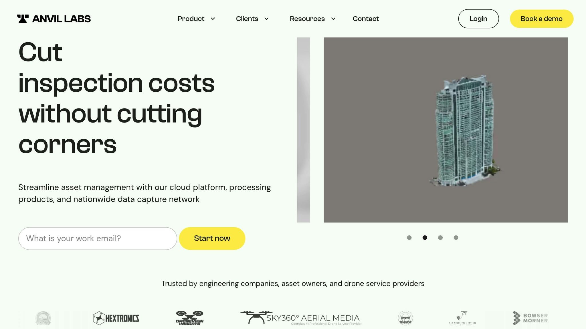
When it comes to accessibility planning, collecting drone data is just the beginning. What truly makes a difference is how that data is processed, managed, and turned into actionable insights. That’s where Anvil Labs steps in, combining advanced drone technology with efficient data management to simplify the process.
Data Processing and Hosting with Anvil Labs
After drones gather data, Anvil Labs takes over, converting raw inputs into 3D models, orthomosaics, and detailed annotations - all in record time. By automating much of the processing, the platform slashes the turnaround time by 50%. This means planners can go from gathering data in the field to analyzing it in just a few days instead of weeks.
What sets Anvil Labs apart is its ability to handle a variety of data types crucial for accessibility planning. These include LiDAR data, thermal imagery, orthomosaics, and 360° photos, all stored securely in the cloud. For instance, LiDAR models are particularly effective for mapping evacuation routes, as they can detect obstacles that might hinder accessibility. Angel Rojas from Red Angel Drones shared his experience, saying, "My overall experience with the software has been satisfying because of the efficient workflow... The ROI is clearly marked within the first few uses".
The platform’s LiDAR processing creates highly accurate elevation models and contour lines, with error margins as low as ±0.5%. This level of precision helps planners pinpoint barriers that aerial photography might overlook. The data is then seamlessly integrated into virtual assessments, enabling teams to collaborate and make decisions faster.
Visualization and Collaboration Features
Anvil Labs takes processed data and transforms it into interactive 3D models and digital twins. These tools make it easier to identify critical access points and evacuation routes, which are essential for disaster response. Emergency planners can remotely assess sites and quickly spot bottlenecks in evacuation plans.
The platform’s annotation tools are another standout feature. Teams can mark accessibility barriers directly on 3D models, whether it’s noting narrow doorways, measuring corridors for ADA compliance, or flagging emergency exits. These annotations act as a shared resource for architects, emergency managers, and consultants. Plus, with cross-device access, field teams can pull up annotated models on tablets or smartphones during on-site evaluations.
To ensure sensitive information stays secure, the platform includes role-based access controls. This means only authorized users - like facility managers or emergency responders - can view critical evacuation route data. Adrian, a drone service provider, highlighted this as a key advantage: "This is a differentiator. Those that aren't able to provide visualization but are just doing raw footage - this gives you, in my opinion, that competitive edge".
AI Analysis Integration on Anvil Labs
Anvil Labs’ AI tools take accessibility planning to the next level by automating barrier detection and task management. The platform uses machine learning to identify obstacles, evaluate evacuation route efficiency, and flag areas that need attention. This AI-driven approach has been shown to detect 30% more issues than manual inspections alone.
One of the platform’s standout features is point cloud classification, which differentiates between ground surfaces, vegetation, and man-made structures. This makes it easier to map out clear, accessible pathways. Barriers like overhanging branches or encroaching vegetation are quickly identified, and the system can even integrate with task management tools to generate work orders for remediation. This ensures that responsibilities are assigned, and progress is tracked effectively.
For emergency planning, speed is everything. Drone inspections using Anvil Labs are 75% faster than traditional methods, allowing teams to survey large areas and produce accessibility reports in just hours. This rapid turnaround is invaluable when preparing for disasters, as it helps planners quickly identify safe evacuation routes and emergency access points.
sbb-itb-ac6e058
Applications and Case Studies
Real-world applications showcase how AI-powered drone surveys are reshaping accessibility planning across different scenarios.
Disaster Response and Emergency Planning
Hurricane Maria in 2017 highlighted the critical need for real-time road status updates, especially in disaster-stricken areas like Puerto Rico. In April 2020, researchers from MIT Lincoln Laboratory, led by Chad Council and Dieter Schuldt, tackled this challenge by deploying an AI-driven lidar system for FEMA. This system mapped 400 square miles across regions like Puerto Rico, the Carolinas, Florida, and Texas after major hurricanes. The results were impressive: 87% accuracy in assessing road viability and the ability to process a 250-square-mile area in just 36 hours.
The system automatically flagged issues such as downed trees, washed-out roads, and even a construction gap in Bedford, Massachusetts that hindered evacuation efforts. As Chad Council explained:
With our particular approach, you can determine road viability, do optimal routing, and also get quantified road damage. You fly it, you run it, you've got everything.
- Chad Council
The technology's Geiger-mode lidar was able to detect roads hidden beneath dense vegetation. By integrating drone data with OpenStreetMap, it even calculated alternative routes through fields and parking lots - an essential feature for reaching isolated communities.
Another striking example comes from the 2018 Camp Fire in California, where the fire advanced at a speed of one football field per second. This disaster emphasized the importance of pre-planned Temporary Fire Refuge Areas (TFRAs). Today, drone surveys play a key role in identifying and preparing these critical safe zones in advance.
These cases underline the growing importance of AI in emergency response, offering tools that can also inform broader urban and indoor accessibility solutions.
Urban Accessibility Improvements
AI-powered drone surveys are also helping urban planners tackle complex accessibility challenges. In 2024, researchers in Beijing used a VGAE-RF model to optimize the placement of emergency shelters in densely populated areas. Meanwhile, in Ghent, Belgium, urban planners combined drone footage with AI video analytics to create heatmaps and trajectory matrices. This approach pinpointed conflict zones at a busy intersection, enabling targeted safety upgrades.
Indoor accessibility has also advanced, thanks to initiatives like the 3D mapping challenge sponsored by NIST in January 2025. This competition focused on developing systems for first responders to navigate earthquake-damaged, GPS-denied environments.
These advancements highlight how AI and drone technology are not only improving emergency response but are also paving the way for safer and more accessible urban and indoor environments.
Challenges and Best Practices
Addressing Data Accuracy and Quality Issues
Ensuring accurate data from AI-driven drones hinges on precise sensor calibration. One recurring problem is sensor inconsistency - data gathered by different sensors or through improvised processes often lacks the traceability needed for seamless integration with other geospatial datasets. Without proper calibration, raw data from drone cameras becomes unreliable for scientific purposes.
Geometric accuracy depends on several factors, including high-quality ground control points (GCPs), tie points, sensor calibration, flight altitude, image overlap, and lens calibration. As highlighted by the U.S. Geological Survey:
The ground control points and the quality of tie points directly contribute to the geometric accuracy of the data, regardless of the ground sample distance of the imagery.
- U.S. Geological Survey
For engineering and cadastral applications, using RTK/PPK systems with well-placed GCPs typically achieves horizontal errors of 2–3 cm and vertical errors of 3–6 cm.
Environmental factors also complicate data collection. Shifting lighting conditions and non-Lambertian surfaces can distort results. Areas with uniform visual features, such as water bodies or snowfields, make it particularly challenging for photogrammetry software to align images accurately.
To improve reliability, combine RTK/PPK systems with independent checkpoint validation. Use at least two calibration panels to refine raw data and validate the final model with checkpoints not included in the initial processing. This approach ensures both horizontal and vertical accuracy. With disciplined workflows, achieving sub-2-inch accuracy is possible. Additionally, drone surveys can cut project durations by up to 45% and reduce field costs by 50% compared to traditional methods.
Once technical accuracy is addressed, the next priority is meeting regulatory standards.
Meeting Regulatory Requirements
Beyond technical precision, regulatory compliance is essential for the success of drone surveys. Legal and privacy considerations are just as critical, especially for applications like accessibility planning and evacuation route design.
Operating within regulations requires close collaboration with aviation authorities and a commitment to privacy safeguards. In the U.S., commercial drone operations typically require licensed pilots, registered drones, and sufficient insurance coverage to mitigate liability. Coordination with authorities is especially important when working near airports, highways, tunnels, or private property.
In July 2025, AECOM completed over ten survey projects in Hong Kong using drones and AI-powered video analytics, achieving a 99% vehicle capture rate. Steven Lui, Technical Director at AECOM, emphasized the importance of balancing data collection with privacy concerns:
Collecting useful data must be balanced with individual rights, ensuring safeguards against misuse while enabling effective identification of violations.
- Steven Lui
This initiative delivered a 3:1 cost-benefit ratio, generating a net present value of $150 million over ten years through reduced travel time and fuel consumption.
To address privacy concerns, implement transparent data collection systems and launch public awareness campaigns to reassure communities about non-consensual footage. Secure sensitive geospatial data with robust encryption and consider blockchain technology to protect data exchanges. As David Stirling from Crawford & Company cautions:
Drones must be recognised as susceptible to compromise and malicious exploitation. Insurers may wish to take proactive steps to address the emerging risks associated with drones before it's too late.
- David Stirling, Crawford & Company
For added security, train AI models to adapt to local conditions and use edge computing on drones to minimize latency and reduce communication risks. Weather conditions also play a role - avoid flying in winds exceeding 25 mph and plan for battery limitations of 20–30 minutes by preparing backup drones or scheduling rotations.
| Challenge Category | Specific Issue | Recommended Mitigation |
|---|---|---|
| Regulatory | Airspace restrictions near airports and tunnels | Pre-flight coordination with aviation authorities |
| Privacy | Non-consensual recording and surveillance | Transparent data collection and public awareness campaigns |
| Security | Cyberattacks and hijacking | Encryption and blockchain-secured data exchanges |
| Technical | Limited battery life (20–30 minutes) | Use of backup drones or battery rotation |
| Environmental | Sensitivity to weather (wind >25 mph) | Monitor conditions and deploy weather-resistant drones |
Conclusion
AI-powered drone surveys are reshaping accessibility and evacuation planning by combining high-resolution 3D models, LiDAR data, and orthomosaics with machine learning. These tools lead to inspections that are 75% faster, uncover 30% more defects, and reduce costs significantly. For example, at DPR Construction's Halawa View Apartments project in Hawaii, drone mapping ensured proper clearances, avoided delays, and simplified safety planning for a multi-building site.
Taking this further, Anvil Labs transforms raw drone imagery into practical insights. Their platform processes 3D models, thermal imagery, and LiDAR point clouds into detailed digital twins that teams can annotate, measure, and securely share. AI tools integrated into the platform automate tasks like hazard identification and route planning, while flexible viewing options allow everyone - from engineers to emergency responders - to collaborate seamlessly. As Brian Wellington from Litewing shared:
I showed this to the fire department and they all loved it!
- Brian Wellington, Litewing
This combination of technology and collaboration underscores the growing role of AI in improving safety and efficiency.
Success in accessibility planning depends on managing data effectively while meeting regulatory standards. Start by collecting drone data for your projects, process it using platforms with AI capabilities, and ensure the results align with established guidelines. By adopting AI-driven workflows, planning teams can speed up their processes by as much as 70% and improve safety outcomes.
As real-time mapping technologies continue to evolve, professionals in accessibility planning have a unique chance to revolutionize urban mobility and disaster preparedness. The tools are already here - the real challenge is how quickly teams will embrace them.
FAQs
How do AI-powered drones enhance accessibility and evacuation route planning?
AI-powered drones integrate cutting-edge tools like high-resolution cameras and LiDAR with smart algorithms to generate detailed 3D models and maps. These capabilities allow for precise identification of obstacles, thorough terrain analysis, and even assessments of infrastructure compliance, such as ensuring adherence to ADA standards.
With real-time data processing, AI significantly boosts the speed and precision of decision-making. This makes tasks like designing safer evacuation routes or enhancing site accessibility far more efficient. The result? Better planning that saves both time and resources.
What types of data do drones collect for accessibility and evacuation planning?
Drones gather a range of data that plays a crucial role in planning accessibility and evacuation routes. Some of the key data types include high-resolution imagery, LiDAR scans, orthomosaics, thermal imaging, and 3D models. These tools provide a detailed look at terrain, infrastructure, and surrounding conditions, offering valuable insights for accurate planning and analysis.
Using this information, planners can pinpoint potential challenges, refine route designs, and ensure they meet accessibility standards, ultimately creating safer and more effective pathways for everyone.
How does AI use drone data to anticipate accessibility challenges?
AI uses data gathered by drones, including high-resolution images and sensor readings, to spot potential problems like obstacles, hazards, or weaknesses in structures. By processing this information, AI can uncover patterns and anticipate future issues, enabling better planning and smarter decisions.
This method allows planners to tackle accessibility challenges upfront, leading to safer evacuation routes and more efficient infrastructure designs.
