Sensor fusion is the process drones use to combine data from multiple sensors - like IMUs, GPS, cameras, and LiDAR - to achieve accurate navigation, even in challenging conditions. Each sensor has strengths and weaknesses: IMUs provide fast motion tracking but drift over time, GPS offers global positioning but struggles indoors, and cameras or LiDAR add environmental awareness. By blending these inputs, drones maintain stability and precision, especially in GPS-denied environments like tunnels or urban areas.
Key Points:
- Why It Matters: GPS alone is insufficient for tight spaces or indoor navigation. Sensor fusion reduces drift and ensures reliable operation when individual sensors fail.
- How It Works: Algorithms like Extended Kalman Filters (EKF) predict motion and correct errors using sensor data.
- Applications: Used in industrial inspections, search-and-rescue, precision agriculture, and urban logistics.
- Challenges: Requires precise calibration, synchronization, and real-time processing to handle sensor data effectively.
Sensor fusion enables drones to navigate accurately, avoid obstacles, and perform complex tasks under varying conditions.
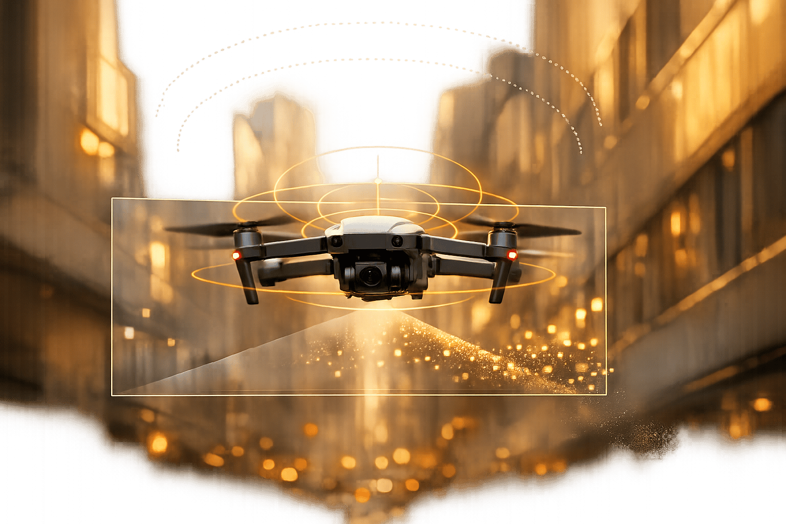
Sensor Fusion: Why Your Drone Doesn't Get Lost
sbb-itb-ac6e058
Primary Sensors for Drone Navigation

Drone Navigation Sensors Comparison: IMU, GNSS, LiDAR, and Camera Capabilities
Drones rely on a combination of core sensors - IMUs for quick motion tracking, GNSS for accurate positioning, and cameras or LiDAR for detailed environmental awareness - to create a cohesive understanding of their surroundings.
Inertial Measurement Units (IMU)
The IMU plays a central role in drone navigation, delivering data at incredibly high rates - anywhere from 100 to 1,000 Hz. It combines accelerometers (which measure linear motion) and gyroscopes (which track rotational motion). This data is processed by the flight controller over 300 times per second, allowing the drone to stay stable even during sudden changes like wind gusts or sharp turns.
That said, IMUs have a weakness: drift. Since position is calculated by double-integrating acceleration, even small inaccuracies can quickly add up. For example, a MEMS IMU with a bias of just 0.01 m/s² can result in a position error of about 18 meters after just one minute. Without corrections from other sensors, a hovering drone could drift significantly over time.
"The GPS tells the flight controller where to be, the compass tells it which way to face, and the IMU is the fast loop that makes the drone physically do what the other two are asking."
- Peter Leslie, Founder & GVC Drone Pilot, HireDronePilot
IMUs excel at fast, short-term motion prediction, while GNSS steps in to handle long-term accuracy by correcting drift.
Global Navigation Satellite Systems (GNSS/GPS)
GNSS provides the absolute position and velocity data needed to counteract the IMU's drift over time. Acting as a stabilizing anchor, it periodically resets the drone's estimated position, ensuring errors don't spiral out of control. However, GNSS updates are relatively slow (1–10 Hz) and can be unreliable in areas like tunnels, dense forests, or urban environments with tall buildings.
Different integration approaches improve GNSS performance:
- Loose coupling: Uses GNSS-derived positions and velocities as filter inputs, effective in stable settings.
- Tight coupling: Directly incorporates raw GNSS data (like pseudorange and Doppler) into the fusion process, improving performance in urban areas.
- Ultra-tight coupling: Goes further by feeding IMU data into the GNSS receiver's tracking loops, enhancing resilience in areas with interference.
For applications requiring high precision, GNSS receivers capable of providing raw data allow for more effective integration with IMU and LiDAR systems.
Cameras and LiDAR Sensors
To complement IMU and GNSS data, vision-based systems like cameras and LiDAR add detailed environmental context, critical for avoiding obstacles and navigating complex areas. Cameras support visual odometry, scene recognition, and even the creation of orthomosaics. However, they can struggle in poor lighting or environments with little visual detail.
LiDAR, on the other hand, uses laser pulses to measure distances and create 3D maps. It excels at capturing surface details, even in low-light or low-texture conditions. This makes it invaluable for tasks like terrain mapping and obstacle detection, especially in areas where GNSS signals are unavailable. In such "GPS-denied" zones, LiDAR can localize the drone by matching terrain features to pre-existing maps.
| Sensor Type | Primary Data Provided | Contribution to Fusion |
|---|---|---|
| IMU | Acceleration, Angular Rate | Predicts fast motion; fills gaps between GNSS updates |
| GNSS | Absolute Position, Velocity | Corrects IMU drift; provides a global reference |
| LiDAR | Distance, 3D Geometry | Generates precise surface maps; works in poor lighting |
| Cameras | Visual Features, Color | Enables visual odometry and scene recognition |
The strength lies in how these sensors work together. The IMU handles quick, real-time adjustments, GNSS ensures long-term accuracy, and LiDAR or cameras provide the spatial awareness needed to navigate obstacles or areas with limited satellite coverage.
Sensor Fusion Algorithms and Methods
When sensors collect raw data, sensor fusion algorithms step in to merge these inputs, creating a dependable estimate of a drone's position and motion. The choice of algorithm plays a big role in how quickly the system responds, how well it deals with uncertainty, and whether it can operate in real time.
Kalman Filters and Extended Kalman Filters
The Kalman Filter works in two stages: it predicts the system's state using a physics-based model and then adjusts that prediction with sensor data. The "Kalman Gain" determines how much weight each sensor's input gets based on its reliability.
Since drone navigation involves nonlinear dynamics - like shifting GPS coordinates and rotations - basic Kalman Filters, which handle only linear systems, fall short. This is where the Extended Kalman Filter (EKF) comes in. By using a first-order Taylor expansion (via Jacobians) to approximate nonlinear relationships, EKFs have become the go-to solution for autonomous flight. For example, ArduPilot's EKF3 runs at 400 Hz and manages a 24-dimensional state vector, which includes crucial data like position, velocity, attitude, and sensor biases.
EKFs also estimate "hidden" states that sensors can't directly measure. For instance, gyroscope drift - common in many MEMS devices at about 0.5° per minute - is accounted for by integrating IMU and optical flow data. This ensures precise hovering. To maintain accuracy, robust systems use innovation gating, a statistical filter (usually 3–5σ) that weeds out anomalies like barometer spikes caused by propeller wash.
"EKF3 is the algorithm that says: 'I know each sensor is lying a little. I know HOW MUCH each sensor typically lies. I will take all their readings, weight them by how reliable each one is, and calculate the BEST POSSIBLE ESTIMATE of where I am and how I'm moving.'"
- Tiny, TCCC CLS, FPV/UAV Certified
For situations involving extreme nonlinearity, like sharp maneuvers, the Unscented Kalman Filter (UKF) offers better accuracy. Instead of approximating with linear models, it uses sigma points to represent probability distributions. However, UKFs demand more computational power, so they're mainly used when EKF errors become too large to ignore. Beyond filtering, global optimization techniques can further enhance navigation precision.
Graph-Based Optimization
Unlike Kalman Filters, which process data sequentially, graph-based optimization methods (often called factor graphs) treat a drone's entire path as a network of interconnected states tied together by sensor data. This approach optimizes the whole trajectory simultaneously, making it particularly effective for handling loop closures - when a drone revisits a previously mapped area and needs to correct accumulated drift. Factor graphs also handle delayed or out-of-order sensor data well, which is crucial for complex SLAM (Simultaneous Localization and Mapping) tasks. The downside? These methods are computationally heavy, often requiring batch processing rather than providing continuous, real-time updates.
Tightly-Coupled Fusion Approaches
For even greater precision, tightly-coupled fusion methods integrate raw sensor data directly, rather than processing each sensor's data separately. Loosely-coupled systems, for example, might calculate visual odometry from cameras and GPS position independently before merging the results. In contrast, tightly-coupled systems feed raw measurements into a single estimator that accounts for correlations between sensors.
Studies show that tightly-coupled fusion can improve accuracy by 15% to 40% in low-texture environments, achieving position errors of under 0.05 meters during intense flight. This approach is also more resilient when one sensor degrades, as it uses all available data to compensate. For instance, in April 2026, the Fischer 26 drone platform combined data from a BMI270 IMU, a PMW3901 optical flow sensor, and a BMP390 barometer using EKF3. This setup achieved a hover drift rate of just 1–3 meters per minute in GPS-denied conditions, thanks to a 5σ innovation gate that filtered out barometer noise from propeller wash.
However, tightly-coupled systems come with challenges. They require highly precise calibration - errors as small as 2 mm or 0.1° can disrupt navigation - and hardware-level timestamping within 1–2 ms to avoid motion distortion. The computational demand also increases with the number of features being tracked. Despite these hurdles, tightly-coupled fusion is often the best choice for applications where maximum accuracy justifies the added complexity.
| Algorithm | Best For | Complexity | Key Limitation |
|---|---|---|---|
| Complementary Filter | Low-power microcontrollers | Very Low | No bias estimation |
| EKF | Standard drone navigation | Medium | Linearization errors |
| UKF | Aggressive maneuvers, high nonlinearity | High | Computationally expensive |
| Factor Graph | SLAM, loop closures, delayed data | Very High | Often requires batch processing |
| Particle Filter | Global localization (no GPS) | Very High | "Curse of dimensionality" |
Using Sensor Fusion in GPS-Denied Environments
When GPS signals vanish - whether indoors, underground, or in urban areas surrounded by tall buildings - drones rely on sensor fusion to maintain stable flight and accurate positioning. The problem is no small feat: relying solely on IMU-based dead reckoning can result in drift of 50–200 meters in just 10 minutes, making it unreliable. However, by blending data from cameras, LiDAR, barometers, and optical flow sensors, modern systems have managed to cut this drift down to roughly 5 meters, even during longer missions. This capability allows drones to handle a variety of GPS-denied scenarios effectively.
Indoor Navigation and Obstacle Avoidance
Navigating indoors comes with its own set of hurdles. Without GPS, drones shift to AHRS (Attitude and Heading Reference System) mode. This system uses the IMU for orientation and a barometer for altitude, but lateral position accuracy deteriorates quickly. To counteract this, Visual-Inertial Odometry (VIO) combines data from high-definition cameras and the IMU, enabling drones to track movement by identifying and following visual features in their surroundings.
In October 2024, researchers Alice James, Avishkar Seth, Endrowednes Kuantama, Subhas Mukhopadhyay, and Richard Han developed an autonomous indoor UAV system using ROS and RTAB-Map. Their solution fused data from a ZED 2i depth camera, IMU, and LiDAR, achieving navigation accuracy with errors as small as 0.4 meters and a mapping RMSE of just 0.13 meters. Designed for tasks like search and rescue or facility inspections in confined spaces, the system demonstrated impressive performance. Flight tests showed that sensor fusion maintained desired flight orientations with an error rate of only 0.1%.
For basic indoor stability, adding optical flow and laser rangefinder data further minimizes drift. However, visual-based systems struggle in environments lacking distinct features, such as over open water, snowy landscapes, or in dense fog. In tunnels or dark areas, supplemental LED lighting can help maintain tracking of visual features.
Underground and Tunnel Operations
Operating underground - whether in mines, tunnels, or subway systems - eliminates GPS entirely and adds challenges like poor lighting, dust, and limited visual features. In these conditions, SLAM (Simultaneous Localization and Mapping) becomes indispensable. SLAM combines depth camera data with LiDAR measurements using Bayesian fusion, enabling drones to create 3D maps of unknown areas in real time while keeping track of their position within those maps. This highlights how sensor fusion ensures reliability when traditional navigation signals are unavailable.
In November 2024, Inertial Labs showcased their "Tunnel Guide" feature for GPS-Aided INS. During a simulated 30-minute GNSS outage, a vehicle equipped with this technology and MEMS IMU data maintained exceptionally low drift rates. When additional CANbus data was integrated into the INS-D Kalman filter, the horizontal position error was reduced to just 0.056% of the distance traveled.
"Sensor Fusion is an integral part of the APNT approach"
- Maria Mendez, Inertial Labs
For tunnel operations, combining LiDAR for large-scale geometry with depth cameras for local details enhances SLAM accuracy in areas with poor textures. Ultrasonic sensors can serve as a backup for obstacle detection and enable precise wall-following in tight spaces. Additionally, RF-based geolocation using MESH network tactical radios can provide beacon-based positioning for drones, with ranges extending up to 30 kilometers.
Formation Flight and Multi-Drone Coordination
When multiple drones fly in formation without GPS, the challenge of maintaining precise relative positioning becomes even more complex. Each drone must not only track its own location but also monitor the positions of nearby drones to avoid collisions and preserve formation structure. Tightly-coupled fusion plays a critical role here by processing raw sensor data from all sources in a single central Kalman filter. This approach offers greater accuracy and reliability compared to loosely-coupled methods.
Federated path planning allows drones to share sensor data and collectively adjust their paths. Inspired by the way the human brain divides tasks, this method distributes computational load across the swarm while maintaining coordinated navigation.
Multimodal sensing is also gaining momentum for formation flight in challenging environments. By integrating visible light, Shortwave Infrared (SWIR), and Longwave Infrared (LWIR) cameras with automatic switching between modalities, drones can maintain object detection and relative positioning even in low-light, foggy, or smoky conditions. This redundancy ensures that if one sensor type fails - such as visible cameras in darkness - the system can seamlessly switch to thermal imaging, preserving the integrity of the formation.
Implementation Challenges and Best Practices
Building a reliable sensor fusion system for field operations involves addressing three main challenges: synchronizing sensor data in time and space, maintaining real-time computational performance, and ensuring graceful handling of failures.
Sensor Calibration and Data Synchronization
One of the trickiest parts of sensor fusion is aligning data from multiple sensors accurately in both time and space. Drones, for instance, use sensors that operate at vastly different speeds - IMUs might run at 100–1,000 Hz, cameras at 30 Hz, and LiDAR at 10 Hz. If the data from these sensors aren't properly synchronized, the fusion algorithm ends up working with mismatched measurements that don't represent the same moment in time.
Timing errors often stem from clock drift, as each sensor runs on its own internal clock, and these small differences add up over time. While software-based synchronization methods like Network Time Protocol can introduce timing errors of 10–50 milliseconds, hardware-level techniques such as Pulse-Per-Second signals or IEEE 1588 Precision Time Protocol can achieve alignment within 1 microsecond. For drones operating at 100 Hz control loops with just 10 milliseconds per cycle, these differences are critical.
Spatial misalignment is another concern. If sensors aren't perfectly aligned on the drone's frame, even tiny angular errors can lead to major inaccuracies. For instance, a 1-degree misalignment between a LiDAR and a camera can result in an 87-centimeter lateral error at a 50-meter range. To avoid this, mount sensors on rigid, thermally stable brackets that resist vibration and temperature-induced shifts during flight.
"Wrong extrinsic calibration or timestamps can ruin a 'correct' filter."
- Kevin Grub, Author
To address these issues, capture timestamps at the moment of sensor acquisition and use innovation gating to filter outliers. With synchronization challenges managed, the next step is ensuring real-time computational efficiency.
Managing Processing Requirements
Real-time sensor fusion systems must operate within tight computational constraints, especially on embedded hardware. The choice of algorithms plays a big role in maintaining performance. For example, state-space complexity can range from O(n³) for small systems to much slower processing for larger systems. ArduPilot's EKF3 algorithm, which operates at 400 Hz, delivers a state prediction every 2.5 milliseconds.
"Real-time means predictable, not fast. A system executing at 1 Hz with deterministic 1-second deadlines is a real-time system. A system executing at 1 kHz with unbounded jitter is not."
- IEEE Standards Association
To reduce computational demands, decision-level fusion can be used. This approach combines independent classifications rather than raw data streams, easing the processing load. When prototyping, start with simplified models - such as 1D or 2D linear approximations - before advancing to full 6-degree-of-freedom nonlinear implementations. Using a real-time OS or Linux with PREEMPT_RT can also minimize scheduling uncertainties to microsecond levels.
Another factor to watch is thermal throttling. Prolonged sensor fusion workloads can cause processors to overheat, triggering dynamic clock rate reductions that disrupt real-time performance. Mitigate this by including a 30-second stationary alignment phase before takeoff, allowing filters to converge and keeping linearization errors in check.
Building Reliable Systems
Once calibration and processing issues are addressed, the final focus shifts to reliability. A robust system leverages the strengths of different sensors while compensating for their weaknesses. IMUs, for example, excel at short-term motion tracking but drift over time, whereas GPS provides long-term accuracy but struggles indoors or near obstructions. Combining these sensors creates a system that outperforms either one alone.
"The goal is not to find the 'best' sensor. The goal is to build an estimator whose blind spots do not all line up at the same time."
- Thomas Thelliez
As discussed earlier in the "Sensor Fusion Algorithms and Methods" section, tightly coupled fusion methods enhance system reliability, especially in tough environments. Fault detection mechanisms, such as monitoring innovation residuals (the difference between predicted and measured states), can flag and reject updates when residuals exceed acceptable thresholds.
To further improve reliability, divide the estimator into local and global components. Use IMU, encoders, and visual odometry for smooth short-term control, while GPS and landmarks provide long-term accuracy for mission planning. This approach prevents sudden pose jumps when global corrections are introduced mid-flight. Additionally, account for the physical offset (lever arm) between the GNSS antenna and the IMU, as their differing motions can destabilize the filter.
A well-designed sensor fusion system combines precise calibration, efficient processing, and robust fault detection. For example, noise models should be based on recorded ground-truth datasets rather than relying solely on sensor specifications. Validate covariance matrices against held-out data to ensure they reflect actual performance. Implementing online calibration can also help adjust for factors like IMU biases caused by temperature changes or mechanical wear during operations.
Conclusion
In the realm of digital twin applications for drone navigation, sensor fusion plays a central role. It ensures drones can operate safely, even when a single sensor might fail. By combining data from sources like IMUs, GPS, cameras, and LiDAR, drones achieve far better positioning and obstacle detection. As Jessica May from DroneBundle Blog puts it:
"The drone doesn't just see obstacles – it builds a three-dimensional map of its surroundings. This digital representation updates constantly as the aircraft moves through space".
The beauty of sensor fusion lies in its ability to balance the strengths and weaknesses of each sensor. Algorithms work tirelessly to manage sensor reliability, compensating for any shortcomings. But making this work requires precise calibration and synchronization. For example, even a small misalignment - like a 1° error - can lead to an 87-cm offset at 50 meters. Synchronizing sensors that operate at different speeds is equally critical, as is incorporating fault detection to ensure safe flight even when individual sensors fail.
A prime example of these principles in action is the MIT Aerospace Controls Lab's SANDO system. Tested in April 2026, it successfully completed 10 flights through dynamic obstacles, all while achieving a 7.4× speedup in trajectory optimization with onboard processing.
Beyond navigation, sensor fusion is transforming industrial 3D mapping and spatial analysis. Companies like Anvil Labs use fusion-powered datasets, incorporating LiDAR, thermal imagery, and orthomosaics, to create tools for annotation, measurement, and secure data sharing across teams. These advancements simplify managing complex site data while providing unparalleled accuracy.
The field isn't standing still. Edge computing is cutting down latency during critical maneuvers, AI is improving how drones recognize obstacles, and miniaturization is packing advanced fusion capabilities into smaller drones. Ultimately, the future of drone navigation depends on systems that can stay reliable, even as individual sensors near their performance limits.
FAQs
Which sensors should my drone fuse for reliable navigation indoors?
For dependable indoor navigation, combine LiDAR for detailed 3D mapping and obstacle detection with cameras to provide visual context and texture. This pairing works well even in GPS-denied or low-light settings. Integrating IMUs ensures stability, while ultrasonic sensors are ideal for navigating tight or confined spaces. By using these sensors together with fusion algorithms, you can achieve precise and safe navigation in challenging indoor environments.
When should I choose an EKF vs a factor graph for sensor fusion?
When real-time navigation is the goal, especially in scenarios like UAVs or autonomous vehicles, an Extended Kalman Filter (EKF) is a solid choice. Its strength lies in delivering low-latency state estimation with efficient computational demands, making it ideal for dynamic environments and systems with limited processing power.
On the other hand, factor graphs shine in offline applications. They are well-suited for tasks requiring high precision, such as detailed mapping or managing complex sensor setups. These are typically accuracy-driven scenarios like terrain mapping or post-mission analysis, where computational resources and time constraints are less pressing.
What calibration and timestamp accuracy do I need for stable fusion?
For reliable sensor fusion, it's critical to achieve precise calibration to reduce systematic errors. Equally important is ensuring timestamp synchronization, which aligns sensor data within the latency of the control loop - usually within milliseconds or less. This level of precision allows for smooth data integration from various sensors, enhancing functionality in tasks like drone navigation or avoiding obstacles.
