Drones are transforming how large industrial sites like oil refineries, power plants, and mining operations are monitored. Traditional methods - manual inspections and fixed sensors - are often slow, expensive, and risky for workers. Drones solve these issues by offering faster, safer, and more efficient solutions. But to scale drone operations effectively, companies need the right hardware, standardized workflows, centralized data systems, and skilled teams.
Key Takeaways:
- Efficiency Gains: Drones complete inspections in minutes instead of hours or days. For example, Shell reduced 82-foot manual climbs to 20-minute drone tasks.
- Hardware Selection: Multirotor drones excel at close inspections, fixed-wing drones cover large areas, and drone-in-a-box systems automate operations.
- Data Management: Centralized platforms streamline analysis, enabling real-time insights and collaboration.
- Regulatory Compliance: Scaling requires navigating FAA regulations, including BVLOS approvals and safety protocols.
- Phased Rollouts: Pilot projects help fine-tune operations, with many companies achieving ROI within 12–18 months.
Scaling drone monitoring isn’t just about adding more drones - it’s about creating efficient systems, managing data effectively, and training teams to handle complex operations. By following a structured approach, companies can reduce costs, improve safety, and cover vast areas with precision.

Drone Monitoring ROI and Efficiency Gains for Industrial Sites
How drones and robotics are transforming industrial inspection safety
sbb-itb-ac6e058
Assessing Your Current Monitoring System and Scaling Requirements
Before expanding drone operations, it’s crucial to identify the limitations of your current setup. Many companies start small, using a single drone and pilot for occasional inspections. While this works initially, scaling up often exposes hardware limitations, data management issues, and inconsistent workflows. To avoid these pitfalls, analyze your system’s capacity in terms of site size, asset complexity, and workflow efficiency.
Site Size and Asset Complexity
The size of your site plays a major role in determining the right drone hardware and flight strategies. Consumer-grade drones typically have a flight time of just 20–30 minutes, making careful planning essential. On the other hand, enterprise drones like the DJI Matrice 400, which can fly up to 59 minutes and carry payloads of around 13 pounds, offer better performance but still face challenges when monitoring large, distributed, or linear assets.
The complexity of the assets being inspected further shapes your approach. For instance, a simple storage tank may only require basic visual imaging, while high-voltage substations demand advanced sensors like thermal imaging, optical gas detection, or LiDAR for detailed inspections. To put it in perspective, manual inspections of transmission towers typically cover just three towers per day. Fixed-wing drones, which can fly for 1–2 hours or more, are well-suited for covering vast areas efficiently. However, their inability to hover makes them less effective for close-up inspections.
Current Drone Workflows and Bottlenecks
Hardware limitations are just one part of the equation - streamlined workflows are equally important for scaling operations. Inconsistent flight paths can make it difficult to compare data over time. For example, when pilots don’t follow standardized flight paths, it becomes challenging to track changes in asset conditions. The New York Power Authority (NYPA) addressed this issue by adopting standardized flight plans, which allowed pilots to consistently capture the same equipment angles. This improved their ability to analyze and compare inspection data.
Another challenge is managing the sheer volume of high-resolution imagery and sensor data. Without tools like AI or machine learning to automate anomaly detection - whether it’s corrosion, cracks, or thermal hotspots - manual data analysis can slow down decision-making. Environmental factors also add complexity. Most enterprise drones operate within a temperature range of –4°F to 122°F, meaning extreme weather can halt operations. Additionally, regulatory hurdles, such as the lack of Beyond Visual Line of Sight (BVLOS) approvals, continue to restrict fully autonomous and large-scale deployments.
Selecting Drone Hardware and Platforms for Large-Scale Operations
Choosing the right drone hardware is crucial for meeting your site's monitoring needs. The process starts by addressing workflow and data management challenges, and this section breaks down three main drone types and the essential features needed for large-scale operations.
Multirotor, Fixed-Wing, and Drone-in-a-Box Systems
Multirotor drones are perfect for detailed inspections. Their hovering and maneuvering capabilities make them ideal for navigating complex structures like bridges, cell towers, and substations. This makes them particularly useful in urban or industrial settings where space is tight. However, their shorter flight time limits their ability to cover large areas efficiently. For instance, mapping a 1,200-acre site could take several days and multiple battery swaps.
Fixed-wing drones are designed for large-area coverage. Unlike multirotors, they can fly for hours, enabling them to map a 1,200-acre site in just one flight. The downside? They lack the ability to hover or perform close-up inspections, as they need to keep moving forward. Some fixed-wing models require launch systems, though hybrid VTOL (Vertical Take-Off and Landing) versions can sidestep this issue. Keep in mind, operating fixed-wing drones often demands more advanced training and expertise.
Drone-in-a-box (DiaB) systems, like the DJI Dock 3, take automation to the next level. These systems handle everything - from charging to deployment and data collection - without the need for on-site human intervention. They’re especially useful for remote locations or continuous monitoring programs like "Drone as First Responder", minimizing the need for pilots to be physically present.
While the type of drone platform is important, certain operational features are key to scaling efficiency.
Key Features for Scaling Operations
Selecting the right drone is only part of the equation. To truly scale operations, focus on features that enhance efficiency and adaptability.
Flight endurance is a top priority. Industrial drones typically offer 40–60 minutes of continuous flight, with models like the DJI Matrice 350 RTK reaching up to 55 minutes. To put this in perspective, drones can survey about 120 acres per hour - far outpacing the five acres per hour achieved through manual methods.
A real-world example highlights the benefits: In October 2021, ArcelorMittal's steel plant in Fos sur Mer used DJI Mavic 2 Enterprise Advanced and Matrice series drones to inspect chimneys operating at extreme temperatures of up to 1,600°C (about 2,900°F) and to monitor stockpiles. This switch saved the company between $110,000 and $220,000 annually by eliminating the need for scaffolding and rope access teams.
Payload flexibility is another critical factor. Modular payload bays allow users to quickly swap sensors - like thermal cameras, LiDAR systems, or optical gas detectors - depending on the mission. Heavy-lift drones can carry payloads up to 66 lbs, catering to specialized industrial tasks. Additionally, precision positioning using dual GPS modules and Real-Time Kinematic (RTK) technology ensures centimeter-level accuracy, which is essential for tasks like surveying and mapping where standard GPS only provides meter-level precision.
For challenging environments, robust IP ratings (like IP43 or IP55) and backup systems help protect against weather and mission failures.
Efficient power management is also vital. Features like hot-swappable batteries and 5C fast-charging reduce downtime between flights. While high-end fixed-wing systems can cost around $20,000 - double the price of advanced multirotors - the labor savings from covering 1,200 acres in a single flight versus several days can make the higher initial investment worthwhile.
Creating Standard Workflows and Using Automation
Scaling drone monitoring across large sites relies heavily on having consistent, repeatable operations. Standardized workflows ensure inspections follow the same protocols, making it easier to compare data across different locations and timeframes. When paired with automation, these workflows cut down on manual tasks by using repeatable processes. Together, they create a foundation for efficient, real-time monitoring across sprawling industrial assets.
Checklist-Based Inspections and Automated Scheduling
Digital checklists built into drone software guide operators step by step through each mission. These checklists outline exactly what needs to be captured - like visual scans, thermal imaging, or LiDAR mapping - and specify which areas of a site need to be covered. This structured approach ensures inspections are thorough and reduces the chance of missing critical assets, even when different team members are involved.
Automation takes it a step further by removing the need for manual flight planning. Drone-in-a-box systems can execute missions automatically, based on pre-set schedules, weather conditions, or regulatory requirements. For example, mining operations might program drones for daily checks of pit wall stability, while power plants schedule regular inspections of high-voltage lines. These automated flights can detect problems, like overheating equipment, in just minutes instead of days.
By combining these automated routines with coordinated drone operations, companies can achieve even greater efficiency across large-scale sites.
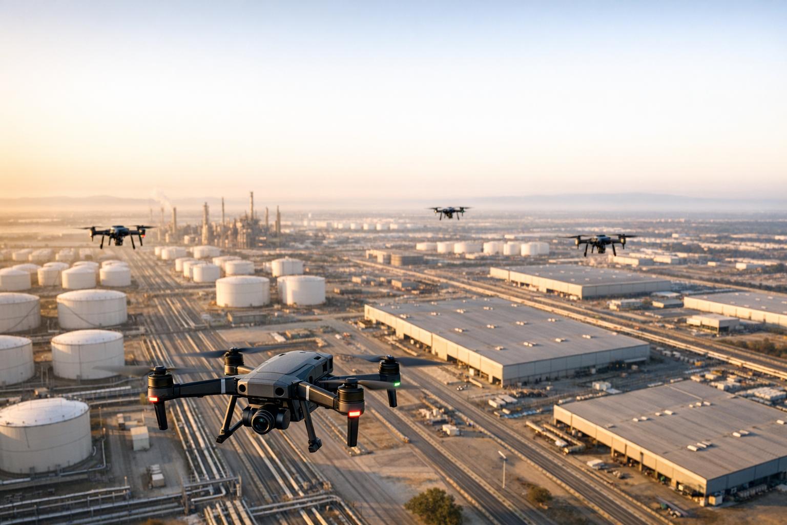
Multi-Drone Coordination and AI Analytics
For sites that cover hundreds or even thousands of acres, using multiple drones at once significantly speeds up inspections. Centralized software assigns specific zones to each drone, synchronizes their flight paths, and ensures they don’t collide. This method is especially useful for tasks like perimeter security, where multiple drones can patrol different sections and send real-time alerts for potential intrusions.
AI analytics further enhances these operations by processing data as it’s collected. Advanced computer vision algorithms can spot structural issues, temperature anomalies, or equipment malfunctions immediately - issues that might take hours for human reviewers to identify. For instance, in chemical plants, AI-powered drones equipped with thermal imaging can detect spills or leaks in real time and send instant alerts, enabling quick action.
Currently, over 43% of large North American manufacturing firms use drones for inspections, compliance, and testing. This number is projected to rise to over 60% by 2026.
Centralizing Drone Data with Management Platforms
When drones collect data across sprawling industrial sites, the next big challenge is managing and analyzing the massive datasets they generate. Without a centralized system, this data often ends up scattered across hard drives, cloud storage, and individual devices. The result? Silos that slow down decision-making and make it harder to track changes over time. A unified platform solves this by serving as a single hub where all drone data is stored, processed, and turned into actionable insights.
The global market for drone services is expected to grow more than tenfold from 2020 levels, reaching $515 million by 2030. This rapid expansion highlights the need for scalable systems that can handle increasing volumes of data without creating bottlenecks.
Hosting and Managing Multiple Data Types
Drone operations generate a variety of data formats, including 3D models, thermal imagery, LiDAR point clouds, orthomosaic maps, and 360° captures. Managing all these formats efficiently requires specialized systems. Platforms like Anvil Labs bring everything under one roof. For example, in 2025, Israel Chemical Industries (ICL) Dead Sea used autonomous drone systems to create 3D models and volumetric data, enabling precise inventory assessments across large operational areas.
Automation plays a key role in scaling these processes. Instead of manually uploading files and running analyses, centralized platforms automate the entire workflow - from uploading data to generating AI-driven insights and reports. AI-powered analytics can identify and prioritize anomalies for immediate attention. In industrial applications, AI-based data extraction achieves accuracy rates of up to 99%, while AI-driven visual analytics can cut weld inspection times by as much as 70%.
This streamlined approach not only simplifies data analysis but also enables seamless collaboration across devices.
Cross-Device Access and Secure Sharing
Centralized platforms go beyond data processing - they also ensure secure access and sharing. Cloud-based systems allow stakeholders to view live video streams and monitor site conditions from anywhere through a web browser. This capability is particularly important during emergencies or when coordinating remote teams. Anthony Foisy, Senior GIS Engineer, explains:
"FlytBase software provides real-time video streaming, seamlessly integrating with existing VMS. This enables immediate access to drone footage, ideal for monitoring large events, inspecting critical infrastructure, or emergency operations."
These platforms often include built-in tools for tasks like precise measurements and annotations. Security features such as end-to-end encryption, firewalled environments, and customizable access controls protect sensitive information. For example, in 2025, Florida Power and Light (FPL) used autonomous drones to locate power outage sources after storms, conducting 24/7 monitoring of hard-to-reach assets like power lines and solar panels.
Integration with enterprise systems further enhances efficiency. Drone workflows can connect directly with tools like Video Management Systems (VMS), ERPs, and asset management software, ensuring that inspection data feeds seamlessly into maintenance schedules for quicker repairs and component orders. Platforms like Anvil Labs also offer integrations with services like Matterport, YouTube, AI analytics tools, and task management systems, making it easier to incorporate drone data into daily operations.
Meeting Compliance Requirements and Preparing Your Team
Expanding drone operations across large industrial sites means navigating a complex regulatory landscape. A key development is the industry's adoption of the Part 108 framework, which sets the standard for autonomous BVLOS (Beyond Visual Line of Sight) operations. The FAA introduced the Part 108 Notice of Proposed Rulemaking on August 7, 2025, with the final rule anticipated between February and April 2026. This framework shifts accountability from individual pilots to organizational operators, requiring formal Safety Management Systems (SMS) and oversight protocols. These changes pave the way for updated approval processes and safety requirements.
Regulatory Approvals and Safety Standards
Under the current Part 107 regulations, scaling BVLOS operations requires securing waivers (14 CFR Part 107.31), which can take 90 to 120 days to process. Organizations typically obtain these waivers through methods like shielded operations, visual observer networks, or using Detect and Avoid (DAA) systems. The cost of DAA equipment varies significantly, ranging from $5,000 for basic ADS-B receivers to $50,000 for advanced radar and optical sensor arrays.
Part 108 introduces a more structured two-tier system for authorization. Operating Permits are designed for lower-risk operations, such as agricultural surveys, and impose fleet size limits. In contrast, Operating Certificates cater to more complex, large-scale operations in populated areas and have no fleet size restrictions. Organizations must appoint an Operations Supervisor to oversee all Part 108 activities and act as the primary point of contact with the FAA. Additionally, personnel in key roles must pass Level 3 TSA security threat assessments, which can take several months to complete. All scaled operations must also comply with Remote ID requirements under 14 CFR Part 89, ensuring airspace identification and monitoring. These regulatory frameworks are crucial when planning training programs and operational strategies.
Team Training and Hybrid Operational Models
Effective training starts with FAA Part 107 certification and progresses to BVLOS-specific courses that cover system operations, emergency procedures, and Crew Resource Management (CRM). Clearly defined roles are essential: the RPIC (Remote Pilot in Command) manages operations through the Ground Control Station, Visual Observers ensure situational safety, and Technical Operators monitor the drone's system health.
A hybrid operational model can streamline scaling efforts. By blending in-house oversight with licensed third-party contractors for high-volume data collection, organizations can scale quickly without the need to build large in-house teams from scratch. Flight Coordinators under Part 108 must log at least 5 hours of experience on a specific drone model, and their daily work hours are capped at 14 hours. Developing a detailed operational manual is also key - it should outline procedures for pre-flight planning, maintenance schedules, and incident reporting. This manual ensures consistent training and operational standards across the team. These strategies and training frameworks are essential for implementing scalable drone workflows across extensive industrial sites.
Rolling Out in Phases and Tracking Performance
Scaling operations successfully means taking a step-by-step approach and keeping a close eye on performance metrics. This builds on the earlier points about standardized workflows and centralized data management.
Pilot Projects and Standardized Templates
A pilot project is a smart first move. Start small - work with 10 to 20 structures or inspection points to fine-tune your drone operations, data collection, and analysis methods. This limited scale helps you build expertise while keeping initial costs low.
During the pilot, stick to manual data analysis until you’re consistently getting reliable results. Once you know what quality data looks like, you can shift to automated AI analysis. This method helps you set up strong quality control protocols, which are essential for long-term success. Use this phase to test different hardware and sensors, like LiDAR and RGB cameras, and nail down your quality standards.
Make sure to involve stakeholders early to align the pilot with operational goals. Define clear objectives upfront, such as the data you need, the accuracy levels you expect, and the outcomes you’re aiming for. It’s also a great time to streamline data management by implementing consistent file naming and cloud storage practices. Many organizations find that drone inspections can deliver a full return on investment within 12 to 18 months, often cutting costs by 50% to 80% compared to traditional methods.
Once the pilot proves your approach works, set clear KPIs to measure success as you scale up.
Key Performance Indicators (KPIs)
KPIs are essential for tracking how well your drone operations are performing. Start by measuring how much time you’re saving - tasks that used to take days can often be done in hours with drones. Cost savings are another big metric. Drone inspections typically cost between $200 and $800 per event, compared to $1,000 to $5,000 for traditional methods like helicopters or scaffolding.
Accuracy is another area to watch. Modern drones equipped with tools like advanced GPS and LiDAR can capture data with millimeter-level precision. Other useful KPIs include how many assets you can inspect per flight hour, how quickly you can process data, and the number of safety violations reported during operations.
After gathering data from these metrics, refine your approach and prepare to expand.
Continuous Improvement and Expansion
The lessons learned during the pilot phase and early deployments are invaluable. Use this knowledge to fine-tune your workflows before scaling up. For the first six months, review KPIs monthly, then switch to quarterly reviews to identify and address any bottlenecks in areas like data processing, flight scheduling, or team coordination.
As your team gets more comfortable and confident, you can gradually expand to additional sites or tackle more complex inspection scenarios. Professional drone management and data processing plans, starting at around $169 per month, can help handle larger data volumes. Keep in mind the ongoing costs of running a drone program, which typically range from $20,000 to $40,000 annually. These costs include training, insurance, and software subscriptions.
Conclusion
Scaling drone monitoring for large industrial sites requires more than just adding more drones - it's about creating a well-integrated system that works seamlessly. The construction industry alone loses around $1.2 trillion each year due to inefficiencies and waste, but drones have shown they can help turn things around. For instance, companies using drones for surveying have reported up to 20% savings on survey costs, and data quality improvements as high as 61% have been documented.
The first step to success is picking the right hardware for the job. Fixed-wing drones are ideal for covering vast areas, rotary-wing models shine in smaller, confined spaces, and hybrid systems offer flexibility, though they come with added complexity. But having the right equipment isn’t enough - it’s equally important to establish standardized workflows that ensure consistent data collection across all sites. Once the equipment and processes are in place, the next challenge is bringing all the data together.
Platforms like Anvil Labs make this possible by integrating drone data with BIM and GIS systems to create digital twins. These digital models allow for real-time decision-making and support various data types, from thermal imagery to LiDAR point clouds. Plus, they offer secure sharing and accessibility across devices, making collaboration easier.
Finally, scaling drone operations requires attention to compliance, training, and phased rollouts. Adhering to aviation regulations, privacy laws, and safety standards is non-negotiable. Pilot projects can help fine-tune operations before full-scale implementation, ensuring a smoother transition.
FAQs
How do I choose between multirotor, fixed-wing, and drone-in-a-box?
Choosing the right type of drone - multirotor, fixed-wing, or drone-in-a-box systems - boils down to your specific site requirements and objectives.
- Multirotors are your go-to for agility and precision. They excel in tight spaces and are perfect for detailed inspections where maneuverability is key.
- Fixed-wing drones shine when you need to cover vast areas. Their longer flight times make them ideal for surveying or monitoring expansive terrain.
- Drone-in-a-box systems take automation to the next level. These are designed for continuous, hands-off monitoring, especially for large or difficult-to-access locations.
Think about factors like the environment, how long missions will last, and the operational demands of your site to determine which option aligns best with your needs.
What do I need to scale BVLOS legally in the U.S.?
To operate drones Beyond Visual Line of Sight (BVLOS) legally in the U.S., you need to follow FAA regulations. This involves securing waivers or authorizations by proving your operations are safe and reliable. You'll need to present a detailed safety case, outline operational procedures, and implement strategies to reduce risks.
The main requirements include obtaining FAA approval, using certified pilots, ensuring drones are registered, adhering to airspace rules, and equipping drones with advanced safety features like detect-and-avoid systems.
What’s the best way to centralize and share drone data?
The most effective way to manage and share drone data for large industrial sites is by utilizing a secure platform that integrates multiple data types - such as 3D models, orthomosaics, thermal imagery, and LiDAR - into a single, streamlined system. Tools like Anvil Labs offer features like cloud hosting, access across devices, and collaboration tools, including annotations, measurements, and role-based access controls. This ensures your data remains secure while enabling smooth sharing and efficient management, even for complex, large-scale operations.
