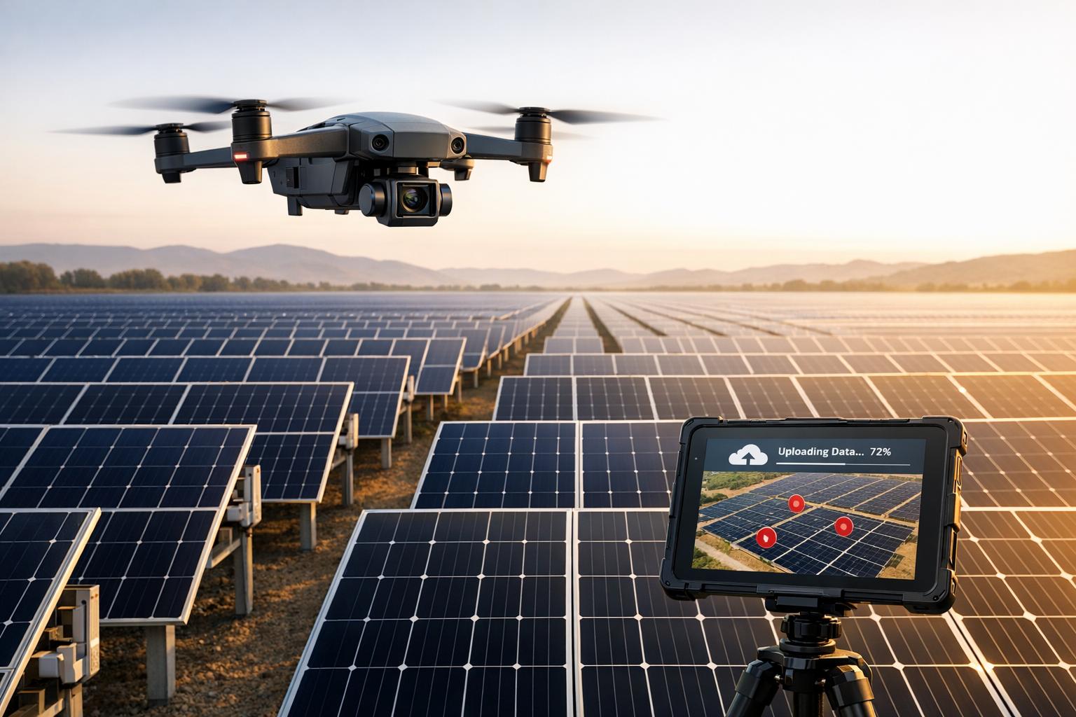
Managing drone data is challenging without the right tools. A single flight can generate hundreds of gigabytes of information, making traditional storage inefficient. Cloud platforms solve this by centralizing data, ensuring faster workflows, secure storage, and seamless collaboration.
Key benefits:
- Faster Inspections: Complete tasks 75% quicker.
- Improved Accuracy: AI tools detect 30% more defects.
- Cost Savings: Reduce site visits and labor expenses, with ROI in just 2 months.
Cloud solutions are essential for industries like construction, agriculture, and infrastructure, offering secure access, real-time collaboration, and advanced analytics. Platforms like Anvil Labs streamline drone operations, helping teams process, store, and share complex data efficiently.
For drone teams, adopting cloud technology isn’t just about storage - it’s about transforming workflows and staying competitive.

Enterprise Cloud Solutions for Drone Teams: Key Benefits and ROI Statistics
Core Features of Cloud Platforms for Drone Teams
Data Hosting and Processing
When it comes to drone operations, a solid hosting infrastructure does more than just store data - it transforms it into actionable insights. Cloud platforms designed for drone teams need to handle large, complex file types like LiDAR point clouds, thermal imagery, orthomosaics, and 360° panoramas without lag or performance issues. The best systems go beyond storage, offering flexible processing options. Whether it's converting raw drone data into over 20 deliverable formats or letting teams "Bring Your Own Model", these platforms adapt to various workflows. Some teams may prefer to process data in-house before uploading, while others rely entirely on the platform for data management from start to finish.
Automated AI tools take this a step further, streamlining tasks like defect detection and ensuring consistent quality control. Features like version control and audit trails allow teams to track changes over time, making it easier to monitor deterioration or verify completed repairs. These advanced capabilities not only boost efficiency but also meet the demands of large-scale projects. And with secure data sharing baked into the system, collaboration becomes seamless, even across geographically dispersed teams.
Secure Sharing and Team Collaboration
Handling sensitive drone footage requires top-notch security. Enterprise-grade measures like encryption, firewalls, and compliance with regulations such as GDPR and HIPAA are non-negotiable. But security isn't just about keeping data safe - it’s also about ensuring the right people have access. Role-based access controls let administrators tailor permissions, so field technicians, engineers, and executives only see the data relevant to their roles.
Collaboration features take this further by eliminating delays in reporting. As field teams upload data, office-based analysts can dive into processing immediately. Interactive report sharing allows stakeholders to explore 3D models and take measurements directly, speeding up approvals and cutting down on miscommunication - especially useful for teams spread across different locations or time zones.
Multi-Device Access and Platform Integrations
Secure collaboration becomes even more effective when paired with flexible device access and seamless integrations. Cross-device compatibility ensures team members can review data from anywhere, whether they’re in the office, on-site, or working remotely. This consistent access keeps everyone aligned, even when they're away from their primary workstations.
Platform integrations take functionality up a notch. Tools like Matterport allow teams to incorporate existing 3D captures, while YouTube integration simplifies sharing flight footage with external stakeholders. AI tools can automate defect detection, and integrations with task management systems enable teams to create action items directly from inspection results. By consolidating workflows that previously required juggling multiple apps, these integrations save time and reduce the risk of errors, making operations smoother and more efficient.
sbb-itb-ac6e058
How Anvil Labs Supports Drone Teams
Anvil Labs builds on scalable cloud technology to simplify drone operations and deliver impactful outcomes for industrial teams.
Data Management Tools
Anvil Labs offers a centralized platform for managing drone data, capable of handling everything from 360° panoramas and thermal imagery to orthomosaics, LiDAR scans, and point clouds. This all-in-one solution makes data storage and organization seamless. Teams can upload raw data using a drag-and-drop interface with over 20 processing options for deliverables, or they can host pre-processed models alongside new captures.
The platform features advanced photogrammetry tools that automatically correct for camera tilt and lens distortion, ensuring spatially accurate 3D models. Once data is processed, teams can annotate, measure volumes, and perform calculations directly within the platform. This transforms digital twins into effective virtual site assessment tools. The result? Inspections are completed 75% faster, and teams identify 30% more defects. Additionally, Anvil Labs connects users to a network of more than 10,000 drone pilots across the country. These capabilities seamlessly integrate into broader workflows.
Integration and Workflow Optimization
Anvil Labs bridges drone workflows with existing business tools by incorporating AI-powered analysis for automated defect detection and task management integrations. These features allow inspection results to generate actionable tasks automatically. Manual compliance tracking is replaced with automated reporting and spatial analysis, reducing errors and saving time.
Angel Rojas from Red Angel Drones shared, "My overall experience with the software has been satisfying because of the efficient workflow... The ROI is clearly marked within the first few uses."
Most users see a return on investment within just two months of using the platform. Alongside these integrations, the platform ensures data security with robust measures.
Security and Access for Enterprise Teams
To protect sensitive drone data, Anvil Labs employs secured storage with role-based access, ensuring that only authorized personnel can view project information. The cloud-based system enables immediate uploads from the field and quick desktop reviews, eliminating delays. Automated compliance checks ensure data integrity and adherence to industrial standards, reducing operational risks.
For companies managing infrastructure like bridges, highways, utilities, or mining sites, this centralized approach has proven highly cost-effective. Engineering firms and asset owners report saving hundreds of thousands of dollars compared to traditional inspection methods.
Adrian, a Drone Service Provider, remarked, "This is a differentiator. Those that aren't able to provide visualization but are just doing raw footage - this gives you, in my opinion, that competitive edge."
Implementing Cloud Solutions for Drone Teams
To make the most of cloud solutions for your drone team, it's essential to follow a structured approach. Here's how you can ensure a smooth implementation.
Assessing Team Requirements
Start by identifying your team's specific needs. Take inventory of the data your team collects - whether it's thermal imagery, LiDAR scans, orthomosaics, or 360° photos - and note the volume of data and the number of remote users involved. If your team operates in regulated industries, compliance should be a top priority. Choose platforms that meet strict standards like GDPR or HIPAA and offer robust security audits. Addressing these foundational needs early can save you from the hassle and expense of switching platforms later.
Evaluating Platform Features
When evaluating platforms, focus on scalability and integration. You need a system that can handle increasing data volumes without compromising performance. Features like real-time collaboration, version control, and simultaneous editing are particularly useful for teams working on shared projects. Security is equally critical - look for encryption and role-based access controls to protect sensitive data. To ensure smooth adoption, test the platform's usability through demo missions or trial accounts. A platform that's overly complex or requires extensive training can slow your team's workflow, so ease of use is a must.
Onboarding and Training
Proper onboarding and training are key to maximizing the platform's potential. Standardize flight capture protocols to maintain at least 80% overlap (85% recommended) and 70% sidelap (75% recommended) for accurate data processing. Use pre-loaded demo missions to help your team get comfortable with the platform. Train them on essential tasks like creating 3D annotations, managing embed access, and using measurement tools for area, distance, and volume calculations. For teams dealing with large data volumes, include API training to automate uploads and emphasize the importance of keeping browser tabs open until uploads are confirmed to avoid data loss.
Conclusion
Cloud-based solutions have become a game-changer for managing complex drone projects. Transitioning from traditional manual inspections to cloud-enabled workflows delivers impressive results: inspections are completed 75% faster, defect detection improves by 30%, and companies save hundreds of thousands of dollars compared to older methods. Even better, the return on investment often materializes within just two months of implementation.
Adrian, a drone service provider, highlights the competitive advantage of these tools:
"This is a differentiator. Those that aren't able to provide visualization but are just doing raw footage - this gives you, in my opinion, that competitive edge".
Providing processed 3D models, thermal analysis, and detailed spatial measurements gives teams a distinct edge over competitors offering only raw footage.
Anvil Labs tackles the challenges of drone data management with a powerful, scalable platform. It supports a variety of data formats, from LiDAR scans to thermal imagery, and connects users to a nationwide network of over 10,000 drone pilots, enabling operations to scale without the need for additional internal resources. The platform’s per-project pricing ensures predictable costs, making budgeting straightforward. These features make implementation smooth and efficient.
To fully leverage these capabilities, focus on strategic deployment. Align the platform’s tools with your team’s data and collaboration needs, assess features like security controls and integration options, and prioritize comprehensive onboarding. This approach will help drive faster, informed decisions across industries like infrastructure, utilities, mining, and beyond.
FAQs
How much cloud storage do drone teams actually need?
Drone operations generate a wide range of storage needs. While individual users might only need around 10GB, enterprise teams often require hundreds of gigabytes or more. For small fleets, daily storage demands can skyrocket to 150TB, depending on fleet size and the data being collected. Selecting a storage solution that can scale alongside your team's growth and data demands is essential for long-term success.
What security controls matter most for enterprise drone data?
To keep enterprise drone data safe, it's crucial to implement several key security measures:
- Role-based access controls (RBAC): Restrict access to sensitive data based on users' roles, ensuring only authorized personnel can view or modify critical information.
- End-to-end encryption: Secure data during transmission to prevent interception, ensuring that information remains protected from the drone to its final destination.
- Strong API security: Use practices like OAuth 2.0 for authentication, TLS encryption for secure connections, and input validation to guard against vulnerabilities and block unauthorized access.
These measures work together to reduce the risk of data breaches and unauthorized access, keeping drone data secure.
How do you connect drone data to your existing tools and workflows?
To integrate drone data into your tools and workflows, APIs and cloud platforms are your go-to solutions. For instance, platforms like Anvil Labs let you securely share and organize various data types, including 3D models and LiDAR, ensuring everything works smoothly together.
To make the process even more efficient, consider these steps:
- Standardize formats to avoid compatibility issues.
- Run pilot projects to test the integration before full-scale implementation.
- Use role-based access controls (RBAC) to maintain security and ensure compliance throughout the process.
These strategies can help you connect and manage drone data effectively.
