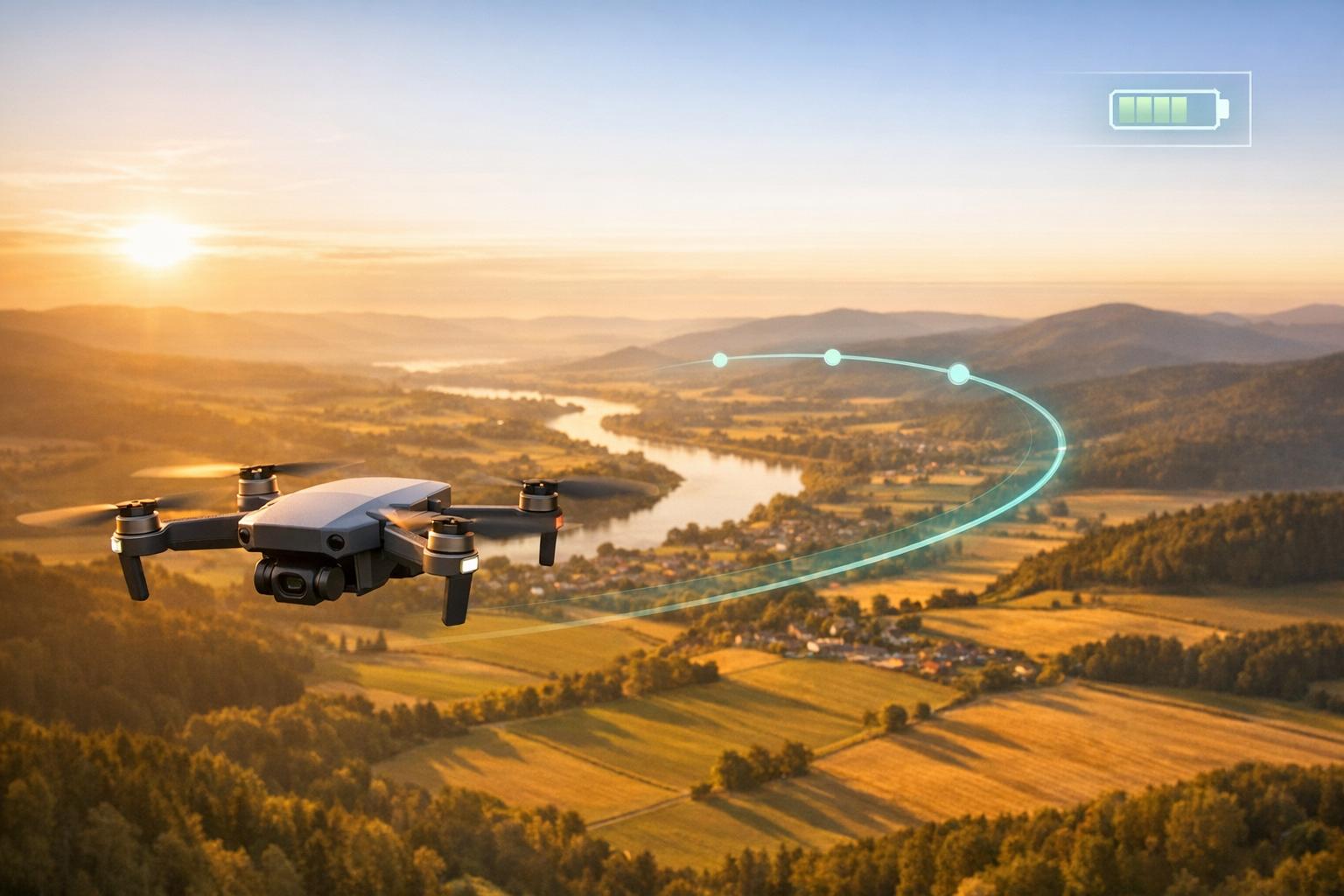
Drones are revolutionizing industries like monitoring, firefighting, and surveying, but limited battery life remains a challenge. Edge AI offers a solution by enabling drones to process data locally, reducing reliance on cloud networks. This approach improves real-time responsiveness and conserves energy, making it possible to optimize flight paths and extend mission durations.
Key takeaways:
- Edge AI reduces energy use by processing data onboard, avoiding power-draining data transmissions.
- Energy-efficient path planning can cut energy use by up to 50%, allowing drones to fly longer and farther.
- Recent advancements, like the E2EdgeAI and A3D frameworks, have improved onboard AI efficiency and extended flight ranges by over 25%.
- Lightweight AI models and hybrid edge-cloud systems further reduce battery consumption while maintaining performance.
These innovations are transforming how drones operate, enabling longer flights, smarter navigation, and broader applications in areas like wildfire response, infrastructure inspections, and conservation efforts.

Edge AI Energy Savings and Performance Improvements in Drone Operations
AI and ML in Drone Navigation: Insights for Product Development
sbb-itb-ac6e058
How Edge AI Reduces Energy Consumption in Drones
Edge AI helps drones save energy by processing data locally and making smart, real-time decisions. These methods directly tackle the battery drain issues that limit how far and how long drones can operate.
Onboard Processing Saves Power
Sending video feeds or images from a drone to a remote server eats up a lot of energy. Edge AI avoids this problem by processing data directly on the drone itself. As researchers from the University of Trento explained:
"Deep learning (DL) at the edge... reduces energy consumption by avoiding the transmission of data between the device and the server."
Tiny Machine Learning (TinyML) platforms are a great example of this. They can handle advanced tasks while using less than 1 mW of power. In October 2021, a team of researchers demonstrated this by equipping a DJI Tello drone with an OpenMV Cam H7 microcontroller for face mask detection. By using a quantized MobileNet V2 model, they brought RAM usage down to 296 KB and cut inference time from 1.7 seconds to just 859 milliseconds. Even though the drone’s flight time dropped by 30% due to the added payload, it still operated autonomously without needing a ground station.
Beyond processing data locally, making real-time decisions also plays a key role in conserving energy.
Real-Time Decision-Making for Smarter Flight Paths
While onboard processing reduces the need for energy-draining data transmission, real-time decision-making ensures drones use their energy efficiently during flight. This capability allows drones to instantly adjust their flight paths, avoiding unnecessary energy waste.
One example is the A3D (Adaptive, Accurate, and Autonomous) framework developed by Liekang Zeng's team, published in February 2024. This system uses deep reinforcement learning to continuously decide whether to process data onboard or on an edge server, while also adjusting image resolution as needed. Tested in real-world campus environments and AirSim simulations, this framework extended flight distances by 27.28% and cut latency by 28.06%. It strikes a balance between computational demands and navigation needs.
Another approach, E2EdgeAI, tested on Crazyflie tiny drones in December 2022, focused on optimizing memory access and processor core usage with an octa-core RISC-V chip. This method improved energy per inference by 78% and boosted overall energy efficiency by 5.6×.
Algorithms and Technologies for Energy-Efficient Path Planning
Energy-efficient path planning relies on smart algorithms that minimize battery usage by optimizing both computational and flight decisions. From compact machine learning models to hybrid processing systems, these approaches are reshaping drone operations.
Machine Learning Models for Path Optimization
Lightweight machine learning models are key to advanced path planning without draining a drone's battery. For example:
- Multi-Layer Perceptrons (MLPs) for path planning use less than 200 KB of memory.
- Tiny Convolutional Neural Networks (CNNs) for object detection require under 500 KB.
- Long Short-Term Memory (LSTM) networks for predicting flight sequences typically consume less than 300 KB of memory.
Techniques like 8-bit quantization and pruning make these models even more efficient, while hardware-aware designs, such as E2EdgeAI, align memory access patterns with processor capabilities to reduce energy use. Small adjustments, like switching from RGB to grayscale imagery, further cut computational demands and extend flight times.
Between 2023 and 2025, local AI systems became 5.3× more efficient in terms of intelligence per watt thanks to these advancements in algorithms and hardware. These improvements also enable drones to operate in coordinated groups for complex tasks.
Multi-Agent Systems and Swarm Coordination
Building on lightweight AI models, drone swarms enhance energy efficiency by reducing dependence on high-bandwidth communication with central ground stations. Instead, each drone uses its own small AI model to make decisions based on local data and occasional low-bandwidth updates from nearby units.
The Efficient Self UAV Swarm Network (ESUSN) demonstrates the impact of optimized swarm communication. By limiting active connections, ESUSN reduced energy use by 63% in a 5-drone swarm and 78% in a 10-drone swarm compared to traditional mesh networks. Communication delays also dropped by 53% and 64%, respectively.
A practical example comes from the EagleEye Swarm, deployed in November 2025 to monitor a 1,000-acre forest for illegal logging. Each of the 20 drones ran a 120 KB AI model on a Raspberry Pi 4. During its first month, the swarm identified 12 previously undetected illegal logging sites. As Adolfo Usier noted:
"Tiny models keep power consumption low, extend flight time, and let more drones be packed into a swarm."
Further energy savings come from multi-agent reinforcement learning (MARL), which helps drones anticipate demand and position themselves accordingly. For instance, in delivery scenarios, prioritizing heavier payloads early reduces the overall energy needed for the remaining flight.
Hybrid Edge-Cloud Architectures
Hybrid architectures combine local processing, edge servers, and cloud systems to balance performance with battery conservation. In this setup:
- Drones handle immediate tasks like obstacle avoidance.
- Edge servers manage intermediate tasks like depth estimation.
- Cloud systems tackle high-level tasks like semantic reasoning.
In December 2025, researchers introduced CoDrone, a hybrid framework tested in the AirSim simulation environment. CoDrone used the Depth Anything V2 model on edge servers for depth estimation and the Qwen-VL-Max vision-language model in the cloud for semantic guidance. A reinforcement learning scheduler dynamically decided whether to process data locally or offload it based on bandwidth and battery status. This setup extended average flight distances by 40% and improved navigation quality by 5% compared to baseline methods.
The team explained the importance of this balanced approach:
"Solely relying on onboard or edge-assisted computing may lead to performance degradation caused by latency or even navigation failures."
Hybrid systems also achieve over 80% energy savings compared to purely cloud-based methods. However, cloud-based Vision-Language Models often have inference delays exceeding 200 milliseconds, making them unsuitable for real-time control without local support. By dynamically balancing local and external processing, hybrid architectures ensure drones navigate efficiently while conserving power.
Applications of Edge AI in Energy-Efficient Drone Path Planning
Field tests show how energy-efficient planning can extend mission durations and improve coverage in diverse scenarios.
Wildfire Detection and Response
In November 2025, researchers from the Indian Institute of Science and the University of Southern California tested AeroResQ, an edge AI framework, during California wildfire scenarios like the Palisades fire. Using NVIDIA Jetson Orin AGX and Nano modules, this system processed fire detection algorithms directly on-board, achieving response times under 500 milliseconds while also generating safe evacuation routes for firefighters. By analyzing imagery locally, network usage was reduced by 83%. As S M Towhidul Islam and Xiaolin Hu noted:
"The proposed algorithm uses real-time data collected by the UAS to direct the UAS to monitor the wildfire with special attention to the most active regions of the fire."
The optimized edge AI models reached a 98.99% detection accuracy, with a 37% improvement in early detection rates. This distributed processing approach ensures rapid responses even in remote areas with unreliable connectivity, making it a critical tool for challenging wildfire conditions.
Infrastructure Monitoring and Maintenance
Energy-efficient navigation also enhances routine industrial inspections. The Improved Genetic Algorithm based Cooperative Path Planning (IGCPA) demonstrated a 17.35% reduction in energy costs compared to standard genetic algorithms when inspecting infrastructure like power plants and bridges. This improvement is largely due to minimizing flight turns, which consume significantly more energy than straight-line flights.
For complex infrastructure, the SSDP method calculates optimal paths with minimal overlap. In large-scale sites, edge AI divides global routes into manageable segments for drone swarms, ensuring each unit operates within its battery limits. Additionally, energy-optimized genetic algorithms can use two to five times less power than traditional greedy approaches by reducing unnecessary maneuvers. Distributed edge AI frameworks improve operational resilience too - if a lead drone fails, follower drones autonomously elect a new leader, preventing wasted energy from incomplete missions.
Environmental Monitoring and Conservation
Environmental applications also benefit from optimized path planning, enabling drones to operate longer and more reliably. In November 2025, researchers at the New Jersey Institute of Technology introduced EcoFlight for water quality monitoring in lakes and reservoirs. EcoFlight uses 3D topographic maps that account for altitude changes, wind resistance, and drone weight to identify energy-efficient flight paths in environments with dense obstacles like forests.
In wildlife tracking and conservation, edge AI systems maintain over 98% task completion rates despite battery or environmental challenges by automatically redistributing spatial workloads. By processing environmental data locally with deep neural networks, these drones can cover larger areas and extend their operational range without frequent recharging.
These examples highlight how edge AI is transforming drone operations by enabling energy-efficient navigation and extending mission capabilities. Platforms such as Anvil Labs are leveraging these advancements to provide precise, real-time spatial analysis for industrial and environmental applications.
The Future of Edge AI in Drone Path Planning
The next wave of drone navigation is set to leverage a cloud-edge-end framework, where tasks are efficiently divided among three layers. At the core, drones manage real-time steering and safety. Edge servers handle depth estimation and spatial awareness, while cloud systems perform high-level semantic reasoning powered by Vision-Language Models (VLMs). This layered approach tackles the challenge of balancing ultra-low latency needs with the computational demands of advanced decision-making. With the low-altitude economy projected to hit $400 billion by 2030, these hybrid systems are driving rapid advancements in drone technology.
Frameworks like CoDrone highlight the potential of hybrid architectures by dynamically allocating tasks. This flexibility allows drones to decide whether to process data onboard or offload it to edge servers, depending on real-time network conditions.
On the hardware side, advancements are making onboard AI more efficient, enabling even resource-limited drones to navigate autonomously in confined indoor spaces. For example, researchers are improving energy efficiency by using grayscale imagery instead of RGB for navigation models, which significantly reduces energy consumption and data transmission latency.
Future systems will push these innovations further by incorporating foundation models capable of handling open-set environments - scenarios that traditional networks struggle to manage. These advancements build on prior research in energy-efficient path planning, opening the door for drones to navigate more complex and unpredictable scenarios.
In practical terms, industrial operators can benefit from adaptive offloading and energy mapping strategies to optimize drone performance. Platforms like Anvil Labs are already exploring ways to integrate edge AI into spatial analysis tools, extending drone mission ranges and improving infrastructure monitoring.
As the concept of Quality of Navigation (QoN) becomes a standard metric for evaluating how well navigation decisions meet safety thresholds, the deployment of energy-efficient drone fleets will likely expand across industries. From environmental conservation to emergency response, these advancements promise to enhance the effectiveness and reach of drone operations.
FAQs
What hardware do I need to run edge AI on a drone?
To enable edge AI on a drone, you'll need onboard hardware capable of handling real-time data processing. This typically includes embedded GPUs or neural accelerators, such as the NVIDIA Jetson or Qualcomm Snapdragon. These components process sensor data directly on the drone, allowing for smooth and autonomous operations without relying on external systems.
When should a drone offload tasks to an edge server or the cloud?
When a drone needs to handle tasks that demand real-time processing, like obstacle avoidance or analyzing complex surroundings, it’s best to offload these to an edge server or the cloud. Doing so lightens the drone’s onboard computational workload and minimizes latency. This is particularly important in fast-changing or resource-limited situations where quick and efficient responses are crucial.
How do I measure energy savings without reducing navigation safety?
To gauge energy savings while maintaining safe navigation, focus on tracking essential metrics such as path length, obstacle avoidance performance, and battery efficiency. Compare energy consumption data from before and after implementing energy-efficient algorithms, ensuring that obstacle avoidance systems continue to function effectively.
Leveraging edge AI for real-time obstacle detection and adaptive path planning plays a key role in preventing collisions. At the same time, validating safety parameters - like maintaining proper obstacle clearance - ensures dependable navigation throughout the optimization process.
