Drone photogrammetry is changing how stockpile volumes are measured. It’s faster, safer, and more precise than traditional methods, making it ideal for industries like mining and construction. Here’s why it matters:
- Accuracy: Drone-based measurements have a 1–3% error margin, compared to 5–15% for older methods.
- Speed: Drones can survey 10–15 stockpiles in 20–40 minutes, while manual methods take nearly a full day.
- Safety: Remote operation eliminates risks like climbing unstable piles.
- Cost: Reduces man-hours by up to 60% and achieves ROI in under six months.
While drones excel in outdoor environments and complex audits, older techniques like GNSS still work well for small, simple, or indoor piles. Many operations combine both methods for flexibility and efficiency.
| Feature | Drone Photogrammetry | Manual Methods (GNSS, Total Station) |
|---|---|---|
| Accuracy | 1–3% error margin | 2.3–2.94% (controlled); 5–15% otherwise |
| Data Points | Millions per survey | 50–100 per pile |
| Speed | 20–40 minutes (10–15 piles) | Full day (10–15 piles) |
| Safety | No on-site hazards | Requires climbing piles |
| Cost Efficiency | Saves labor, ROI in 6 months | Higher labor costs |
Drones are reshaping stockpile management by combining precision, speed, and safety. But for small-scale or indoor tasks, traditional methods still hold their ground.

Drone Photogrammetry vs Traditional Methods for Stockpile Volume Measurement
How to measure stockpile volumes using drones? | Complete workflow | Hammer Missions

sbb-itb-ac6e058
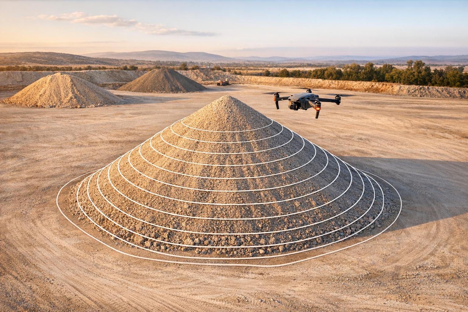
1. Drone Photogrammetry
Drone photogrammetry has transformed stockpile volume measurement by offering a comprehensive view of entire piles in just a single flight. Unlike traditional methods, drones capture millions of data points - ranging from 100 to 500 per square meter - resulting in high-resolution digital surface models. These models detail every contour, slope, and irregularity, significantly reducing the uncertainty caused by relying on sparse data points.
Accuracy
The precision of drone photogrammetry is impressive. By using RTK (Real-Time Kinematic) or PPK (Post-Processed Kinematic) workflows, horizontal and vertical accuracy can be kept within 1.2 inches (3 cm). When Ground Control Points (GCPs) are added, Surface RMSE typically stays within ±1.2 to 2 inches (3 to 5 cm) . Volume measurements can achieve accuracy levels of 1%–3%. For instance, one study showed a UAV approach differed by only 2.94% from actual mill-machine volumes.
"Drone-derived point clouds deliver 'to-the-inch' volumes that auditors can verify, streamlining reconciliation cycles and supporting emissions-mass-balance requirements." - Advexure
To ensure maximum accuracy, maintain an 80% front overlap and a 70% side overlap, strategically place GCPs around the perimeter and at high points, and include 2–3 checkpoints for quality control.
These advancements in precision have paved the way for significant improvements in operational efficiency.
Efficiency
Compared to traditional GNSS surveys, drones are a major time-saver. While GNSS surveys might take an entire day to measure 10 to 15 stockpiles, a drone can complete the same task in just 20 to 40 minutes. For example, in 2018, PricewaterhouseCoopers (PwC) used a DJI Phantom 4 to survey a coal pile in only 30 minutes. Similarly, Balfour Beatty reduced rail-ballast yard surveys to a 15-minute flight, followed by a two-hour processing time.
"By swapping clipboards for point-clouds, mines reclaim hours of survey time and keep boots off unstable slopes, sharply reducing fall-hazard exposure." - Advexure
The efficiency gains are remarkable across industries. Event 38 cut monthly stockpile management time from 40 hours to 16 hours, saving 60% in man-hours. Idaho Forest Group saw an 80% reduction in field time after adopting a WingtraOne drone program, achieving full ROI in under six months. Processing tools like DJI Terra further enhance efficiency, processing 500 photos in just 25 minutes - four times faster than older methods.
This combination of faster data capture and reduced labor not only boosts safety but also lowers operational costs.
Data Density
Drones capture dense datasets that eliminate many of the interpolation errors common with traditional methods, which often rely on sparse spot heights. This high-density data ensures repeatable results, with surveys of undisturbed piles yielding volume measurements within 1% to 2% of each other. Beyond volume metrics, drones produce deliverables like 3D meshes, orthomosaics, and heatmaps, offering valuable visual insights for inventory management - capabilities that far surpass manual methods.
Cost
While the upfront costs of drone photogrammetry can vary, the long-term savings are undeniable. Programs commonly reduce man-hours by about 60% and field time by up to 80%, leading to full ROI in less than six months. These time and cost savings allow teams to focus on higher-priority tasks while minimizing the risks associated with climbing stockpiles. For clean, well-lit aggregate yards, drone photogrammetry also serves as a cost-effective alternative to LiDAR, which requires heavier and more expensive equipment. However, LiDAR remains the better choice for areas with dense vegetation or shadowed conditions, such as coal piles.
2. Traditional Methods (Manual Surveying, Total Stations, GNSS)
Before drones became a go-to solution, stockpile volumes were measured using manual surveying, total stations, and GNSS rovers. While drones now offer faster and more detailed data collection, these older techniques are still valued for their precision in controlled settings. However, they require surveyors to collect data points manually, one at a time, making the process both labor-intensive and time-consuming.
Accuracy
Total stations and GNSS equipment excel at capturing highly accurate point measurements. For example, in March 2021, researchers Oluibukun Gbenga Ajayi and John Ajulo from the Federal University of Technology, Minna, conducted a study on a twin-stockpile of gravel. Using a Leica TS06 Total Station, they collected ground data, processed it in ArcGIS, and created a TIN model. Their method estimated the stockpile volume at 2,830.713 m³, compared to a known standard of 2,750 m³, showing a difference of just 2.94%. This level of accuracy meets the ±3% standard required by mining regulations in many regions. However, accuracy in these methods depends heavily on the number of points collected. Sparse data collection can lead to volume errors ranging from 5% to 15%.
Efficiency
Surveying 10 to 15 stockpiles with GNSS can take nearly an entire day. Manual GNSS grid surveys for larger piles typically capture only 50 to 100 data points, relying on interpolation to fill in gaps. This process often involves climbing unstable slopes, navigating hazardous zones, and working around active machinery - all of which increase safety risks and disrupt operations. These challenges make traditional methods less efficient for modern, fast-paced workflows.
Data Density
Traditional methods capture a limited number of data points - usually between 50 and 100 per pile. This sparse data collection misses finer surface details, forcing software to interpolate and potentially introducing errors, especially on irregularly shaped piles.
Cost
The combination of low data density and slower processes adds hidden costs to traditional methods. These inaccuracies can cost a quarry $60,000–$70,000 annually. Additionally, the labor-intensive nature of these techniques reduces cost efficiency. Transitioning to drone-based workflows can cut man-hours by 60%. Traditional methods are only cost-effective for very small, simple, and isolated stockpiles where advanced technology may not be worth the investment.
Advantages and Disadvantages
As discussed earlier, accurate volume measurement is essential for both efficiency and safety. When it comes to stockpile volume measurement, drone photogrammetry and traditional methods each bring their own strengths and weaknesses to the table. The comparison below outlines the key differences to help you decide which method aligns best with your needs.
| Feature | Drone Photogrammetry | Traditional Methods (Total Station/GNSS) |
|---|---|---|
| Accuracy | 1–3% volume error | 2.3–2.94% for controlled surveys; 5–15% for tape-and-formula methods |
| Data Density | Millions of points (100–500 per m²) | 50–100 spot heights per pile |
| Speed (10–15 piles) | 20–40 minutes | Most of a full day |
| Safety | High - remote operation avoids climbing hazards | Low - requires walking unstable slopes near machinery |
| Cost Efficiency | Lower recurring labor costs; higher upfront tech investment | Higher recurring labor costs; 60% more man-hours |
| Deliverables | 3D models, orthomosaics, elevation heatmaps | Single volume figure |
| Environment | Outdoor only (requires GPS and open sky) | Suitable for both indoor and outdoor use |
| Best Use Case | Multiple, irregular piles; frequent audits; safety-critical sites | Single, small, regular-shaped cones; indoor stockpiles |
This comparison highlights how each method serves specific operational needs. Drones shine in terms of speed, safety, and the sheer amount of data they collect. They eliminate on-site risks and provide detailed outputs like 3D models and orthomosaics. On the other hand, traditional methods are a better fit for simpler tasks, such as measuring small, isolated piles or working in indoor environments where drones might not be practical.
"A surveyor with GNSS measuring 10 to 15 piles on a busy quarry or depot needs most of a day... Same 10 to 15 piles, 20 to 40 minutes of flight time [with a drone]." - Fergal McCarthy, Founder & Chief Pilot, Drone Services Ireland
Given these differences, many operations opt for a hybrid approach. Drones are often used for routine monthly or quarterly inventories, while traditional equipment is kept on hand for restricted airspace zones or covered storage areas where drones can't operate. The key is to choose the right tool for the task - drones for large-scale and frequent measurements, and traditional methods for specific, niche scenarios.
Conclusion
Drone photogrammetry has revolutionized stockpile volume measurement, offering unmatched speed and precision. With volume accuracy ranging between 1%–3%, these drones can survey 10–15 stockpiles in just 20–40 minutes - a process that’s not only faster but also far safer than traditional methods.
But it’s not just about speed. Drones deliver georeferenced orthomosaics, 3D point clouds, and elevation heatmaps, transforming static data into actionable insights. This shift highlights how drone technology is reshaping stockpile management by making processes more efficient and data-driven.
"Drone-based LiDAR and high-overlap photogrammetry workflows are stripping the danger, drudgery, and delay out of stockpile measurement." - Advexure
To maximize the value of this data, innovative platforms like Anvil Labs automate the workflow. They process drone imagery by correcting lens distortion and elevation changes to produce accurate 3D models. These models are accessible across devices, enabling teams to calculate volumes, compare current conditions with design plans, and securely share insights with stakeholders. Integration with ERP systems adds another layer of utility, allowing real-time inventory reconciliation and reducing the risk of costly errors caused by miscounted stockpiles.
While drones shine in routine audits, traditional surveying still has its place, especially in confined or indoor environments. Together, these methods create a balanced approach, with drone photogrammetry serving as a cornerstone of modern, efficient stockpile management.
FAQs
What flight settings produce the most accurate stockpile volumes?
Accurately measuring stockpile volumes requires the use of RTK-enabled drones for pinpoint positioning. To ensure high-quality data during drone photogrammetry, it's also crucial to maintain proper image overlap and operate under good lighting conditions. These steps help capture more reliable and detailed information.
When are GNSS or total stations a better choice than drones?
When tasks demand extremely high precision, especially on flat and stable surfaces, GNSS and total stations are often the best tools for the job. These methods shine in scenarios where control points are readily accessible, and safety concerns are minimal.
On the other hand, drones are incredibly efficient for surveying large or irregular stockpiles. However, they may fall short of the ultra-precise accuracy provided by GNSS or total stations in tightly controlled environments, making the latter the go-to choice when maximum precision is a priority.
How do you verify drone volume results for audits?
Drone volume results can be verified by comparing the drone-derived measurements with trusted reference data, like a GNSS grid survey. Generally, drone volumetric surveys are accurate within 1-3% of reference volumes. If the drone-calculated volume falls within this range, it can be considered reliable for tasks like audits, inventory checks, and reporting.
