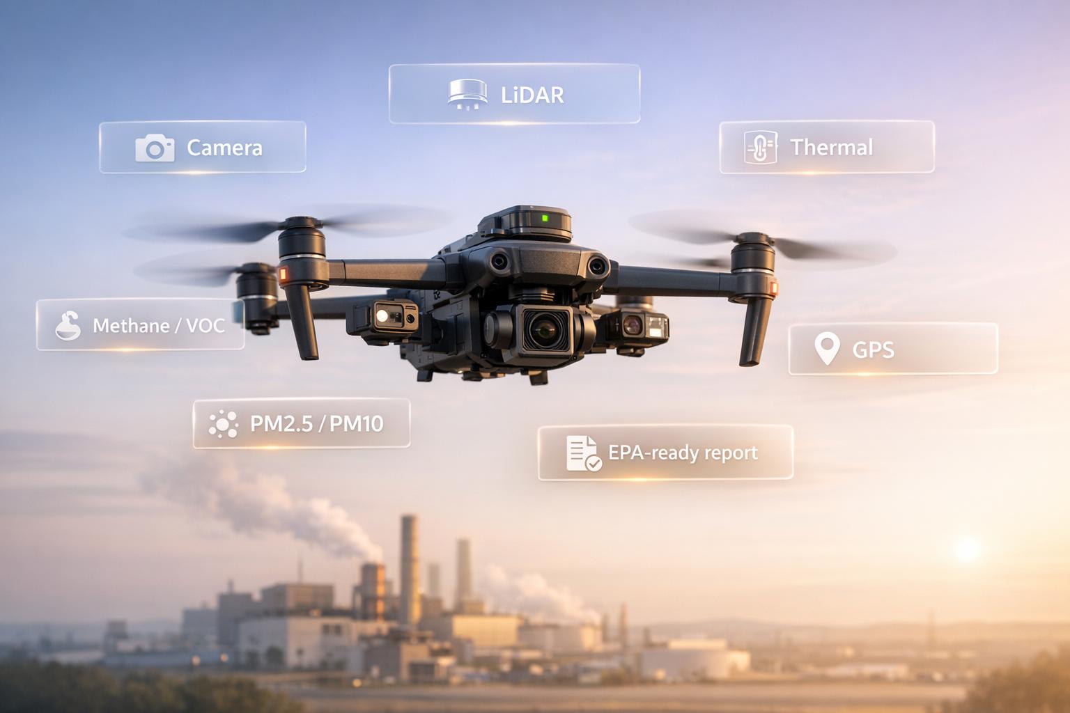
Drones are transforming how facilities meet EPA air emissions rules. They offer faster, safer, and more accurate inspections compared to traditional methods. Here's what you need to know:
- High-Resolution RGB Cameras: Visualize emissions with geotagged 4K video.
- Multispectral Sensors: Detect invisible gases like NO2 and CO.
- Thermal Infrared Sensors: Identify heat signatures for fugitive leaks.
- Particulate Matter (PM) Sensors: Measure dust and aerosols in real-time.
- VOC and Methane Sensors: Track volatile organic compounds and methane leaks.
- Real-Time Data Transmission: Stream and process data during flights.
- Precise GPS Geotagging: Pinpoint emission sources accurately.
- Extended Battery Life: Cover large areas with fewer interruptions.
- LiDAR Technology: Create 3D emission models for detailed analysis.
- EPA-Compliant Software: Simplify reporting with automated data formats.
These features help facilities meet tighter EPA deadlines, avoid penalties, and improve air quality monitoring.

10 Essential Drone Features for EPA Air Emissions Compliance
EPA uses new technology to protect the environment

sbb-itb-ac6e058
1. High-Resolution RGB Cameras for Visual Emissions Detection
High-resolution RGB cameras are essential tools for documenting fugitive emissions, such as flare plumes or stack discharges. With their 4K resolution, these cameras allow operators to safely observe and record emission events while staying compliant with regulatory standards.
Sensor Accuracy and Sensitivity
The effectiveness of these cameras lies in their ability to combine real-time video with precise geolocation. Live video feeds enable operators to visually confirm emissions from a safe distance, while each frame is geotagged with detailed GPS and altitude data. Advanced drone systems further enhance accuracy by using patented sampling methods that reduce downwash, ensuring the integrity of natural emissions. These drones can operate at altitudes of up to 150 meters (approximately 492 feet), offering thorough coverage of elevated emission sources. This precise geolocation ensures smooth integration of data into broader systems.
Data Processing and Reporting Integration
The visual data captured by these cameras is often paired with other sensor measurements, such as temperature and humidity, using secure transmission protocols like LoRa. High-performance systems analyze data in real time, processing over 100 samples per second during flight. The integrated software then generates 3D heat maps and dispersion models, simplifying the process of creating reports for the EPA.
Compliance with EPA Standards
Once the data is collected and processed, meeting regulatory requirements becomes the priority. Drones weighing over 0.55 lbs must be registered with the FAA, and many airspaces require Remote ID technology to electronically broadcast operator details. Operators also need to maintain visual line-of-sight, follow altitude restrictions, and secure pre-approved flight plans or special authorizations when operating near critical infrastructure.
2. Multispectral and Hyperspectral Sensors for Gas Plume Mapping
Multispectral and hyperspectral sensors go beyond the capabilities of high-resolution visual sensors by detecting multiple wavelengths. This makes them ideal for mapping invisible gas plumes like NO2, SO2, and CO. These sensors are especially helpful for spotting emission hotspots and determining optimal locations for future regulatory monitors.
Sensor Accuracy and Sensitivity
In February 2024, the EPA released supplemental reports outlining performance benchmarks for NO2, CO, and SO2 sensors. These benchmarks were validated through both field and lab testing, comparing sensor outputs to those of regulatory-grade monitors. It's important to note that these sensors are intended for Non-regulatory Supplemental and Informational Monitoring (NSIM) rather than formal regulatory reporting.
"EPA has recognized that air sensors will not meet the stringent requirements for air quality instruments used for regulatory purposes, although they may have utility for a variety of non-regulatory applications such as understanding local air quality, identifying hotspots, or helping to identify sites for regulatory monitors." - US EPA
For drone operators, this means using multispectral data as a complement to, not a replacement for, traditional air quality monitoring methods. The verified accuracy of these sensors ensures they can integrate smoothly with existing data systems.
Data Processing and Reporting Integration
As of March 23, 2026, the EPA's Air Sensor Toolbox offers updated testing protocols and performance metrics. A key resource is the "sensortoolkit" Python library, which enables users to process drone-mounted sensor data by reformatting it and comparing it with reference data from ambient monitoring stations. To ensure consistency, the EPA provides approved templates (Appendix F) for reporting test results. Additionally, sensors must adhere to ASTM D8559-24, the standard for portable and fixed-point ambient air quality sensors.
3. Thermal Infrared Sensors for Heat and Fugitive Emission Tracking
Thermal infrared sensors are game-changers when it comes to spotting heat signatures that regular cameras simply can't detect. They can pinpoint fugitive emissions, active combustion sources, overheating equipment, and hidden leaks. This level of precision doesn't just improve detection - it also ensures compliance with strict EPA regulations.
Compliance with EPA Standards
Thermal drone footage has proven invaluable in exposing violations of the Clean Air Act. For example, in early 2025, Floodlight and The Guardian used thermal imagery - captured by producer Evan Simon - to uncover 15 unpermitted gas turbines operating at xAI's data centers in Southaven, Mississippi, and Memphis, Tennessee. These turbines were running two weeks past an EPA-mandated permit deadline. The projections? Over 6,000,000 tons of greenhouse gases and more than 1,300 tons of air pollutants annually.
"That is a violation of the law." - Bruce Buckheit, Former EPA Air Enforcement Chief
The thermal evidence directly challenged state regulators' claims that the turbines were exempt, offering clear, visual proof to settle disputes between state and federal agencies. This kind of documentation, provided by thermal sensors, works hand-in-hand with other sensor data to deliver a full picture for EPA reporting.
Flight Efficiency and Coverage
Thermal sensors aren't just about compliance - they also boost operational efficiency. These drones are especially effective at surveying industrial sites with limited access. In the xAI investigation, drones equipped with thermal sensors scanned a 114-acre complex, allowing operators to remotely locate and count active heat-emitting units. This approach saves time and resources while enhancing accuracy.
4. Particulate Matter (PM) Sensors for Dust and Aerosol Measurement
Drone-mounted PM sensors provide precise detection of dust and aerosols (PM1.0, PM2.5, and PM10), making them indispensable for EPA reporting.
Sensor Accuracy and Sensitivity
The Sniffer4D Nano2 stands out as a compact yet industrial-grade solution. Weighing just 7 ounces, this sensor delivers exceptional sensitivity without compromising the drone's flight capabilities. Rafael Suárez from DroneXL highlighted its performance:
"That is not a consumer air quality sensor. That is industrial-grade instrumentation in a package small enough to fly on a drone that also carries a full camera and obstacle avoidance suite without breaking a sweat."
For even greater accuracy, pairing sensors with stable platforms like the DJI Matrice 400 is key. This drone is built to endure challenging conditions, boasting an IP55 rating and an operating range of –4°F to 122°F. Such durability ensures reliable data collection even in environments where manual sampling would be unsafe or impractical, such as during storms or in heavy dust.
Once accurate data is captured, it’s immediately processed for real-time compliance purposes.
Data Processing and Reporting Integration
Gone are the days of waiting for post-flight data analysis. Tools like Sniffer4D Mapper allow operators to process PM data in real time, creating 2D isolines and 3D point clouds while the drone is still airborne. As DroneXL observed:
"Operators do not return to the office with raw data files. They watch the plume build on a map while the drone is still in the air."
Additionally, multi-payload configurations enable PM sensors to work alongside other modules, such as those detecting methane or VOCs. This creates a complete chemical profile within a single flight. The DJI M400, capable of supporting up to 13.2 pounds of payload across seven mount points, allows operators to screen emissions comprehensively without requiring multiple missions.
Flight Efficiency and Coverage
Extended flight capabilities make large-scale PM monitoring practical and efficient. The DJI M400 offers up to 59 minutes of flight time with a transmission range of 25 miles, enabling operators to cover vast industrial sites in a single mission. This is particularly advantageous in hazardous settings like landfills, refineries, or chemical plants, where direct human intervention could pose significant risks.
The seamless integration of these sensors with advanced drones not only improves efficiency but also strengthens compliance with EPA standards.
| Feature | Specification (Sniffer4D Nano2 / DJI M400) | Benefit for EPA Reporting |
|---|---|---|
| PM Sizes Detected | PM1.0, PM2.5, PM10 | Comprehensive particulate profiling |
| Module Weight | 7 ounces | Supports multi-sensor configurations |
| Flight Endurance | Up to 59 minutes | Enables long-duration monitoring |
| Data Visualization | 2D Grids, 2D Isolines, 3D Point Clouds | Real-time detection of emission hotspots |
| Operating Temp | –4°F to 122°F | Consistent performance in harsh climates |
| Environmental Rating | IP55 | Operates reliably in adverse conditions |
5. VOC and Methane-Specific Gas Sensors
A dual-sensor setup that combines Optical Gas Imaging (OGI) cameras with flammable-gas sensors is highly effective for detecting volatile organic compounds (VOCs) and methane. OGI cameras excel at visually locating gas plumes by identifying absorption features in the long-wave infrared spectrum, while flammable-gas sensors measure concentration levels relative to the Lower Explosive Limit (%LEL). Together, these tools provide the visual evidence and time-stamped readings necessary for meeting EPA compliance requirements.
Sensor Accuracy and Sensitivity
High-sensitivity sensors are capable of identifying fugitive emissions that traditional equipment often misses. For instance, the Scentroid DR1000 processes data at over 100 samples per second, enabling operators to create detailed 3D maps of gas plumes. This device has been successfully used in real-world scenarios to trace urban smog sources and assist in enforcement actions.
To improve sampling accuracy, advanced probes ranging from 17 to 35 inches are used to avoid turbulence caused by rotors. For OGI operations, flying at slower speeds and planning flights during periods of high temperature contrast (ΔT) can further boost detection reliability.
Data Processing and Reporting Integration
Modern sensors automatically log critical data such as GPS coordinates, elevation, time, temperature, and humidity. Systems like DRIMS2 then process this data into user-friendly formats like heat maps and 3D models. Export options in CSV or JSON formats allow for geotagged traces, creating a clear audit trail that pinpoints exactly where exceedances occurred.
To ensure accuracy, regular bump tests and sensor zeroing before flights are essential to minimize drift. For OGI data, operators should revisit suspected leaks from multiple angles to avoid false positives caused by factors like heat shimmer or reflections. These streamlined processes integrate seamlessly into compliance reporting workflows.
| Sensor Type | Target Pollutant | Detection Technology |
|---|---|---|
| TVOC Sensor | Volatile Organic Compounds | Photo-Ionization Detection (PID) |
| Methane Sensor | CH4 | Non-Dispersive Infrared (NDIR) |
| %LEL Sensor | Flammable Gases | Catalytic Bead or Infrared |
Flight Efficiency and Coverage
Efficient sensor performance is key to maximizing flight time, which is critical for large-scale monitoring. The Scentroid DR1000 provides up to 3 hours of continuous operation thanks to its fast-charge battery. Meanwhile, hybrid platforms like the Skyfront Perimeter 8 can remain airborne for over 5 hours, enabling the coverage of extensive pipeline networks in a single mission. Secure real-time data transmission is achieved using the LoRa protocol, ensuring encrypted communication between the sensor and ground station throughout these extended flights.
Compliance with EPA Standards
Accurate sensor data plays a critical role in meeting EPA standards. In December 2023, the EPA finalized methane regulations, with 2024 state-plan requirements explicitly referencing OGI procedures. While OGI excels as a detection method under EPA Appendix K, direct emission-rate measurements often require approved techniques like drone-based methane LiDAR. Including contextual data - such as ventilation settings, wind speed, and ambient temperatures - enhances the interpretation of sensor readings during regulatory reviews.
6. Real-Time Data Transmission and Onboard Processing
Real-time data transmission lets operators monitor emissions as they occur, eliminating delays tied to post-flight analysis. Drones equipped with 4G/5G networks or specialized radio links can stream video and sensor data straight to ground stations. This instant access enables the immediate identification of pollutants, which is crucial for adhering to EPA repair timelines - 15 days for AVO (audio, visual, and olfactory) findings and 30 days for OGI (optical gas imaging) detections under NSPS OOOOb regulations. Additionally, this live feed integrates seamlessly with onboard data processing systems.
Data Processing and Reporting Integration
With onboard processors, drones can analyze sensor data during flights, filter out noise, and identify emission plumes in real time. For example, the EPA-approved Kolibri sensor employs edge computing to capture and process data instantly. It can operate pumps and transmit live readings for gases like CO2, methane, and particulate matter.
This method not only minimizes the amount of raw data but also generates immediate alerts, making compliance reporting faster and more efficient. It aligns perfectly with the EPA's 2023 methane rules, which emphasize streamlined reporting.
Many systems are designed to integrate directly with EPA-compliant formats such as XML for Air Emissions Reporting Requirements (AERR). A standout example is the SnifferDRONE CH4 UAS, which the EPA approved in December 2022 as an alternative to Method 21. Using onboard DSEM algorithms, this drone quantifies methane emissions in real time, making it ideal for landfill monitoring. Additionally, geotagged data streams automatically generate logs that are compatible with enterprise systems.
Flight Efficiency and Coverage
Real-time data capabilities also enhance flight efficiency. By allowing pilots to adjust flight paths dynamically, drones can optimize their operations based on live plume detection. This flexibility reduces flight times over large oil and gas facilities, providing a more cost-effective solution compared to manned aircraft.
Drones can also respond immediately to significant emissions, such as super-emitters releasing over 100 kg/hr of methane. This ensures compliance with quarterly OGI monitoring requirements and enables timely notifications to certified third parties.
7. GPS Precision and Geotagging for Emission Source Attribution
When it comes to pinpointing emission sources, precise GPS data is a game-changer. By pairing sensor readings with exact location, time, and elevation, GPS data transforms air quality measurements into legally reliable evidence. Every air sample captured by a drone must be automatically geotagged with key details like GPS coordinates, elevation, time, date, temperature, and humidity. This automated process ensures accuracy in identifying emission origins, leaving no room for guesswork.
Sensor Accuracy and Sensitivity
Getting the vertical positioning right is just as important as horizontal accuracy, especially for meeting EPA standards. By combining barometric sensors with GPS, systems like the DR1000 air analyzer achieve incredible precision. This device processes over 100 samples per second and logs one sample per second, providing highly accurate elevation data critical for 3D emissions modeling and stack monitoring. With this level of detail, emission anomalies can be mapped in three dimensions, feeding directly into GIS systems for more detailed and actionable emission maps.
Data Processing and Reporting Integration
Modern tools simplify the process of turning GPS-tagged data into formats that EPA reviewers and GIS professionals can easily work with. For instance, the Air Sensor Data Unifier (ASDU) exports sensor logs into Keyhole Markup Language (KML), making them compatible with tools like Google Earth and other GIS platforms. SENTINEL takes it a step further by integrating meteorological data, concentration levels, and operational details to create detailed emission source maps. Meanwhile, the EPA's Real Time Geospatial Data Viewer (RETIGO) - with its Version 5 expected in late 2025 - offers a way to visualize environmental data alongside specific drone flight paths. These KML files can also be used in platforms like Anvil Labs, which specialize in 3D modeling and spatial analysis, ensuring EPA reports are both comprehensive and easy to interpret.
Compliance with EPA Standards
Accurate and secure data handling is critical for meeting EPA requirements. This starts with secure transmission. Using Long Range Radio (LoRa protocol), GPS-tagged data is encrypted and sent to ground stations in real time, minimizing the risk of data loss during critical operations. Sensors calibrated to ISO 9001 standards further ensure the quality and reliability of EPA reports. To avoid any gaps in compliance reporting, data is redundantly stored on an internal 16GB SD card and transmitted to cloud servers, safeguarding against potential data loss.
8. Extended Battery Life and Autonomous Flight Paths
Flight Efficiency and Coverage
Longer battery life combined with automated flight paths allows drones to effectively survey large industrial sites. By following pre-programmed routes, drones can systematically inspect extensive areas, ensuring that hidden issues, like fugitive emissions or unpermitted equipment, aren’t missed during ground-level checks. What’s more, these repeatable flight patterns provide consistent, reliable data essential for maintaining compliance with EPA regulations. With extended battery life, drones can stay airborne longer, reducing the need for frequent recharging and enabling more comprehensive coverage in a single mission. This approach not only improves operational efficiency but also delivers strong evidence needed for regulatory adherence.
Compliance with EPA Standards
Autonomous flight paths don’t just improve efficiency - they also play a key role in gathering critical evidence for meeting EPA standards. For example, thermal drone footage has uncovered unpermitted turbines operating at industrial facilities without federal oversight. Bruce Buckheit, a former EPA air enforcement chief, pointed out:
"That is a violation of the law."
The environmental impact of such violations is staggering, as a single unregulated facility can release millions of tons of greenhouse gases each year. This underscores the importance of precise, automated monitoring. When paired with advanced sensors, drones simplify the process of collecting and reporting data to meet EPA air emissions requirements.
9. Software Integration for EPA Reporting Formats
Effective software integration plays a key role in ensuring smooth, EPA-compliant reporting processes, building on the foundation of real-time onboard data processing.
Data Processing and Reporting Integration
Seamlessly integrating software is essential for meeting EPA regulations. Drone sensors collect emissions data, which must flow directly into Environmental Management Information Systems (EMIS) designed to produce EPA-compliant reports. Relying on manual data transfers can lead to inefficiencies and errors - issues that account for 30% of EPA violations and can result in fines reaching millions of dollars. Automated platforms simplify this process by syncing real-time drone data into formats required by programs like the Clean Air Act (CAA), National Emission Standards for Hazardous Air Pollutants (NESHAP), and the Greenhouse Gas Reporting Program.
Compliance with EPA Standards
Compliance with EPA standards is further supported by continuous emissions monitoring and automated audit trails. Continuous Emissions Monitoring Systems (CEMS) track pollutants in real time, ensuring adherence to air quality regulations. By integrating drone data with these systems, companies can automate audit trails - an essential feature during EPA inspections. Real-time synchronization allows for daily validations, quality assurance checks, and automated timestamps, while also triggering alerts for missed deadlines. Platforms such as Anvil Labs accommodate diverse data types, including thermal imagery, LiDAR, and orthomosaics, streamlining the incorporation of drone-captured data into compliance workflows. Regular comparisons between digital metrics and physical meter readings add another layer of accuracy to the system.
10. LiDAR for 3D Emissions Modeling and Dispersion Analysis
LiDAR technology, combined with precise GPS geotagging and real-time data integration, is revolutionizing the way industrial facilities map and monitor air emissions. By generating detailed three-dimensional point clouds, LiDAR captures gas plumes as they disperse, offering an in-depth look at emissions. With millions of laser pulses per second, it measures both distance and intensity, identifying surfaces and analyzing particle composition with remarkable accuracy.
In December 2024, a research team at Princeton University, led by Professors Gerard Wysocki, Mark Zondlo, Elie Bou-Zeid, and Jaime Fernández Fisac, unveiled a drone-mounted system named "ChemScanAir." This cutting-edge LiDAR system detects various chemicals, locating methane leaks and toxic emissions from waste facilities. Professor Mark Zondlo highlighted its capabilities, stating:
"We can really fingerprint where the sources are."
When LiDAR is integrated with GPS, it adds pinpoint accuracy to emissions tracking. By calculating precise coordinates for every data point, it ensures emissions are attributed to specific locations, meeting EPA reporting standards. Companies like Anvil Labs take this a step further by combining LiDAR point cloud data with thermal imagery and orthomosaics, creating a comprehensive emissions monitoring solution. Additionally, the ChemScanAir project has been commercialized in collaboration with ThorLabs, offering a rapid-deployment package designed for disaster response and pollution monitoring.
Conclusion
EPA standards demand drones equipped with advanced sensors, robust processing capabilities, and seamless software integration. The ten features discussed in this article - ranging from high-resolution RGB cameras and thermal infrared sensors to LiDAR and EPA-compatible software - transform compliance into an opportunity for proactive environmental management. These technologies allow facilities to pinpoint emissions down to the component level, often with an impressive accuracy of within 0.5 meters.
Autonomous drone systems bring significant advantages, such as enabling remote quarterly monitoring, reducing inspection times compared to traditional ground crews, and automatically generating geotagged records. This level of automation helps facilities stay ahead of regulatory deadlines and reduces the risk of costly penalties. With the EPA planning to expand hazardous air pollutant reporting to roughly 130,000 facilities by 2027, the precision and efficiency offered by drone technology are becoming increasingly vital.
Additionally, these systems align with programs targeting super-emitter events. The EPA’s super-emitter initiative focuses on curbing emissions exceeding 100 kg/hr, and drones play a key role in addressing these challenges. Certified third-party organizations now use aerial technologies to monitor such events, while drones with integrated software simplify both notifications and follow-up surveys.
To enhance these capabilities, Anvil Labs combines LiDAR point cloud data with thermal imagery and orthomosaics, offering a comprehensive emissions monitoring solution tailored to federal requirements. For organizations aiming to stay compliant and cost-efficient, selecting autonomous systems with multi-sensor capabilities, precise GPS attribution, and compatibility with EPA reporting formats is essential. These tools provide not just compliance, but a strategic edge in environmental oversight.
FAQs
Can drone sensor data be used for official EPA reporting?
Drone sensor data can indeed be utilized for EPA reporting, but its primary applications are in non-regulatory contexts. For instance, it’s effective for evaluating local air quality or identifying pollution hotspots. However, many sensors used in drones may not meet the stringent standards necessary for regulatory compliance.
What FAA rules apply to drones used for emissions inspections?
When using drones for emissions inspections, it's essential to follow Federal Aviation Administration (FAA) regulations. Here’s what you need to know:
- Drone Registration: Every drone must be properly registered with the FAA before use.
- Remote Pilot Certificate: Operators need to hold a valid remote pilot certificate under Part 107 regulations.
- Waivers and Authorizations: Depending on the inspection's location and timing, you may need additional permissions. For example, operating in restricted airspace or conducting flights at night often requires specific FAA waivers or authorizations.
Adhering to these rules ensures safe and legal drone operations during emissions inspections.
How do I turn drone flights into EPA-ready report files?
To produce report files that align with EPA requirements from drone flights, start by gathering top-notch data using specialized sensors such as optical gas imaging or thermal sensors to meet the necessary standards. Keep thorough documentation of your flights, including flight logs, maintenance records, and FAA compliance information. Platforms like Anvil Labs can help you process and structure this data into detailed reports. These tools also offer features like annotation, secure data sharing, and automation, making it easier to manage compliance and reporting tasks efficiently.
