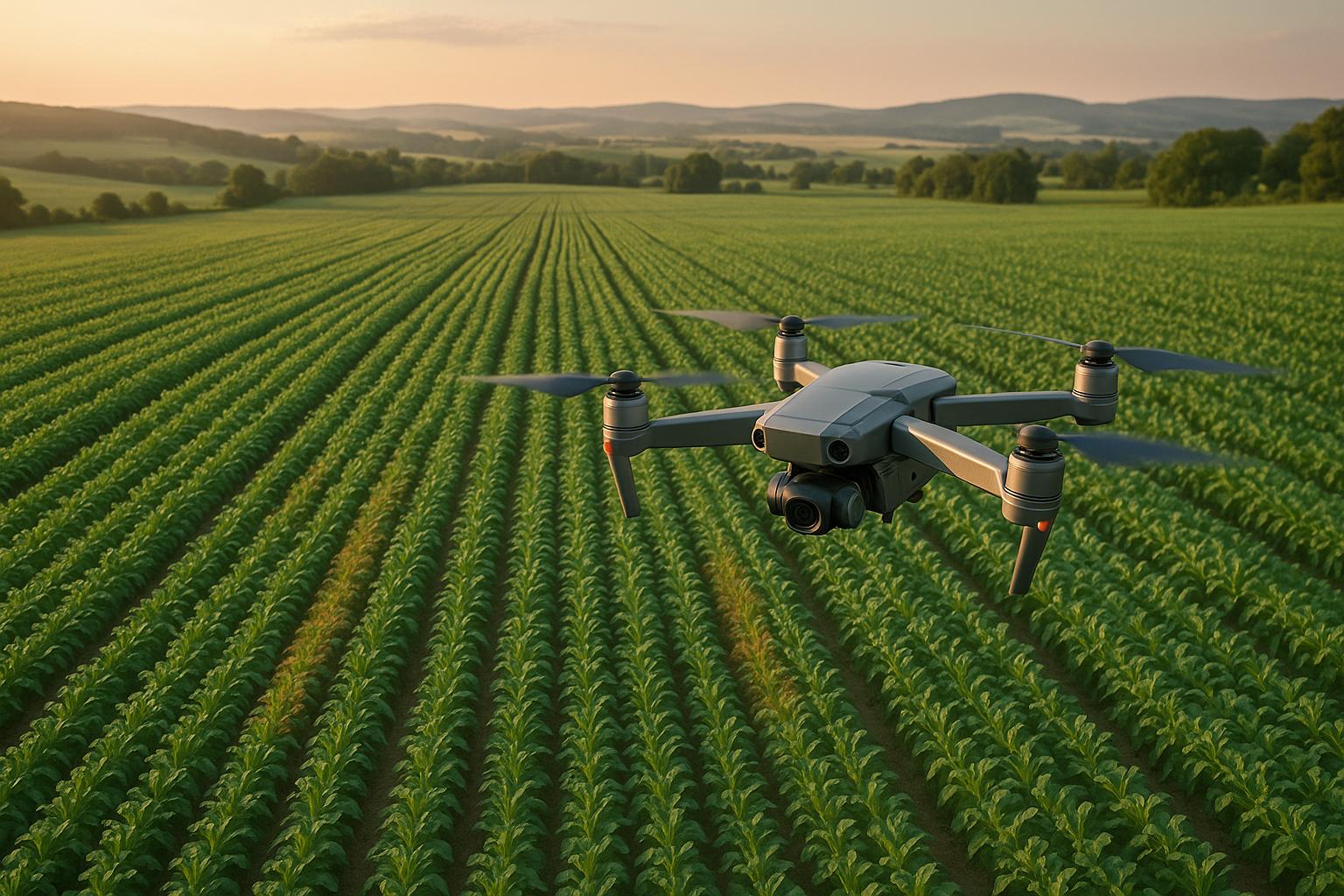
Drones are transforming agriculture by helping farmers detect crop diseases earlier and manage fields more efficiently. Time-lapse models, built from drone-captured images, allow farmers to monitor how diseases progress over time. These models provide actionable insights, enabling targeted interventions that improve crop health and reduce costs. Here's a quick breakdown:
- Why it matters: Crop diseases develop gradually, and early detection is critical to minimize losses.
- How drones help: Drones provide high-resolution images, covering large areas quickly, and identify disease signs invisible to the naked eye.
- Tech behind it: Multispectral sensors, AI-powered analysis, and precise flight planning create accurate time-lapse models.
- Benefits: Reduce pesticide use by up to 30%, increase crop yields by 25%, and save time compared to manual inspections.
With the agricultural drone market set to reach $6 billion by 2025, this technology is becoming a key tool for smarter farming practices.
【Remote Sensing】Crop Disease Detection Using UAV and Deep Learning Techniques
Drone Data Collection for Crop Disease Monitoring
Collecting high-quality drone data requires thoughtful preparation and the right tools. With the agriculture drone market expected to hit $18.22 billion by 2030, it's clear that these technologies are becoming indispensable. Starting with a solid data collection strategy is key to creating time-lapse models that can effectively track how diseases progress over time.
Drone Types and Sensors for Agricultural Use
Selecting the right drone depends on factors like the size of your fields, your budget, and what you need to monitor. Different drones serve different purposes in crop surveillance.
Rotary drones are ideal for scouting specific problem areas. They’re easy to maneuver, can hover in place, and typically have flight times ranging from 15 to 40 minutes. These drones can carry medium to heavy payloads, making them excellent for tasks like spot inspections and thermal imaging [14, 17]. Their ability to take off and land vertically means you can use them almost anywhere on your farm.
Fixed-wing drones are better suited for large-scale operations. They can fly for 60 to 90 minutes, making them efficient for surveying vast farmland. These drones handle windy conditions well and are commonly used for wide-area mapping and orthomosaic imaging. However, they require a runway-like space for takeoff and landing, which might not be practical for every farm.
Hybrid VTOL drones combine the strengths of both rotary and fixed-wing designs. They offer long flight times of 90 to 180 minutes along with the convenience of vertical takeoff and landing. While they are more expensive and complex to operate, they’re perfect for extensive mapping in remote areas where both endurance and flexibility are critical.
| Drone Type | Flight Time | Payload Capacity | Common Uses in Agriculture |
|---|---|---|---|
| Fixed-Wing | 60–90 minutes | Low to Medium | Wide-area surveying, orthomosaic mapping, crop health monitoring |
| Multi-Rotor | 15–40 minutes | Medium to High | Spraying, spot inspections, thermal analysis, plant counting |
| Hybrid (VTOL) | 90–180 minutes | Medium | Large-scale mapping in remote areas, combining vertical takeoff with long endurance |
Once you’ve chosen the right drone, the sensor package becomes just as important. Multispectral cameras capture visual and near-infrared data, helping identify plant stress before it’s visible to the human eye. Thermal cameras are excellent for detecting temperature changes linked to disease or water stress, while LiDAR sensors measure plant height and canopy structure. A combination of digital, multispectral, hyperspectral, thermal, and fluorescence sensors allows for thorough disease detection and analysis.
Flight Planning and Data Collection Methods
Effective data collection starts with detailed flight planning. You’ll need to map out flight paths and set altitudes that ensure complete coverage of your fields. Factors like field size, shape, and the level of detail you need will guide these decisions. Specialized software can help create efficient flight paths that maximize data collection while minimizing flight time.
High-precision satellite navigation systems are essential for achieving centimeter-level accuracy. This ensures drones can follow the same flight paths during each session, allowing your time-lapse models to reflect real crop changes instead of inconsistencies caused by different angles or positions.
Practical examples highlight the value of systematic planning. In Iowa, farmers use drones for stand counts, emergency assessments, and nitrogen management, which helps them make better replanting and fertilizer decisions. Similarly, cotton growers in Texas use drones to monitor plant health, optimize pest control, and improve irrigation, especially in areas with limited water.
For consistent image quality, drones equipped with IMUs and GPS offer real-time corrections and flight stability. Lower-altitude flights are recommended for spotting issues like disease or weeds. Combining data from multiple sensors - such as multispectral, thermal, and RGB cameras - provides a more complete analysis.
Weather and Regulatory Factors
Weather plays a major role in both the quality of your data and the safety of your flights. Wind can destabilize drones and drain batteries faster, while rain can damage electronics and obscure sensors. Extreme temperatures also affect battery performance and overall drone efficiency.
"Drones have revolutionized engineering surveys by providing a faster, safer, and more accurate method of data acquisition. Their ability to access challenging terrain and capture vast areas in a fraction of the time significantly enhances efficiency and project timelines." - Olguy Louis, Mississippi's USDA NRCS State Conservation Engineer
Always check weather forecasts before flying. If conditions are less than ideal, consider using weather-resistant drones or protective covers. Store batteries correctly and carry spares, especially in extreme temperatures. In low-visibility conditions, calibrate sensors to maintain accuracy.
On the regulatory side, FAA Part 107 rules govern commercial drone operations for drones under 55 pounds. These include holding a Remote Pilot Certificate and following rules like maintaining 3 miles of visibility and staying at least 500 feet below clouds. For drones over 55 pounds, operators can apply for Section 44807 exemptions, which use a risk-based approach.
Remote ID requirements mandate that drones broadcast their identification and location. Local laws might also impose additional restrictions, such as requiring warrants for surveillance or banning weaponization. Always ensure compliance with federal, state, and local regulations before starting your operations.
Investing in the right equipment and planning pays off. Drones can cover up to 500 acres in a single day - work that would take weeks using traditional methods. The data they collect can reduce fertilizer and pesticide use by as much as 30%, while early disease detection can increase crop yields by 25%. These precise data collection methods set the stage for building accurate time-lapse models that track crop health over time.
Building and Processing Time-Lapse Models
Once you've gathered high-quality drone data, the next step is turning it into dependable time-lapse models. This involves processing the raw imagery and converting it into detailed visualizations that can track changes over time.
Preparing Data for Time-Lapse Models
To create effective time-lapse models, follow a structured workflow: mission planning, flying the drone, extracting data, stitching images, calculating vegetation indices, and storing the data securely.
For accurate image stitching, aim for a 75% overlap in both horizontal and vertical directions. This ensures the software can align the images seamlessly. Insufficient overlap can lead to gaps or misaligned sections, making the time-lapse analysis unreliable.
Selecting the right flight altitude is also key. Lower altitudes provide more detailed imagery but require more time and storage space. Scheduling flights between 10 a.m. and 2 p.m. helps maintain consistent lighting and minimizes shadows.
Georeferenced maps are essential for tracking crop health over time. These maps transform individual drone photos into cohesive visuals with precise geographic coordinates, ensuring that each frame aligns perfectly for accurate comparisons.
When processing your images, you can choose between local desktop software and cloud-based services. Local software offers faster processing and more control but requires high-end hardware and technical know-how. On the other hand, cloud-based services are user-friendly and allow easy sharing, though they depend on fast internet and often involve pay-per-use costs.
Lastly, always back up your raw imagery regularly to prevent data loss.
Using AI and Machine Learning for Disease Analysis
Artificial intelligence is revolutionizing the way we analyze crop diseases in time-lapse models. Machine learning models, such as Convolutional Neural Networks (CNNs) and Vision Transformers (ViTs), can quickly detect even subtle disease patterns. CNNs are particularly effective for processing drone imagery, identifying diseases based on features like color, texture, and shape. When properly trained, these models can achieve classification accuracies exceeding 95%.
Globally, up to 40% of crop production is lost annually due to pests and diseases, costing the economy around $220 billion. Early detection using AI can significantly reduce these losses.
ViTs represent a newer approach, analyzing entire images as sequences of patches to capture global relationships. For example, the lightweight CropViT model achieves an impressive 98.64% accuracy in classifying plant diseases. Hybrid models that combine CNNs and ViTs are also gaining popularity, as they leverage both local feature extraction and broader context understanding.
Specific AI models have shown exceptional results: U-Net achieved 97.13% accuracy in detecting wheat yellow rust, while Mask R-CNN recorded an IoU score of 0.96 for identifying northern leaf blight in maize. By incorporating these advanced tools, time-lapse models can move beyond observation and become proactive systems for early disease detection.
To ensure your models perform well across different environments, train them on diverse datasets that include various plant species, disease types, and environmental conditions. This helps optimize their reliability across different geographies, crops, and farming practices.
Combining Multiple Data Types for Better Analysis
Integrating different data sources can dramatically improve the accuracy of AI-driven disease detection. For instance, combining UAV and satellite imagery allows for large-scale crop monitoring, while soil health data can help link disease presence to nutrient deficiencies. Adding weather data can even help predict potential outbreaks.
Image fusion plays a critical role in precision agriculture. Combining thermal and multispectral data, for example, provides a more complete picture of crop health than either data type alone. However, merging these images is no small task. Techniques like the Enhanced Correlation Coefficient (ECC) algorithm are particularly effective, as they handle differences in intensity and support various motion models.
Accurate georeferencing is another crucial step. Use robust algorithms and ground control points to align diverse data types like thermal, multispectral, and LiDAR imagery. For example, researchers at the King Abdulaziz University Agricultural Research Station found that a crop water stress index above 0.36 indicated plant stress. They determined that the best time to collect UAV-based temperature data was between fruit formation and ripening.
To ensure reliable results, data fusion should occur at the level of physical units, with quality flags to exclude unstable measurements. This approach minimizes errors and ensures that time-lapse models reflect genuine changes in crop health rather than artifacts from poor data integration.
Platforms like Anvil Labs simplify this process by supporting various data types, such as 3D models, thermal imagery, LiDAR, and orthomosaics. Their tools allow for easy integration and customization, enabling you to create interactive models that clearly illustrate disease progression.
sbb-itb-ac6e058
Viewing and Using Time-Lapse Models for Decisions
Once you've processed your drone data into time-lapse models, the next challenge is turning those visualizations into actionable insights for better crop management. How you interact with these models can be the difference between catching early signs of disease and missing critical red flags. These interactive visualizations transform raw data into practical tools for decision-making.
Creating Interactive Views of Disease Progression
3D time-lapse models are especially effective for tracking how crop diseases develop over time. A striking example comes from a desert locust outbreak in East Africa, where these models were used to trace locust movements. In one instance, 3D visualizations revealed locust descent over the Gulf of Aden, offering a clear picture of their spread and helping inform response strategies.
Anvil Labs takes this a step further by offering tools to customize and view data across devices, whether you're in the field or at your desk. Their platform supports automated 3D time-lapse movies, which can simplify short-term forecasting and make it easier to interpret risks and trends.
Data Analysis and Disease Prediction
AI-driven systems are game-changers for analyzing complex datasets, from plant health metrics to weather patterns. These systems allow for faster, more informed decisions. Disease forecasting models, for example, predict the likelihood and severity of outbreaks by factoring in how environmental and weather conditions affect crops and pathogens.
The stakes are high. Take wheat, a staple crop: in 2019, about 21.5% of global wheat yields were lost post-harvest due to pests and diseases. Fungal infections like blight and rust cause annual losses of 10–23%. Models like Ethiopia's wheat rust early warning system and the ShIFT model for Zymoseptoria tritici demonstrate how time-lapse analysis can guide disease management. These tools help reduce losses, improve resource use, and enhance productivity by enabling better fungicide application and resource allocation strategies. By integrating these predictive models into collaborative platforms, teams can respond faster and more effectively.
Secure Data Sharing and Team Collaboration
Collaboration is essential in agriculture, where farm managers, agronomists, and analysts often work together. Federated learning offers a way for multiple users to train AI models without sharing raw data, ensuring privacy. For instance, a study using ResNet-50 for disease classification achieved 99.5% accuracy across various configurations. Blockchain technology adds another layer of security, providing tamper-proof data storage to protect ownership and integrity.
Cloud-based platforms enhance this collaboration by offering secure storage, efficient processing, and real-time multi-user access. Anvil Labs stands out with its tools for secure data sharing and 3D model management. Their annotation and measurement features allow team members to highlight areas of concern directly on the models, ensuring everyone stays on the same page.
Integrating drone data with existing farm management systems centralizes analysis and visualization, making time-lapse models a seamless part of broader workflows. Collaboration with agronomists and analysts can improve data interpretation and help develop tailored strategies. Plus, connecting these tools with AI systems and task management platforms can automate alerts and management actions, streamlining operations.
Practical Applications and Benefits in U.S. Agriculture
Using drone data to create time-lapse models is transforming how farmers in the U.S. manage their fields, especially in tracking and controlling crop diseases. Across the country, farmers are turning to drones to address challenges in crop health, paving the way for noticeable improvements in agricultural practices.
Improving Crop Management with Drone Data
Drones have reshaped how farmers detect and treat crop diseases. These devices can identify early signs of disease - long before they’re visible to the human eye - giving farmers a critical advantage.
By cutting manual scouting by up to 90%, drones save farmers considerable time and effort. What once took days of walking through fields now takes only minutes. This technology also enables precise application of pesticides and fertilizers, targeting only the necessary areas. As a result, farmers use fewer chemicals, reducing the risk of runoff into nearby water sources .
Additionally, drones can locate dry patches in fields, helping farmers fine-tune their irrigation systems. When paired with tools like 3D mapping and topographical models, drone data supports smarter field layouts, better drainage planning, and more accurate soil analysis.
Drone Monitoring vs Other Methods
| Method | Coverage Speed | Resolution | Cost | Monitoring Frequency | Weather Dependency |
|---|---|---|---|---|---|
| Drone Monitoring | Minutes for large fields | High-resolution imagery | Moderate initial cost | Multiple flights/season | Low to moderate |
| Manual Assessment | Days for large fields | Visual inspection only | High labor costs | Limited by manpower | Low |
| Satellite Imagery | Instant coverage | Pixelated, lower detail | High subscription costs | Fixed schedule | High |
Compared to other methods, drones provide unmatched detail. Unlike satellite imagery, which often suffers from pixelation, drones capture sharp, high-resolution visuals. They also have the advantage of flying below cloud cover, avoiding the atmospheric distortions that can affect satellite data.
Economically, drones strike a balance. Satellite imagery requires expensive subscriptions, and manual assessments demand significant labor costs. In contrast, drones offer a cost-effective solution. Once purchased, they can be flown multiple times throughout the growing season without additional fees, making frequent monitoring more affordable .
Drones also excel in accessibility. They can navigate challenging areas like waterlogged fields, steep slopes, or dense vegetation - places that are hard or unsafe for humans to reach.
U.S. Regulations and Privacy Requirements
While drones offer clear advantages, operating them in the U.S. requires strict adherence to federal, state, and local regulations. Farmers must comply with Federal Aviation Administration (FAA) rules, including registering drones weighing more than 0.55 pounds (250 grams) for a $5 fee valid for three years. Commercial operators need a Remote Pilot Certificate (Part 107 license).
As of September 16, 2023, most drone pilots must also comply with Remote ID requirements.
State-level privacy laws vary widely. For instance, Virginia prohibits drones from flying within 50 feet of homes without permission, with violations treated as misdemeanors. In Texas and California, laws restrict unauthorized image capture of individuals or private property.
To avoid legal issues and maintain good relationships with neighbors, farmers should follow best practices. These include keeping flights brief and purposeful, flying at respectful altitudes, and avoiding residential areas or night operations. Operators should also verify local rules before flying, as some municipalities impose additional restrictions on areas like parks, schools, or neighborhoods.
Respecting privacy is equally important. Farmers should focus their drone operations exclusively on their own fields and avoid capturing images of neighboring properties without consent. Using cameras responsibly and steering clear of surveillance-like activities helps build trust with neighbors and ensures compliance with privacy laws.
The regulatory landscape is constantly evolving, so staying informed about FAA updates and local laws is crucial. Following these guidelines safeguards both the operator and the broader agricultural community, ensuring drones continue to benefit U.S. farming.
Conclusion and Key Takeaways
Drone data and time-lapse models are changing the way U.S. farmers tackle crop disease management. With crop diseases and pests responsible for an estimated 20%-40% of annual crop-yield losses, the urgency for proactive solutions has never been greater.
The results are hard to ignore. A citrus farmer in central Florida reported a 30% drop in disease-related losses after adopting an AI-driven drone monitoring program. And this isn’t an isolated case - using high-resolution cameras and AI for pest and disease detection has been shown to improve efficiency by an estimated 50-60%.
The agricultural drone market is also booming. In 2020, it was valued at $1.2 billion, and by 2025, it’s projected to hit nearly $6 billion. This rapid growth underscores the unique advantage drones offer: the ability to detect diseases before they’re visible to the human eye.
For farmers looking to adopt this technology, the first step is straightforward. Partnering with "Drone as a Service" (DaaS) providers allows access to advanced drone systems without hefty upfront costs. To get the most out of this technology, integration is essential - combine drone data with existing tools like farm management software, weather stations, and crop monitoring systems. Equally important is ensuring farmers and workers are properly trained to interpret and act on the insights provided by these systems.
Navigating regulations might seem daunting, but adhering to FAA guidelines and respecting privacy laws ensures sustainable and responsible drone operations. This not only benefits individual farms but also strengthens the agricultural community as a whole.
At its core, time-lapse models powered by drone data go beyond simple monitoring. They enable prediction and prevention, shifting farming from reactive problem-solving to strategic disease management. This approach helps safeguard crops and profitability in an increasingly unpredictable agricultural landscape.
FAQs
How do drones help detect crop diseases earlier than traditional methods?
Drones make it possible to spot crop diseases earlier by capturing high-resolution aerial images and using advanced sensors to assess plant health. These tools can pinpoint problems like disease outbreaks, irrigation issues, or nutrient shortages across vast fields - tasks that would take significantly more time if done manually.
With this precise and timely information, farmers can tackle issues faster, boosting crop health and minimizing potential losses. This method isn’t just quicker; it’s also more accurate, helping farmers make smarter decisions and manage their farms more efficiently.
What should I consider when choosing a drone and sensors for agricultural applications?
When choosing a drone and sensors for agricultural tasks, it's essential to think about payload capacity, flight duration, sensor type, and coverage area. For activities like spraying, drones with larger payload capacities are a better fit, while monitoring crops often calls for specialized sensors like multispectral or RGB cameras.
For large-scale farms, look for drones with longer flight times and a range that can handle expansive areas efficiently. Battery life is another key factor, as it helps reduce downtime during operations. Aligning the drone's features with your specific farming needs will lead to more effective results and smoother workflows.
What steps should farmers take to comply with US drone regulations for crop monitoring?
To operate drones within the bounds of U.S. regulations, farmers must secure an FAA Remote Pilot Certificate, register their drones with the FAA, and adhere to the Part 107 rules governing small unmanned aircraft systems (UAS). Beyond federal requirements, it’s also crucial to review any state-specific laws that might apply in your location to ensure everything is in order.
