Digital twins are transforming mining by creating virtual replicas of physical operations, enabling safer, more efficient blast optimization. By integrating AI and real-time data, mining companies can simulate and refine blast designs without physical testing, reducing costs and improving outcomes. Tools like drones and 3D modeling further enhance precision by providing high-resolution site data quickly and safely.
Key Insights:
- AI Integration: Companies like BHP have cut production losses by 70% using AI-driven digital twins.
- Drone Efficiency: Drones collect blast site data 20x faster than ground surveys, with minimal safety risks.
- Cost Savings: Real-time monitoring and predictive analytics reduce equipment downtime by 30% and maintenance costs by 15%.
- Improved Fragmentation: AI models optimize blast designs, reducing ore loss by 18% and enhancing material processing.
Digital twins are reshaping mining operations, offering precise, data-driven solutions for blast planning, monitoring, and post-blast analysis. As the technology evolves, its adoption is expected to grow significantly in the mining industry.
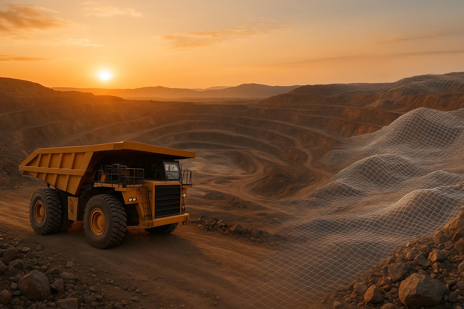
Blast Digital Twin (Sub español)
Drone Data Collection and 3D Modeling for Blast Sites
Optimizing blast performance begins with accurate drone data that can be transformed into detailed 3D models. Let’s dive into how drones and 3D modeling turn raw data into actionable insights for blast site management.
Drone Technologies for Data Collection
Drones equipped with tools like photogrammetry and LiDAR are revolutionizing how data is collected on blast sites. Photogrammetry captures overlapping images to map surface conditions and terrain, while LiDAR goes a step further by penetrating vegetation to render highly detailed topographic data. For areas that are tough to access, aerial 360° imagery adds another layer of clarity to site documentation.
One of the biggest advantages? Speed. Drone surveys are over 20 times faster than traditional ground methods, allowing mining operations to gather comprehensive data without disrupting daily workflows. Even better, the processed data is often ready within 24 hours.
"The site map can be updated every day – if not multiple times a day." - Ravi Sahu, CEO of Strayos
These advanced data collection techniques lay the groundwork for virtual blast design and ongoing performance monitoring.
Steps to Create High-Resolution 3D Models
The process of creating detailed 3D models starts with drones capturing overlapping images. Software like DJI Terra and Pix4D then processes these images into 2D orthomosaics and 3D terrain models. By analyzing shared points across multiple images, the software calculates precise spatial relationships.
To ensure the highest level of accuracy, ground control points (GCPs) are strategically placed across the survey area. These points anchor the digital models to real-world coordinates, providing centimeter-level precision critical for blast optimization.
During processing, the raw drone data is converted into a variety of products, including geotagged 3D maps and models like Digital Elevation Models (DEM), Digital Terrain Models (DTM), and Digital Surface Models (DSM). Each of these models serves a specific role in blast analysis and planning.
High-resolution aerial imagery combined with photogrammetry captures intricate details of benches, ramps, and walls, all georeferenced to survey-grade accuracy. This depth of detail allows engineers to pinpoint potential issues, plan drill hole locations, and fine-tune blast patterns with greater precision.
Recording Pre- and Post-Blast Conditions
Pre-blast data plays a crucial role in designing safe and efficient explosive plans. It provides engineers with the foundation to select the right explosives and design blasts that maximize productivity while adhering to safety standards.
By comparing pre- and post-blast models, engineers can evaluate the effectiveness of their designs and make adjustments for future improvements. These evaluations are critical for analyzing changes in factors of safety (FoS) and identifying potential slope stability concerns.
Once 3D models are created, they become the basis for detailed assessments. Pre- and post-blast 3D models help engineers measure mineral extraction volumes, analyze muck pile dynamics, and evaluate fragmentation metrics.
Post-blast analysis goes further by visually assessing muckpile shape, back damage, distribution, and fragmentation. Drones also provide precise measurements of pile volume and fragment size, offering quantitative data to refine future blasts.
Another major advantage of drones is their ability to safely record blasts from hard-to-reach locations. This footage gives engineers a clearer understanding of blast dynamics and highlights areas for improvement.
"Using a drone for perimeter security is to help the people in charge get people out of the hazardous blast zone. Not only by radio and phone but by aerial video for better oversight too. This brings an added value to the process that ensures better control." - Alexander
Monitoring changes in factors of safety (FoS) and assessing slope stability after blasting are essential for preventing accidents and maintaining safe operations.
Using Digital Twins for Blast Planning and Optimization
Leveraging detailed 3D models created by drones, digital twins provide a cutting-edge approach to blast planning. These virtual replicas allow engineers to simulate, test, and fine-tune explosive designs in a completely safe environment before actual implementation. By transforming drone-captured data into powerful simulation tools, digital twins enhance safety, reduce costs, and refine blast efficiency. This technology opens the door to detailed testing of various blast scenarios, offering a more controlled and predictive planning process.
Virtual Blast Design and Scenario Testing
Digital twins allow engineers to model and evaluate multiple blast scenarios without the risks associated with physical testing. These simulations enable a thorough analysis of explosive configurations, timing sequences, and charge placements under different geological conditions. This method minimizes the need for expensive on-site trials while yielding valuable insights into the most effective strategies for operations.
Take Rio Tinto's Autonomous Drilling operations as an example. By integrating AI into their blast planning process, they achieved a 30% improvement in drill utilization. This advancement supports more precise hole placement, ultimately leading to better blast outcomes.
Fast simulation capabilities further enhance the process, enabling engineers to quickly test and compare various configurations. This rapid iteration helps refine parameters and optimize performance.
AI-Powered Analytics for Geological Insights
When combined with AI, digital twins become more than just simulations - they transform into intelligent systems capable of uncovering geological details that traditional methods might overlook. By analyzing factors like rock hardness, joint patterns, bedding, and ore boundaries, AI-driven platforms create custom blast designs that maximize resource extraction efficiency.
For instance, BHP's Jansen Potash Mine highlights the benefits of AI-powered geological analysis. Using GeologicAI's platform, they achieved a 22% faster resource modeling process compared to conventional techniques. This speed allows for more adaptive blast planning that can respond to shifting geological conditions.
"Machine learning models reduce 'ore loss' by 18% through boundary delineation algorithms that identify economic mineralization zones conventional methods might miss."
– Dr. Anika Patel, BHP Principal Geologist
AI systems also integrate multiple data streams to create high-resolution, three-dimensional geological models. Neural networks analyzing historical drilling data reach 95% accuracy in predicting deposit locations, enabling more targeted designs focused on high-value ore zones.
Newmont's Tanami mine provides another compelling example. By adopting AI-guided targeting, they reduced exploratory drilling waste by 30%. Additionally:
"GeologicAI's sensor fusion platform eliminates weeks-long lab delays, delivering real-time lithology interpretation and mineral identification."
– Dr. Evan Zhao, CTO of GeologicAI
AI doesn't stop at design - it continuously monitors and adjusts operational parameters, ensuring precision and reducing equipment wear. This dynamic optimization keeps blast plans effective even as geological conditions change.
Real-Time Model Updates with New Data
The accuracy of digital twins relies on constant updates from fresh data sources. By integrating new drone and sensor data, digital twins stay aligned with the latest site conditions, including geological changes, bench configurations, and updated safety zones. This real-time data flow ensures that blast plans remain relevant and effective.
Anglo American's Minas-Rio Mine illustrates the value of real-time data integration. Their AI-driven predictive maintenance strategy reduced equipment failures by 25%, resulting in substantial annual savings. In the context of blast planning, such data can guide optimal drilling patterns and the precise placement of explosives.
Combining data streams, such as LiDAR measurements, creates a comprehensive operational view. This enables precise blast layout designs and the ability to adapt quickly to changing conditions. Post-blast data further refines the digital twin, establishing a continuous feedback loop that improves future operations.
sbb-itb-ac6e058
Blast Performance Monitoring and Fragmentation Analysis
Digital twins have revolutionized how engineers analyze blast performance, turning what was once an educated guess into a precise science. These tools allow for real-time monitoring, enabling engineers to measure how effective explosive designs are and make data-driven improvements. The following sections dive into the methods used for post-blast evaluations and how digital twins drive ongoing improvements.
Techniques for Post-Blast Monitoring
Modern digital twin platforms leverage AI-powered computer vision to analyze blast results with impressive precision. Drones equipped with high-resolution cameras capture detailed images of muck piles immediately after a blast. This imagery is then processed by machine learning algorithms to measure fragment sizes, assess pile geometry, and analyze material distribution patterns.
The process starts with 3D photogrammetry reconstruction. Drones collect thousands of images from various angles, which are stitched together into accurate 3D models of the post-blast site. These models allow engineers to measure changes in bench geometry and serve as the basis for detailed fragmentation analysis.
Using AI-based image processing, the system automatically determines fragment size distribution and evaluates the shape and volume of muck piles. This data is critical for optimizing future blasts.
Real-time monitoring during the blast itself adds another layer of insight. Specialized cameras and sensors track throw velocity, fragmentation patterns, and material displacement as the explosion occurs. These metrics validate simulation predictions and enhance the accuracy of digital twin models.
At Gold Fields' St Ives gold mine in Western Australia, this advanced approach to monitoring paid off in a big way. By optimizing blasting based on high-resolution data and simulations, the mine achieved smaller, more uniform fragments, eliminating the need for primary crushing. This adjustment cut energy consumption by 8% and increased mill recovery rates simultaneously.
Comparison of Drone-Based vs. Standard Methods
Drone technology has proven to be a game-changer compared to traditional ground-based methods. It offers faster, safer, and more accurate blast monitoring, making it an increasingly popular choice for mining operations.
| Survey Method | Survey Duration | Measurement Accuracy | Personnel Needed | Safety Incidents (per 100 surveys) | Operational Cost | Data Output Type |
|---|---|---|---|---|---|---|
| Traditional Ground Surveys | 3-7 days per 247 acres | 4-12 inches (2D, limited 3D) | 4-8 surveyors | 2-5 (hazardous terrain exposure) | $10,000–$15,000 per large site | 2D maps, basic 3D models |
| Drone-Based Surveys | 1-3 hours per 247 acres | 0.8-2 inches (accurate 3D models) | 1-2 operators | <0.1 (minimal personnel risk) | $2,000–$5,000 per large site | High-res 2D/3D maps, point clouds, orthomosaics |
The time savings alone are staggering. Drones can survey up to 247 acres in just a few hours, collecting thousands of data points per minute. This speed allows for near-instant analysis, enabling quicker decisions for the next steps in the operation.
For example, Granite Construction used drones for volumetric stockpile measurements and achieved comparable accuracy to traditional methods in a fraction of the time. Their volume calculations were within 1% of alternative methods.
Safety is another major advantage. Ground surveys often expose workers to hazardous post-blast conditions, such as unstable terrain and loose rock. Drone-based monitoring eliminates this risk, reducing safety incidents from 2-5 per 100 surveys to less than 0.1.
Reducing Ore Loss and Improving Fragmentation
Digital twins also play a critical role in minimizing ore loss and enhancing fragmentation quality. By using machine learning for boundary delineation and predictive modeling, they can reduce ore loss by 18% while ensuring optimal fragment sizes. These systems identify economic mineral zones that traditional methods might overlook, maximizing the value extracted from each blast.
Predictive fragmentation modeling is a key component of this process. AI systems analyze geological data, explosive parameters, and past blast results to predict the ideal fragment sizes before detonation. These models continuously learn and refine their predictions, ensuring fragmentation patterns that improve downstream processing efficiency.
At Roy Hill's iron ore mine in Australia, real-time monitoring led to significant operational gains. By analyzing data from excavator sensors, engineers optimized equipment motion and digging paths. This resulted in larger payloads and better fill factors, streamlining material handling.
"A mine site changes every single day - AI gives you real-time insights so you can make better decisions before problems arise." - Ravi Sahu, CEO of Strayos
The Strayos platform, used in over 3,000 sites globally, illustrates the impact of AI-driven optimization. One customer reduced crusher gap settings by 7% using Strayos' analysis, leading to energy savings and improved throughput across processing operations.
This continuous feedback loop between post-blast data and future designs is a game-changer. Fragmentation data updates the digital model, refining geological insights and improving blast plans. Each blast builds on the lessons learned from previous ones, creating a cycle of consistent improvement.
"AI doesn't replace humans - it makes them better at their jobs. Blasters, geologists, and engineers now have real-time intelligence that makes their decision-making faster and more accurate." - Ravi Sahu, CEO of Strayos
Platform Solutions for Managing Blast Digital Twins
Effectively managing digital twins for blast optimization demands platforms that can handle massive datasets, facilitate real-time collaboration, and seamlessly integrate with mining workflows. In today’s mining operations, it’s not enough to rely on basic file storage - modern platforms must support large-scale 3D data management to meet the growing demands of the industry.
Key Features of Digital Twin Management Platforms
The most effective platforms transform raw drone imagery into detailed, actionable 3D models while allowing access across multiple devices. As Melanie G. Devins, Senior Project Systems and Information Management Manager at Worley, put it:
"Digital twins make information easily accessible from anywhere. We're seeing fewer unnecessary trips to site offices to review drawings and documents such as equipment manufacturer manuals... All this information is now available on tablet devices. This not only saves time but also increases safety and reduces plant downtime."
One of the biggest challenges in mining - securely sharing data among stakeholders - is addressed by these platforms through granular access controls. Historically, data security concerns and a lack of trust have limited the broader use of data across operations. Annotation and measurement tools further enhance collaboration, enabling teams to mark blast hole locations, measure geological features, and add notes directly within 3D models. Additionally, integration with AI tools and task management systems connects these platforms to fragmentation analysis software and geological modeling tools, creating a streamlined workflow. These features set the foundation for advanced solutions like those offered by Anvil Labs.
Anvil Labs' Capabilities for Mining Operations

Anvil Labs takes these features a step further with its Asset Viewer, a specialized tool designed to manage and share industrial digital assets throughout the blast optimization process. From processing initial drone data to conducting post-blast analysis, the Asset Viewer simplifies collaboration. It includes in-browser measurement tools, eliminating the need for installing specialized software on every device.
Pricing for the Asset Viewer starts at $99/month, with project hosting available at $49/project and automated processing priced at $3 per gigapixel. Users can easily upload and manage finished meshes, orthomosaics, and LiDAR data, streamlining project file management.
Support for Diverse Data Types
Blast optimization platforms must accommodate a variety of data types. For instance, LiDAR point clouds provide precise geological measurements, while orthomosaics offer high-resolution surface imagery. Thermal imagery reveals subsurface conditions that can impact the effectiveness of a blast. Anvil Labs supports widely used file formats such as .obj, .laz, and .fbx, and even allows for immersive site reviews with 360° panoramas. Its integration with Matterport further enhances its capabilities, enabling mining professionals to leverage existing 3D capture investments alongside specialized workflow tools.
The mining sector faces unique challenges that require tailored digital twin solutions. Unlike manufacturing and construction, which have embraced digital twins more readily, mining has lagged behind - with only 4% of published studies focusing on mining applications. However, platforms like Anvil Labs are changing this narrative by offering accessible, industry-specific tools that address the distinct needs of blast optimization and mining operations.
"Imagine a world where all your engineering information – from tag data to drawings, documents, and 3D models – is at your fingertips... That world is possible with digital twins." - Melanie G. Devins, Senior Project Systems and Information Management Manager, Worley
Conclusion
Digital twins are reshaping mining operations by enabling highly accurate blast optimization. By leveraging real-time data, they help reduce vibration and improve fragmentation efficiency, leading to better overall performance in drilling, blasting, and ore extraction. This virtual testing capability not only boosts productivity but also minimizes waste, setting the foundation for streamlined operations.
The impact of digital twins is striking: they can reduce unplanned equipment downtime by up to 30%, enhance productivity by 20%, and cut maintenance costs by 15%. The market reflects this potential, with projections showing growth from $3.1 billion in 2020 to $48.2 billion by 2026, driven by an impressive 58% compound annual growth rate (CAGR).
Safety is another key area where digital twins shine. By creating virtual environments for training and enabling remote operation of equipment, they significantly enhance workplace safety. Additionally, these models monitor equipment performance to identify potential issues early, enabling predictive maintenance and reducing the risk of costly breakdowns. This proactive approach not only optimizes resources but also helps reduce emissions, limit waste, and incorporate renewable energy sources more effectively.
Companies like Anvil Labs are already showcasing the practical benefits of digital twins. Their technology enables inspections to be completed 75% faster, detects 30% more defects, and delivers a return on investment (ROI) in just two months. Angel Rojas of Red Angel Drones highlights this efficiency:
"My overall experience with the software has been satisfying because of the efficient workflow... The ROI is clearly marked within the first few uses".
Looking ahead, digital twins are expected to transition from niche applications to enterprise-wide solutions across the mining value chain. Experts predict that advancements in 5G, augmented reality, and blockchain will pave the way for ultra-high-fidelity twins with seamless real-time data integration over the next 5–10 years. To fully harness this potential, mining companies will need to craft clear data strategies and prioritize user engagement through intuitive interfaces and robust training programs.
With over 40% of mining companies projected to adopt digital twin technology by 2025, the race is on for organizations to integrate these tools into their operations and unlock their transformative potential.
FAQs
How do digital twins improve safety and efficiency in mining blast optimization?
Digital twins enhance safety and streamline mining blast optimization by providing detailed virtual models of mining sites that replicate actual conditions. These digital replicas allow teams to carefully plan and test blast designs, predicting outcomes with greater accuracy and reducing potential risks.
With real-time data integration, digital twins empower mining teams to make quick adjustments, improve resource allocation, and maintain safer working environments. This modern technique not only cuts down on waste but also boosts productivity and supports smarter decision-making during the blasting process.
How do drones and 3D modeling enhance the efficiency and accuracy of blast site data collection in mining?
Drones make it possible to scan blast sites quickly and efficiently, gathering high-resolution data in just a few hours. This approach significantly cuts down the time and effort needed compared to older, more labor-intensive methods.
When paired with 3D modeling, the benefits become even greater. These models provide highly detailed and accurate representations of the site, often precise to within a few millimeters. By combining these technologies, mining operations can simplify data collection, make better decisions, and fine-tune blast performance with greater ease.
How do AI-powered digital twins enhance mining efficiency and reduce ore loss?
AI-powered digital twins are revolutionizing mining operations by using real-time data to fine-tune extraction processes. This can lead to efficiency gains of up to 25%, a significant boost for an industry where every percentage point matters. These systems can adapt on the fly, adjusting blasting and extraction strategies to make sure resources are utilized as effectively as possible.
On top of that, digital twins play a key role in cutting down ore loss. By predicting potential equipment problems and spotting inefficiencies early, they help prevent issues from snowballing. This proactive approach not only reduces waste but also ensures better resource recovery, making mining operations both more economical and environmentally friendly.
