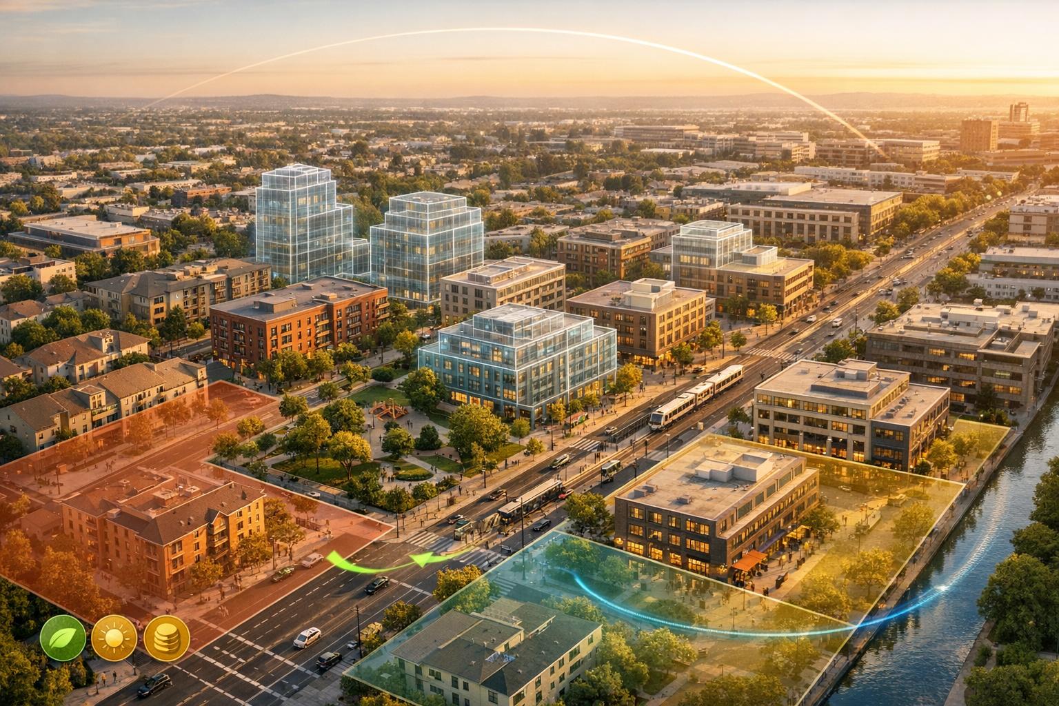
AI and digital twins are reshaping urban zoning by cutting analysis times, improving accuracy, and addressing challenges like housing shortages and infrastructure planning. Here's what you need to know:
- AI-powered tools analyze thousands of parcels in minutes, reducing manual work by up to 80%.
- Digital twins integrate 3D geospatial models with real-time data (e.g., traffic, air quality) for precise simulations.
- Cities like Singapore, Miami, and Rotterdam are using these tools to optimize zoning, manage flood risks, and plan infrastructure.
- AI models predict housing demand, check zoning compliance, and simulate environmental impacts.
- Benefits include reduced permit delays, lower costs, and smarter resource allocation.
These technologies are transforming urban planning into a data-driven process, enabling faster, more informed decisions while balancing growth and community needs.
Building Smart Cities With Digital Twins and Agentic AI
sbb-itb-ac6e058
Technologies Behind AI and Digital Twins
Digital twins bring together multiple data streams using AI to create highly detailed and functional models. It all starts with geospatial information systems (GIS), which provide essential layers like land-use maps, zoning regulations, and property records. To add depth, planners incorporate LiDAR point clouds, which are used to generate Digital Elevation Models (DEMs) for bare earth and Digital Surface Models (DSMs) that include structures and vegetation.
Real-time updates come from IoT sensors, such as traffic cameras, air quality monitors, and smart meters. These sensors track everything from infrastructure stress to temperature changes, keeping the digital twin up to date. Drone imagery adds another layer of precision, offering resolutions as fine as 1.6 inches (4 cm) - far sharper than satellite imagery, which typically ranges from 1 to 30 meters. Additionally, multispectral data, including Near-Infrared (NIR) and Shortwave Infrared (SWIR), is used to assess vegetation health (NDVI) and soil moisture (NDMI), aiding in environmental zoning efforts.
By integrating these varied data streams, digital twins achieve a level of accuracy that supports a wide range of applications.
Data Sources for Digital Twins
The development of digital twins relies on a growing variety of data sources. Building Information Modeling (BIM) provides architects' and engineers' 3D structural models, while demographic datasets add insights into population density and socioeconomic conditions.
AI-powered GIS systems take these inputs further by extracting meaningful details from satellite and aerial imagery. Techniques like photogrammetry transform 2D images into 3D models. More advanced methods, such as Neural Radiance Fields (NeRF) for realistic textures and 3D Gaussian Splatting for real-time rendering, enhance the visual and functional quality of these models. For example, in October 2023, Duality and Amazon Web Services collaborated to create a 200-square-kilometer digital twin of Melbourne. Using aerial imagery with 2-inch (5 cm) resolution and Digital Surface Models, they analyzed evacuation timelines during floods and studied how bridge closures affected traffic flow.
These comprehensive data inputs enable AI-driven zoning simulations that are both detailed and actionable.
AI Tools for Zoning Simulations
AI serves as the backbone of predictive urban zoning, leveraging advanced algorithms to simulate and plan urban environments. Machine learning models, including MaskRCNN, YOLO3, and SSD, are used to segment and identify urban elements with precision. Generative AI models like GANs, VAEs, and GPT/LLMs take it a step further by automating the creation of urban scenarios and 3D models.
Large Language Models (LLMs) have also become instrumental in zoning. They can interpret complex zoning documents, converting natural language into structured data or executable algorithms for tasks like capacity calculations. Time-series forecasting models, such as ARIMA and Long Short-Term Memory (LSTM) networks, are employed to predict trends in traffic patterns and urban development.
AI-powered tools streamline planning and simulations, reducing project timelines by as much as 60%. This is achieved through automated simulations and generative layout designs, making urban planning faster and more efficient.
How AI and Digital Twins Are Used in Urban Zoning
Urban zoning is getting a major upgrade thanks to AI and digital twins. These tools are turning the process into a predictive, data-driven practice. Planners now rely on advanced simulations to test outcomes before permits are even filed. For example, Natural Language Processing (NLP) can extract zoning parameters in seconds, achieving an impressive 90% to 95% accuracy when pulling requirements from complex ordinances. On top of that, automated systems catch 15%–20% of non-conforming uses that manual reviews might miss.
Predictive Zoning and Land Use Analysis
Digital twins take zoning analysis to the next level by creating 3D models that help planners visualize scenarios with incredible precision. These models allow for assessments of shadow impacts, views, and energy consumption before a single brick is laid. AI systems also step in to compare project plans with zoning codes, flagging any compliance issues early in the process.
Predictive AI models are another game-changer. They can forecast housing demand based on population trends and pinpoint underutilized land that could be redeveloped. This approach also helps balance socioeconomic factors in urban planning. A standout example is Vienna’s aspern Seestadt project, where geospatial digital twins were used to visualize future scenarios and engage stakeholders with detailed 3D models. This saved planners significant time - AI zoning tools can reduce property evaluation times from several days to just a few hours, slashing 70% to 80% of manual work.
"The technology ingests the full text of zoning codes, identifies the structural elements including districts, use tables, dimensional standards, and exceptions, and builds a queryable database." – Avi Hacker, J.D., The AI Consulting Network
These tools don’t just stop at zoning - they’re also making waves in environmental and infrastructure planning.
Environmental and Infrastructure Planning
Digital twins are being used to simulate environmental factors like runoff, air quality, and flood risks. They let planners test infrastructure changes - such as bike lanes, new traffic signals, or public transit adjustments - in a virtual environment. This helps measure impacts on congestion and emissions before anything is implemented in the real world. Real-time flood simulations and evacuation modeling also allow cities to prepare for weather emergencies.
AI is also helping identify areas where mixed-use zoning could promote walkable neighborhoods, cutting commute times and boosting local businesses. Research even shows that AI-analyzed form-based codes can lead to better walkability and shorter commutes. This shift from static planning to dynamic simulations empowers cities to make smarter, evidence-based decisions while balancing development with environmental needs.
Case Studies: Cities Using AI and Digital Twins
AI and digital twins are not just about improving technical processes - they're reshaping how cities approach urban zoning while delivering meaningful benefits to communities. Let’s dive into how Singapore, Miami, and Rotterdam are using these technologies to tackle urban challenges.
Singapore's Urban Redevelopment and Virtual Planning
Singapore's Virtual Singapore project is a $73 million initiative that uses a dynamic 3D model to improve planning and risk management. This platform includes over 160,000 buildings and more than 25 terabytes of data, following a "Capture Once, Use by Many" approach. By sharing high-resolution data across agencies, they’ve eliminated redundant surveys and improved efficiency.
With modern rapid capture techniques, costs dropped from SGD 35 million to SGD 6 million, timelines were slashed from two years to just eight months, and mapping accuracy hit an impressive 0.1 centimeters. The project even includes underground infrastructure, mapping buried utilities to better use underground space.
In 2023, planners used the digital twin in Yuhua estate to design a pedestrian bridge and implement a green project focusing on energy and water recycling. It also played a key role in redeveloping Jurong East, where planners tested infrastructure compatibility for a future high-speed rail terminus - avoiding costly mistakes in a densely populated zone.
"Virtual collaboration means you can - without spending a dollar on the field - try to make the two projects compatible."
– Alexandre Parilusyan, Vice President, Dassault Systèmes
The digital twin is also helping Singapore achieve its solar energy goals. By integrating building data, planners crafted a roadmap to install solar panels targeting 2 gigawatts peak (GWp) by 2030. These efforts highlight how digital twins are transforming urban planning while supporting sustainability and community-focused projects.
Miami's Flood Modeling and Zoning Strategies
Miami is tapping into AI-powered digital twins to enhance climate resilience and improve zoning efficiency. As of April 2025, the city expanded its digital twin testbed to cover 10.5 square miles, creating a real-time model that integrates predictive analytics for traffic, zoning, and real estate development.
The city processes hundreds of zoning verifications annually, supporting a $4.5 billion construction industry. To streamline this, Miami’s Department of Economic Innovation and Development partnered with C3.ai in May 2025 to adopt AI-driven tools that simplify research and reduce errors.
"It's such a lengthy process to actually research and provide correct information, because if bad information goes out and bad information comes in, bad development."
– Tamara Allen-Frost, Director for Zoning, City of Miami
A study by Deepblocks in November 2023 reviewed 67,507 properties in Miami, identifying potential for nearly 994,719 residential units, including opportunities on 7,863 vacant parcels that could accommodate 236,286 units. This data-driven strategy is helping Miami address housing shortages while considering climate risks, improving both affordability and resilience for its residents.
Rotterdam's Water Management and Zoning Applications
Rotterdam has integrated digital twin technology into its urban landscape, focusing on water management and zoning. The city’s semantic 3D model combines data for 205,000 buildings, six iconic bridges, and a historical hotel boat, improving modeling efficiency sixfold.
Using "3Di" technology, Rotterdam simulates surface water flows and sewer systems within its digital twin. In May 2024, planners applied flood simulations in Nieuw Kralingen to calculate a Flood Resilience Score (FReSco), testing designs for flood resistance before implementation.
In February 2023, Rotterdam automated its permitting process by combining Building Information Models (BIM) with smart rules, enabling compliance checks with city codes in record time. The city invested €800,000 in the Open Urban Platform, with partners contributing to a total project cost of €2.3 million.
"We're not focusing on the software, we're focusing on the data and [making sure] that data can flow for that digital infrastructure."
– Roland van der Heijden, Digital City Programme Manager, City of Rotterdam
Rotterdam has also embraced augmented reality to involve residents in redesigning public spaces. Locals can visualize tree and bench placements in real-time while staying within zoning and budget constraints. Additionally, the city is using digital twin data to plan an energy transition for 250,000 homes away from natural gas. These efforts combine advanced planning with community engagement, addressing both environmental and social priorities.
These case studies show how AI-powered digital twins are not just technical tools - they’re reshaping urban zoning to deliver lasting benefits for cities and their residents.
Socioeconomic Effects of AI-Powered Zoning Analysis

AI Digital Twins vs Traditional Zoning Methods Comparison
AI and digital twin technologies are reshaping urban zoning, directly influencing housing affordability, job accessibility, and equity in resource distribution. These tools go beyond traditional planning methods by tackling socioeconomic challenges and addressing long-standing issues like exclusionary zoning. By identifying where infrastructure can support growth and highlighting resource disparities, AI offers a new lens for urban development.
In May 2025, researchers Andrea Salazar-Miranda and Emily Talen conducted a groundbreaking study using Natural Language Processing (NLP) to analyze zoning codes in over 2,000 U.S. census-designated areas. Their findings revealed that cities employing form-based codes - zoning that emphasizes building form rather than land use - achieved higher floor area ratios and a greater share of multifamily housing. This shift promotes urban density, affordability, and walkable neighborhoods, reducing reliance on cars and enhancing access to jobs and essential services.
Digital twins also play a crucial role in promoting equitable urban development. For example, in early 2025, A. A. Majrashi's team used constrained Bayesian optimization to refine a digital twin of Riyadh. By incorporating fairness constraints, they achieved a 13% reduction in extreme heat exposure, improved accessibility, and lowered the Atkinson inequality index - a measure of income inequality. This approach demonstrates how AI can prioritize fairness, ensuring that urban improvements don’t just benefit affluent areas but extend to underserved communities.
"Digital twins only serve the public interest when they are governed as civic digital commons - with explicit equity goals, participatory institutions, and safeguards against tokenistic engagement."
– Nabil Mohareb, Associate Professor, The American University in Cairo
The economic benefits of these technologies are equally impressive. AI-powered digital twins have helped infrastructure projects cut capital expenditures by 10% to 20% and operational costs by 15% to 25%. Cities have also reduced planning timelines by 30% to 50%, enabling quicker responses to housing and infrastructure demands. For instance, Chattanooga integrated data from 500 sources into a digital twin, leading to a 30% improvement in traffic flow and greater energy efficiency. Similarly, Nanyang Technological University in Singapore achieved a 31% drop in energy consumption and reduced carbon emissions by 9.6 kilotons through digital twin implementation.
AI Digital Twins vs. Traditional Zoning Methods
| Feature | Traditional Zoning Methods | AI Digital Twins |
|---|---|---|
| Data State | Static (CAD/GIS snapshots) | Real-time (IoT/sensor feeds) |
| Analysis Basis | Manual calculations & expert judgment | AI-driven simulations & algorithms |
| Implementation Time | Months for masterplan reviews | Weeks (automated compliance) |
| Cost Management | Budget overshoots of 20-45% | 10-20% CAPEX and 15-25% OPEX savings |
| Scope | Isolated/siloed (e.g., just transport) | Integrated (multi-sectoral impacts) |
| Public Engagement | Static surveys & public hearings | Immersive VR/AR & interactive feedback |
| Scalability | Difficult to analyze across regions | High (can parse thousands of codes via NLP) |
These advancements highlight how AI and digital twins are driving more efficient, inclusive, and responsive urban development. By integrating cutting-edge tools into zoning practices, cities can create environments that better serve their communities, fostering equity and sustainability in urban growth.
How Anvil Labs Supports Urban Zoning Workflows
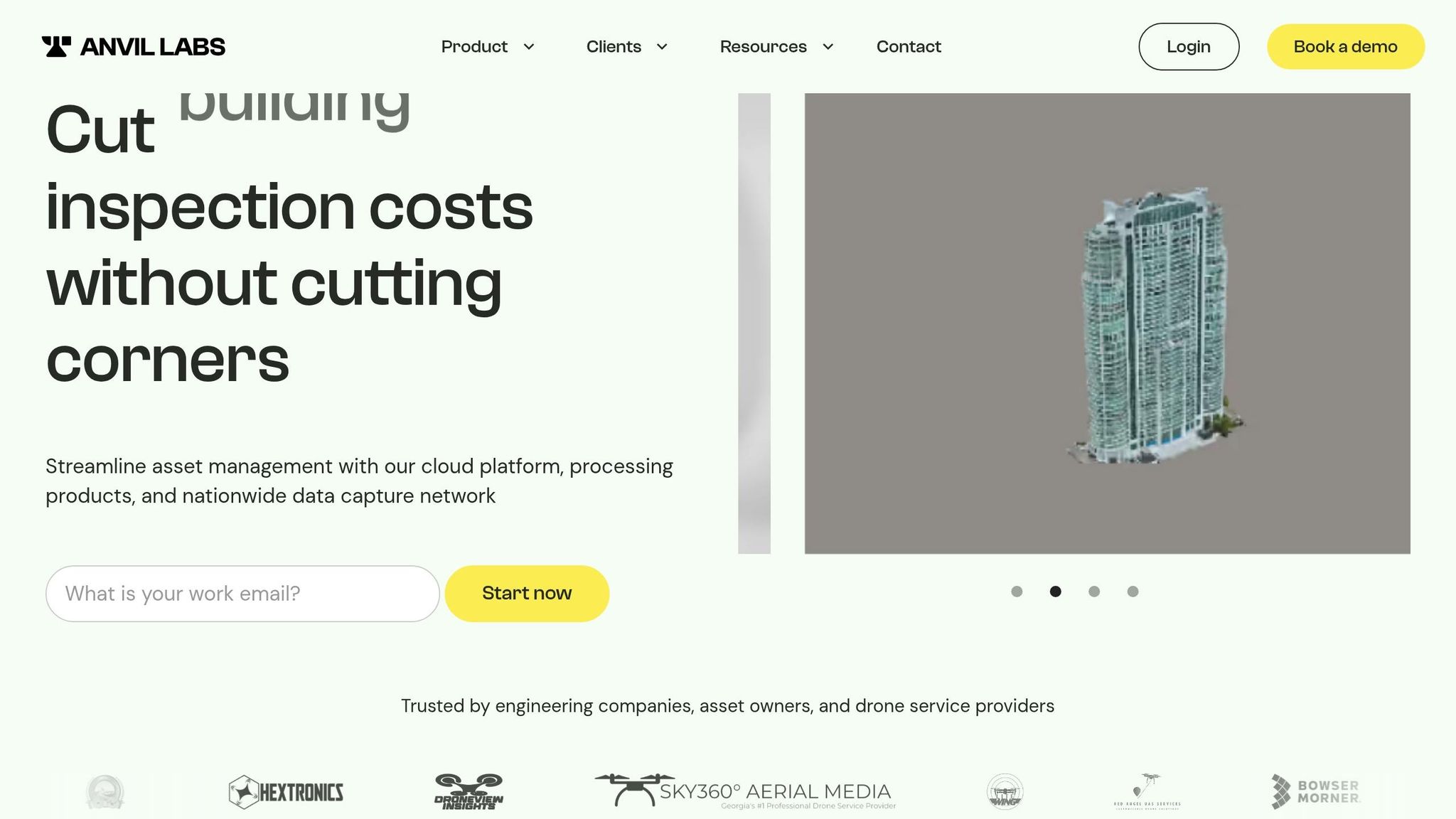
Urban planning teams often juggle complex spatial data and need effective tools for collaboration. Anvil Labs provides a centralized platform where planners can manage all the essential data for zoning analysis - everything from LiDAR and orthomosaics to 3D models and thermal imagery. Instead of hopping between different tools, teams can process, host, and share all their spatial assets in one place. This streamlined approach integrates data management with collaborative tools, making it easier to build and refine digital twins, a key component in modern urban zoning.
With annotation and measurement tools, zoning professionals can directly mark up 3D models or aerial imagery, making it simpler to communicate land use recommendations. The platform’s cross-device accessibility means planners can check site conditions on a tablet during field visits and seamlessly transition to a desktop for deeper analysis. This ensures continuity and efficiency throughout the workflow. Below, we’ll dive into the platform’s features and pricing to show exactly how Anvil Labs supports urban zoning efforts.
Platform Features for Urban Planning Teams
Anvil Labs covers the entire process, from data capture to decision-making. It handles LiDAR data and orthomosaics, critical for precise terrain modeling and assessing land use. Planners can overlay zoning boundaries on high-resolution imagery to quickly identify conflicts between existing infrastructure and proposed developments. Additionally, the platform’s thermal imagery support helps evaluate heat island effects and energy efficiency - key considerations for climate-conscious urban planning.
The platform’s AI capabilities add another layer of functionality by offering predictive simulations. These tools let teams test zoning scenarios, assess impacts on traffic flow or green space, and make adjustments before committing resources. This adaptability is especially useful when coordinating with municipal departments, engineering firms, or community groups. Anvil Labs also integrates with task management systems, simplifying review and approval workflows. Secure sharing features with access control ensure that sensitive documents are shared appropriately while staying compliant with public records regulations.
Pricing Options for Urban Zoning Projects
Anvil Labs offers flexible pricing tailored to the needs of urban planning teams. The Asset Viewer plan, priced at $99 per month, provides full access to hosting, management, and collaboration tools. This option is perfect for municipal departments managing ongoing zoning efforts. For agencies handling single projects, the Project Hosting plan costs $49 per project and includes secure storage and sharing for individual proposals. Both plans feature optional data processing at $3 per gigapixel, allowing teams to scale their usage as needed. These pricing options make the platform accessible while supporting the efficiency required for modern zoning projects.
Conclusion
AI and digital twins are transforming urban zoning by dramatically cutting analysis times from weeks to just days, while also identifying compliance issues with incredible efficiency. Traditional methods, often reliant on fragmented PDFs and manual code reviews, are a major culprit behind nearly 50% of project delays. By automating compliance tasks with an accuracy rate of about 99%, AI platforms are eliminating these bottlenecks, enabling planners to focus on more strategic tasks. This evolution allows for real-time forecasting of housing demands, simulation of environmental impacts, and testing of zoning scenarios - helping cities adapt more quickly to growth and climate challenges.
"AI zoning analysis provides information to developers and architects on buildable sites more efficiently, reduces compliance risk, and improves ROI-based decision-making." - Christopher Vardanyan, ArchiWise
AI also democratizes access to expert knowledge. With searchable libraries of zoning interpretations and variance records, junior staff can perform tasks typically reserved for senior professionals. Immersive 3D models further enhance this process by allowing residents to visualize proposed developments, fostering community engagement and ensuring that plans align with local priorities. These tools transform complex zoning codes into actionable insights that balance economic growth with livable communities.
Digital platforms like Anvil Labs take this transformation a step further by streamlining the practical application of these technologies. By integrating LiDAR, orthomosaics, thermal imagery, and 3D models into a single environment, teams can avoid the inefficiencies of switching between multiple tools. Features like annotation capabilities and cross-device accessibility ensure that observations made in the field translate seamlessly into actionable plans. With pricing starting at $49 per project, even smaller municipal departments can afford to implement digital twin workflows without significant financial strain.
As cities tackle the challenges of sustainable and equitable growth, AI-powered zoning analysis offers a level of precision and clarity that allows planners to make smarter, data-driven decisions - decisions designed to benefit all members of the community.
FAQs
What data do cities need to build a zoning digital twin?
Cities require a wide range of data to build an effective zoning digital twin. Essential sources include geospatial data such as maps, land use information, and zoning regulations. To keep models up-to-date, cities also rely on real-time inputs like sensor data, satellite imagery, and LiDAR scans.
Additional layers, like demographic, economic, and environmental data, add depth to the analysis. By integrating these diverse datasets, cities can create dynamic models that aid in better planning, engaging the public, and ensuring compliance with zoning laws.
How does AI turn zoning code text into automated compliance checks?
AI leverages natural language processing (NLP) and machine learning to simplify the analysis of zoning codes and ordinances. It pulls out critical details like setbacks, height restrictions, and permitted uses, then cross-references these with project plans to spot potential compliance issues. By transforming dense, complex text into structured, easily digestible data, AI significantly accelerates the review process. What once took weeks of manual effort can now be completed in days - helping to avoid expensive redesigns or delays during planning.
How can digital twins improve equity and housing affordability decisions?
Digital twins play a key role in addressing housing affordability and promoting equity by offering real-time virtual models of urban environments. These models incorporate socioeconomic data, enabling urban planners to evaluate how zoning changes and land use policies affect underserved communities. With tools that allow for scenario visualization and interactive community engagement, digital twins support more inclusive decision-making. This approach ensures that housing policies are better aligned with goals of affordability and social equity.
